 Block
Alexander City, Alabama
12 topographic sheets cover this place, the earliest surveyed in 1906 and the latest in 1981. It stands in the Alexander City census division. It lies in ZIP code area 35010. The Survey maps it on the Alexander City quadrangle. 14,843 people lived here at the 2020 count. It stands 705 feet above sea level.
On record in Alexander City
Buildings and businesses the archive holds for this place. Each opens its own page, with the source record it came from.
On the National Register 6 records
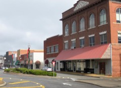 Alexander City Commercial Historic Districtlisted 2000
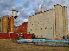 Avondale Historic Districtlisted 2005
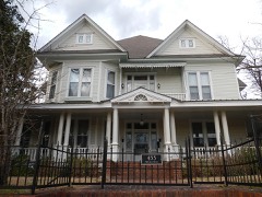 A. J. and Emma E. Thomas Coley Houselisted 1991
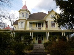 Reuben Herzfeld Houselisted 1995
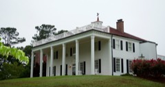 Russell Family Historic Districtlisted 2006
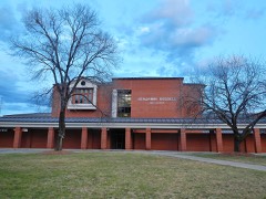 South Central Historic Districtlisted 2005
Surveyed buildings and structures 1 record
- Robinson Iron Foundry, Vulcan, 1856 Robinson Road, Alexander Cityfederal building survey, 1 photograph
Population over time
2 figuresAlexander City fell from 14,875 to 14,843 between 2010 and 2020. These are the recorded population figures Wikidata holds for this place, reached through the Geographic Names Information System number this page is keyed on rather than by name, so they belong to this place and not to another of the same name. Most are census counts, but not all are: an early figure may be a founding or settlement estimate, and an estimate published within five years of a census is left out. The change column is computed, and is left blank where more than 20 years separate a figure from the one before it, because a gap that long is not a change between two counts.
| Year | People | Change |
|---|---|---|
| 2010 | 14,875 | |
| 2020 | 14,843 | -32 (-0%) |
Topographic sheets covering this place
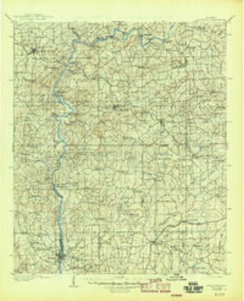
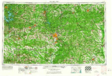
6 surveys from 12 printed sheetsMatched by testing this settlement's coordinate against the published boundary of every sheet in the United States Geological Survey's historical collection. Each opens the scanned sheet at the Survey.
- 1906 USGS Dadeville quadrangle1:125000, 3 printings
- 1955 USGS Phenix City quadrangle1:250000, 3 printings
- 1957 USGS Phenix City quadrangle1:250000
- 1958 USGS Phenix City quadrangle1:250000
- 1971 USGS Alexander City quadrangle1:24000, 3 printings
- 1981 USGS Opelika quadrangle1:100000
Fires near this place
96 since 1994Regional context, not property-specific evidence. The federal wildfire occurrence database lists 96 fires within 5 miles of Alexander City between 1994 and 2020, burning about 574 acres in total. 1 started naturally. 21 were recorded as arson. Distance is straight-line from the map coordinates, so a fire counted here may appear on a neighbouring settlement's page as well.
| Reported cause | Fires |
|---|---|
| Debris and open burning | 37 |
| Arson/incendiarism | 21 |
| Missing data/not specified/undetermined | 17 |
| Recreation and ceremony | 9 |
| Equipment and vehicle use | 8 |
| Fireworks | 1 |
| Natural | 1 |
| Misuse of fire by a minor | 1 |
| Other causes | 1 |
The most recent of them, most recent first, with the day each was reported and the service that recorded it.
| Date | Cause | Size | Reported by | Name on the report |
|---|---|---|---|---|
| 27 September 2001 | Arson/incendiarism | under an acre | Alabama Forestry Commission | not named |
| 19 September 2014 | Missing data/not specified/undetermined | 1.0 acres | Alabama Forestry Commission | ECR-20140919-001 |
| 13 September 2019 | Missing data/not specified/undetermined | under an acre | Alabama Forestry Commission | 20190913-9 |
| 12 September 2010 | Debris and open burning | 9.0 acres | Alabama Forestry Commission | not named |
| 18 August 1996 | Debris and open burning | 1.0 acres | Alabama Forestry Commission | not named |
| 11 August 2007 | Debris and open burning | under an acre | Alabama Forestry Commission | not named |
| 6 July 2018 | Equipment and vehicle use | 3.0 acres | Alabama Forestry Commission | 20180706-1 |
| 5 July 1995 | Debris and open burning | 3.0 acres | Alabama Forestry Commission | not named |
Settlements close enough to share some of these fires:
Mines and quarries near this place
2 within 5 milesRegional context, not property-specific evidence. The federal mineral resources record lists 2 workings within 5 miles of Alexander City: 1 occurrence, 1 producer. 1 still produces. What was taken out: Fluorine-Fluorite, Clay. Distance is straight-line from the map coordinates, so a quarry counted here may appear on a neighbouring settlement's page as well.
| Where | Site | Commodity | Status | Recorded |
|---|---|---|---|---|
| Hillabee Plant and Pit Number 1 | Clay | Producer | ||
| Rockford Area | Fluorine-Fluorite | Occurrence |
Storms near this place
59 since 1994Regional context, not property-specific evidence. The National Weather Service names Alexander City in 59 storm reports between 1994 and 2026: 24 hail, 22 thunderstorm wind, 5 flash flood, 4 lightning. The reports record 1 injury. Each account below is quoted exactly as the forecast office filed it, from the NOAA Storm Events Database, and each date opens the federal record of that event.
| When | Event | Place named | Harm | What the report says |
|---|---|---|---|---|
| July 2005 | Lightning | Alexander City | 1 hurt, $55,000 | Lightning struck a home in Alexander City and a fire ensued. The home suffered significant damage. A woman sustained minor burns in the fire. |
| June 1999 | Flash Flood | Alexander City | $120,000 | More than two inches of rain fell in a short period of time around Alexander City. Numerous roads were flooded and had to be temporarily closed. Several homes and businesses sustained water damage. A dam was also severely damaged due to the volume of water. |
| December 1996 | Tornado (F0) | Alexander City | $80,000 | no account filed |
| August 2002 | Lightning | Alexander City | $75,000 | Two separate house fires were initiated by lightning. One of the fires caused significant structural damage and also destroyed an automobile. In the second instance, the lightning bolt hit a tree next to the structure, and both caught on fire. No injuries were reported in either event. |
| May 1998 | Thunderstorm Wind | Alexander City | $75,000 | A large Texaco sign was destroyed, several cars were pushed around at an apartment parking lot, and numerous trees and power lines were down. |
| June 2006 | Thunderstorm Wind | Alexander City | $50,000 | Three trees were blown down onto houses in Alex City. |
| August 1995 | Thunderstorm Wind | Alexander City | $50,000 | Thunderstorm wind caused damage across the northern section of Lake Martin in the area from south of Alexander City to southeast of Alexander City including the communities of Our Town and Walnut Hill. About 4,200 electric customers were without power as power lines and trees came down. Damage was reported as extensive at Chuck's Marina on the east side of Lake Martin. |
| June 1998 | Thunderstorm Wind | Alexander City | $50,000 | no account filed |
| August 2005 | Lightning | Alexander City | $35,000 | The New Elkahatchee Baptist Church was struck by lightning. The church steeple caught on fire and was destroyed. |
| April 1996 | Thunderstorm Wind | Alexander City | $30,000 | no account filed |
| June 2006 | Thunderstorm Wind | Alexander City | $25,000 | A tree was blown down and fell on a house, along Highway 22 between Alex City and New Site. |
| July 2011 | Flash Flood | Alexander City | $10,000 | A nursing home had over two feet of water inside, leading to the 63 residents being evacuated by boat. Several other high water rescues were performed in the same area. |
| May 1998 | Hail | Alexander City | $10,000 | Golf ball size hail was reported in Alexander City. |
| March 1996 | Hail | Alexander City | $10,000 | no account filed |
| June 1997 | Thunderstorm Wind | Alexander City | $6,000 | no account filed |
| December 2011 | Tornado (EF0) | Alexander City | $5,000 | A tornado initially touched down along Grey Ferry Road in Elmore County, where it caused tree damage. It moved northeastward and crossed into Coosa County, where extensive tree damage and structure damage occurred. Continuing on a northeastward path, the tornado crossed into Tallapoosa County just south of Sasser road. A few trees were snapped or uprooted along this section of the path. The tornado eventually lifted along Hix Road. |
| March 2000 | Lightning | Alexander City | $5,000 | Lightning apparently struck a small tree near a home and traveled through the ground to a metal pole with an electric light. From there the lightning traveled along the wiring approximately 100 feet and into the basement of the house. The lightning left a ditch about 8 inches wide and 10 inches deep. Along this path some concrete steps were damaged with large pieces thrown around. Inside the basement, the lightning knocked a hole in the wall about 3 to 4 feet round, blew the fuse box off the wall, blew fuses out of the box, and burned additional wiring. Though there was smoke in the house, no fire was found. |
| June 1999 | Thunderstorm Wind | Alexander City | $5,000 | Several trees and power lines were blown down in Alexander City. Numerous power outages occurred throughout the city and many roads were temporarily flooded and closed due to high water and downed trees. |
| April 1998 | Hail | Alexander City | $4,000 | no account filed |
| March 2000 | Hail | Alexander City | $3,000 | Quarter size hail was observed in Alexander City. |
| August 2000 | Thunderstorm Wind | Alexander City | $3,000 | Several trees were blown down in and around the city of Alexander City. |
| June 2009 | Thunderstorm Wind | Alexander City | $2,000 | Trees were blown down on AL-22 east of Alexander City. |
| July 2005 | Flash Flood | Alexander City | $2,000 | A few roads were flooded and were temporarily impassable near Alexander City. |
| December 2005 | Hail | Alexander City | $2,000 | Quarter to golf ball size hail fell just northeast of Alexander City. |
| March 2000 | Thunderstorm Wind | Alexander City | $2,000 | A few trees were blown down in and around Alexander City. |
| March 2026 | Thunderstorm Wind | Alexander City | - | A couple trees were downed on Pearson Chapel Rd. |
| February 2026 | Thunderstorm Wind | Alexander City | - | A bowing segment embedded within a line of strong thunderstorms produced isolated damage around the Kellyton community in eastern Coosa County on the morning of February 21, 2026. This damage was surveyed by NWS meteorologists and was determined to be the result of straight-line winds. A manufactured home sustained major roof damage on Trailer Park Rd, but this was an isolated incident with no further damage noted to the surrounding homes or trees. The bowing segment continued east with a localized area of several uprooted and a few snapped pines noted along Moon Rd. A metal outbuilding in this area also sustained minor roof damage with a corner of tin peeled back. Minor tree and power line damage was noted at times as far east as Dobbs Rd and Greenleaf St near Highway 63 in Tallapoosa County. |
| February 2025 | Thunderstorm Wind | Alexander City | - | Trees were downed across much of Tallapoosa County. Near Alexander City, a tree was blown down onto a home on Andrew Jackson Road. |
| August 2024 | Hail | Alexander City | - | Quarter-size to golf ball-size hail fell across northern and eastern sections of Alexander City. |
| May 2023 | Thunderstorm Wind | Alexander City | - | Several reports of trees uprooted and power lines downed in Alexander City. |
| May 2023 | Hail | Alexander City | - | Nickel size hail reported on Parrish Drive in Alexander City. |
| June 2023 | Thunderstorm Wind | Alexander City | - | Several trees uprooted along Dejarnett Road north of Alexander City. One of the trees landed on a vehicle and produced significant damage. |
| August 2023 | Thunderstorm Wind | Alexander City | - | Multiple trees uprooted and several power lines down north of Highway 22. |
| May 2021 | Thunderstorm Wind | Alexander City | - | Numerous trees uprooted and power lines downed in the city of Alexander City. |
| September 2021 | Flash Flood | Alexander City | - | Several roads flooded and impassable in Alexander City. Water covered portions of Elkahatchee Road, Center Street, and 12th Avenue North. |
| April 2020 | Thunderstorm Wind | Alexander City | - | Several trees fell onto a home with two injuries. |
| July 2020 | Thunderstorm Wind | Alexander City | - | Several trees uprooted in the city of Alexander City. |
| January 2014 | Thunderstorm Wind | Alexander City | - | Several trees were uprooted just north of Alexander City. One tree fell on a home on Cedar Street causing major damage. Trees fell on houses on Locust Street and Sewell Street causing minor roof damage. |
| June 2009 | Heavy Rain | Alexander City | - | Heavy rainfall caused street flooding on AL-63, north of Alexander City. |
| November 2006 | Flash Flood | Alexander City | - | Red Barn Road and Haven Place became temporarily closed due to flooding from heavy rainfall. |
| March 2003 | Hail | Alexander City | - | Quarter size hail was reported in Alexander City. |
| July 2003 | Hail | Alexander City | - | Penny size hail was reported near the intersection of US 280 and SR 22. |
| August 2002 | Hail | Alexander City | - | Nickel size hail was reported in and around Alexander City. |
| June 1999 | Hail | Alexander City | - | Alexander City PD reported hail all over the city ranging from dime to quarter size. |
| April 1998 | Hail | Alexander City | - | Dime size hail was reported at US 280 river bridge. |
| March 1998 | Hail | Alexander City | - | Dime size hail was reported in Alexander City. |
| February 1998 | Hail | Alexander City | - | Dime size hail was reported in Alexander City. |
| May 1994 | Hail | Alexander City | - | Three-quarter inch hail was reported by state troopers in Alexander City and golf ball-size hail was reported eight miles southwest of Alexander City. |
| April 1994 | Hail | Alexander City | - | Hail from three-quarters of an inch to golf ball-size fell during one of several thunderstorms that went through the Alexander City area during the day and early evening. More than two inches of rain was also reported with the various storms. |
| April 2020 | Hail | Alexander City | - | no account filed |
| March 2013 | Hail | Alexander City | - | no account filed |
| March 2011 | Hail | Alexander City | - | no account filed |
| April 2007 | Hail | Alexander City | - | no account filed |
| April 2007 | Hail | Alexander City | - | no account filed |
| June 2002 | Hail | Alexander City | - | no account filed |
| May 1999 | Thunderstorm Wind | Alexander City | - | no account filed |
| May 1999 | Funnel Cloud | Alexander City | - | no account filed |
| April 1998 | Hail | Alexander City | - | no account filed |
| June 1998 | Hail | Alexander City | - | no account filed |
Nearest settlements
The eight closest, with where each one stands in the county. Distances are straight-line, computed from the Geographic Names Information System coordinates.
| Map | Place | Distance | Sheets |
|---|---|---|---|
| Parish Hills | 1.4 miles | 12 | |
| Bevelle | 1.5 miles | 12 | |
| Westfield | 1.8 miles | 12 | |
| Elkahatchee Park | 1.9 miles | 12 | |
| Morningside | 2.0 miles | 12 | |
| Sherwood Forest | 2.0 miles | 12 | |
| Dobbs | 2.1 miles | 12 | |
| Indian Hills | 2.3 miles | 12 |
Elsewhere
Matched on this settlement's Geographic Names Information System number rather than its name, so it cannot be a different place of the same name in another state.
| Wikipedia article on Alexander City | An encyclopaedic summary. Its text is share-alike, so it is linked here rather than copied. |
| Wikidata item Q79663 | The structured record the population and elevation above come from. Public domain (CC0). |
Provenance
This settlement is recorded in the Geographic Names Information System as feature 112981. The sheet list is computed by point-in-boundary test against the United States Geological Survey's historical topographic inventory. Both are works of the United States government and carry no copyright under 17 U.S.C. 105.
Wildfire. Short, Karen C. 2022. Spatial wildfire occurrence data for the United States, 1992-2020 [FPA_FOD_20221014]. 6th Edition. Fort Collins, CO: Forest Service Research Data Archive. https://doi.org/10.2737/RDS-2013-0009.6 Collected with United States Government funding and usable without additional permissions or fees.
Mines and quarries. USGS Mineral Resources Data System (MRDS) https://mrdata.usgs.gov/mrds/ A work of the United States government, no copyright under 17 U.S.C. 105.
Storms. NOAA National Centers for Environmental Information, Storm Events Database https://www.ncei.noaa.gov/stormevents/ A work of the United States government, no copyright under 17 U.S.C. 105. Narratives are quoted verbatim from the National Weather Service report and are not edited or summarised.