 Block
Brannon Stand, Alabama
8 topographic sheets cover this place, the earliest surveyed in 1953 and the latest in 1981. It stands in the Dothan census division. It lies in ZIP code area 36305. It stands on Murphy Mill Branch. The Survey maps it on the Dothan West quadrangle.
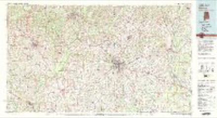
Topographic sheets covering this place
5 surveys from 8 printed sheetsMatched by testing this settlement's coordinate against the published boundary of every sheet in the United States Geological Survey's historical collection. Each opens the scanned sheet at the Survey.
- 1953 USGS Dothan quadrangle1:250000, 3 printings
- 1954 USGS Dothan quadrangle1:250000
- 1955 USGS Dothan quadrangle1:250000
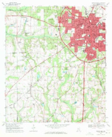
- 1969 USGS Dothan West quadrangle1:24000, 2 printings
- 1981 USGS Dothan quadrangle1:100000
Fires near this place
29 since 1994Regional context, not property-specific evidence. The federal wildfire occurrence database lists 29 fires within 5 miles of Brannon Stand between 1994 and 2016, burning about 325 acres in total. None started naturally. 5 were recorded as arson. Distance is straight-line from the map coordinates, so a fire counted here may appear on a neighbouring settlement's page as well.
| Reported cause | Fires |
|---|---|
| Debris and open burning | 7 |
| Missing data/not specified/undetermined | 7 |
| Arson/incendiarism | 5 |
| Misuse of fire by a minor | 4 |
| Railroad operations and maintenance | 2 |
| Equipment and vehicle use | 1 |
| Recreation and ceremony | 1 |
| Smoking | 1 |
| Other causes | 1 |
The most recent of them, most recent first, with the day each was reported and the service that recorded it.
| Date | Cause | Size | Reported by | Name on the report |
|---|---|---|---|---|
| 4 September 2009 | Arson/incendiarism | under an acre | Alabama Forestry Commission | TIDWELL FALLS OFF ENFINGER RD, AL |
| 24 September 2010 | Missing data/not specified/undetermined | 1.0 acres | Alabama Forestry Commission | not named |
| 17 August 2000 | Railroad operations and maintenance | 5.0 acres | Alabama Forestry Commission | not named |
| 20 June 2000 | Misuse of fire by a minor | 22 acres | Alabama Forestry Commission | not named |
| 11 June 2006 | Missing data/not specified/undetermined | 2.0 acres | Alabama Forestry Commission | not named |
| 4 May 2000 | Debris and open burning | 6.0 acres | Alabama Forestry Commission | not named |
| 29 May 2000 | Smoking | 7.0 acres | Alabama Forestry Commission | not named |
| 28 May 2000 | Missing data/not specified/undetermined | 3.0 acres | Alabama Forestry Commission | not named |
Settlements close enough to share some of these fires:
Mines and quarries near this place
10 of 20 shownRegional context, not property-specific evidence. The federal mineral resources record lists 20 workings within 5 miles of Brannon Stand: 9 producers, 6 unknowns, 4 occurrences, 1 past producer. 9 still produce. What was taken out: Iron, Sand and Gravel, Construction, Sand and Gravel, Construction, Clay. Distance is straight-line from the map coordinates, so a quarry counted here may appear on a neighbouring settlement's page as well.
| Where | Site | Commodity | Status | Recorded |
|---|---|---|---|---|
| 231 North Quarry | Sand and Gravel, Construction, Clay | Producer | Unconsolidated Sediments | |
| Couch Construction Co. Pit | Sand and Gravel, Construction | Producer | ||
| Couch Construction Co. Pit | Sand and Gravel, Construction | Past Producer | ||
| Couch Number 6 Quarry | Sand and Gravel, Construction | Producer | Quartz | |
| Gray Quarry | Sand and Gravel, Construction | Producer | Quartz | |
| Reese Quarry | Sand and Gravel, Construction | Producer | Quartz | |
| Reese Quarry | Sand and Gravel, Construction | Producer | Quartz | |
| Roy J. Lingo Sand Co. Pit | Sand and Gravel, Construction | Producer | ||
| Thomas Quarry | Sand and Gravel, Construction | Producer | Quartz | |
| Unnamed Quarry | Sand and Gravel, Construction | Producer | Quartz |
Storms near this place
12 since 2009Regional context, not property-specific evidence. The National Weather Service names Brannon Stand in 12 storm reports between 2009 and 2026: 8 thunderstorm wind, 2 tornado, 1 flash flood, 1 hail. No death or injury is recorded in these reports. Each account below is quoted exactly as the forecast office filed it, from the NOAA Storm Events Database, and each date opens the federal record of that event.
| When | Event | Place named | Harm | What the report says |
|---|---|---|---|---|
| December 2018 | Tornado (EF0) | Brannon Stand | $15,000 | Damage, consisting of a few dozen snapped pine trees, began near the end of Muirfield Lane in Highland Oaks. The tornado traveled to the northeast and crossed Highway 84 near its intersection with Brannon Stand Road where a power pole was snapped and several trees were downed. The tornado then crossed through the Whispering Pines subdivision, downing a few dozen trees and damaging fences. The most significant damage was noted along Chloe Court, where in addition to tree damage, a couple of homes suffered roof damage and a car was flipped over from a driveway into a yard. The tornado continued traveling northeast, and the last evidence of damage was five or six snapped trees along Westwood Rd. There were no injuries due to the tornado. The tornado was rated EF0 with estimated max winds of 85 mph. The National Weather Service would like to thank Houston County EMA Director Chris Judah for his assistance with this damage survey. |
| April 2023 | Thunderstorm Wind | Brannon Stand | $10,000 | A tree was blown down onto a home on Whatley Drive. |
| August 2023 | Thunderstorm Wind | Brannon Stand | $10,000 | A roof was blown off a barn in the Wicksburg area. |
| June 2009 | Thunderstorm Wind | Brannon Stand | $10,000 | Numerous trees and power lines were down. A sign was overturned on Brannon Stand Road. |
| December 2012 | Thunderstorm Wind | Brannon Stand | $7,000 | Damage occurred at 505 Beaver Creek Road. Multiple trees were down and snapped, and there was structural damage to a garage. A fence was also blown down. Monetary damage was estimated. |
| February 2016 | Thunderstorm Wind | Brannon Stand | $5,000 | Power lines were blown down on Murphy Mill Road as well as near Technology and Westgate. |
| December 2018 | Thunderstorm Wind | Brannon Stand | $3,000 | Several trees and power poles were snapped. |
| January 2026 | Thunderstorm Wind | Brannon Stand | $2,000 | A line was blown down near Brannon Stand and Pine Needles Drive. |
| February 2016 | Thunderstorm Wind | Brannon Stand | - | A tree was blown down onto John D Odom Road near West Main. |
| February 2016 | Tornado (EF1) | Brannon Stand | - | This is the second Houston county segment of the second tornado to develop in northwest Houston county, spawned by the same parent thunderstorm. After initially developing in Houston county, the tornado crossed into extreme southeast Dale county before moving back into Houston county in the Murphy Mill Road area. There was a small area of EF1 damage along Murphy Mill Road where many large diameter pine trees were snapped and uprooted. This tornado likely lifted before reaching U.S. Highway 231. This tornado was rated EF1 with max winds estimated near 100 mph. |
| February 2013 | Flash Flood | Brannon Stand | - | WWNT Radio reported that a portion of Whatley Drive was closed due to high water with barricades. |
| March 2025 | Hail | Brannon Stand | - | no account filed |
Nearest settlements
The eight closest, with where each one stands in the county. Distances are straight-line, computed from the Geographic Names Information System coordinates.
| Map | Place | Distance | Sheets |
|---|---|---|---|
| Whispering Pines | 0.1 miles | 8 | |
| Brannon Stand Heights | 0.2 miles | 8 | |
| Spann Brothers Estates | 1.3 miles | 8 | |
| Green Acres | 1.4 miles | 8 | |
| Peach Tree Hills | 1.7 miles | 8 | |
| Brentwood | 1.8 miles | 8 | |
| Pine Ridge Estates | 1.9 miles | 8 | |
| Jones Crossroads | 2.0 miles | 8 |
Elsewhere
Matched on this settlement's Geographic Names Information System number rather than its name, so it cannot be a different place of the same name in another state.
| Wikidata item Q122559643 | The structured record the population and elevation above come from. Public domain (CC0). |
Provenance
This settlement is recorded in the Geographic Names Information System as feature 114835. The sheet list is computed by point-in-boundary test against the United States Geological Survey's historical topographic inventory. Both are works of the United States government and carry no copyright under 17 U.S.C. 105.
Wildfire. Short, Karen C. 2022. Spatial wildfire occurrence data for the United States, 1992-2020 [FPA_FOD_20221014]. 6th Edition. Fort Collins, CO: Forest Service Research Data Archive. https://doi.org/10.2737/RDS-2013-0009.6 Collected with United States Government funding and usable without additional permissions or fees.
Mines and quarries. USGS Mineral Resources Data System (MRDS) https://mrdata.usgs.gov/mrds/ A work of the United States government, no copyright under 17 U.S.C. 105.
Storms. NOAA National Centers for Environmental Information, Storm Events Database https://www.ncei.noaa.gov/stormevents/ A work of the United States government, no copyright under 17 U.S.C. 105. Narratives are quoted verbatim from the National Weather Service report and are not edited or summarised.