 Block
Caddo, Alabama
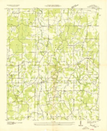
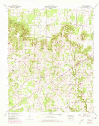
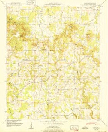
14 topographic sheets cover this place, the earliest surveyed in 1936 and the latest in 1986. It stands in the Morris Chapel census division. It lies in ZIP code area 35673. The Survey maps it on the Caddo quadrangle.
Topographic sheets covering this place
8 surveys from 14 printed sheetsMatched by testing this settlement's coordinate against the published boundary of every sheet in the United States Geological Survey's historical collection. Each opens the scanned sheet at the Survey.
- 1936 USGS Caddo quadrangle1:24000
- 1948 USGS Caddo quadrangle1:24000
- 1950 USGS Caddo quadrangle1:24000, 2 printings
- 1956 USGS Gadsden quadrangle1:250000, 3 printings
- 1958 USGS Gadsden quadrangle1:250000
- 1960 USGS Gadsden quadrangle1:250000, 2 printings
- 1963 USGS Gadsden quadrangle1:250000
- 1986 USGS Tuscumbia quadrangle1:100000, 3 printings




Fires near this place
130 since 1994Regional context, not property-specific evidence. The federal wildfire occurrence database lists 130 fires within 5 miles of Caddo between 1994 and 2017, burning about 1,052 acres in total. None started naturally. 54 were recorded as arson. Distance is straight-line from the map coordinates, so a fire counted here may appear on a neighbouring settlement's page as well.
| Reported cause | Fires |
|---|---|
| Arson/incendiarism | 54 |
| Debris and open burning | 44 |
| Missing data/not specified/undetermined | 15 |
| Recreation and ceremony | 10 |
| Equipment and vehicle use | 3 |
| Misuse of fire by a minor | 2 |
| Smoking | 1 |
| Railroad operations and maintenance | 1 |
The most recent of them, most recent first, with the day each was reported and the service that recorded it.
| Date | Cause | Size | Reported by | Name on the report |
|---|---|---|---|---|
| 8 September 1995 | Recreation and ceremony | 5.0 acres | Alabama Forestry Commission | not named |
| 5 September 1995 | Recreation and ceremony | 20 acres | Alabama Forestry Commission | not named |
| 3 September 1999 | Debris and open burning | 1.0 acres | Alabama Forestry Commission | not named |
| 25 September 1999 | Equipment and vehicle use | 3.0 acres | Alabama Forestry Commission | not named |
| 16 September 2000 | Arson/incendiarism | 5.0 acres | Alabama Forestry Commission | not named |
| 13 September 2002 | Debris and open burning | 2.0 acres | Alabama Forestry Commission | not named |
| 12 September 1999 | Debris and open burning | 4.0 acres | Alabama Forestry Commission | not named |
| 10 September 2007 | Arson/incendiarism | under an acre | Alabama Forestry Commission | not named |
Settlements close enough to share some of these fires:
Mines and quarries near this place
1 within 5 milesRegional context, not property-specific evidence. The federal mineral resources record lists 1 working within 5 miles of Caddo: 1 unknown. None of them still produces. What was taken out: Iron. Distance is straight-line from the map coordinates, so a quarry counted here may appear on a neighbouring settlement's page as well.
| Where | Site | Commodity | Status | Recorded |
|---|---|---|---|---|
| Unnamed | Iron | Unknown |
Storms near this place
25 since 2003Regional context, not property-specific evidence. The National Weather Service names Caddo in 25 storm reports between 2003 and 2025: 12 hail, 10 thunderstorm wind, 2 tornado, 1 flash flood. No death or injury is recorded in these reports. Each account below is quoted exactly as the forecast office filed it, from the NOAA Storm Events Database, and each date opens the federal record of that event.
| When | Event | Place named | Harm | What the report says |
|---|---|---|---|---|
| May 2009 | Tornado (EF1) | Caddo | $200,000 | The tornado touched down in the backyard of a mobile home along CR 327. At this location, a large oak tree fell onto the mobile home splitting it in two where a woman and her young daughter were taking shelter. Numerous trees were uprooted and snapped surrounding the home. The tornado path continued northeast along CR 328 producing significant damage to another mobile home. More than half of the structure was moved off its well secured foundation and the majority of the roof was blown off. A few outbuildings were completely destroyed and vehicles were moved from their original locations in the driveway. Numerous large trees were snapped and uprooted at this location. Peak wind speed was estimated at 105 mph. |
| May 2022 | Thunderstorm Wind | Caddo | $20,000 | Ten to twelve trees were reported down from CR 434 east about 2 miles to CR 214. |
| June 2025 | Thunderstorm Wind | Caddo | $15,000 | Multiple large trees were knocked down or uprooted at 3259 County Road 316. One of the trees landed on a parked camper. Time estimated by radar. |
| June 2010 | Thunderstorm Wind | Caddo | $15,000 | Several trees were blown down on CR 327 and 434 near Caddo. Additional trees were blown down on CR 316 near these locations. Several tree limbs were also blown down in the Caddo area. |
| April 2006 | Tornado (F0) | Caddo | $5,000 | A short lived tornado touched down and produced minor tree damage two three trees and minor roof damage to a manufactured home. |
| July 2008 | Thunderstorm Wind | Caddo | $2,000 | A few power lines were downed by thunderstorm winds near Caddo. |
| June 2025 | Thunderstorm Wind | Caddo | $1,000 | A tree was knocked down blocking the roadway at the intersection of CR 358 and CR 547. Time estimated by radar. |
| June 2011 | Thunderstorm Wind | Caddo | $1,000 | Trees were knocked down. |
| April 2025 | Hail | Caddo | - | One and one quarter of an inch diameter hail was reported at this location by a Cocorahs observer 2 miles SW of Trinity. |
| April 2025 | Hail | Caddo | - | Quarter size hail was reported by a NWS observer long highway 434. |
| April 2025 | Thunderstorm Wind | Caddo | - | Trees and powerlines were reported down at this location off of CR 214 near Caddo Cemetery. |
| May 2025 | Hail | Caddo | - | Nickel hail was reported on highway 24 on the near the Lawrence/Morgan county line. |
| May 2022 | Hail | Caddo | - | Quarter size hail was reported at East Lawrence Elementary School. |
| November 2016 | Thunderstorm Wind | Caddo | - | APRS weather station at East Lawrence High School. Relayed via Amateur Radio. |
| December 2015 | Flash Flood | Caddo | - | Flooded culvert washed away a portion of County Road 328. |
| March 2013 | Hail | Caddo | - | Quarter sized hail was reported. |
| March 2012 | Hail | Caddo | - | Nickel sized hail was reported in Caddo. |
| March 2012 | Thunderstorm Wind | Caddo | - | A swath of wind damage downed numerous trees and power lines, and destroyed one farm outbuilding. The path of damage began off County Road 434 just south of State Highway 24 north of the Five Points community. Here, severe small trees were snapped. Just southeast of this area along County Roads 434 and 324, a farm outbuilding was completely destroyed by peak winds estimated to be 90 mph. Continuing to move south-southwest along a path, several more trees were snapped or uprooted along County Road 87 heading south towards Five Points.||Near the Oakville community, several more small to moderate size trees were snapped along County Road 336. A pocket of winds estimated at 70 to 80 mph impacted a small area along County Road 203 around the Jesse Owens Memorial Park and Museum. At the park, a metal light pole was bent back slightly and a small outhouse was pushed off it's foundation and partially destroyed. Tree branches were snapped around the park and near the museum, but no structural damage occurred to the actual museum.||Heading farther south toward the interchange of State Highways 157 and 36 near Speake, an area of trees were either snapped or uprooted by estimated wind speeds of 75 mph. All the uprooted trees were lying in a south-southwest direction. Outside of a few snapped tree branches along County Road 81 just south of Speake, no additional damage was noted.||Joe Wheeler Electric Membership Corporation reported a power outage that affected at least 831 customers. |
| April 2009 | Hail | Caddo | - | One inch hail was reported in the Caddo community. |
| April 2009 | Hail | Caddo | - | Baseball size hail was reported in the Caddo area. |
| June 2009 | Hail | Caddo | - | A CoCoRaHS observer reported hail to the size of ping pong balls. |
| June 2009 | Hail | Caddo | - | Golfball size hail was reported on Highway 24 east of Caddo. |
| April 2009 | Hail | Caddo | - | Nickel size hail fell in Caddo. |
| April 2009 | Hail | Caddo | - | Baseball sized hail was reported falling at the Town Hall in Trinity. This broke vehicle windows there and damaged an addition to the fire station. |
| May 2003 | Thunderstorm Wind | Caddo | - | numerous trees and power lines down. |
Nearest settlements
The eight closest, with where each one stands in the county. Distances are straight-line, computed from the Geographic Names Information System coordinates.
| Map | Place | Distance | Sheets |
|---|---|---|---|
| Midway | 1.6 miles | 14 | |
| Chalybeate Springs | 4.6 miles | 14 | |
| Pittsburg | 4.6 miles | 14 | |
| Reynolds | 4.7 miles | 15 | |
| Fish Pond | 5.1 miles | 15 | |
| Hillsboro | 5.6 miles | 15 | |
| Kitchens Mill | 6.0 miles | 17 | |
| Harmony | 6.0 miles | 14 |
Provenance
This settlement is recorded in the Geographic Names Information System as feature 115355. The sheet list is computed by point-in-boundary test against the United States Geological Survey's historical topographic inventory. Both are works of the United States government and carry no copyright under 17 U.S.C. 105.
Wildfire. Short, Karen C. 2022. Spatial wildfire occurrence data for the United States, 1992-2020 [FPA_FOD_20221014]. 6th Edition. Fort Collins, CO: Forest Service Research Data Archive. https://doi.org/10.2737/RDS-2013-0009.6 Collected with United States Government funding and usable without additional permissions or fees.
Mines and quarries. USGS Mineral Resources Data System (MRDS) https://mrdata.usgs.gov/mrds/ A work of the United States government, no copyright under 17 U.S.C. 105.
Storms. NOAA National Centers for Environmental Information, Storm Events Database https://www.ncei.noaa.gov/stormevents/ A work of the United States government, no copyright under 17 U.S.C. 105. Narratives are quoted verbatim from the National Weather Service report and are not edited or summarised.