 Block
Crews, Alabama
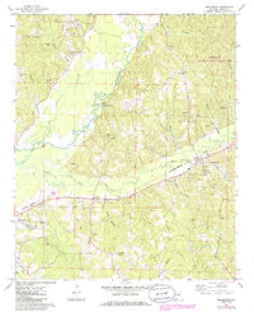
12 topographic sheets cover this place, the earliest surveyed in 1953 and the latest in 1984. It stands in the Sulligent census division. It lies in ZIP code area 35586. It stands on Crews Mill Branch. The Survey maps it on the Beaverton quadrangle.
On record in Crews
Buildings and businesses the archive holds for this place. Each opens its own page, with the source record it came from.
Surveyed buildings and structures 1 record
- George Bankhead House, Old Military Road, Crewsfederal building survey, 3 photographs
Topographic sheets covering this place
6 surveys from 12 printed sheetsMatched by testing this settlement's coordinate against the published boundary of every sheet in the United States Geological Survey's historical collection. Each opens the scanned sheet at the Survey.
- 1953 USGS West Point quadrangle1:250000, 3 printings
- 1958 USGS West Point quadrangle1:250000
- 1963 USGS West Point quadrangle1:250000, 2 printings
- 1967 USGS Beaverton quadrangle1:24000, 2 printings
- 1982 USGS West Point quadrangle1:100000
- 1984 USGS West Point quadrangle1:250000, 3 printings
Photographs
1 photograph,Taken for the Office of War Information and the Farm Security Administration, who photographed the country between 1935 and 1944. Works of United States government photographers, with no known restriction on use. Each opens its catalogue record.
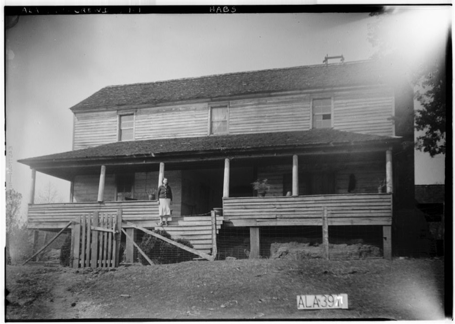
Photographer not recorded. Library of Congress
Fires near this place
67 since 1994Regional context, not property-specific evidence. The federal wildfire occurrence database lists 67 fires within 5 miles of Crews between 1994 and 2020, burning about 353 acres in total. 5 started naturally. 17 were recorded as arson. Distance is straight-line from the map coordinates, so a fire counted here may appear on a neighbouring settlement's page as well.
| Reported cause | Fires |
|---|---|
| Arson/incendiarism | 17 |
| Debris and open burning | 16 |
| Missing data/not specified/undetermined | 12 |
| Equipment and vehicle use | 5 |
| Natural | 5 |
| Recreation and ceremony | 4 |
| Smoking | 3 |
| Railroad operations and maintenance | 3 |
| Misuse of fire by a minor | 2 |
The most recent of them, most recent first, with the day each was reported and the service that recorded it.
| Date | Cause | Size | Reported by | Name on the report |
|---|---|---|---|---|
| 4 September 2000 | Natural | under an acre | Alabama Forestry Commission | not named |
| 3 September 1999 | Arson/incendiarism | 1.1 acres | Alabama Forestry Commission | not named |
| 20 September 1999 | Arson/incendiarism | 14 acres | Alabama Forestry Commission | not named |
| 18 September 1999 | Misuse of fire by a minor | 1.2 acres | Alabama Forestry Commission | not named |
| 16 September 2019 | Arson/incendiarism | 1.0 acres | Alabama Forestry Commission | 20190916-6 |
| 16 September 1999 | Debris and open burning | 18 acres | Alabama Forestry Commission | not named |
| 10 September 2016 | Equipment and vehicle use | 22 acres | Alabama Forestry Commission | 20160910-4 |
| 1 September 2016 | Debris and open burning | 18 acres | Alabama Forestry Commission | 20160901-3 |
Settlements close enough to share some of these fires:
Mines and quarries near this place
1 within 5 milesRegional context, not property-specific evidence. The federal mineral resources record lists 1 working within 5 miles of Crews: 1 producer. All of them still produce. What was taken out: Sand and Gravel, Construction. Distance is straight-line from the map coordinates, so a quarry counted here may appear on a neighbouring settlement's page as well.
| Where | Site | Commodity | Status | Recorded |
|---|---|---|---|---|
| Mixon Pit | Sand and Gravel, Construction | Producer | Unconsolidated Sediments |
Storms near this place
42 since 2008Regional context, not property-specific evidence. The National Weather Service names Crews in 42 storm reports between 2008 and 2026: 23 thunderstorm wind, 11 flash flood, 5 hail, 3 tornado. No death or injury is recorded in these reports. Each account below is quoted exactly as the forecast office filed it, from the NOAA Storm Events Database, and each date opens the federal record of that event.
| When | Event | Place named | Harm | What the report says |
|---|---|---|---|---|
| January 2009 | Flash Flood | Crews | $100,000 | Heavy rainfall produced flooding at numerous locations across Lamar County. Close to 40 roads were closed due to high water, including 10 that were completely washed out. Just east of Vernon, 3 people were rescued without injury after their car was caught in fast moving flood waters. |
| April 2010 | Flash Flood | Crews | $10,000 | Portions of AL-17 and River Road, in the city of Sulligent, had to be temporarily closed due to flash flooding. |
| May 2009 | Flash Flood | Crews | $10,000 | An estimated 3 to 4 inches of rain caused US-278 in Sulligent to become impassable due to flooding. |
| August 2010 | Thunderstorm Wind | Crews | $8,000 | Trees and power lines down just West of town along Highway 278. |
| August 2011 | Thunderstorm Wind | Crews | $7,000 | Numerous trees were reported down across Lamar County, especially to the north of Vernon. |
| April 2011 | Flash Flood | Crews | $5,000 | A portion of US-278, in the city of Sulligent, briefly became flooded due to heavy rain. |
| April 2010 | Thunderstorm Wind | Crews | $5,000 | Several trees were blown down onto US-278, between Sulligent and Beaverton, and blocked all 4 lanes of traffic. |
| April 2009 | Thunderstorm Wind | Crews | $5,000 | A shopping center in Sulligent suffered roof damage. |
| September 2009 | Flash Flood | Crews | $5,000 | All four lanes of US-278, east of Sulligent, had to be closed due to water flowing over them. |
| October 2010 | Thunderstorm Wind | Crews | $4,000 | Trees were blown down on Buck Jackson Road. |
| April 2009 | Thunderstorm Wind | Crews | $3,000 | Numerous trees and signs were blown down in and around Sulligent. |
| May 2008 | Thunderstorm Wind | Crews | $3,000 | Numerous trees were blown down. |
| July 2010 | Thunderstorm Wind | Crews | $2,000 | Power lines reported down near Sulligent. |
| June 2009 | Thunderstorm Wind | Crews | $2,000 | Several trees were blown down on US-278, near Sulligent. |
| July 2011 | Thunderstorm Wind | Crews | $1,000 | A tree was reported down along Blaylock Road. |
| April 2008 | Thunderstorm Wind | Crews | $1,000 | Several trees were blown down near the state line. |
| August 2008 | Thunderstorm Wind | Crews | $1,000 | A couple of trees were blown down on Al-17, just south of Sulligent. |
| March 2026 | Thunderstorm Wind | Crews | - | Three trees were downed near the intersection of Highway 278 and Crews Rd. |
| June 2025 | Thunderstorm Wind | Crews | - | Trees and power lines were downed in the Sulligent area. |
| December 2024 | Tornado (EF0) | Crews | - | The tornado began near Lost Creek Road, moved northeastward across Byson Road, and ended near Chapel Road. Damage consisted of downed limbs and several snapped and uprooted trees. Maximum winds were estimated at 65 mph. |
| December 2021 | Tornado (EF0) | Crews | - | National Weather Service meteorologists surveyed damage in northern Lamar County and determined that it was consistent with an EF0 tornado, with maximum winds near 75 mph. The tornado touched down southwest of the town of Beaverton near Highway 77, about one-quarter of a mile north of Highway 278. The tornado tracked east across Highway 278 producing sporadic tree damage as it crossed Turkey Branch Road and Markham Road. A small barn was also damaged in this area. The tornado then crossed into far southwestern Marion County near Reese Road. |
| May 2017 | Thunderstorm Wind | Crews | - | Several large trees uprooted in the Crews Community. One vehicle was heavily damaged. |
| February 2016 | Flash Flood | Crews | - | The Fire Department reported up to one foot of water flowing across Waterworks Road near the intersection of Highway 278. |
| June 2015 | Thunderstorm Wind | Crews | - | Several trees uprooted northwest of the town of Sulligent. |
| December 2015 | Flash Flood | Crews | - | Several roads flooded across the northern portions of the county, including Highway 17 at River Road and Highway 278 in the towns of Sulligent and Beaverton. |
| January 2013 | Tornado (EF1) | Crews | - | An EF1 tornado touched down in Monroe County, Mississippi, south of Greenwood Springs (See WFO Memphis Storm Data) and tracked northeastward into Lamar County, Alabama. The EF1 tornado with winds of 90 mph and 300 yards wide entered Alabama near the intersection of Pleasant Hills Rd and State Line Rd, downing trees near the state line. The tornado took a turn to the east, remaining south of US Highway 278. As the tornado crossed Shake Rag Rd and Abernathy Rd, it caused minor roof damage to one home and an outbuilding, and downed many trees. As the tornado turned to the north northeast, it crossed Sulligent Lake Rd and dissipated just west of Glass Rd. Path length in Mississippi was 7.02 miles. |
| March 2013 | Thunderstorm Wind | Crews | - | Trees and powerlines down in Sulligent. |
| March 2013 | Thunderstorm Wind | Crews | - | Wind gust measured at the Lamar County EOC. |
| April 2012 | Thunderstorm Wind | Crews | - | Several trees were reported down in and around Sulligent. |
| February 2012 | Thunderstorm Wind | Crews | - | A home suffered significant damage to a portion of its roof and one outside wall when a tree was blown down onto it. Five out of eight light poles at the Sulligent High School Baseball field were either collapsed or bent in half. Numerous other trees were blown down across the north half of the county and shingles were blown off several homes in downtown Sulligent. |
| July 2012 | Thunderstorm Wind | Crews | - | Several trees were reported down in Sulligent. |
| July 2012 | Thunderstorm Wind | Crews | - | Numerous trees were reported down. |
| August 2012 | Flash Flood | Crews | - | Periods of heavy rainfall led to 6 inches of flowing water over Highway 278 in Sulligent, as well as Highway 18 in Vernon. |
| August 2012 | Flash Flood | Crews | - | A period of heavy rainfall led to over 6 inches of flowing water covering Highway 278 in Sulligent, causing it to be closed. |
| June 2012 | Thunderstorm Wind | Crews | - | Numerous trees were reported down between Sulligent and Detroit. |
| June 2012 | Flash Flood | Crews | - | Water over Highways 278 and 17 led to roads being closed. |
| December 2008 | Flash Flood | Crews | - | Street flooding, up to one and a half feet deep, was reported on AL-118, west of Sulligent. |
| April 2012 | Hail | Crews | - | no account filed |
| April 2011 | Hail | Crews | - | no account filed |
| October 2009 | Hail | Crews | - | no account filed |
| April 2009 | Hail | Crews | - | no account filed |
| February 2008 | Hail | Crews | - | no account filed |
Nearest settlements
The eight closest, with where each one stands in the county. Distances are straight-line, computed from the Geographic Names Information System coordinates.
| Map | Place | Distance | Sheets |
|---|---|---|---|
| Sulligent | 3.0 miles | 12 | |
| Moscow | 3.2 miles | 12 | |
| Beaverton | 3.4 miles | 12 | |
| Pine Springs | 4.3 miles | 12 | |
| Mansfield | 7.0 miles | 11 | |
| Henson Springs | 7.4 miles | 8 | |
| Detroit | 9.2 miles | 10 | |
| Blooming Grove | 9.9 miles | 11 |
Provenance
This settlement is recorded in the Geographic Names Information System as feature 116863. The sheet list is computed by point-in-boundary test against the United States Geological Survey's historical topographic inventory. Both are works of the United States government and carry no copyright under 17 U.S.C. 105.
Wildfire. Short, Karen C. 2022. Spatial wildfire occurrence data for the United States, 1992-2020 [FPA_FOD_20221014]. 6th Edition. Fort Collins, CO: Forest Service Research Data Archive. https://doi.org/10.2737/RDS-2013-0009.6 Collected with United States Government funding and usable without additional permissions or fees.
Mines and quarries. USGS Mineral Resources Data System (MRDS) https://mrdata.usgs.gov/mrds/ A work of the United States government, no copyright under 17 U.S.C. 105.
Storms. NOAA National Centers for Environmental Information, Storm Events Database https://www.ncei.noaa.gov/stormevents/ A work of the United States government, no copyright under 17 U.S.C. 105. Narratives are quoted verbatim from the National Weather Service report and are not edited or summarised.