 Block
Crooked Oak, Alabama
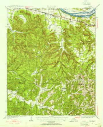
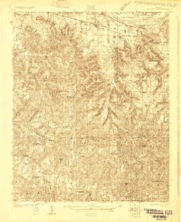
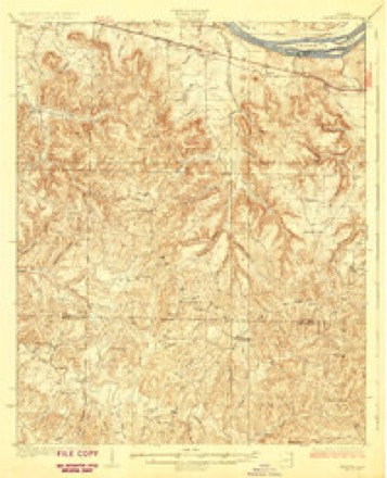
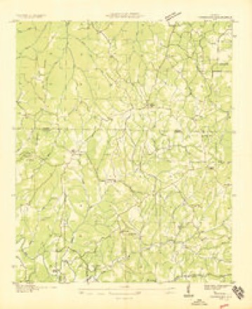
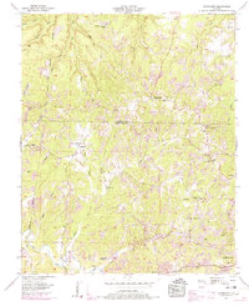
19 topographic sheets cover this place, the earliest surveyed in 1925 and the latest in 1986. It stands in the Littleville census division. It lies in ZIP code area 35653. The Survey maps it on the Frankfort quadrangle.
Topographic sheets covering this place
10 surveys from 19 printed sheetsMatched by testing this settlement's coordinate against the published boundary of every sheet in the United States Geological Survey's historical collection. Each opens the scanned sheet at the Survey.
- 1925 USGS Barton quadrangle1:62500
- 1926 USGS Barton quadrangle1:48000
- 1929 USGS Barton quadrangle1:62500, 3 printings
- 1936 USGS Frankfort quadrangle1:24000
- 1956 USGS Gadsden quadrangle1:250000, 3 printings
- 1957 USGS Frankfort quadrangle1:24000, 3 printings
- 1958 USGS Gadsden quadrangle1:250000
- 1960 USGS Gadsden quadrangle1:250000, 2 printings
- 1963 USGS Gadsden quadrangle1:250000
- 1986 USGS Tuscumbia quadrangle1:100000, 3 printings





Fires near this place
114 since 1997Regional context, not property-specific evidence. The federal wildfire occurrence database lists 114 fires within 5 miles of Crooked Oak between 1997 and 2019, burning about 916 acres in total. None started naturally. 46 were recorded as arson. Distance is straight-line from the map coordinates, so a fire counted here may appear on a neighbouring settlement's page as well.
| Reported cause | Fires |
|---|---|
| Arson/incendiarism | 46 |
| Debris and open burning | 46 |
| Missing data/not specified/undetermined | 17 |
| Smoking | 2 |
| Equipment and vehicle use | 2 |
| Misuse of fire by a minor | 1 |
The most recent of them, most recent first, with the day each was reported and the service that recorded it.
| Date | Cause | Size | Reported by | Name on the report |
|---|---|---|---|---|
| 8 September 2002 | Arson/incendiarism | under an acre | Alabama Forestry Commission | not named |
| 23 September 2010 | Arson/incendiarism | 3.0 acres | Alabama Forestry Commission | not named |
| 21 September 2019 | Missing data/not specified/undetermined | 5.0 acres | Alabama Forestry Commission | 20190921-7 |
| 21 September 2010 | Debris and open burning | 25 acres | Alabama Forestry Commission | not named |
| 13 September 2010 | Debris and open burning | 27 acres | Alabama Forestry Commission | not named |
| 13 September 2010 | Debris and open burning | 2.0 acres | Alabama Forestry Commission | not named |
| 29 August 1999 | Debris and open burning | 1.0 acres | Alabama Forestry Commission | not named |
| 23 August 2006 | Debris and open burning | 1.0 acres | Alabama Forestry Commission | not named |
Settlements close enough to share some of these fires:
Mines and quarries near this place
10 of 66 shownRegional context, not property-specific evidence. The federal mineral resources record lists 66 workings within 5 miles of Crooked Oak: 55 unknowns, 11 occurrences. None of them still produces. What was taken out: Iron. Distance is straight-line from the map coordinates, so a quarry counted here may appear on a neighbouring settlement's page as well.
Storms near this place
50 since 1999Regional context, not property-specific evidence. The National Weather Service names Crooked Oak in 50 storm reports between 1999 and 2026: 41 thunderstorm wind, 6 hail, 2 tornado, 1 lightning. The reports record 2 injuries. Each account below is quoted exactly as the forecast office filed it, from the NOAA Storm Events Database, and each date opens the federal record of that event.
| When | Event | Place named | Harm | What the report says |
|---|---|---|---|---|
| November 2016 | Tornado (EF1) | Crooked Oak | 2 hurt | A tornado crossed into Colbert County from Franklin County. More softwood and hardwood trees were snapped causing damage to a single wide manufactured home and car shed on Jones Road. More softwood and hardwood trees were snapped as the tornado continued northeast across County Road 49. Then, as the tornado continued to move northeast multiple softwood and hardwood trees were snapped close to Underwood Mountain Road before striking a single wide manufactured home. The single wide manufactured home sustained damage consistent with EF-1 rating with destruction of roof and walls leaving floor and undercarriage in place. Two people within this home sustained injuries. Another single family dwelling next to this manufactured home sustained damage uplift of the roof damage while more snapped hardwood trees were noted just to the northeast of these houses. This is also where the tornado had the largest width of 100 yards. The tornado then lifted shortly after this damage occurred. |
| August 2010 | Thunderstorm Wind | Crooked Oak | $20,000 | Multiple trees were blown down in the New Bethel area. |
| June 2009 | Thunderstorm Wind | Crooked Oak | $15,000 | Thunderstorm winds knocked down numerous trees and a power pole along Jone road and Cemetery road. |
| August 2023 | Thunderstorm Wind | Crooked Oak | $8,000 | A power pole was knocked down or leaning at this location on Lime Rock Road. Time was estimated by radar. |
| August 2023 | Thunderstorm Wind | Crooked Oak | $7,500 | A power pole was down or leaning at this location on Claunch Loop road. Time was estimated from radar. |
| April 2013 | Thunderstorm Wind | Crooked Oak | $5,000 | A tree was downed by thunderstorm winds on Wagnon Mountain Road, about a mile and a half northwest of Crooked Oak, Alabama. |
| April 2013 | Thunderstorm Wind | Crooked Oak | $5,000 | A tree was downed by thunderstorm winds on Loop Road, about 9 miles south-southwest of Tuscumbia, Alabama. |
| May 2010 | Thunderstorm Wind | Crooked Oak | $5,000 | A tree was blown down at the intersection of Frankfort road and New Bethel road. |
| June 2008 | Thunderstorm Wind | Crooked Oak | $5,000 | Thunderstorms winds downed a radio tower and a few tree limbs at the New Bethel Fire Department. |
| June 2008 | Thunderstorm Wind | Crooked Oak | $3,000 | Thunderstorm winds downed a few trees and power lines at Loop Road just off of Hawk Pride Mountain Road. |
| July 2012 | Thunderstorm Wind | Crooked Oak | $2,000 | A tree and power lines were knocked down at the intersection of Jones Road and Highway 247. Time estimated by radar. |
| June 2011 | Thunderstorm Wind | Crooked Oak | $2,000 | A tree was blown down on Underwood Mountain road. |
| June 2008 | Thunderstorm Wind | Crooked Oak | $2,000 | Thunderstorm winds downed a few trees. |
| April 2025 | Thunderstorm Wind | Crooked Oak | $1,000 | A large tree was blown down onto a powerline on Waterloo Road. |
| June 2025 | Thunderstorm Wind | Crooked Oak | $1,000 | A tree was knocked down at 4525 Jones Road. Time estimated by radar. |
| June 2025 | Thunderstorm Wind | Crooked Oak | $1,000 | A tree was reported down on Frankfort Road near the intersection with Waterloo Road. Time estimated by radar. |
| July 2024 | Thunderstorm Wind | Crooked Oak | $1,000 | A decaying outflow boundary from strong storms moved north and knocked down a tree at the intersection of Indian Springs Circle and Underwood Mountain Road. |
| May 2023 | Thunderstorm Wind | Crooked Oak | $1,000 | A tree was reported down on Frankfort road. |
| August 2023 | Thunderstorm Wind | Crooked Oak | $1,000 | A tree was knocked down at the intersection of Waterloo road and Crooked Oak road. Time was estimated from radar. |
| August 2023 | Thunderstorm Wind | Crooked Oak | $1,000 | A tree was knocked down at the intersection of Underwood Mountain road and Indian Springs road. Time was estimated from radar. |
| August 2023 | Thunderstorm Wind | Crooked Oak | $1,000 | A tree was knocked down at 1919 Hawk Pride Mountain road. Time was estimated from radar. |
| April 2008 | Thunderstorm Wind | Crooked Oak | $1,000 | Thunderstorm winds blew down a power line in Crooked Oak. |
| June 2008 | Thunderstorm Wind | Crooked Oak | $1,000 | The public reported a few trees down due to thunderstorm winds along Wagon Mountain Road. |
| July 2007 | Lightning | Crooked Oak | $1,000 | Lightning struck a building and sparked a fire at 190 New Bethel Road in Colbert County. Exact damage estimate was not available. |
| January 2025 | Thunderstorm Wind | Crooked Oak | $500 | A tree was knocked down at the intersection of Ligon Springs Road and Boy Scout Road. Time estimated by radar. |
| June 2024 | Thunderstorm Wind | Crooked Oak | $500 | A tree was knocked down onto the road at Lime Rock Road and Little Egypt Road. Time estimated by radar. |
| June 2024 | Thunderstorm Wind | Crooked Oak | $500 | A tree was knocked down on Wagon Mountain Road at Frankfort Road. Time estimated by radar. |
| June 2023 | Thunderstorm Wind | Crooked Oak | $500 | A tree was knocked down at 8255 Waterloo Road. Time estimated by radar. |
| June 2021 | Thunderstorm Wind | Crooked Oak | $500 | A tree was knocked down by thunderstorm winds at 1618 Little Egypt Road. Time estimated by radar. |
| June 2021 | Thunderstorm Wind | Crooked Oak | $500 | A tree was knocked down by thunderstorm winds on Frankford Road north of New Bethel Road. Time estimated by radar. |
| August 2021 | Thunderstorm Wind | Crooked Oak | $500 | A tree was knocked down in the 800 block of Ligon Road. Time estimated by radar. |
| March 2019 | Thunderstorm Wind | Crooked Oak | $500 | A power pole was knocked down on Ligon Springs Road. |
| February 2014 | Thunderstorm Wind | Crooked Oak | $500 | A tree was knocked down on Loop Road. |
| February 2014 | Thunderstorm Wind | Crooked Oak | $500 | A tree was knocked down on the 300 block of Claunch Loop. |
| June 2008 | Thunderstorm Wind | Crooked Oak | $500 | Thunderstorm winds downed a tree at the New Bethel cemetery. |
| May 2021 | Thunderstorm Wind | Crooked Oak | $200 | A tree was knocked down on New Bethel Road. |
| July 2020 | Thunderstorm Wind | Crooked Oak | $200 | A tree was knocked down at the intersection of Indian Springs Road and Waterloo Road. Time estimated by radar. |
| August 2020 | Thunderstorm Wind | Crooked Oak | $200 | A tree was knocked down at 1745 Frankfort Road. Time estimated by radar. |
| July 2019 | Thunderstorm Wind | Crooked Oak | $200 | A tree was knocked down across the road. |
| November 2017 | Thunderstorm Wind | Crooked Oak | $100 | A tree was knocked down on Frankfort Road. |
| February 2026 | Hail | Crooked Oak | - | One inch diameter hail was reported. |
| February 2026 | Hail | Crooked Oak | - | Up to 2 inch diameter hail was measured on Wagon Mountain Road. |
| December 2019 | Thunderstorm Wind | Crooked Oak | - | Trees were knocked down on Claunch Loop and Ligon Springs Road. |
| April 2018 | Thunderstorm Wind | Crooked Oak | - | Multiple trees and power lines were knocked down near the Ligon Springs area. |
| November 2017 | Tornado (EF1) | Crooked Oak | - | The tornado touched down in the vicinity of Ligon Springs Road, about half a mile north of where Ligon Springs Road turns east. Multiple trees in this area were uprooted. The tornado then tracked almost due east. Where the tornado intersected Cook Creek Road, there were numerous trees uprooted and smaller trunks snapped. A house was also damaged on Cook Creek Road. The garage attached to the house was almost completely collapsed and was pulled away from the main house. The house also had some shingle and siding damage as well as the porch supports blown out. Multiple trees behind the home were uprooted and smaller trunks were snapped. The tornado continued to track east and cross the eastern portion of Ligon Springs Road. On this road, a small barn was mostly collapsed along with a few trees uprooted and lying|across the road. No additional damage was found farther east. |
| February 2014 | Thunderstorm Wind | Crooked Oak | - | Debris was blown into the roadway and power outages were reported near Crooked Oak. |
| July 2010 | Hail | Crooked Oak | - | Penny size hail was reported in the town of Frankfort. Wind gusts around 40 mph were also reported. |
| April 2009 | Hail | Crooked Oak | - | Nickel size hail was reported in Belgreen. |
| December 2007 | Hail | Crooked Oak | - | Penny sized hail was reported by the New Bethel Fire Department. |
| December 1999 | Hail | Crooked Oak | - | Dime size hail was reported on SR 247 about 3 miles inside the Franklin/Colbert County line by the 247 Volunteer Fire Department. |
Nearest settlements
The eight closest, with where each one stands in the county. Distances are straight-line, computed from the Geographic Names Information System coordinates.
| Map | Place | Distance | Sheets |
|---|---|---|---|
| Sand Lick (historical) | 0.9 miles | 19 | |
| Lime Rock | 3.2 miles | 20 | |
| Flatwoods | 4.0 miles | 20 | |
| Underwood Heights | 4.1 miles | 18 | |
| New Bethel | 4.2 miles | 19 | |
| Ligon Springs | 4.4 miles | 20 | |
| Little Zion (historical) | 5.1 miles | 19 | |
| Bear Creek | 6.0 miles | 18 |
Provenance
This settlement is recorded in the Geographic Names Information System as feature 156229. The sheet list is computed by point-in-boundary test against the United States Geological Survey's historical topographic inventory. Both are works of the United States government and carry no copyright under 17 U.S.C. 105.
Wildfire. Short, Karen C. 2022. Spatial wildfire occurrence data for the United States, 1992-2020 [FPA_FOD_20221014]. 6th Edition. Fort Collins, CO: Forest Service Research Data Archive. https://doi.org/10.2737/RDS-2013-0009.6 Collected with United States Government funding and usable without additional permissions or fees.
Mines and quarries. USGS Mineral Resources Data System (MRDS) https://mrdata.usgs.gov/mrds/ A work of the United States government, no copyright under 17 U.S.C. 105.
Storms. NOAA National Centers for Environmental Information, Storm Events Database https://www.ncei.noaa.gov/stormevents/ A work of the United States government, no copyright under 17 U.S.C. 105. Narratives are quoted verbatim from the National Weather Service report and are not edited or summarised.