 Block
Dancy, Alabama
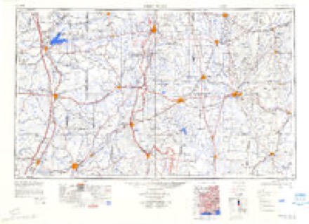
11 topographic sheets cover this place, the earliest surveyed in 1953 and the latest in 1984. It stands in the Aliceville census division. It lies in ZIP code area 35442. The Survey maps it on the Dancy quadrangle.
Topographic sheets covering this place
5 surveys from 11 printed sheetsMatched by testing this settlement's coordinate against the published boundary of every sheet in the United States Geological Survey's historical collection. Each opens the scanned sheet at the Survey.
- 1953 USGS West Point quadrangle1:250000, 3 printings
- 1958 USGS West Point quadrangle1:250000
- 1963 USGS West Point quadrangle1:250000, 2 printings
- 1974 USGS Dancy quadrangle1:24000, 2 printings
- 1984 USGS West Point quadrangle1:250000, 3 printings
Fires near this place
19 since 1996Regional context, not property-specific evidence. The federal wildfire occurrence database lists 19 fires within 5 miles of Dancy between 1996 and 2016, burning about 344 acres in total. 1 started naturally. 5 were recorded as arson. Distance is straight-line from the map coordinates, so a fire counted here may appear on a neighbouring settlement's page as well.
| Reported cause | Fires |
|---|---|
| Missing data/not specified/undetermined | 5 |
| Arson/incendiarism | 5 |
| Debris and open burning | 4 |
| Recreation and ceremony | 2 |
| Natural | 1 |
| Smoking | 1 |
| Equipment and vehicle use | 1 |
The most recent of them, most recent first, with the day each was reported and the service that recorded it.
| Date | Cause | Size | Reported by | Name on the report |
|---|---|---|---|---|
| 27 September 1998 | Arson/incendiarism | 40 acres | Mississippi Forestry Commission | not named |
| 16 September 1997 | Missing data/not specified/undetermined | under an acre | Alabama Forestry Commission | not named |
| 24 August 2007 | Natural | 3.5 acres | Alabama Forestry Commission | not named |
| 4 July 2014 | Missing data/not specified/undetermined | under an acre | Alabama Forestry Commission | NWR-20140704-002 |
| 3 April 1996 | Smoking | 25 acres | Alabama Forestry Commission | not named |
| 12 April 2014 | Recreation and ceremony | 11 acres | Mississippi Forestry Commission | 10320140412003 |
| 24 March 2014 | Missing data/not specified/undetermined | under an acre | Alabama Forestry Commission | NWR-20140324-002 |
| 2 March 2008 | Debris and open burning | 25 acres | Alabama Forestry Commission | not named |
Settlements close enough to share some of these fires:
Storms near this place
7 since 2003Regional context, not property-specific evidence. The National Weather Service names Dancy in 7 storm reports between 2003 and 2021: 5 tornado, 2 thunderstorm wind. The reports record 1 injury. Each account below is quoted exactly as the forecast office filed it, from the NOAA Storm Events Database, and each date opens the federal record of that event.
| When | Event | Place named | Harm | What the report says |
|---|---|---|---|---|
| February 2016 | Tornado (EF2) | Dancy | 1 hurt | National Weather Service meteorologists surveyed damage in Pickens County and determined that the damage was consistent with an EF-2 tornado. Maximum winds were estimated to be around 135 mph. The tornado first touched down in southwestern Pickens County south of AL Hwy 32 and west of County Road 87. From there, it continued on a northeastward path across a large part of Pickens County. The tornado was caught live on Camera by local media just after it crossed the intersection of Hwy 32 and County Road 1, just west of Cochrane. It continued northeast to the Cochrane Campground on the Tombigbee River, where scores of trees were snapped, causing minor damage to one of the buildings on the campground. The tornado first reached EF-2 magnitude as it crossed private wooded land just south of County Road 78 snapping and uprooting hundreds of trees. As the tornado crossed Huff-Barnett Road, it mowed down a wide swath of trees, with a distinct classic convergence pattern of tree fall just east of Beaver Creek. The tornado continued northeastward across Al Hwy 14 causing damage to the federal prison, and then moved on to the Martin Luther King Road/Sapp community northwest of Aliceville. Here, the tornado reached its highest rated damage. Many of the homes in this portion of the Sapp community received some extent of damage, and several were destroyed. From there, the weakening tornado continued northeastward roughly parallel to AL Hwy 17 over open and forested rural Pickens County until it passed just west of Carrollton. The tornado reintensified and broadened somewhat, with a more significant tree-fall causing damage to a few homes on the west side of Carrollton. The tornado continued on the same northeastward path gradually weakening over rural areas before lifting near Herbert Windle Road southwest of Reform. |
| April 2011 | Tornado (EF1) | Dancy | $2,900,000 | A tornado developed along a Quasi-Linear Convective System and touched down in Kemper County Mississippi (See Storm Data Jackson), then tracked northeast through Noxubee County before crossing into Pickens County, southwest of Dancy. The tornado weakened to an EF1 rating as it entered Alabama, with winds of 100 mph. As the tornado moved across AL Hwy 17 near Dancy, a barn with metal siding and roofing and two small silos were destroyed. Significant tree damage was noted along CR 85. The tornado crossed the Tombigbee River and moved parallel to CR 13. The tornado crossed AL Hwy 14 south of Aliceville, damaging a farm irrigation system. The tornado continued northeast, lifting near Hamilton Jr Craft Rd, northwest of Benevola. Dozens of trees were also downed along this path. The average path width of the Alabama portion of the tornado path was 0.5 mile (880 yds). |
| April 2003 | Tornado (F1) | Dancy | $100,000 | A landspout, a tornado that forms under a strong updraft of a developing thunderstorm, touched down in extreme southwestern Pickens County. The brief tornado destroyed a mobile home, destroyed a home, and downed a few trees. The damage occurred in the Dancy-Cochrane Community. Many surrounding trees and structures were undamaged. No injuries occurred with this tornado.Beg: 33 01.952/88 18.763 End: 33 01.952/88 18.739 |
| March 2021 | Tornado (EF1) | Dancy | - | National Weather Service meteorologists surveyed damage in southwest Pickens County and determined that it was consistent with an EF1 tornado, with maximum winds near 90 mph.||This tornado originated in Noxubee County, Mississippi and crossed the state line southwest of the intersection of Highway 17 and Highway 32. |
| February 2019 | Tornado (EF0) | Dancy | - | National Weather Service meteorologists surveyed damage in southwest Pickens County and determined that it was consistent with an EF0 tornado, with maximum sustained winds near 75 mph.||The tornado touched down over open pasture just east of Nancy Clark Road, and caused damage along an east-west treeline between two pastures. The tornado then tracked just northeast, roughly a half mile north of and parallel to Highway 32, crossing largely open pasture land which was punctuated by fence lines and thin tree lines. As it crossed Ziegler Road, the tornado snapped five power poles and also uprooted a few hardwood trees. The tornado lifted several hundred yards east of Ziegler Road. |
| April 2019 | Thunderstorm Wind | Dancy | - | Carport torn off home. |
| April 2017 | Thunderstorm Wind | Dancy | - | A church near the intersection of Highway 87 and County Road 32 sustained damage to its roof. |
Nearest settlements
The eight closest, with where each one stands in the county. Distances are straight-line, computed from the Geographic Names Information System coordinates.
| Map | Place | Distance | Sheets |
|---|---|---|---|
| Clark | 0.4 miles | 11 | |
| Cochrane | 4.3 miles | 11 | |
| Vienna | 5.4 miles | 12 | |
| Memphis | 8.6 miles | 11 | |
| Bridgeville | 10.3 miles | 12 | |
| Aliceville | 11.1 miles | 11 | |
| McMullen | 11.3 miles | 11 | |
| Garden | 11.6 miles | 11 |
Provenance
This settlement is recorded in the Geographic Names Information System as feature 117039. The sheet list is computed by point-in-boundary test against the United States Geological Survey's historical topographic inventory. Both are works of the United States government and carry no copyright under 17 U.S.C. 105.
Wildfire. Short, Karen C. 2022. Spatial wildfire occurrence data for the United States, 1992-2020 [FPA_FOD_20221014]. 6th Edition. Fort Collins, CO: Forest Service Research Data Archive. https://doi.org/10.2737/RDS-2013-0009.6 Collected with United States Government funding and usable without additional permissions or fees.
Storms. NOAA National Centers for Environmental Information, Storm Events Database https://www.ncei.noaa.gov/stormevents/ A work of the United States government, no copyright under 17 U.S.C. 105. Narratives are quoted verbatim from the National Weather Service report and are not edited or summarised.