 Block
Fernbank, Alabama
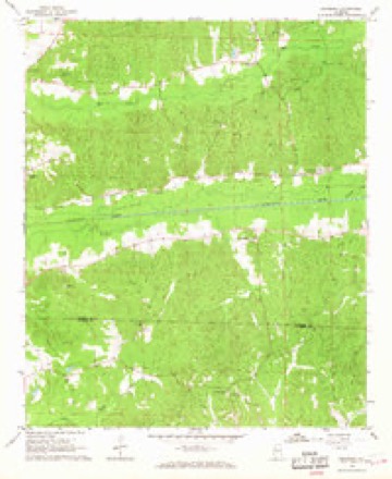
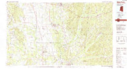
12 topographic sheets cover this place, the earliest surveyed in 1953 and the latest in 1984. It stands in the Millport census division. It lies in ZIP code area 35576. It stands on Brushy Creek. The Survey maps it on the Fernbank quadrangle.
Topographic sheets covering this place
6 surveys from 12 printed sheetsMatched by testing this settlement's coordinate against the published boundary of every sheet in the United States Geological Survey's historical collection. Each opens the scanned sheet at the Survey.
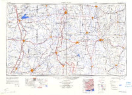
- 1953 USGS West Point quadrangle1:250000, 3 printings
- 1958 USGS West Point quadrangle1:250000
- 1963 USGS West Point quadrangle1:250000, 2 printings
- 1967 USGS Fernbank quadrangle1:24000, 2 printings
- 1982 USGS West Point quadrangle1:100000
- 1984 USGS West Point quadrangle1:250000, 3 printings
Fires near this place
86 since 1994Regional context, not property-specific evidence. The federal wildfire occurrence database lists 86 fires within 5 miles of Fernbank between 1994 and 2019, burning about 1,211 acres in total. None started naturally. 29 were recorded as arson. Distance is straight-line from the map coordinates, so a fire counted here may appear on a neighbouring settlement's page as well.
| Reported cause | Fires |
|---|---|
| Arson/incendiarism | 29 |
| Debris and open burning | 23 |
| Missing data/not specified/undetermined | 14 |
| Equipment and vehicle use | 9 |
| Smoking | 5 |
| Recreation and ceremony | 3 |
| Railroad operations and maintenance | 2 |
| Misuse of fire by a minor | 1 |
The most recent of them, most recent first, with the day each was reported and the service that recorded it.
| Date | Cause | Size | Reported by | Name on the report |
|---|---|---|---|---|
| 7 September 2007 | Arson/incendiarism | under an acre | Alabama Forestry Commission | not named |
| 6 September 2007 | Debris and open burning | 2.4 acres | Alabama Forestry Commission | not named |
| 30 September 2007 | Debris and open burning | 8.0 acres | Alabama Forestry Commission | not named |
| 3 September 2003 | Arson/incendiarism | under an acre | Alabama Forestry Commission | STEEDLEY ROAD, AL |
| 29 September 1998 | Arson/incendiarism | 2.0 acres | Alabama Forestry Commission | not named |
| 25 September 2010 | Debris and open burning | 1.0 acres | Alabama Forestry Commission | not named |
| 20 September 1999 | Arson/incendiarism | 8.0 acres | Alabama Forestry Commission | not named |
| 19 September 1999 | Arson/incendiarism | 1.0 acres | Alabama Forestry Commission | not named |
Settlements close enough to share some of these fires:
Storms near this place
16 since 1996Regional context, not property-specific evidence. The National Weather Service names Fernbank in 16 storm reports between 1996 and 2025: 6 thunderstorm wind, 5 hail, 3 tornado, 1 flash flood. The reports record 2 injuries. Each account below is quoted exactly as the forecast office filed it, from the NOAA Storm Events Database, and each date opens the federal record of that event.
| When | Event | Place named | Harm | What the report says |
|---|---|---|---|---|
| November 2002 | Tornado (F2) | Fernbank | 2 hurt, $200,000 | The Fernbank Tornado was the second tornado of the evening in Alabama, but it actually began in Mississippi. The tornado crossed the Alabama-Mississippi State Line at 7:31 pm, downing trees in Luxapallila Creek. When it reached County Road 12, a well built home was deroofed along with damage to the upper floor of the house and tremendous tree destruction. The tornado continued on a northeast track, damaging mostly trees before knocking over head stones at the Ebenezer Church and flipping automobiles. The tornado weakened fairly quickly after it passed the church and ended about 7:42 pm.This tornado was rated an F2 in Alabama but was rated an F3 in Mississippi. No deaths and two injuries were reported in the Alabama portion of this tornado.The path length was 7.2 miles with an estimated width of 150 yards. |
| November 2010 | Tornado (EF1) | Fernbank | $145,000 | The tornado touched down about 1 mile southwest of the city of Millport, where it uprooted several trees. From there, it moved northeastward and crossed AL-17 about a half mile west of Millport. On both sides of the highway, 50 to 70 trees were either snapped off or uprooted, and a few homes sustained shingle damage. Tree limbs were actually embedded into the roof of one home. In the same general area, a tractor trailer was overturned and a metal roof was blown off a garage building. In addition, Metal roof stripping was blown off a barn roof and was transported 100 yards downstream into the top of a 60 foot tree. The tornado lifted on the north side of Millport, near James Street, where a few more trees were snapped off and a barn was damaged. |
| March 1996 | Thunderstorm Wind | Fernbank | $50,000 | no account filed |
| March 1996 | Hail | Fernbank | $50,000 | no account filed |
| June 2009 | Thunderstorm Wind | Fernbank | $2,000 | Several trees and power lines were blown down on CR-27, near Millport. |
| March 2025 | Thunderstorm Wind | Fernbank | - | National Weather Service meteorologists assessed storm damage|across the southern portion of Lamar and Fayette counties, |associated with a line of storms early in the morning on Monday, |March 31st, 2025. It was determined that low-end and sporadic tree|damage was associated with gusty, straight-line winds in the|vicinity of Fernbank, Millport, Kennedy, and southwestern Fayette|County. |
| March 2024 | Thunderstorm Wind | Fernbank | - | Several trees were uprooted sporadically along Mud Creek Rd, Ebenezer Rd, Steedley Rd, and Mount Pleasant Church Rd. |
| May 2024 | Hail | Fernbank | - | Social media image of quarter-size hail near the Mississippi state line. |
| March 2019 | Thunderstorm Wind | Fernbank | - | Several trees uprooted near Country lane Road. |
| July 2014 | Thunderstorm Wind | Fernbank | - | Several trees uprooted along Highway 96 west of the town of Millport. |
| April 2014 | Tornado (EF1) | Fernbank | - | A tornado originally touched down in Lowndes County, Mississippi, 3.2 miles south southeast of Steens and moved northeast, crossing into Alabama along State Road 96 in Lamar County. The tornado moved through the Lacey Brooke Community, where several well-built homes sustained minor roof and exterior damage. As the tornado tracked nearly parallel to State Road 96, dozens of trees were snapped or uprooted. The tornado took a turn to the north, crossing Luxapallilia Creek, strengthening to winds of 100mph, and tracking parallel to Fernbank Road. It continue snapping trees until it dissipated near the intersection of Fernbank Road and Mud Creek Road, where only small limbs were damaged. |
| September 2011 | Flash Flood | Fernbank | - | Heavy rainfall from the remnants of Tropical Storm Lee caused flash flooding across southern Lamar County, resulting in numerous road closures in Millport and the surrounding areas. |
| September 2011 | Flood | Fernbank | - | Heavy rainfall from the remnants of Tropical Storm Lee led to flash flooding across portions of southern Lamar County Monday, September 5. Several roads in and around Millport remained closed through the following Wednesday morning due to flood waters. |
| March 2011 | Hail | Fernbank | - | no account filed |
| July 2011 | Hail | Fernbank | - | no account filed |
| June 2009 | Hail | Fernbank | - | no account filed |
Nearest settlements
The eight closest, with where each one stands in the county. Distances are straight-line, computed from the Geographic Names Information System coordinates.
Provenance
This settlement is recorded in the Geographic Names Information System as feature 118260. The sheet list is computed by point-in-boundary test against the United States Geological Survey's historical topographic inventory. Both are works of the United States government and carry no copyright under 17 U.S.C. 105.
Wildfire. Short, Karen C. 2022. Spatial wildfire occurrence data for the United States, 1992-2020 [FPA_FOD_20221014]. 6th Edition. Fort Collins, CO: Forest Service Research Data Archive. https://doi.org/10.2737/RDS-2013-0009.6 Collected with United States Government funding and usable without additional permissions or fees.
Storms. NOAA National Centers for Environmental Information, Storm Events Database https://www.ncei.noaa.gov/stormevents/ A work of the United States government, no copyright under 17 U.S.C. 105. Narratives are quoted verbatim from the National Weather Service report and are not edited or summarised.