 Block
Gnatville, Alabama
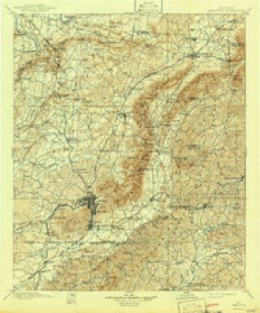
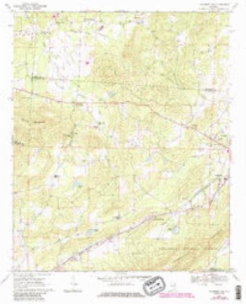
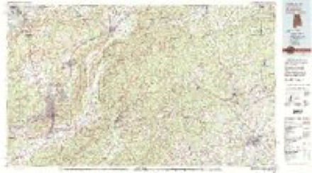
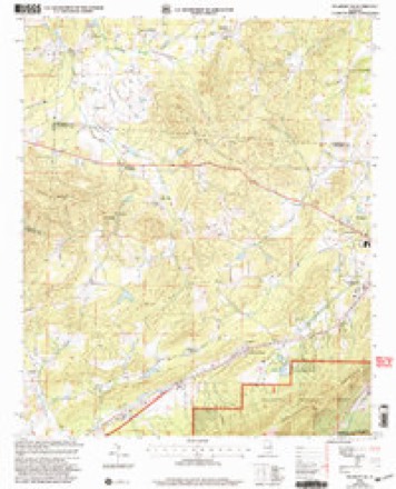
16 topographic sheets cover this place, the earliest surveyed in 1900 and the latest in 2001. It stands in the Centre census division. It lies in ZIP code area 36272. The Survey maps it on the Piedmont NW quadrangle.
Topographic sheets covering this place
7 surveys from 16 printed sheetsMatched by testing this settlement's coordinate against the published boundary of every sheet in the United States Geological Survey's historical collection. Each opens the scanned sheet at the Survey.
- 1900 USGS Anniston quadrangle1:125000, 6 printings
- 1953 USGS Atlanta quadrangle1:250000, 2 printings
- 1957 USGS Atlanta quadrangle1:250000
- 1958 USGS Atlanta quadrangle1:250000
- 1967 USGS Piedmont NW quadrangle1:24000, 3 printings
- 1981 USGS Anniston quadrangle1:100000, 2 printings
- 2001 USGS Piedmont NW quadrangle1:24000
Fires near this place
359 since 1994Regional context, not property-specific evidence. The federal wildfire occurrence database lists 359 fires within 5 miles of Gnatville between 1994 and 2020, burning about 11,012 acres in total. 3 started naturally. 203 were recorded as arson. Distance is straight-line from the map coordinates, so a fire counted here may appear on a neighbouring settlement's page as well.
| Reported cause | Fires |
|---|---|
| Arson/incendiarism | 203 |
| Debris and open burning | 95 |
| Missing data/not specified/undetermined | 39 |
| Recreation and ceremony | 7 |
| Equipment and vehicle use | 6 |
| Smoking | 3 |
| Natural | 3 |
| Misuse of fire by a minor | 2 |
| Railroad operations and maintenance | 1 |
The most recent of them, most recent first, with the day each was reported and the service that recorded it.
| Date | Cause | Size | Reported by | Name on the report |
|---|---|---|---|---|
| 6 September 2002 | Arson/incendiarism | 6.0 acres | Alabama Forestry Commission | not named |
| 4 September 1998 | Arson/incendiarism | 14 acres | Alabama Forestry Commission | not named |
| 4 September 1998 | Arson/incendiarism | 3.0 acres | Alabama Forestry Commission | not named |
| 4 September 1995 | Debris and open burning | under an acre | Alabama Forestry Commission | not named |
| 27 September 2019 | Missing data/not specified/undetermined | 5.0 acres | Alabama Forestry Commission | 20190927-2 |
| 27 September 2006 | Arson/incendiarism | 33 acres | Alabama Forestry Commission | not named |
| 24 September 2016 | Missing data/not specified/undetermined | 1.0 acres | Alabama Forestry Commission | 20160924-24 |
| 23 September 2010 | Arson/incendiarism | 87 acres | Alabama Forestry Commission | not named |
Settlements close enough to share some of these fires:
Mines and quarries near this place
10 of 39 shownRegional context, not property-specific evidence. The federal mineral resources record lists 39 workings within 5 miles of Gnatville: 15 occurrences, 13 prospects, 8 past producers, 3 unknowns. None of them still produces. What was taken out: Aluminum, Manganese, Iron, Cobalt, Manganese. Distance is straight-line from the map coordinates, so a quarry counted here may appear on a neighbouring settlement's page as well.
| Where | Site | Commodity | Status | Recorded |
|---|---|---|---|---|
| Dupont | Aluminum, Water, Free | Past Producer | 1897 | |
| Gilley Deposit | Fluorine-Fluorite, Barium-Barite | Occurrence | ||
| Gilley Fluorspar Deposit | Calcium, Fluorine-Fluorite | Occurrence | 1900 | |
| Harbour and Thompson Prospects | Nickel, Cobalt, Manganese | Occurrence | ||
| Industrial Filler Co. Mine | Silica | Past Producer | Quartz | |
| Johnson Prospect | Aluminum, Kaolin | Prospect | ||
| Knighton Deposit | Iron, Manganese | Prospect | 1953 | |
| Rock Run-Goshen Ala. | Kaolin, Aluminum | Past Producer | 1891, 1923 | |
| Gilley Fluorspar Deposit | Fluorine-Fluorite | Past Producer | 1900 | |
| Greer Prospect | Gold | Occurrence | 1881 |
Storms near this place
8 since 2008Regional context, not property-specific evidence. The National Weather Service names Gnatville in 8 storm reports between 2008 and 2025: 4 thunderstorm wind, 3 tornado, 1 flash flood. The reports record 26 injuries. Each account below is quoted exactly as the forecast office filed it, from the NOAA Storm Events Database, and each date opens the federal record of that event.
| When | Event | Place named | Harm | What the report says |
|---|---|---|---|---|
| April 2011 | Tornado (EF3) | Gnatville | 25 hurt, $19,000,000 | This tornado initially touched down in eastern Jefferson County, north northeast of Trussville and moved northeast through portions of St. Clair, Calhoun, Etowah and Cherokee Counties. The tornado then moved into Georgia, across Polk, Floyd and Bartow (See Storm Data Peachtree City) Counties. The tornado moved into southwestern Cherokee County south of Estes Crossroads, along CR 19. As the tornado continued northeast, it strengthened as it moved south of Gnatville, to an EF2 rating with winds of 120 mph. Extensive tree damage was noted along CR 6 and several mobile homes sustained significant damage off of CR 447. The tornado strengthened further to an EF3 rating with winds of 150 mph as it crossed AL Hwy 9 south of Coloma. A single family home was destroyed on CR 31. The tornado weakened slightly as it crossed Frog Mountain, but continued to knock down trees and damage an outbuilding. The tornado re-strengthened as it crossed CR 45 north of Rock Run. Damage along CR 29 south of Forney was consistent with an EF3 rating and winds of 160 mph. Several well built homes were completely destroyed. The tornado weakened as it moved toward the Alabama/Georgia stateline, but continued to cause significant tree damage consistent with an EF1 rating and winds of 105 mph. The tornado crossed into Polk County Georgia at CR 28, south of Hanson. ||This tornado was produced by a supercell thunderstorm that began in Newton County Mississippi at 13:54 pm CST, and eventually dissipated in Macon County, North Carolina at approximately 21:18 pm CST. This supercell spawned several strong to violent tornadoes along its long path, which included another violent EF4 tornado that crossed portions of Tuscaloosa and western suburbs of the Birmingham. |
| April 2011 | Thunderstorm Wind | Gnatville | 1 hurt, $15,000 | Strong winds damaged a home on CR 6 near Gnatville, resulting in one injury. |
| March 2008 | Tornado (EF2) | Gnatville | $75,000 | The tornado touched down near the intersection of CR-6 and CR-31, just west of AL-9, about 5 miles north of Piedmont. From there, it moved just north of due east, across AL-9, and then roughly parallel to CR-10 for about 3 miles, before lifting near Hurricane Creek. Some metal roof paneling was torn off a barn and one-half of a roof was torn off a brick home. Two other homes and another barn also sustained damage. Numerous trees in the area were also snapped or uprooted. |
| May 2010 | Thunderstorm Wind | Gnatville | $15,000 | Trees and power lines were blown down on CR-9, north of Piedmont. One tree fell onto a house. |
| May 2025 | Flash Flood | Gnatville | - | A few roads around Terrapin Creek were impassable due to flooding, including CR 8 near Stewart Bridge and CR 14 and CR 433. Water surrounded a home off Highway 9 just north of Piedmont. A section of CR 33 was washed out as well. |
| March 2021 | Tornado (EF0) | Gnatville | - | National Weather Service meteorologists surveyed damage in southern Cherokee County and determined that it was consistent with an EF0 tornado, with maximum winds near 80 mph.||This tornado originated in Calhoun County and crossed into Cherokee County just west of Highway 9. The tornado tracked northeast and crossed Highway 9 and County Road 33. The tornado was in a weakening phase once it crossed into Cherokee County and dissipated just east of County Road 29. Damage consisted mostly of uprooted trees. |
| August 2019 | Thunderstorm Wind | Gnatville | - | A downburst took off a roof from a large storage building and scattered the debris into an adjacent field. The storm also uprooted several trees. |
| July 2012 | Thunderstorm Wind | Gnatville | - | A security light was blown down with powerlines on County Road 31. |
Nearest settlements
The eight closest, with where each one stands in the county. Distances are straight-line, computed from the Geographic Names Information System coordinates.
| Map | Place | Distance | Sheets |
|---|---|---|---|
| Estes Crossroads | 1.8 miles | 16 | |
| Pine Grove | 3.1 miles | 18 | |
| Ball Flat | 3.4 miles | 18 | |
| Old Coloma | 3.9 miles | 18 | |
| Mona (historical) | 4.3 miles | 18 | |
| Ricks (historical) | 4.4 miles | 18 | |
| Pope | 4.8 miles | 18 | |
| McFrey Crossroads | 5.5 miles | 17 |
Elsewhere
Matched on this settlement's Geographic Names Information System number rather than its name, so it cannot be a different place of the same name in another state.
| Wikidata item Q122550857 | The structured record the population and elevation above come from. Public domain (CC0). |
Provenance
This settlement is recorded in the Geographic Names Information System as feature 159672. The sheet list is computed by point-in-boundary test against the United States Geological Survey's historical topographic inventory. Both are works of the United States government and carry no copyright under 17 U.S.C. 105.
Wildfire. Short, Karen C. 2022. Spatial wildfire occurrence data for the United States, 1992-2020 [FPA_FOD_20221014]. 6th Edition. Fort Collins, CO: Forest Service Research Data Archive. https://doi.org/10.2737/RDS-2013-0009.6 Collected with United States Government funding and usable without additional permissions or fees.
Mines and quarries. USGS Mineral Resources Data System (MRDS) https://mrdata.usgs.gov/mrds/ A work of the United States government, no copyright under 17 U.S.C. 105.
Storms. NOAA National Centers for Environmental Information, Storm Events Database https://www.ncei.noaa.gov/stormevents/ A work of the United States government, no copyright under 17 U.S.C. 105. Narratives are quoted verbatim from the National Weather Service report and are not edited or summarised.