 Block
Hazel Green, Alabama
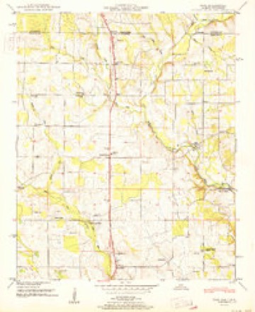
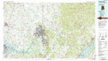
21 topographic sheets cover this place, the earliest surveyed in 1888 and the latest in 1984. It stands in the Hazel Green census division. It lies in ZIP code area 35750. The Survey maps it on the Fisk quadrangle. 4,105 people lived here at the 2020 count. It stands 794 feet above sea level.
Topographic sheets covering this place
10 surveys from 21 printed sheetsMatched by testing this settlement's coordinate against the published boundary of every sheet in the United States Geological Survey's historical collection. Each opens the scanned sheet at the Survey.
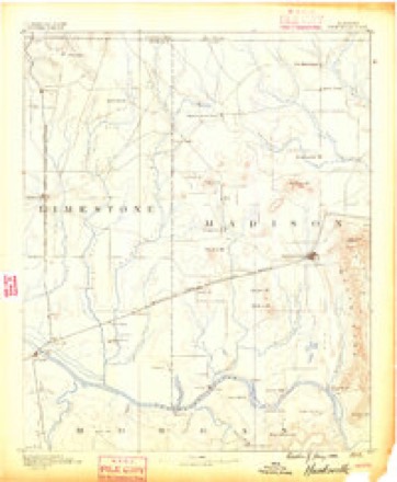
- 1888 USGS Huntsville quadrangle1:125000
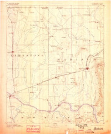
- 1892 USGS Huntsville quadrangle1:125000, 6 printings
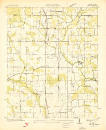
- 1936 USGS Fisk quadrangle1:24000
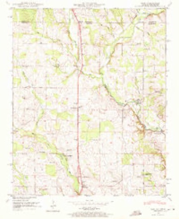
- 1948 USGS Fisk quadrangle1:24000, 2 printings
- 1951 USGS Fisk quadrangle1:24000
- 1956 USGS Gadsden quadrangle1:250000, 3 printings
- 1958 USGS Gadsden quadrangle1:250000
- 1960 USGS Gadsden quadrangle1:250000, 2 printings
- 1963 USGS Gadsden quadrangle1:250000
- 1984 USGS Huntsville quadrangle1:100000, 3 printings




Fires near this place
60 since 1997Regional context, not property-specific evidence. The federal wildfire occurrence database lists 60 fires within 5 miles of Hazel Green between 1997 and 2020, burning about 190 acres in total. None started naturally. 14 were recorded as arson. Distance is straight-line from the map coordinates, so a fire counted here may appear on a neighbouring settlement's page as well.
| Reported cause | Fires |
|---|---|
| Debris and open burning | 28 |
| Arson/incendiarism | 14 |
| Missing data/not specified/undetermined | 6 |
| Misuse of fire by a minor | 4 |
| Smoking | 3 |
| Equipment and vehicle use | 3 |
| Recreation and ceremony | 1 |
| Fireworks | 1 |
The most recent of them, most recent first, with the day each was reported and the service that recorded it.
| Date | Cause | Size | Reported by | Name on the report |
|---|---|---|---|---|
| 9 September 2002 | Equipment and vehicle use | 1.0 acres | Alabama Forestry Commission | not named |
| 9 September 1999 | Arson/incendiarism | 1.5 acres | Alabama Forestry Commission | not named |
| 9 September 1999 | Arson/incendiarism | 1.0 acres | Alabama Forestry Commission | not named |
| 9 September 1998 | Debris and open burning | 1.0 acres | Alabama Forestry Commission | not named |
| 8 September 1999 | Debris and open burning | under an acre | Alabama Forestry Commission | not named |
| 8 September 1999 | Misuse of fire by a minor | under an acre | Alabama Forestry Commission | not named |
| 3 September 1999 | Smoking | 10 acres | Alabama Forestry Commission | not named |
| 24 September 1999 | Debris and open burning | under an acre | Alabama Forestry Commission | not named |
Settlements close enough to share some of these fires:
Storms near this place
60 of 71 shownRegional context, not property-specific evidence. The National Weather Service names Hazel Green in 71 storm reports between 1995 and 2026: 33 thunderstorm wind, 28 hail, 5 flash flood, 2 tornado. The reports record 1 death and 1 injury. Each account below is quoted exactly as the forecast office filed it, from the NOAA Storm Events Database, and each date opens the federal record of that event.
| When | Event | Place named | Harm | What the report says |
|---|---|---|---|---|
| September 2021 | Flash Flood | Hazel Green | 1 killed | A 35 year old man drowned as a strong water current pulled him into a nearby drainage pipe along Bullard Road. |
| January 2022 | Tornado (EF0) | Hazel Green | 1 hurt | A tornado with a peak wind speed of 85 mph touched down at Nix Road and Charity Lane doing some minor structure damage and knocking down several tree branches. As it crossed U.S. Highway 231 it produced minor structural damages to several businesses. The tornado continued moving northeast eventually crossing Boles Road. Just to the north of Buddy Williamson Road and along Manley Road, the tornado reached its peak intensity where it knocked the roof off a mobile home and snapped several tree branches. The tornado dissipated near J.B. Walker Road west of School House Road. |
| August 2007 | Thunderstorm Wind | Hazel Green | $1,000,000 | Thunderstorm winds produced some siding damage to a home in the Hazel Green community. |
| August 2009 | Lightning | Hazel Green | $20,000 | Lightning struck a communications tower resulting in a power surge which sparked a fire at a residence on Lowe Drive in Hazel Green. Information on the extent of the fire and damages are not known. |
| July 2005 | Thunderstorm Wind | Hazel Green | $20,000 | Several Bradford pear, oak, and pine trees were blown down by a microburst in a North to South direction along Jimmy Fisk Road south of Joe Quick Road. The largest pine tree was two feet in diameter. In the Silverwood subdivision, a weakly anchored metal storage building was moved about 6 feet off of its foundation. In addition, there was minor roof damage to several homes and one tree fell on a home. |
| June 1996 | Hail | Hazel Green | $15,000 | no account filed |
| June 2008 | Thunderstorm Wind | Hazel Green | $10,000 | Thunderstorm winds downed several trees including one onto a home. Power lines were also downed in the area. |
| April 2006 | Hail | Hazel Green | $10,000 | Golf ball size hail was reported by the public. The hail lightly damaged seven cars and a few homes. |
| April 2025 | Thunderstorm Wind | Hazel Green | $5,000 | Social media photos indicated a very large tree uprooted and a carport flipped in Hazel Green. |
| June 2011 | Thunderstorm Wind | Hazel Green | $5,000 | Power lines were blown down on Charity Lane. |
| February 2009 | Thunderstorm Wind | Hazel Green | $5,000 | Thunderstorm winds produced power outages in the Sherwood Park area of Huntsville, near Alabama A & M University, in Hazel Green, Toney and New Market. |
| April 2000 | Hail | Hazel Green | $5,000 | Golfball size hail was reported on Walker Lane near Hazel Green. |
| July 1997 | Thunderstorm Wind | Hazel Green | $5,000 | no account filed |
| August 2024 | Thunderstorm Wind | Hazel Green | $4,000 | Lots of power line down or leaning in Hazel Green. |
| April 2025 | Thunderstorm Wind | Hazel Green | $3,000 | A tree was knocked down onto powerlines at 224 Joe Quick Road. |
| May 2012 | Thunderstorm Wind | Hazel Green | $3,000 | Multiple trees, up to one foot in diameter, were knocked down on Jimmy Fisk Road in Hazel Green. Time estimated by radar. |
| November 1997 | Hail | Hazel Green | $3,000 | Hail covered the ground in Hazel Green. |
| July 1997 | Hail | Hazel Green | $3,000 | no account filed |
| April 2025 | Thunderstorm Wind | Hazel Green | $2,000 | Power lines were knocked down at 1469 Charity Lane. |
| April 2025 | Thunderstorm Wind | Hazel Green | $2,000 | A tree was knocked down near Hazel Green High School. |
| April 2000 | Thunderstorm Wind | Hazel Green | $2,000 | Two power poles were blown down on Joe Quick Road in Hazel Green. |
| November 2000 | Thunderstorm Wind | Hazel Green | $2,000 | A few trees were blown down in the northern part of Madison County near Hazel Green. Some minor flooding and pea size hail were also reported on Joe Quick Road. |
| April 1998 | Hail | Hazel Green | $2,000 | Hail the size of quarters was reported in Hazel Green. |
| May 1998 | Hail | Hazel Green | $2,000 | no account filed |
| May 2021 | Thunderstorm Wind | Hazel Green | $1,000 | A tree was knocked down on a garage. Time estimated by radar. |
| April 2015 | Thunderstorm Wind | Hazel Green | $1,000 | A tree was downed by thunderstorm winds on U.S. Highway 231 and Steger road just south of Hazel Green, Alabama. |
| December 2024 | Thunderstorm Wind | Hazel Green | $500 | A tree was knocked down at the intersection of Willow Run and Jimmy Fisk. |
| June 2019 | Thunderstorm Wind | Hazel Green | $500 | A tree was knocked down onto power lines near the intersection of Britt Adam Lnae and West Limestone Road. West Limestone Road was impassible. Time estimated by radar. |
| February 2009 | Thunderstorm Wind | Hazel Green | $500 | Thunderstorm winds damaged a tin roof near Ready Section and Steven Green Roads. |
| August 2019 | Thunderstorm Wind | Hazel Green | $200 | A large tree was knocked down in Hazel Green. |
| June 2008 | Thunderstorm Wind | Hazel Green | $100 | Former NWS employee estimated wind gusts between 50 and 60 mph with a severe thunderstorm that pushed through the Hazel Green community. An outdoor bench, as well as other outdoor equipment was blown around the yard. |
| February 2026 | Hail | Hazel Green | - | Half dollar sized hail was reported. |
| February 2022 | Tornado (EF0) | Hazel Green | - | The main damage indicators from this tornado were at least 2 downed or uprooted trees and multiple areas of large branches that were downed by the winds. The damage occurred mainly along Grimwood Drive, west of U.S. Highway 431 in Hazel Green. Damage also extended into a neighborhood off Grimwood Drive near Bentley and Cherrywood Drive. Very minor, small branch damage was noted just east of U.S. Highway 431 on Walker Lane south of Briar Crest Rd. This is likely where the weak, short-lived tornado dissipated. |
| February 2022 | Hail | Hazel Green | - | Gumball sized hail was reported in Hazel Green. |
| May 2021 | Thunderstorm Wind | Hazel Green | - | Trees were down on Jimmy Fisk Road. Time estimated by radar. |
| July 2020 | Thunderstorm Wind | Hazel Green | - | Numerous trees down/uprooted near Dundee Road and highway 231/431 intersection. One of the uprooted tree knocked down a power line and snapped a street light pole. Trees down on a home. Damage also reported near West Limestone Road. |
| August 2017 | Flash Flood | Hazel Green | - | Media relayed social media report of flooding along West Limestone Road near Hazel Green. |
| March 2017 | Hail | Hazel Green | - | Golf ball sized hail was reported. |
| March 2017 | Hail | Hazel Green | - | Nickel sized hail was reported 1.2 miles northwest of Hazel Green. |
| March 2017 | Hail | Hazel Green | - | Quarter sized hail was reported. |
| January 2012 | Flash Flood | Hazel Green | - | Flash flooding was reported along Nix Road. |
| March 2012 | Hail | Hazel Green | - | Golf ball sized hail was reported at Hazel Green High School. |
| March 2012 | Hail | Hazel Green | - | Half dollar sized hail was reported 4 miles north-northwest of Hazel Green. |
| March 2012 | Hail | Hazel Green | - | Penny sized hail was reported. |
| March 2012 | Hail | Hazel Green | - | Golf ball sized hail was reported. |
| November 2010 | Flash Flood | Hazel Green | - | Rainfall amounts from 3 to over 5 inches produced flash flooding on numerous roads in the Moores Mill, Huntsville, and Madison communities. According to the Huntsville Times, parts of Hampton Cove, Redstone Arsenal, Harvest, Meridian Street, Bob Wallace Avenue and Triana Boulevard were under water. A boulder was dislodged from soggy Huntsville Mountain and rolled onto Cecil Ashburn Drive. Rainfall of 5.67 inches was reported along Aldridge Creek in Farley. A motorist was stranded due to high water on the 300 block of Naugher Road. Two vehicles were swamped in high water from an overflowing drainage ditch on First Street in Huntsville near Brahan Spring Park. |
| March 2009 | Hail | Hazel Green | - | Penny sized hail was reported 1 mile east northeast and 2 miles northeast of Colonial Gardens subdivision near Highway 231. |
| April 2009 | Heavy Rain | Hazel Green | - | Two to three inches of water was reported covering the road on Nix Road between Charity Lane and West Limestone Road in Hazel Green. |
| July 2008 | Thunderstorm Wind | Hazel Green | - | A few trees were downed by thunderstorm winds on Joe Quick Road near Summer Street, which blocked traffic in both directions. |
| May 2006 | Funnel Cloud | Hazel Green | - | A funnel cloud was spotted near Brooks Chapel Road and in the community of Bobo. |
| May 2006 | Thunderstorm Wind | Hazel Green | - | A power line was blown down and ignited on fire along Shiloh Road. |
| May 2006 | Thunderstorm Wind | Hazel Green | - | Powerlines were blown down on Bobo Section Road. |
| May 2006 | Hail | Hazel Green | - | Nickel sized hail reported. |
| July 2005 | Thunderstorm Wind | Hazel Green | - | A few trees and power lines were blown down near Highway 231/431. |
| July 2004 | Thunderstorm Wind | Hazel Green | - | Several trees blown down due to thunderstorm winds associated with a line of severe thunderstorms moving southeast through the county. |
| July 2004 | Thunderstorm Wind | Hazel Green | - | A few power lines were blown down due to thunderstorm winds. |
| February 2003 | Flash Flood | Hazel Green | - | Flood lane flooded. |
| March 2003 | Thunderstorm Wind | Hazel Green | - | Mobile Home overturned. |
| March 2003 | Thunderstorm Wind | Hazel Green | - | A large street sign and power lines down |
| June 2003 | Thunderstorm Wind | Hazel Green | - | few large limbs down |
Nearest settlements
The eight closest, with where each one stands in the county. Distances are straight-line, computed from the Geographic Names Information System coordinates.
| Map | Place | Distance | Sheets |
|---|---|---|---|
| Fisk | 2.0 miles | 21 | |
| Keys Mill | 2.6 miles | 21 | |
| Skinem | 3.3 miles | 21 | |
| Sulphur Springs | 3.6 miles | 21 | |
| New Sharon | 3.8 miles | 21 | |
| State Line | 4.0 miles | 21 | |
| Walnut Grove | 4.1 miles | 20 | |
| Colonial Gardens | 4.3 miles | 24 |
Elsewhere
Matched on this settlement's Geographic Names Information System number rather than its name, so it cannot be a different place of the same name in another state.
| Wikipedia article on Hazel Green | An encyclopaedic summary. Its text is share-alike, so it is linked here rather than copied. |
| Wikidata item Q1268787 | The structured record the population and elevation above come from. Public domain (CC0). |
Provenance
This settlement is recorded in the Geographic Names Information System as feature 155094. The sheet list is computed by point-in-boundary test against the United States Geological Survey's historical topographic inventory. Both are works of the United States government and carry no copyright under 17 U.S.C. 105.
Wildfire. Short, Karen C. 2022. Spatial wildfire occurrence data for the United States, 1992-2020 [FPA_FOD_20221014]. 6th Edition. Fort Collins, CO: Forest Service Research Data Archive. https://doi.org/10.2737/RDS-2013-0009.6 Collected with United States Government funding and usable without additional permissions or fees.
Storms. NOAA National Centers for Environmental Information, Storm Events Database https://www.ncei.noaa.gov/stormevents/ A work of the United States government, no copyright under 17 U.S.C. 105. Narratives are quoted verbatim from the National Weather Service report and are not edited or summarised.