 Block
Huntsville Park, Alabama
25 topographic sheets cover this place, the earliest surveyed in 1888 and the latest in 1984. It stands in the Huntsville census division. It lies in ZIP code area 35805. It stands on Merrimac Branch. The Survey maps it on the Huntsville quadrangle.
On record in Huntsville Park
Buildings and businesses the archive holds for this place. Each opens its own page, with the source record it came from.
On the National Register within a mile 1 record
The National Register names another town for these. They stand within one mile of this settlement's coordinate.
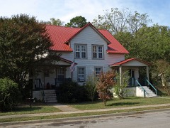 Merrimack Mill Village Historic Districtlisted 2010 · 0.4 miles away
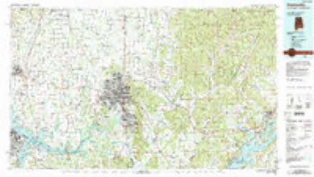
Topographic sheets covering this place
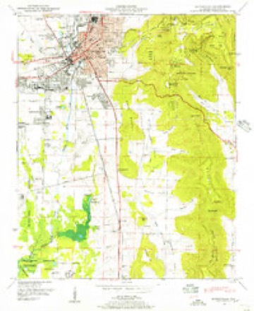
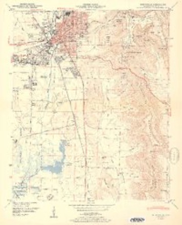
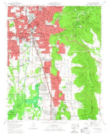
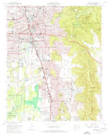
12 surveys from 25 printed sheetsMatched by testing this settlement's coordinate against the published boundary of every sheet in the United States Geological Survey's historical collection. Each opens the scanned sheet at the Survey.
- 1888 USGS Huntsville quadrangle1:125000
- 1892 USGS Huntsville quadrangle1:125000, 6 printings
- 1936 USGS Huntsville quadrangle1:24000
- 1948 USGS Huntsville quadrangle1:24000
- 1950 USGS Huntsville quadrangle1:24000, 2 printings
- 1956 USGS Gadsden quadrangle1:250000, 3 printings
- 1958 USGS Gadsden quadrangle1:250000
- 1960 USGS Gadsden quadrangle1:250000, 2 printings
- 1963 USGS Gadsden quadrangle1:250000
- 1964 USGS Huntsville quadrangle1:24000
- 1975 USGS Huntsville quadrangle1:24000, 3 printings
- 1984 USGS Huntsville quadrangle1:100000, 3 printings




Fires near this place
10 since 1997Regional context, not property-specific evidence. The federal wildfire occurrence database lists 10 fires within 5 miles of Huntsville Park between 1997 and 2011, burning about 72 acres in total. None started naturally. 3 were recorded as arson. Distance is straight-line from the map coordinates, so a fire counted here may appear on a neighbouring settlement's page as well.
| Reported cause | Fires |
|---|---|
| Debris and open burning | 5 |
| Arson/incendiarism | 3 |
| Equipment and vehicle use | 2 |
The most recent of them, most recent first, with the day each was reported and the service that recorded it.
| Date | Cause | Size | Reported by | Name on the report |
|---|---|---|---|---|
| 19 September 1997 | Debris and open burning | 6.0 acres | Alabama Forestry Commission | not named |
| 16 September 2000 | Arson/incendiarism | 2.0 acres | Alabama Forestry Commission | not named |
| 15 September 1999 | Arson/incendiarism | 3.0 acres | Alabama Forestry Commission | not named |
| 18 June 2008 | Debris and open burning | under an acre | Alabama Forestry Commission | 217 CHRIS RYAN LANE TONEY ALABAMA, AL |
| 12 June 2011 | Equipment and vehicle use | 25 acres | Alabama Forestry Commission | HUNTSVILLE BROWNS FERRY / MALONE ROAD, AL |
| 17 May 2001 | Debris and open burning | under an acre | Alabama Forestry Commission | not named |
| 5 October 1999 | Equipment and vehicle use | under an acre | Alabama Forestry Commission | not named |
| 25 October 2011 | Debris and open burning | 2.0 acres | Alabama Forestry Commission | 3196 CR 2 , AL |
Settlements close enough to share some of these fires:
Mines and quarries near this place
4 within 5 milesRegional context, not property-specific evidence. The federal mineral resources record lists 4 workings within 5 miles of Huntsville Park: 2 producers, 1 plant, 1 unknown. 3 still produce. What was taken out: Sand and Gravel, Construction, Clay, Molybdenum. Distance is straight-line from the map coordinates, so a quarry counted here may appear on a neighbouring settlement's page as well.
| Where | Site | Commodity | Status | Recorded |
|---|---|---|---|---|
| Teledyne Wah Chang/Huntsville, Ala. | Molybdenum | Unknown | ||
| Wheeler Lake Mine | Clay | Producer | ||
| Baker Terminal | Sand and Gravel, Construction | Producer | ||
| Base Plant | Sand and Gravel, Construction | Plant |
Storms near this place
53 since 2007Regional context, not property-specific evidence. The National Weather Service names Huntsville Park in 53 storm reports between 2007 and 2025: 29 thunderstorm wind, 12 hail, 5 flash flood, 4 flood. The reports record 1 injury. Each account below is quoted exactly as the forecast office filed it, from the NOAA Storm Events Database, and each date opens the federal record of that event.
| When | Event | Place named | Harm | What the report says |
|---|---|---|---|---|
| January 2010 | Tornado (EF2) | Huntsville Park | 1 hurt | A tornado first touched down in a residential development on the Redstone Arsenal, just 2 miles south of the National Weather Service office located on the campus of the University of Alabama in Huntsville. A narrow tornado path uprooted a large tree, then moved into a residential area along Magnolia Circle. Here, the tornado tore shingles off of roofs and ripped siding off several homes. The tornado then lifted briefly before touching down again near the intersection of Triana Blvd and 9th Ave in Huntsville. It then proceeded northeast another 4.4 miles, through the Old Town and Five Points communities, before lifting near the intersection of Gaboury Lane and Rosalie Ridge road near Chapman Mountain. Along it's path, many hardwood/softwood trees and utility poles were snapped. Multiple well-built single family homes sustained substantial roof damage. Two teenagers sustained minor injuries near the Windover Drive and Maysville road intersection, when a tree fell onto the truck while they were inside. The tornado also picked up a truck in its path and threw it approximately 30 feet into the the porch of a residence on Oakwood Avenue. The driver of the truck sustained minor injuries. Luckily no one was injured at the residence. The winds were estimated to reach peak speeds of 115 mph. |
| April 2025 | Thunderstorm Wind | Huntsville Park | $3,000 | Trees were knocked down at 316 Wingate Avenue. |
| August 2008 | Thunderstorm Wind | Huntsville Park | $3,000 | A few trees and power lines were blown down near the intersection of Drake Ave and Mcvay street. |
| August 2023 | Thunderstorm Wind | Huntsville Park | $2,000 | Several trees were uprooted and snapped on Redstone Arsenal at Vincent Drive at Phoenix Road. Time estimated by radar. |
| May 2012 | Thunderstorm Wind | Huntsville Park | $2,000 | A three foot diameter tree was knocked down and blocking a portion of the intersection of Triana Boulevard and Archer. |
| July 2009 | Thunderstorm Wind | Huntsville Park | $2,000 | An outflow from a decaying thunderstorm complex downed a tree onto a house on Alpine Street in Huntsville. |
| June 2008 | Thunderstorm Wind | Huntsville Park | $2,000 | Thunderstorm winds downed two trees at the intersection of Bob Wallace and Memorial Parkway. |
| July 2021 | Thunderstorm Wind | Huntsville Park | $1,500 | A tree was knocked down on a trailer off of Johnson Road. Time estimated by radar. |
| March 2020 | Thunderstorm Wind | Huntsville Park | $1,000 | A power pole was snapped near Bob Wallace Avenue. Photo relayed through social media. |
| May 2017 | Thunderstorm Wind | Huntsville Park | $1,000 | A tree was knocked down on a house. |
| May 2017 | Thunderstorm Wind | Huntsville Park | $1,000 | A tree was knocked down onto a house. |
| May 2017 | Thunderstorm Wind | Huntsville Park | $1,000 | A tree was knocked down on a house. |
| August 2016 | Thunderstorm Wind | Huntsville Park | $1,000 | A tree and power lines were knocked down on Biscayne Street. Time estimated from radar. |
| August 2007 | Flash Flood | Huntsville Park | $1,000 | Flash flooding prompted a section of Balmoral Drive to be blocked off. Flash flooding was reported on several Huntsville streets including Meridian Street, Whitesburg Drive, South Memorial Parkway, and University Drive. Time estimated. |
| June 2023 | Lightning | Huntsville Park | $500 | Lightning struck a tree between Clopton Street and Triana Blvd. |
| July 2023 | Thunderstorm Wind | Huntsville Park | $500 | A tree was knocked down near the intersection of Patton Road SW and Drake Avenue SW. |
| June 2017 | Thunderstorm Wind | Huntsville Park | $500 | Trees were knocked down at Newson Road and Westdale Court in Huntsville. |
| May 2016 | Thunderstorm Wind | Huntsville Park | $500 | Power lines were downed by thunderstorm winds at Knight and Johnson Roads. The road intersection was closed. |
| April 2011 | Thunderstorm Wind | Huntsville Park | $500 | An 8 foot section of a tree top was snapped by thunderstorm winds on Lewter Road. |
| May 2020 | Thunderstorm Wind | Huntsville Park | $200 | One inch tree limbs were broken and roof shingles blown off. Report via mPING. |
| July 2020 | Thunderstorm Wind | Huntsville Park | $200 | A tree was knocked down at this location. |
| July 2020 | Thunderstorm Wind | Huntsville Park | $200 | A tree was knocked down on Surrey Road Southwest. |
| April 2019 | Thunderstorm Wind | Huntsville Park | $200 | A tree was knocked down in the Huntsville Botanical Garden. Time estimated from radar. |
| May 2025 | Hail | Huntsville Park | - | Hail with a diameter of 1.75 inches was reported via mPING. |
| May 2025 | Hail | Huntsville Park | - | Hail with a diameter of 1.25 inches was reported via mPING. |
| May 2025 | Hail | Huntsville Park | - | Hail with a diameter of 1.5 inches was reported via mPING. |
| May 2025 | Hail | Huntsville Park | - | Egg sized hail was reported near the intersection of Bob Wallace and Memorial Parkway. |
| May 2025 | Hail | Huntsville Park | - | Ping pong sized hail was reported at Huntsville High School. Time estimated by radar. |
| May 2025 | Hail | Huntsville Park | - | Three quarter inch in diameter hail was reported by an observer on the MPING network. |
| August 2023 | Hail | Huntsville Park | - | Hail of 3/4 inch in diameter was reported via mPING. |
| September 2021 | Flood | Huntsville Park | - | Water over the road at Bob Wallace Ave and Memorial Parkway. |
| September 2021 | Flood | Huntsville Park | - | Water over the road just west of Memorial Parkway along Airport Road. |
| September 2021 | Flood | Huntsville Park | - | Video shows right lane flooded along Whitesburg Drive between Drake Avenue and California Street. Depth of water unknown. |
| May 2020 | Thunderstorm Wind | Huntsville Park | - | Trees and a power transformer were knocked down on Bob Wallace Avenue. |
| September 2019 | Thunderstorm Wind | Huntsville Park | - | Trees were knocked down at the 4400 block of Millvale Drive. Time estimated by radar. |
| September 2019 | Thunderstorm Wind | Huntsville Park | - | A large tree was knocked down onto an apartment building causing severe damage on Hood Road. |
| September 2019 | Thunderstorm Wind | Huntsville Park | - | Trees and power lines were knocked down on Baywood Drive and Johnson Drive. Time estimated by radar. |
| January 2017 | Flood | Huntsville Park | - | Estimated three feet of water coming out of Pinhool Creek at the intersection of Jaycee Way and Airport Road. Water reported not to be flowing over the intersection, though Huntsville PD is blocking off the road at this time. |
| May 2017 | Thunderstorm Wind | Huntsville Park | - | A broken power pole and transformer was down near Leeman Ferry Road and the Memorial Parkway. |
| May 2017 | Thunderstorm Wind | Huntsville Park | - | Signs were blown down around the Memorial Parkway at Drake Avenue. |
| March 2017 | Hail | Huntsville Park | - | Half dollar sized hail was reported near the intersection of Whitesburg Drive and Drake Avenue. |
| April 2017 | Thunderstorm Wind | Huntsville Park | - | A wind gust of 64 mph was measured by the public near I-565 and Bob Wallace Avenue. |
| November 2016 | Flash Flood | Huntsville Park | - | Water covering the roadway at the intersection of 1st Street and 15th Avenue. |
| June 2016 | Thunderstorm Wind | Huntsville Park | - | Power lines were knocked down and a roof was blown off at Winter Park Apartments. |
| April 2013 | Thunderstorm Wind | Huntsville Park | - | A 30 foot tall hollow aluminum flagpole was snapped off near it's base. |
| August 2013 | Flash Flood | Huntsville Park | - | Between six inches and a foot of water was flowing across the road at the intersection of Bob Wallace and Triana Boulevard Southwest. |
| April 2011 | Hail | Huntsville Park | - | A thunderstorm produced hail up to 1 inch in south Huntsville. |
| May 2011 | Hail | Huntsville Park | - | Nickel size hail was reported at the intersectoin of Bob Wallace and Triana. |
| May 2009 | Flash Flood | Huntsville Park | - | Heavy rains from thunderstorms caused water six inches deep to occur over Airport Road in southeast portions of Huntsville. |
| September 2009 | Flash Flood | Huntsville Park | - | The two outside lanes of Drake Avenue were reported unusable due to flash flooding between Memorial Parkway and Whitesburg. |
| April 2007 | Hail | Huntsville Park | - | This thunderstorm dropped hail in the city of Madison and moved east along I-565 toward Huntsville. Hail was reported throughout the city of Huntsville, from the UAH campus to the downtown area mainly along and south of I-565. |
| April 2007 | Hail | Huntsville Park | - | Hail occurred at the Parkway Place Mall. |
| August 2007 | Heavy Rain | Huntsville Park | - | Intense rainfall was measured at the Spring Branch gage at Johnson Road. One hour rainfall from 6:00 to 7:00 pm was 3.40 inches. 30 minute rainfall from 6:00 to 6:30 pm was 2.41 inches. 20 minute rainfall from 6:15 pm to 6:35 pm was 2.18 inches, averaging 0.55 every 5 minutes during this time frame. |
Nearest settlements
The eight closest, with where each one stands in the county. Distances are straight-line, computed from the Geographic Names Information System coordinates.
| Map | Place | Distance | Sheets |
|---|---|---|---|
| Pea Ridge | 0.7 miles | 25 | |
| Chelsea | 1.1 miles | 25 | |
| Lynwood Gardens | 1.1 miles | 27 | |
| West Huntsville | 1.1 miles | 25 | |
| Westlawn | 1.1 miles | 27 | |
| Oak Leaf | 1.2 miles | 25 | |
| Hillmont | 1.3 miles | 25 | |
| Green Acres | 1.5 miles | 27 |
Provenance
This settlement is recorded in the Geographic Names Information System as feature 120562. The sheet list is computed by point-in-boundary test against the United States Geological Survey's historical topographic inventory. Both are works of the United States government and carry no copyright under 17 U.S.C. 105.
Wildfire. Short, Karen C. 2022. Spatial wildfire occurrence data for the United States, 1992-2020 [FPA_FOD_20221014]. 6th Edition. Fort Collins, CO: Forest Service Research Data Archive. https://doi.org/10.2737/RDS-2013-0009.6 Collected with United States Government funding and usable without additional permissions or fees.
Mines and quarries. USGS Mineral Resources Data System (MRDS) https://mrdata.usgs.gov/mrds/ A work of the United States government, no copyright under 17 U.S.C. 105.
Storms. NOAA National Centers for Environmental Information, Storm Events Database https://www.ncei.noaa.gov/stormevents/ A work of the United States government, no copyright under 17 U.S.C. 105. Narratives are quoted verbatim from the National Weather Service report and are not edited or summarised.