 Block
Jones Chapel, Alabama
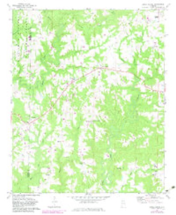
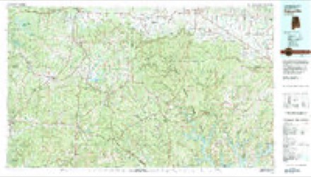
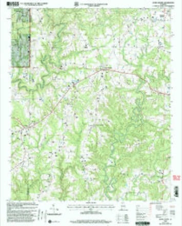
11 topographic sheets cover this place, the earliest surveyed in 1956 and the latest in 2000. It stands in the Jones Chapel census division. It lies in ZIP code area 35057. It stands on Dripping Springs Creek. The Survey maps it on the Jones Chapel quadrangle.
Topographic sheets covering this place
7 surveys from 11 printed sheetsMatched by testing this settlement's coordinate against the published boundary of every sheet in the United States Geological Survey's historical collection. Each opens the scanned sheet at the Survey.
- 1956 USGS Gadsden quadrangle1:250000, 3 printings
- 1958 USGS Gadsden quadrangle1:250000
- 1960 USGS Gadsden quadrangle1:250000, 2 printings
- 1963 USGS Gadsden quadrangle1:250000
- 1969 USGS Jones Chapel quadrangle1:24000, 2 printings
- 1980 USGS Haleyville quadrangle1:100000
- 2000 USGS Jones Chapel quadrangle1:24000




Fires near this place
109 since 1993Regional context, not property-specific evidence. The federal wildfire occurrence database lists 109 fires within 5 miles of Jones Chapel between 1993 and 2020, burning about 2,096 acres in total. None started naturally. 50 were recorded as arson. Distance is straight-line from the map coordinates, so a fire counted here may appear on a neighbouring settlement's page as well.
| Reported cause | Fires |
|---|---|
| Arson/incendiarism | 50 |
| Debris and open burning | 32 |
| Missing data/not specified/undetermined | 21 |
| Equipment and vehicle use | 3 |
| Recreation and ceremony | 1 |
| Railroad operations and maintenance | 1 |
| Smoking | 1 |
The most recent of them, most recent first, with the day each was reported and the service that recorded it.
| Date | Cause | Size | Reported by | Name on the report |
|---|---|---|---|---|
| 7 September 1998 | Arson/incendiarism | 10 acres | Alabama Forestry Commission | not named |
| 6 September 1999 | Arson/incendiarism | 3.0 acres | National Forests in Alabama | MILL CREEK 1 |
| 4 September 2010 | Arson/incendiarism | 33 acres | Alabama Forestry Commission | not named |
| 4 September 1998 | Debris and open burning | 5.0 acres | Alabama Forestry Commission | not named |
| 3 September 2008 | Arson/incendiarism | 17 acres | Alabama Forestry Commission | 1925 COUNTY ROAD 998, AL |
| 29 September 2014 | Missing data/not specified/undetermined | 1.0 acres | Alabama Forestry Commission | NER-20140929-002 |
| 29 September 2004 | Debris and open burning | under an acre | Alabama Forestry Commission | not named |
| 24 September 2019 | Debris and open burning | 10 acres | Alabama Forestry Commission | 20190924-6 |
Settlements close enough to share some of these fires:
Storms near this place
55 since 1994Regional context, not property-specific evidence. The National Weather Service names Jones Chapel in 55 storm reports between 1994 and 2025: 27 thunderstorm wind, 18 hail, 6 tornado, 2 lightning. The reports record 5 injuries. Each account below is quoted exactly as the forecast office filed it, from the NOAA Storm Events Database, and each date opens the federal record of that event.
| When | Event | Place named | Harm | What the report says |
|---|---|---|---|---|
| June 2018 | Tornado (EF2) | Jones Chapel | 3 hurt | As the tornado crossed from Winston into Cullman County, the tornado likely lifted shortly after crossing CR 1069 and producing minor limb damage. The tornado likely touched down again west of the CR 1055 and CR 1082 intersection. Extensive tree damage was observed. Numerous trees were either uprooted or snapped as the tornado tracked through a depression on the north side of CR 1055. Intensity was documented as 90 mph (EF-1) as it approached CR 1082. At this point, the tornado likely lifted again as it moved east of CR 1082 with only minor limb damage observed through Sullivan Creek.||Peak intensity of the tornado was observed along CR 1091, west of CR 1114. A one year old manufactured home was completely destroyed as it broke away from its anchors, causing 3 injuries. The home was perpendicular to the winds, facing due west. It was displaced about 20 yards from its original location. Three of four corner anchor units were ripped from the ground. The fourth remained lodged in ground but the metal strap was ripped from the I-Beam. It is worth noting that the anchors were approximately 2-3 feet into the ground, and were strapped to the I-Beam (from what could be observed). However, given the highly saturated, muddy soil, the anchors were pulled out as the home tipped backwards. Given this potential failure, winds were estimated at 130 mph (EF-2), or slightly above the expected value for a completely destroyed manufactured home. Additionally, near this location, several trees were uprooted. Peak width of approximately 180 yards were also documented in this area.||As the tornado tracked east, another area of downed branches and uprooted trees were noted east of CR 1107. This was the final location of observed damage as the tornado likely lifted and eventually dissipated along CR 1114. |
| August 2012 | Thunderstorm Wind | Jones Chapel | 1 hurt, $10,000 | Strong thunderstorm winds estimated at 40 mph knocked down a few small tree limbs and produced slight damage to an awning at a Texaco gas station near Addison, Alabama. The awning fell onto a vehicle at the Texaco gas station and slightly injured a person. |
| July 2010 | Lightning | Jones Chapel | 1 hurt | A woman was struck by lightning in her home off highway 939. |
| January 2013 | Tornado (EF1) | Jones Chapel | $50,000 | A tornado crossed the Winston and Cullman county line just south of county road 1043, causing minor tree damage and destroying a barn on county road 1038. The tornado then strengthened to an EF-1 with winds around 90 MPH and destroyed a mobile home along county road 1043 just east of county road 1038. The tornado continued east-northeast. lifting near county road 1047. The survey was conducted by NWS Birmingham since the tornado initially touched down in Winston County. |
| August 2007 | Thunderstorm Wind | Jones Chapel | $20,000 | Thunderstorm winds blew down large trees and caused power outages of up to 2600 residents in the Jones Chapel area. One tree feel on a mobile home likely causing a total loss. The home was unoccupied at the time. A tin roof was ripped of of a barn along County Road 940. |
| July 2005 | Flash Flood | Jones Chapel | $20,000 | Flash flooding washed out a bridge on County Road 985. |
| May 1998 | Thunderstorm Wind | Jones Chapel | $15,000 | Trees were down and minor damage was done to some chicken houses and out buildings southwest of Jones Chapel. |
| April 2013 | Thunderstorm Wind | Jones Chapel | $10,000 | A few trees were downed by thunderstorm winds on County Road 1051 near Jones Chapel, Alabama. |
| May 1998 | Hail | Jones Chapel | $10,000 | Golf ball size hail was reported in Jones Chapel. |
| August 2002 | Lightning | Jones Chapel | $8,000 | One house was struck by lightning on CR 1079 in extreme northwest Cullman County. A fire was started by the lightning and caused minor damage. |
| July 2008 | Thunderstorm Wind | Jones Chapel | $4,000 | Severe thunderstorm winds downed trees and damaged a barn in the Jones Chapel area. |
| April 2008 | Thunderstorm Wind | Jones Chapel | $3,000 | Severe thunderstorm winds blew down trees and power lines along highway 278 along the Cullman and Winston County line. |
| June 2025 | Thunderstorm Wind | Jones Chapel | $2,000 | Power lines were knocked down at 13065 U.S. Highway 278. Time estimated by radar. |
| June 2025 | Thunderstorm Wind | Jones Chapel | $2,000 | Trees were knocked down at 2510 and 1285 CR 940. Time estimated by radar. |
| June 2025 | Thunderstorm Wind | Jones Chapel | $2,000 | Power lines were knocked down at 178 CR 1026. Time estimated by radar. |
| August 2023 | Thunderstorm Wind | Jones Chapel | $2,000 | Power lines were reported down on Highway 278 in the Jones Chapel community. Time was estimated from radar. |
| April 2009 | Thunderstorm Wind | Jones Chapel | $2,000 | Winds blew a tree onto a house in the Jones Chapel area. |
| June 2009 | Thunderstorm Wind | Jones Chapel | $2,000 | Thunderstorm winds knocked trees down in the Jones Chapel area. |
| October 1997 | Hail | Jones Chapel | $2,000 | no account filed |
| June 2025 | Thunderstorm Wind | Jones Chapel | $1,000 | A tree was knocked down at 1237 CR 1092. Time estimated by radar. |
| July 2023 | Thunderstorm Wind | Jones Chapel | $1,000 | Trees were knocked down on Highway 278 between NeSmith and the county line. Time estimated by radar. |
| May 2024 | Thunderstorm Wind | Jones Chapel | $500 | A tree was reported down blocking the road along CR 1082. |
| April 2013 | Thunderstorm Wind | Jones Chapel | $500 | A tree was knocked down at the 9600 block of U.S. Highway 278 West. |
| January 2013 | Thunderstorm Wind | Jones Chapel | $500 | A tree was downed by thunderstorm winds on county road 940. The time was estimated from radar. |
| January 2013 | Thunderstorm Wind | Jones Chapel | $500 | Power lines were knocked down by thunderstorm winds on the roadway at the intersection of county roads 1043 and 1046 near Arkadelphia, Alabama. |
| March 2006 | Thunderstorm Wind | Jones Chapel | $500 | Roof damage was reported to a chicken house. |
| June 2018 | Thunderstorm Wind | Jones Chapel | $200 | A tree was knocked down across the road at 5750 CR 1043. |
| March 2021 | Tornado (EF0) | Jones Chapel | - | A tornado weakened and lifted as it moved out of Winston County about 100 yards across the Cullman County line, about 0.8 miles south-southwest of Nesmith. The tornado knocked down large tree limbs and damaged an outbuilding, with peak wind speeds in the 60 to 65 mph range. |
| April 2021 | Hail | Jones Chapel | - | Quarter-sized hail was reported in the Jones Chapel area. |
| August 2020 | Tornado (EF1) | Jones Chapel | - | A storm survey concluded that the damage in northwestern Cullman County was consistent with an EF-1 tornado with winds up to 87 mph. It appeared that the tornado touched down near CR 1069 where it caused minor damage to a farm building and knocked down several small to large tree branches. Damage was noted on a path between CR 1069 and CR 1059. At CR 1059, several trees were either snapped or uprooted. The most intense damage was noted with two small farm structures that were destroyed and a single-wide mobile home that was knocked off its piers but remained upright. The mobile home remained attached to its straps and the straps to I-beams. However one I-beam and one strap were dislodged on the front end of the mobile home. The tornado continued between CR 1059 and CR 1082 near the CR 1083 intersection where more large trees were uprooted. The tornado continued between CR 1082 and SR 157 and then|lifted before reaching SR 157. |
| May 2019 | Thunderstorm Wind | Jones Chapel | - | Damage to a chicken house was reported near CR 940 and 930 south of U.S. Highway 278. |
| April 2017 | Thunderstorm Wind | Jones Chapel | - | A National Weather Service and Emergency Management surve team found a large swath of straight-line wind damage in the Battleground area. Significant soft and hardwood tree damage was noted near CR 1082, CR 1055, and CR 1087. Damage appeared to track south of Jones Valley through CR 988. The wind swath was approximately 1.5 to 2 miles in width and maximum wind speeds were estimated at 105 mph as 2 large barn structures were completely destroyed near CR 1087. Nearly all damage was oriented to the east-southeast, which was the general storm motion. |
| April 2017 | Thunderstorm Wind | Jones Chapel | - | A chicken house was damaged by thunderstorm winds. |
| April 2017 | Thunderstorm Wind | Jones Chapel | - | Cars and trucks were overturned and barn damage was reported near CR 1055 and CR 1082. Time estimated by radar. |
| April 2017 | Tornado (EF1) | Jones Chapel | - | A National Weather Service and Emergency Management survey team determined a 200 yard swath of tornado damage adjacent to widespread straight-line wind damage. The tornado was an EF-1 with maximum winds estimated at 100 mph.||The tornado appeared to develop near the intersection of CR 1043 and CR 1047 where roof damage to a farm house was noted. The tornado continued near CR 1043 and uprooted several trees before heavily damaging a farm structure west of the CR 1043 and CR 1082 intersection.||Sporadic tree limb damage was noted between CR 1082 and CR 1039 north of Jones Chapel. South of Jones Chapel, several chicken houses were severely damaged by the tornado before dissipating near the CR 991/992. |
| November 2016 | Tornado (EF1) | Jones Chapel | - | The tornado that began in Winston County producing EF-1 damage continued into NW Cullman County near Ne Smith, AL where multiple hardwood and softwood trees were snapped as it moved towards a storage shed building on County Road 1024.||As it moved towards the small building the tornado uplifted the roof of the building causing the walls collapse and sending debris across a field. Then, as the tornado proceeded northeast it uplifted the metal roof on another single family building. This damage was consistent with EF-1 intensity and was the strongest damage with this portion of the tornado track. More trees were snapped just to the northeast|of this position on County Road 1024 near another single family home before it lifted. |
| November 2016 | Hail | Jones Chapel | - | Golf ball sized hail was reported. |
| July 2015 | Thunderstorm Wind | Jones Chapel | - | A few trees were uprooted in and around Jones Chapel. |
| June 2014 | Thunderstorm Wind | Jones Chapel | - | Thunderstorm winds knocked down trees and power lines. The time was estimated by radar. |
| October 2014 | Hail | Jones Chapel | - | Nickel sized hail was reported in the Jones Chapel, Alabama area along the intersection of county road 1091 and county road 1114. |
| April 2011 | Hail | Jones Chapel | - | Quarter sized hail was reported. |
| March 2011 | Hail | Jones Chapel | - | Nickel sized hail was reported. |
| March 2010 | Hail | Jones Chapel | - | A thunderstorm moved northeast from near Logan to the West Point area producing nickel to quarter size hail along it's path. |
| April 2009 | Hail | Jones Chapel | - | Hail up to the size of quarters was reported on Highway 278 on the Cullman/Winston county line. |
| June 2009 | Thunderstorm Wind | Jones Chapel | - | A trained spotter estimated wind gusts of at least 60 mph in the Jones Chapel area. |
| April 2006 | Hail | Jones Chapel | - | Penny size hail was reported. |
| April 2006 | Hail | Jones Chapel | - | Quarter size hail was reported. |
| March 2006 | Hail | Jones Chapel | - | Penny sized hail was reported. |
| March 2005 | Hail | Jones Chapel | - | Penny size hail reported. |
| July 2005 | Flash Flood | Jones Chapel | - | Torrential rains from a thunderstorm resulted in the closure of several roads due to high water. |
| May 2001 | Hail | Jones Chapel | - | Dime size hail was observed in northwest Cullman County near Jones Chapel. |
| February 2000 | Hail | Jones Chapel | - | Dime size hail was reported in Jones Chapel. |
| October 1995 | Hail | Jones Chapel | - | Dime-size hail was reported at Jones Chapel in northwest Cullman County. |
| November 1994 | Hail | Jones Chapel | - | Golf ball size hail was reported in the extreme northwest corner of the county by emergency management. A number of trees were reported downed near Baldwin just west of Cullman. Trees were reported blown down at Good Hope by EMA and electric company. |
| March 1998 | Hail | Jones Chapel | - | no account filed |
Nearest settlements
The eight closest, with where each one stands in the county. Distances are straight-line, computed from the Geographic Names Information System coordinates.
| Map | Place | Distance | Sheets |
|---|---|---|---|
| Central | 2.5 miles | 11 | |
| Chances Crossroad | 2.5 miles | 11 | |
| Dripping Springs | 3.3 miles | 11 | |
| Bethel | 3.8 miles | 17 | |
| Nesmith | 3.9 miles | 11 | |
| Spring Hill | 5.2 miles | 17 | |
| West Point | 5.3 miles | 17 | |
| Logan | 5.5 miles | 11 |
Provenance
This settlement is recorded in the Geographic Names Information System as feature 159870. The sheet list is computed by point-in-boundary test against the United States Geological Survey's historical topographic inventory. Both are works of the United States government and carry no copyright under 17 U.S.C. 105.
Wildfire. Short, Karen C. 2022. Spatial wildfire occurrence data for the United States, 1992-2020 [FPA_FOD_20221014]. 6th Edition. Fort Collins, CO: Forest Service Research Data Archive. https://doi.org/10.2737/RDS-2013-0009.6 Collected with United States Government funding and usable without additional permissions or fees.
Storms. NOAA National Centers for Environmental Information, Storm Events Database https://www.ncei.noaa.gov/stormevents/ A work of the United States government, no copyright under 17 U.S.C. 105. Narratives are quoted verbatim from the National Weather Service report and are not edited or summarised.