 Block
Madrid, Alabama
8 topographic sheets cover this place, the earliest surveyed in 1953 and the latest in 1981. It stands in the Madrid census division. It lies in ZIP code area 36320. It stands on Double Bridges Creek. The Survey maps it on the Madrid quadrangle. 265 people lived here at the 2020 count. It stands 164 feet above sea level.
Population over time
4 figuresMadrid fell from 279 to 265 between 1930 and 2020. These are the recorded population figures Wikidata holds for this place, reached through the Geographic Names Information System number this page is keyed on rather than by name, so they belong to this place and not to another of the same name. Most are census counts, but not all are: an early figure may be a founding or settlement estimate, and an estimate published within five years of a census is left out. The change column is computed, and is left blank where more than 20 years separate a figure from the one before it, because a gap that long is not a change between two counts.
| Year | People | Change |
|---|---|---|
| 1930 | 279 | |
| 2000 | 303 | |
| 2010 | 350 | +47 (+16%) |
| 2020 | 265 | -85 (-24%) |
Topographic sheets covering this place
5 surveys from 8 printed sheetsMatched by testing this settlement's coordinate against the published boundary of every sheet in the United States Geological Survey's historical collection. Each opens the scanned sheet at the Survey.
- 1953 USGS Dothan quadrangle1:250000, 3 printings
- 1954 USGS Dothan quadrangle1:250000
- 1955 USGS Dothan quadrangle1:250000
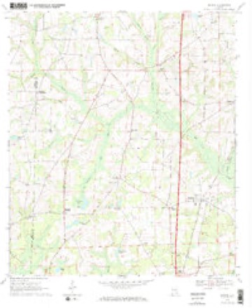
- 1969 USGS Madrid quadrangle1:24000, 2 printings
- 1981 USGS Dothan quadrangle1:100000
Fires near this place
71 since 1994Regional context, not property-specific evidence. The federal wildfire occurrence database lists 71 fires within 5 miles of Madrid between 1994 and 2019, burning about 314 acres in total. 3 started naturally. 1 was recorded as arson. Distance is straight-line from the map coordinates, so a fire counted here may appear on a neighbouring settlement's page as well.
| Reported cause | Fires |
|---|---|
| Missing data/not specified/undetermined | 23 |
| Debris and open burning | 19 |
| Equipment and vehicle use | 12 |
| Railroad operations and maintenance | 5 |
| Smoking | 4 |
| Natural | 3 |
| Recreation and ceremony | 3 |
| Arson/incendiarism | 1 |
| Misuse of fire by a minor | 1 |
The most recent of them, most recent first, with the day each was reported and the service that recorded it.
| Date | Cause | Size | Reported by | Name on the report |
|---|---|---|---|---|
| 8 September 1997 | Debris and open burning | under an acre | Alabama Forestry Commission | not named |
| 5 September 1997 | Missing data/not specified/undetermined | 1.0 acres | Florida Forest Service | not named |
| 19 September 2008 | Equipment and vehicle use | 1.5 acres | Alabama Forestry Commission | not named |
| 17 September 2010 | Debris and open burning | 19 acres | Alabama Forestry Commission | not named |
| 16 September 1999 | Debris and open burning | 20 acres | Alabama Forestry Commission | not named |
| 28 August 2014 | Missing data/not specified/undetermined | under an acre | Alabama Forestry Commission | SER-20140828-002 |
| 4 July 2019 | Missing data/not specified/undetermined | 1.0 acres | Alabama Forestry Commission | 20190704-3 |
| 30 July 2014 | Missing data/not specified/undetermined | 9.9 acres | Alabama Forestry Commission | SER-20140730-001 |
Settlements close enough to share some of these fires:
Storms near this place
17 since 1995Regional context, not property-specific evidence. The National Weather Service names Madrid in 17 storm reports between 1995 and 2026: 9 thunderstorm wind, 5 tornado, 1 funnel cloud, 1 flash flood. The reports record 1 death and 12 injuries. Each account below is quoted exactly as the forecast office filed it, from the NOAA Storm Events Database, and each date opens the federal record of that event.
| When | Event | Place named | Harm | What the report says |
|---|---|---|---|---|
| January 2024 | Tornado (EF2) | Madrid | 1 killed, 10 hurt, $6,000,000 | This is a continuation of the Jackson county tornado. The Houston county portion of the tornado is rated EF2 with max winds estimated at 130 mph. This tornado touched down in a swampy area, just east of Holmes Creek in northwest Jackson County. The tornado initially uprooted and snapped several softwood and hardwood trees, along Hickshill Road and in addition, it damaged an outbuilding there. The tornado continued northeast, damaging more hardwood and softwood trees along Piano Road. The first structure to be impacted by this tornado was a double-wide manufactured home on the northern side of Piano Road. Additional softwood and hardwood trees were snapped and uprooted along Danford Bay Road. Tree damage continued along Orchid Road, Damascus Church Road and Layton Road as the tornado continued to progress northeastward. An outbuilding was damaged along Orchid Road, and a single-family home suffered significant roof damage along Layton Road. The tornado then destroyed two ninety foot, seventy-year-old concrete silos. Damage was found along the entire length of Everett Road which was composed of the snapping and uprooting of trees, along with damage to an outbuilding and a mobile home succumbing to window damage. More trees were damaged along Heislar Road and Peanut Road as the tornado continued its northeastward trek. A single-family home on Peanut Road suffered significant roof damage. When the tornado reached Shiloh Church Loop, a single-family home suffered significant roof damage. The tornado continued to move northeast across Highway 2 where more softwood and hardwood trees were uprooted and snapped. Most of the damage to this point is classified as EF-1. Before the tornado crossed into Alabama, it damaged the roof of a small business on US-231. After crossing into Houston County Alabama, the tornado produced a continuous swath of damage on either side of State Line Road all the way towards the city of Cottonwood. This is also consistent of EF-1 damage. The first instance of EF-2 damage was when the tornado approached Cottonwood proper, along Ramer Loop rolling a single-wide mobile home, destroying it, despite it being well strapped. As the tornado moved through downtown Cottonwood, numerous small businesses sustained damage, ranging from blown out windows, roof damage and in one case the failure of the front-facing brick facade. Additional EF-2 damage occurred when the tornado removed the entire roof of a large two-story home. The tornado continued its northeastward jog, leaving Cottonwood proper, and commenced to destroy a two-story Moose Lodge that was composed of cinder-blocks resulting in another instance of EF-2 damage. The most significant tree damage noted on this survey occurred when the tornado paralleled Dyers Road, thus snapping numerous hardwood and softwood trees. The most significant damage along this northeastward path occurred on September Road where a double-wide home was completely destroyed, and resulted in one fatality. As the tornado continued to move northeast to across Whitaker Road and Creek Church Road, EF-1 tree damage was noted. The tornado caused mainly EF-0 damage to softwood and hardwood trees along Green Frog Road and Ed Tolar Road. One last structural damage occurred to a single-family home where it caused significant roof damage before lifting near the Chattahoochee River. In summary, while most damage was EF-1, there were instances of EF-2 damage with the max wind of 130 mph. In addition to the one fatality, there were also ten direct injuries from the tornado and an additional six indirect injuries during the response phase of the disaster, all in the Cottonwood area. Thanks to Houston County and Jackson County Emergency Management for assistance with this damage survey. |
| February 2018 | Thunderstorm Wind | Madrid | 2 hurt, $100,000 | Six mobile homes were damaged due to high winds. One of the mobile homes blew over and sustained major damage. This resulted in 2 minor injuries. |
| April 2015 | Tornado (EF1) | Madrid | $100,000 | This is a continuation of the long track tornado that started in Jackson county, FL. Along the Houston county portion the track, numerous trees and power lines were blown down. One home in the Cottonwood area was damaged by a tree falling on the structure. In the Pansey area, a large metal outbuilding was destroyed with some of the debris removed from the foundation. The damage path began to widen at this point while approaching the Chattahoochee River and entering Early county, GA. The Alabama portion of the tornado track was rated EF1. |
| June 1995 | Thunderstorm Wind | Madrid | $80,000 | Trees were reported down and shingles blown off a roof near Madrid in southwest Houston County. Five houses were damaged including one that was nearly destroyed. The wind was also believed responsible for blowing a car across the median causing a head-on collision on U.S. 231. |
| December 2019 | Tornado (EF0) | Madrid | $25,000 | An EF0 tornado briefly touched down and damaged one home. The home lost a garage and an outbuilding. A few dozen softwood trees were also snapped or uprooted. |
| January 2026 | Tornado (EF0) | Madrid | $10,000 | A tornado briefly developed along Decatur Road in southwestern Houston County. The tornado lifted the roof off of a manufactured home before dissipating shortly thereafter without causing any additional known damage. An associated Tornadic Debris Signature (TDS) was noted on the Eglin AFB (KEVX) Radar data. The damage was consistent with an EF0 tornado with winds of approximately 85 mph. |
| August 2024 | Thunderstorm Wind | Madrid | $10,000 | A tree was blown down onto a house in the Madrid-Cottonwood area. |
| June 2007 | Thunderstorm Wind | Madrid | $2,000 | Downed utility poles were reported in Madrid. |
| April 2015 | Thunderstorm Wind | Madrid | $1,000 | Trees were blown down near Highway 231 south near the state line. |
| June 2014 | Thunderstorm Wind | Madrid | $1,000 | A tree was blown down on State Line road at Saint Mary Church Road. |
| April 2020 | Thunderstorm Wind | Madrid | - | Several trees were blown down in the Madrid area. |
| December 2019 | Thunderstorm Wind | Madrid | - | There were multiple reports of trees down near Decatur Road. |
| February 2018 | Tornado (EF0) | Madrid | - | A tornado touched down in northwest Jackson county and briefly moved into far southern Houston county. Structural damage was minimal with minor roof damage in Graceville in Jackson county. There was no reported structural damage in Houston county as the tornado tracked through a forested area. Trees were also blown down along the track with a dual-pol tornadic debris signature observed on radar in far southern Houston county due to tree debris. This tornado was rated EF0 with max winds estimated at 65 mph based on the observed damage. |
| July 2018 | Thunderstorm Wind | Madrid | - | Trees were blown down north of Madrid. |
| December 2016 | Flood | Madrid | - | Buntin Road was flooded as a result of a long duration of moderate to heavy rainfall. |
| April 2014 | Flash Flood | Madrid | - | Otter pond overflowed onto Buntin Road near Cottonwood due to heavy rain in a short period of time. |
| April 1998 | Funnel Cloud | Madrid | - | Funnel cloud observed by road and bridge crew just north of Madrid. |
Nearest settlements
The eight closest, with where each one stands in the county. Distances are straight-line, computed from the Geographic Names Information System coordinates.
| Map | Place | Distance | Sheets |
|---|---|---|---|
| Five Points | 1.0 miles | 8 | |
| State Line | 2.5 miles | 8 | |
| Garretts Crossroads | 2.5 miles | 8 | |
| Big Creek | 3.1 miles | 8 | |
| Hodgesville | 3.4 miles | 8 | |
| Southern Junction | 4.1 miles | 8 | |
| Sealy Springs | 4.5 miles | 8 | |
| Cottonwood | 4.8 miles | 8 |
Elsewhere
Matched on this settlement's Geographic Names Information System number rather than its name, so it cannot be a different place of the same name in another state.
| Wikipedia article on Madrid | An encyclopaedic summary. Its text is share-alike, so it is linked here rather than copied. |
| Wikidata item Q66470 | The structured record the population and elevation above come from. Public domain (CC0). |
Provenance
This settlement is recorded in the Geographic Names Information System as feature 122197. The sheet list is computed by point-in-boundary test against the United States Geological Survey's historical topographic inventory. Both are works of the United States government and carry no copyright under 17 U.S.C. 105.
Wildfire. Short, Karen C. 2022. Spatial wildfire occurrence data for the United States, 1992-2020 [FPA_FOD_20221014]. 6th Edition. Fort Collins, CO: Forest Service Research Data Archive. https://doi.org/10.2737/RDS-2013-0009.6 Collected with United States Government funding and usable without additional permissions or fees.
Storms. NOAA National Centers for Environmental Information, Storm Events Database https://www.ncei.noaa.gov/stormevents/ A work of the United States government, no copyright under 17 U.S.C. 105. Narratives are quoted verbatim from the National Weather Service report and are not edited or summarised.