 Block
Nebo, Alabama
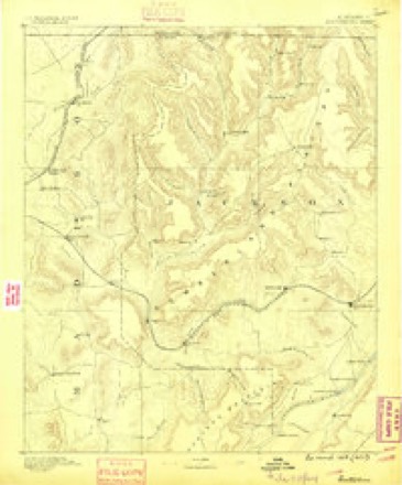
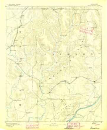
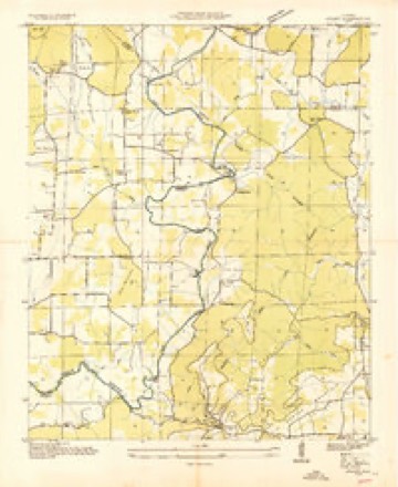
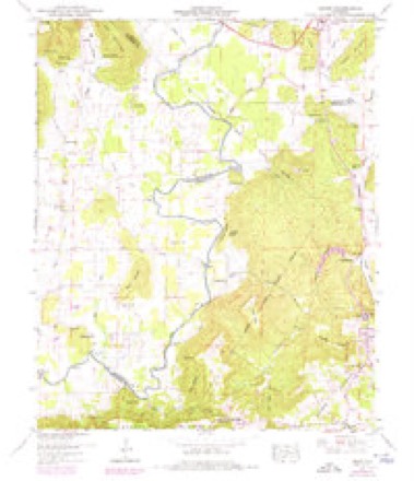
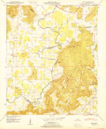
23 topographic sheets cover this place, the earliest surveyed in 1888 and the latest in 1984. It stands in the New Hope census division. It lies in ZIP code area 35760. It stands on Nebo Mountain. The Survey maps it on the Grant quadrangle.
Topographic sheets covering this place
10 surveys from 23 printed sheetsMatched by testing this settlement's coordinate against the published boundary of every sheet in the United States Geological Survey's historical collection. Each opens the scanned sheet at the Survey.
- 1888 USGS Scottsboro quadrangle1:125000
- 1892 USGS Scottsboro quadrangle1:125000, 5 printings
- 1936 USGS Grant quadrangle1:24000
- 1947 USGS Grant quadrangle1:24000, 4 printings
- 1950 USGS Grant quadrangle1:24000, 2 printings
- 1956 USGS Gadsden quadrangle1:250000, 3 printings
- 1958 USGS Gadsden quadrangle1:250000
- 1960 USGS Gadsden quadrangle1:250000, 2 printings
- 1963 USGS Gadsden quadrangle1:250000
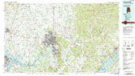
- 1984 USGS Huntsville quadrangle1:100000, 3 printings




Fires near this place
33 since 1994Regional context, not property-specific evidence. The federal wildfire occurrence database lists 33 fires within 5 miles of Nebo between 1994 and 2017, burning about 449 acres in total. None started naturally. 7 were recorded as arson. Distance is straight-line from the map coordinates, so a fire counted here may appear on a neighbouring settlement's page as well.
| Reported cause | Fires |
|---|---|
| Debris and open burning | 15 |
| Arson/incendiarism | 7 |
| Missing data/not specified/undetermined | 5 |
| Equipment and vehicle use | 3 |
| Recreation and ceremony | 2 |
| Misuse of fire by a minor | 1 |
The most recent of them, most recent first, with the day each was reported and the service that recorded it.
| Date | Cause | Size | Reported by | Name on the report |
|---|---|---|---|---|
| 30 September 2016 | Arson/incendiarism | 4.5 acres | Alabama Forestry Commission | 20160930-7 |
| 14 September 1996 | Debris and open burning | under an acre | Alabama Forestry Commission | not named |
| 5 July 1996 | Equipment and vehicle use | 5.0 acres | Alabama Forestry Commission | not named |
| 20 July 2008 | Equipment and vehicle use | 27 acres | Alabama Forestry Commission | 729 MILL ROAD, AL |
| 17 May 1995 | Debris and open burning | 8.0 acres | Alabama Forestry Commission | not named |
| 5 April 2006 | Arson/incendiarism | 40 acres | Alabama Forestry Commission | not named |
| 3 April 1997 | Equipment and vehicle use | 4.0 acres | Alabama Forestry Commission | not named |
| 13 April 1995 | Recreation and ceremony | 2.0 acres | Alabama Forestry Commission | not named |
Settlements close enough to share some of these fires:
Mines and quarries near this place
3 within 5 milesRegional context, not property-specific evidence. The federal mineral resources record lists 3 workings within 5 miles of Nebo: 3 producers. All of them still produce. What was taken out: Sand and Gravel, Construction, Stone, Crushed/Broken. Distance is straight-line from the map coordinates, so a quarry counted here may appear on a neighbouring settlement's page as well.
| Where | Site | Commodity | Status | Recorded |
|---|---|---|---|---|
| Diamond Quarry | Stone, Crushed/Broken | Producer | ||
| New Hope Quarry | Sand and Gravel, Construction | Producer | Quartz | |
| Pit #1 | Sand and Gravel, Construction | Producer |
Storms near this place
54 since 1997Regional context, not property-specific evidence. The National Weather Service names Nebo in 54 storm reports between 1997 and 2025: 27 hail, 19 thunderstorm wind, 4 flash flood, 2 flood. The reports record 3 injuries. Each account below is quoted exactly as the forecast office filed it, from the NOAA Storm Events Database, and each date opens the federal record of that event.
| When | Event | Place named | Harm | What the report says |
|---|---|---|---|---|
| January 2020 | Thunderstorm Wind | Nebo | 3 hurt | A large tree was knocked down onto an ambulance, injuring 3 occupants. The injuries were thankfully minor. The event occurred on Balch Road just north of U.S. Highway 72. |
| March 2022 | Thunderstorm Wind | Nebo | $13,000 | One power pole down across the roadway and 2 others damaged and leaning at this location. |
| June 2009 | Thunderstorm Wind | Nebo | $8,000 | Trees were blown down along Freedom Way near Madison. |
| March 2022 | Thunderstorm Wind | Nebo | $7,500 | Four power poles were knocked down across the road at McCrary Road and Wall Triana Highway. |
| July 2008 | Thunderstorm Wind | Nebo | $5,000 | Numerous trees were downed and uprooted by thunderstorm winds throughout the city of Madison, primarily between 345 pm and 4 pm. A tent was blown over at a store causing apparent damage to the merchandise within the tent. Particularly hard hit were areas between County Line Road and Hughes Road, especially near Gooch Lane. |
| July 2010 | Thunderstorm Wind | Nebo | $4,000 | Four large trees were knocked down near the intersection of Capshaw Road and Sam Thomas Road in Harvest on Blanca Drive. The trees caused minor damage to a fence and home. |
| May 2024 | Thunderstorm Wind | Nebo | $3,000 | Trees were reported down on powerlines on NE McCrary road. |
| June 2009 | Thunderstorm Wind | Nebo | $3,000 | A power pole was blown down at the intersection of County Line Road and Highway 72. |
| October 2009 | Thunderstorm Wind | Nebo | $2,000 | A tree was blown down on County Line Road between Highway 72 and Capshaw Road. |
| April 1997 | Hail | Nebo | $2,000 | Three-quarter inch hail covered the ground west of Nebo, in the extreme western part of the county. |
| July 2023 | Thunderstorm Wind | Nebo | $1,500 | Power lines were knocked down and blocked Wall Triana Highway between Highway 72 and Capshaw Road. |
| September 2014 | Thunderstorm Wind | Nebo | $1,000 | Eight inch diameter tree limbs were downed by thunderstorm winds between Highway 72 and Capshaw road along Old Railroad Bed Road, between Harvest and Madison. |
| August 2011 | Lightning | Nebo | $1,000 | A female in her 30s was indirectly struck by lightning while on a corded telephone and attempting to disconnect power on a home computer during a prolific lightning storm. The person began feeling a tingling in her arm when lightning struck her through the telephone and knocked her to the ground. No apparent injuries were noted. The computer was also damaged by the lightning strike. During this enormous lightning storm, the Madison City school bus system brought students back to school to wait out the lightning storm. |
| July 2010 | Thunderstorm Wind | Nebo | $1,000 | A large tree was knocked down near the Magnolia Springs subdivision. |
| July 2010 | Thunderstorm Wind | Nebo | $1,000 | A tree was knocked down at the intersection of Balch Road and Bordeaux Lane. Time was estimated by radar. |
| April 2009 | Thunderstorm Wind | Nebo | $1,000 | A Tree was heavily damaged at Bordeaux Lane. |
| June 2016 | Thunderstorm Wind | Nebo | $500 | Large tree limbs were knocked down on Capshaw Road. |
| June 2020 | Thunderstorm Wind | Nebo | $100 | One inch tree limbs were broken. Report relayed through mPing. |
| May 2016 | Thunderstorm Wind | Nebo | $100 | Large tree limbs were downed by thunderstorm winds. |
| May 2025 | Hail | Nebo | - | Hail with a diameter of 1 inch was reported via mPING. |
| May 2025 | Hail | Nebo | - | Half dollar sized hail was reported at the Lowes on U.S. Highway 72. |
| May 2025 | Hail | Nebo | - | Hail with a diameter of 1 inch was reported via mPING. |
| June 2023 | Hail | Nebo | - | One inch diameter hail was reported via mPING. |
| June 2023 | Hail | Nebo | - | Social media photo indicated hail larger than quarter sized. |
| June 2023 | Hail | Nebo | - | Hail of 1.5 inches in diameter was reported via mPING. |
| June 2023 | Hail | Nebo | - | A photo on social media relayed indicated quarter to half dollar sized hail off of Capshaw Road. Location estimated by radar. |
| June 2023 | Hail | Nebo | - | A social media photo indicated quarter sized hail on Balch Road. Location and time estimated by radar. |
| June 2023 | Hail | Nebo | - | Ping pong ball sized hail was reported along Wall Triana Highway. Location estimated by radar. |
| June 2023 | Hail | Nebo | - | One inch diameter hail was reported from mPING. |
| July 2023 | Hail | Nebo | - | Hail up to quarter sized was reported off of Pine Grove Road west of Wall Triana. |
| July 2023 | Hail | Nebo | - | Penny sized hail was reported near the intersection of Dustin Lane and Oakway Circle. |
| August 2022 | Hail | Nebo | - | Reports of quarter size hail near Madison. |
| August 2022 | Hail | Nebo | - | Reports of quarter size hail near Madison. |
| April 2021 | Hail | Nebo | - | Hail up to 1.25 inches in diameter was reported. |
| April 2021 | Hail | Nebo | - | Multiple reports of large hail in Madison. |
| April 2021 | Hail | Nebo | - | NWS reports hail in Madison city. |
| April 2021 | Hail | Nebo | - | Multiple reports of large hail in Madison. |
| April 2021 | Hail | Nebo | - | Multiple reports of large hail in Madison. |
| April 2021 | Hail | Nebo | - | Multiple reports of large hail in Madison. |
| February 2019 | Flood | Nebo | - | Flooding occurring near Sanderson and Capshaw Roads. Several inches to a foot of water is flowing over the road. |
| December 2019 | Hail | Nebo | - | Hail up to the size of half-dollars was reported via mPING. |
| April 2018 | Thunderstorm Wind | Nebo | - | Trees were knocked down, windows were blown out of one home, and several homes were damaged. This damage occurred along Sam Thomas Road and in the Magnolia Springs subdivision. |
| December 2015 | Flood | Nebo | - | Knox Creek flowing over US HWY 72 near Madison Hospital in Madison. Relayed from social media. |
| December 2015 | Flash Flood | Nebo | - | Knox Creek flowing over US HWY 72 near Madison Hospital in Madison. Relayed from social media. |
| January 2012 | Flash Flood | Nebo | - | Flash flooding was reported along Old Railroad Bed Road. |
| April 2011 | Hail | Nebo | - | Golf ball sized hail was reported. |
| April 2011 | Tornado (EF1) | Nebo | - | It continued to move to the east-northeast into Madison county and across the Magnolia Springs neighborhood Additional roof and shingle damage was observed along this portion of the track. The most intense damage occurred just east of Vine Cliff Drive, along Water Oak Court, where numerous large trees were snapped at their base. This tornado continued to track to the east-northeast snapping trees and producing some light shingle and gutter damage. The tornado dissipated near Nichols Spring Branch. |
| March 2011 | Flash Flood | Nebo | - | Flash flooding was reported on the westbound lanes of Capshaw Road. |
| June 2010 | Flash Flood | Nebo | - | Six inches of water was reported covering Harbin road near High Green Drive in Monrovia. The westbound lane was reported impassible near this intersection. |
| April 2009 | Hail | Nebo | - | Hen egg size hail was reported in the Ashley Green subdivision. |
| April 2009 | Hail | Nebo | - | Hail up to the size of baseballs was reported in Madison. |
| April 2009 | Hail | Nebo | - | Hail up to baseball size was reported at the intersection of HWY 72 and County Line Road. |
| June 2009 | Thunderstorm Wind | Nebo | - | Trees were blown down at the intersection of Balch and Gooch Lane. |
| April 1998 | Hail | Nebo | - | Dime size hail was reported in Nebo. |
Nearest settlements
The eight closest, with where each one stands in the county. Distances are straight-line, computed from the Geographic Names Information System coordinates.
| Map | Place | Distance | Sheets |
|---|---|---|---|
| Butler Mill | 2.5 miles | 23 | |
| Poplar Ridge | 2.7 miles | 23 | |
| Cedar Point | 3.1 miles | 23 | |
| New Hope | 3.3 miles | 22 | |
| Lowe (historical) | 4.6 miles | 22 | |
| Oak Grove | 6.0 miles | 22 | |
| Johnson | 6.1 miles | 22 | |
| Owens Cross Roads | 6.8 miles | 22 |
Provenance
This settlement is recorded in the Geographic Names Information System as feature 156769. The sheet list is computed by point-in-boundary test against the United States Geological Survey's historical topographic inventory. Both are works of the United States government and carry no copyright under 17 U.S.C. 105.
Wildfire. Short, Karen C. 2022. Spatial wildfire occurrence data for the United States, 1992-2020 [FPA_FOD_20221014]. 6th Edition. Fort Collins, CO: Forest Service Research Data Archive. https://doi.org/10.2737/RDS-2013-0009.6 Collected with United States Government funding and usable without additional permissions or fees.
Mines and quarries. USGS Mineral Resources Data System (MRDS) https://mrdata.usgs.gov/mrds/ A work of the United States government, no copyright under 17 U.S.C. 105.
Storms. NOAA National Centers for Environmental Information, Storm Events Database https://www.ncei.noaa.gov/stormevents/ A work of the United States government, no copyright under 17 U.S.C. 105. Narratives are quoted verbatim from the National Weather Service report and are not edited or summarised.