 Block
Normal, Alabama
24 topographic sheets cover this place, the earliest surveyed in 1888 and the latest in 1984. It stands in the Huntsville census division. It lies in ZIP code area 35811. It lies near Brush Mountain. The Survey maps it on the Meridianville quadrangle. It stands 722 feet above sea level.
On record in Normal
Buildings and businesses the archive holds for this place. Each opens its own page, with the source record it came from.
On the National Register 2 records
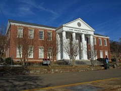 Carnegie Librarylisted 2001
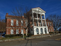 Domestic Science Buildinglisted 1973
Topographic sheets covering this place
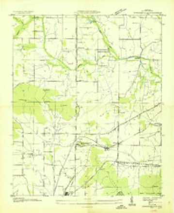
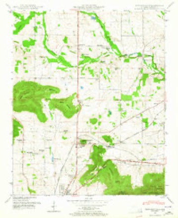
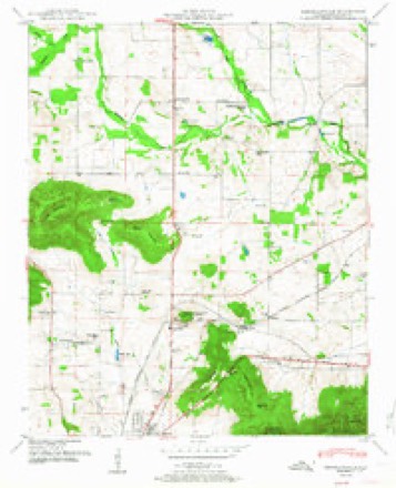
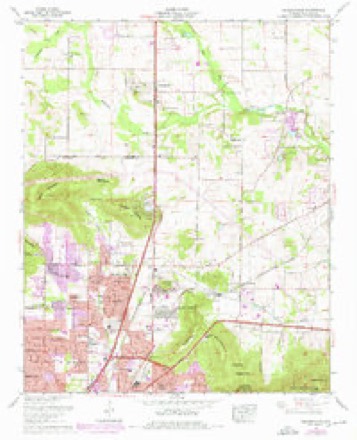
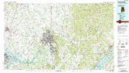
11 surveys from 24 printed sheetsMatched by testing this settlement's coordinate against the published boundary of every sheet in the United States Geological Survey's historical collection. Each opens the scanned sheet at the Survey.
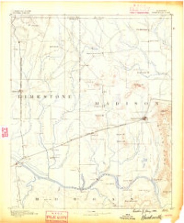
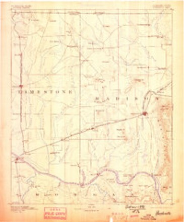
- 1888 USGS Huntsville quadrangle1:125000
- 1892 USGS Huntsville quadrangle1:125000, 6 printings
- 1936 USGS Meridianville quadrangle1:24000
- 1948 USGS Meridianville quadrangle1:24000
- 1951 USGS Meridianville quadrangle1:24000, 2 printings
- 1956 USGS Gadsden quadrangle1:250000, 3 printings
- 1958 USGS Gadsden quadrangle1:250000
- 1960 USGS Gadsden quadrangle1:250000, 2 printings
- 1963 USGS Gadsden quadrangle1:250000
- 1964 USGS Meridianville quadrangle1:24000, 3 printings
- 1984 USGS Huntsville quadrangle1:100000, 3 printings




Fires near this place
33 since 1998Regional context, not property-specific evidence. The federal wildfire occurrence database lists 33 fires within 5 miles of Normal between 1998 and 2019, burning about 92 acres in total. None started naturally. 7 were recorded as arson. Distance is straight-line from the map coordinates, so a fire counted here may appear on a neighbouring settlement's page as well.
| Reported cause | Fires |
|---|---|
| Debris and open burning | 13 |
| Arson/incendiarism | 7 |
| Missing data/not specified/undetermined | 5 |
| Equipment and vehicle use | 3 |
| Misuse of fire by a minor | 3 |
| Recreation and ceremony | 1 |
| Smoking | 1 |
The most recent of them, most recent first, with the day each was reported and the service that recorded it.
| Date | Cause | Size | Reported by | Name on the report |
|---|---|---|---|---|
| 8 September 1999 | Misuse of fire by a minor | under an acre | Alabama Forestry Commission | not named |
| 27 September 2001 | Debris and open burning | under an acre | Alabama Forestry Commission | not named |
| 22 September 2019 | Arson/incendiarism | 4.0 acres | Alabama Forestry Commission | 20190922-20 |
| 22 September 2012 | Missing data/not specified/undetermined | 1.0 acres | Alabama Forestry Commission | NOR-20120922-001 |
| 20 September 2000 | Misuse of fire by a minor | under an acre | Alabama Forestry Commission | not named |
| 16 September 1999 | Arson/incendiarism | under an acre | Alabama Forestry Commission | not named |
| 16 September 1999 | Arson/incendiarism | under an acre | Alabama Forestry Commission | not named |
| 11 September 1999 | Arson/incendiarism | under an acre | Alabama Forestry Commission | not named |
Settlements close enough to share some of these fires:
Mines and quarries near this place
4 within 5 milesRegional context, not property-specific evidence. The federal mineral resources record lists 4 workings within 5 miles of Normal: 2 producers, 1 plant, 1 unknown. 3 still produce. What was taken out: Sand and Gravel, Construction, Stone, Crushed/Broken, Molybdenum. Distance is straight-line from the map coordinates, so a quarry counted here may appear on a neighbouring settlement's page as well.
| Where | Site | Commodity | Status | Recorded |
|---|---|---|---|---|
| Huntsville North Quarry | Stone, Crushed/Broken | Producer | ||
| Teledyne Wah Chang/Huntsville, Ala. | Molybdenum | Unknown | ||
| Baker Terminal | Sand and Gravel, Construction | Producer | ||
| Base Plant | Sand and Gravel, Construction | Plant |
Storms near this place
37 since 2005Regional context, not property-specific evidence. The National Weather Service names Normal in 37 storm reports between 2005 and 2025: 27 thunderstorm wind, 6 flash flood, 2 lightning, 1 hail. No death or injury is recorded in these reports. Each account below is quoted exactly as the forecast office filed it, from the NOAA Storm Events Database, and each date opens the federal record of that event.
| When | Event | Place named | Harm | What the report says |
|---|---|---|---|---|
| November 2011 | Thunderstorm Wind | Normal | $20,000 | Trees and power lines were knocked down in a swath from Oakwood University through the Rutledge Heights area, and across Jordan Lane to Meridian Street in northwest and north Huntsville. |
| May 2010 | Flash Flood | Normal | $10,000 | A home on Swanson Drive was reported flooded. |
| August 2010 | Thunderstorm Wind | Normal | $5,000 | A 100 foot locust tree was blown down near the intersection of Pulaski Pike and Winchester Road on power lines. This caused about 1,000 Huntsville Utility customers to lose their power. |
| April 2025 | Thunderstorm Wind | Normal | $3,000 | A tree and power lines were knocked down at 2126 Lynn Road. |
| December 2025 | Thunderstorm Wind | Normal | $3,000 | Powerlines were reported down along Lakeview Drive. |
| October 2008 | Lightning | Normal | $2,500 | Huntsville utilities reported that lightning caused a power outage in northeast Huntsville affecting 2000 customers. The outage occurred for about 2 hours. |
| April 2025 | Thunderstorm Wind | Normal | $2,000 | A large tree was knocked down blocking the roadway at Apache Road at Vivian Drive. |
| May 2024 | Thunderstorm Wind | Normal | $2,000 | Trees were knocked down onto power lines on Tuxedo Drive. |
| June 2011 | Thunderstorm Wind | Normal | $2,000 | Trees were knocked down onto power lines. |
| November 2011 | Thunderstorm Wind | Normal | $2,000 | A sign at Johnson High School was blown down at the intersection of Cecil Fain Drive and Winchester Road in northwest Huntsville. Time estimated. |
| December 2008 | Lightning | Normal | $2,000 | Several house fires were sparked by lightning strikes in Huntsville. A transformer was damaged by a direct lightning strike just off Winchester Road in north Huntsville. |
| July 2008 | Thunderstorm Wind | Normal | $2,000 | A severe thunderstorm downed power lines at the intersection of Pulaski Pike and Stringfield road. This storm produced a power outage that affected at least 1000 customers. |
| August 2025 | Thunderstorm Wind | Normal | $1,000 | A tree was knocked down at 2502 Rochell Drive NW. Time estimated by radar. |
| December 2025 | Thunderstorm Wind | Normal | $1,000 | A tree was blown down near the intersection of Mastin Lake road & Memorial Parkway. |
| August 2022 | Thunderstorm Wind | Normal | $1,000 | A tree fell onto powerlines on Juniper Drive. |
| May 2022 | Thunderstorm Wind | Normal | $1,000 | A tree was blown down on the 9900 block of N Memorial Parkway. |
| March 2022 | Thunderstorm Wind | Normal | $1,000 | Baseball backstop fencing was toppled and minor fence damage occurred at the Alabama A&M baseball facilities. |
| May 2017 | Thunderstorm Wind | Normal | $1,000 | A tree was knocked down onto a house. |
| August 2022 | Thunderstorm Wind | Normal | $500 | Powerlines were reported down on Teton Drive. |
| July 2021 | Thunderstorm Wind | Normal | $500 | A tree was knocked down near Mountain Park Circle and Kirkland Drive. Time estimated by radar. |
| May 2021 | Thunderstorm Wind | Normal | $500 | A tree and power line were knocked down into the roadway at Eastbrook Circle at Academy Drive. Time estimated by radar. |
| June 2018 | Thunderstorm Wind | Normal | $500 | A tree was knocked down onto a house at the 2300 block of Virginia Blvd. in Huntsville. |
| August 2016 | Thunderstorm Wind | Normal | $500 | A tree was knocked down at the corner of Blue Spring Road and Mastin Lake Road. time estimated from radar. |
| September 2019 | Thunderstorm Wind | Normal | $200 | A tree was knocked down on Normandale Road. Time estimated by radar. |
| July 2008 | Thunderstorm Wind | Normal | $200 | A severe thunderstorm produced damaging winds that downed a tree at 2112 Winchester Road. |
| April 2020 | Thunderstorm Wind | Normal | - | A tree was uprooted near Sparkman Drive and Highway 231. Time estimated by radar. |
| September 2019 | Flash Flood | Normal | - | Two feet of water reported at Washington Street and Max Luther Drive. The road has been closed. Other reports of more minor flooding ongoing in North Huntsville at this time. |
| September 2019 | Thunderstorm Wind | Normal | - | Trees were knocked down along Blue Spring Road at Winchester Road. Time estimated by radar. |
| September 2019 | Flash Flood | Normal | - | A vehicle was flooded and 2 occupants were aided by Fire and Rescue at Cahill Drive and Washington Street just north of Oakwood Avenue. |
| September 2019 | Thunderstorm Wind | Normal | - | A large tree was knocked down onto a car and carport on Lakeview Drive. Time estimated by radar. |
| December 2019 | Thunderstorm Wind | Normal | - | Power lines were knocked down on Meridian Street NE and Wholesale Avenue NE. |
| April 2011 | Tornado (EF1) | Normal | - | A tornado of EF-1 intensity produced peak wind speeds up to 105 mph. The tornado touched down along the downslope portion of Drake Mountain near the intersection of Pulaski Pike and Cedar Point Drive. A concentrated area of damage consisting of snapped hardwood trees, roof and gutter damage was seen along Cedar Point Drive and Green Meadow Road. Less damage was noted along a ridge that extended from Wade Mountain. Another concentrated area of damage that consisted of tree and roof damage was seen along the downslope portion of Smithers Mountain in the Mount Charron Estates and Valley View Estates neighborhoods. The tornado continued east-northeast with the most notable EF-1 damage occurring along Moores Mill Road north of Winchester Road where numerous hardwood trees were snapped and/or sheared off with a convergent damage/debris pattern. Significant tree and roof damage was noted along Henson Drive, Trailwood Drive and Bradford Lane before the tornado dissipated along Briar Fork Waterway. |
| June 2010 | Flash Flood | Normal | - | Up to 6 inches of water reported over Winchester road approximately 2 miles north of Huntsville. |
| September 2009 | Flash Flood | Normal | - | Flash flooding caused Washington Street from Oakwood Avenue to Washington Circle to the closed. |
| June 2008 | Hail | Normal | - | A severe thunderstorm produced nickel size hail at the intersection of Sparkman Drive and North Memorial Parkway. |
| July 2008 | Flash Flood | Normal | - | Intense rainfall rates from strong to severe thunderstorms produced flash flooding at the intersection of Washington Street and Washington Circle in Huntsville. |
| June 2005 | Thunderstorm Wind | Normal | - | A wind gust was estimated at 60 mph and pea size hail was observed. |
Nearest settlements
The eight closest, with where each one stands in the county. Distances are straight-line, computed from the Geographic Names Information System coordinates.
| Map | Place | Distance | Sheets |
|---|---|---|---|
| Meadow Hills | 0.6 miles | 24 | |
| Edmonton Heights | 0.8 miles | 24 | |
| Lakewood | 1.1 miles | 24 | |
| Windsor Manor | 1.1 miles | 24 | |
| Meadow Lane Estates | 1.1 miles | 24 | |
| Mountain Springs Estates | 1.2 miles | 24 | |
| Lakewood Manor | 1.3 miles | 24 | |
| Chase | 1.4 miles | 24 |
Elsewhere
Matched on this settlement's Geographic Names Information System number rather than its name, so it cannot be a different place of the same name in another state.
| Wikipedia article on Normal | An encyclopaedic summary. Its text is share-alike, so it is linked here rather than copied. |
| Wikidata item Q3709719 | The structured record the population and elevation above come from. Public domain (CC0). |
Provenance
This settlement is recorded in the Geographic Names Information System as feature 156798. The sheet list is computed by point-in-boundary test against the United States Geological Survey's historical topographic inventory. Both are works of the United States government and carry no copyright under 17 U.S.C. 105.
Wildfire. Short, Karen C. 2022. Spatial wildfire occurrence data for the United States, 1992-2020 [FPA_FOD_20221014]. 6th Edition. Fort Collins, CO: Forest Service Research Data Archive. https://doi.org/10.2737/RDS-2013-0009.6 Collected with United States Government funding and usable without additional permissions or fees.
Mines and quarries. USGS Mineral Resources Data System (MRDS) https://mrdata.usgs.gov/mrds/ A work of the United States government, no copyright under 17 U.S.C. 105.
Storms. NOAA National Centers for Environmental Information, Storm Events Database https://www.ncei.noaa.gov/stormevents/ A work of the United States government, no copyright under 17 U.S.C. 105. Narratives are quoted verbatim from the National Weather Service report and are not edited or summarised.