 Block
North Florence, Alabama
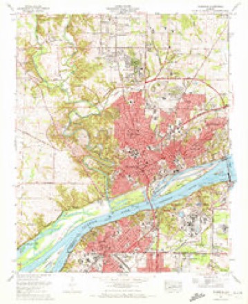
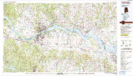
19 topographic sheets cover this place, the earliest surveyed in 1914 and the latest in 1986. It stands in the Florence census division. It lies in ZIP code area 35630. It stands on Cox Creek. The Survey maps it on the Florence quadrangle.
On record in North Florence
Buildings and businesses the archive holds for this place. Each opens its own page, with the source record it came from.
On the National Register within a mile 12 of 15 shown
The National Register names another town for these. They stand within one mile of this settlement's coordinate.
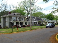 College Place Historic District (Boundary Increase)listed 1998 · 0.3 miles away
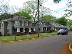 College Place Historic Districtlisted 1995 · 0.4 miles away
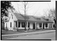 Wood Avenue Historic District (Boundary Increase)listed 1996 · 0.5 miles away
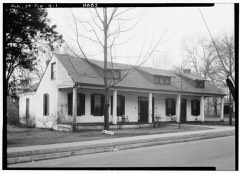 Wood Avenue Historic District (Boundary Increase II)listed 1997 · 0.6 miles away
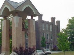 Wesleyan Halllisted 1974 · 0.7 miles away
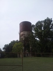 Water Towerlisted 1980 · 0.7 miles away
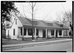 Wood Avenue Historic Districtlisted 1978 · 0.7 miles away
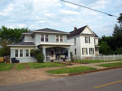 Cherry Street Historic Districtlisted 1997 · 0.8 miles away
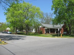 Walnut Street Historic District (Boundary Increase II)listed 1996 · 0.8 miles away
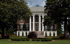 Courtviewlisted 1974 · 0.9 miles away
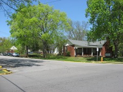 Walnut Street Historic District (Boundary Increase)listed 1993 · 0.9 miles away
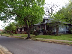 Seminary-O'Neal Historic Districtlisted 1995 · 0.9 miles away
Topographic sheets covering this place
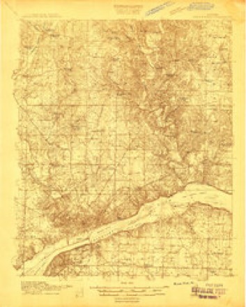
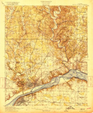
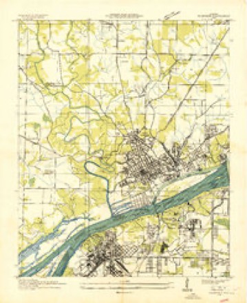
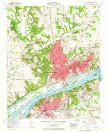
10 surveys from 19 printed sheetsMatched by testing this settlement's coordinate against the published boundary of every sheet in the United States Geological Survey's historical collection. Each opens the scanned sheet at the Survey.
- 1914 USGS Muscle Shoals quadrangle1:48000
- 1916 USGS Muscle Shoals quadrangle1:62500, 2 printings
- 1936 USGS Florence quadrangle1:24000
- 1956 USGS Gadsden quadrangle1:250000, 3 printings
- 1957 USGS Florence quadrangle1:24000, 2 printings
- 1958 USGS Gadsden quadrangle1:250000
- 1960 USGS Gadsden quadrangle1:250000, 2 printings
- 1963 USGS Gadsden quadrangle1:250000
- 1971 USGS Florence quadrangle1:24000, 3 printings
- 1986 USGS Tuscumbia quadrangle1:100000, 3 printings




Fires near this place
90 since 1994Regional context, not property-specific evidence. The federal wildfire occurrence database lists 90 fires within 5 miles of North Florence between 1994 and 2019, burning about 202 acres in total. None started naturally. 28 were recorded as arson. Distance is straight-line from the map coordinates, so a fire counted here may appear on a neighbouring settlement's page as well.
| Reported cause | Fires |
|---|---|
| Debris and open burning | 32 |
| Arson/incendiarism | 28 |
| Smoking | 8 |
| Missing data/not specified/undetermined | 6 |
| Misuse of fire by a minor | 5 |
| Equipment and vehicle use | 5 |
| Power generation/transmission/distribution | 2 |
| Recreation and ceremony | 2 |
| Railroad operations and maintenance | 1 |
| Fireworks | 1 |
The most recent of them, most recent first, with the day each was reported and the service that recorded it.
| Date | Cause | Size | Reported by | Name on the report |
|---|---|---|---|---|
| 29 September 2019 | Arson/incendiarism | under an acre | Alabama Forestry Commission | 20190929-11 |
| 29 September 2003 | Arson/incendiarism | under an acre | Alabama Forestry Commission | 115 COUNTY ROAD 249, AL |
| 28 September 2010 | Debris and open burning | under an acre | Alabama Forestry Commission | not named |
| 25 September 2008 | Smoking | under an acre | Alabama Forestry Commission | COUNTY ROAD 200, AL |
| 25 September 1999 | Arson/incendiarism | under an acre | Alabama Forestry Commission | not named |
| 21 September 1999 | Arson/incendiarism | under an acre | Alabama Forestry Commission | not named |
| 2 September 2011 | Debris and open burning | 1.0 acres | Alabama Forestry Commission | 673 CR 72, AL |
| 17 September 1999 | Equipment and vehicle use | 1.0 acres | Alabama Forestry Commission | not named |
Settlements close enough to share some of these fires:
Mines and quarries near this place
1 within 5 milesRegional context, not property-specific evidence. The federal mineral resources record lists 1 working within 5 miles of North Florence: 1 plant. All of them still produce. What was taken out: Silica, Aluminum. Distance is straight-line from the map coordinates, so a quarry counted here may appear on a neighbouring settlement's page as well.
| Where | Site | Commodity | Status | Recorded |
|---|---|---|---|---|
| Lister Hill Reduction Plant | Silica, Aluminum | Plant |
Storms near this place
58 since 2007Regional context, not property-specific evidence. The National Weather Service names North Florence in 58 storm reports between 2007 and 2025: 48 thunderstorm wind, 6 flash flood, 3 hail, 1 lightning. The reports record 1 injury. Each account below is quoted exactly as the forecast office filed it, from the NOAA Storm Events Database, and each date opens the federal record of that event.
| When | Event | Place named | Harm | What the report says |
|---|---|---|---|---|
| July 2016 | Lightning | North Florence | 1 hurt | Broadcast media and ema reported a man struck by lightning near Florence on the afternoon of 7/14. The man was taken to the hospital with minor injuries. |
| March 2023 | Thunderstorm Wind | North Florence | $1,600,000 | A bow echo from an embedded supercell within a line of thunderstorms intensified and produced destructive winds in a narrow swath of north and northeast Florence.|Wind speeds of 60-65 mph occurred in much of this area, with a few gusts of 80-90 mph in a few locations. Trees, power poles and power lines were taken down in multiple locations. Trees were knocked down onto multiple homes and vehicles. The Seven Points district and areas just north and northeast of the University of North Alabama campus were hit particular hard. Along this long swath, a significant number of trees, power lines and power pols were knocked down. Many residences experience minor to severe damage from trees falling onto their homes or vehicles. |
| April 2025 | Thunderstorm Wind | North Florence | $50,000 | A tree was knocked down on two vehicles at 1247 Graham Avenue. |
| March 2023 | Thunderstorm Wind | North Florence | $15,000 | A tree was knocked down onto an automobile in the Seven Points area. Person inside vehicle. |
| July 2009 | Thunderstorm Wind | North Florence | $15,000 | Around a 100 foot tree was blown down onto a house on Decatur Avenue landing on the home's utility box. This caused the box to smoke which caused residents to call the power company to turn off the power temporarily to the house until the box was replaced. |
| July 2009 | Thunderstorm Wind | North Florence | $15,000 | A tree was blown down onto a house on Hermitage Drive. |
| April 2025 | Thunderstorm Wind | North Florence | $10,000 | A tree was knocked down onto a house at 1110 Glen Avenue. |
| April 2025 | Thunderstorm Wind | North Florence | $10,000 | Multiple trees and power poles were knocked down at 220 Roosevelt Avenue. |
| April 2025 | Thunderstorm Wind | North Florence | $10,000 | A tree was knocked down onto a house at 536 Malone Circle. |
| April 2025 | Thunderstorm Wind | North Florence | $10,000 | A power pole was broken and lines down at 1831 Shade Avenue. A gas line also ruptured. |
| March 2023 | Thunderstorm Wind | North Florence | $10,000 | The roof was torn off of the El Politos restaurant. Multiple trees and power lines were also knocked down along Chisholm Road. |
| October 2010 | Thunderstorm Wind | North Florence | $8,000 | A tree was uprooted and fell on a house in Florence producing minor damage. Time was estimated by radar. |
| April 2025 | Thunderstorm Wind | North Florence | $5,000 | Trees and power lines were knocked down at Wildwood Park Road and Cumberland. |
| April 2025 | Thunderstorm Wind | North Florence | $5,000 | A tree and power pole were knocked down at 2210 Houston Street. |
| June 2011 | Thunderstorm Wind | North Florence | $5,000 | A tree was blown down on a house. |
| April 2025 | Thunderstorm Wind | North Florence | $3,000 | A tree and power lines were knocked down at Seymore Avenue at Jackson Road. |
| April 2025 | Thunderstorm Wind | North Florence | $3,000 | A tree and power lines were knocked down at 209 Foy Avenue. |
| April 2025 | Thunderstorm Wind | North Florence | $3,000 | Trees and power lines were knocked down at 1115 Dixie Avenue. |
| April 2025 | Thunderstorm Wind | North Florence | $3,000 | A tree and power lines were knocked down at Riverview Drive and Dr. Hicks. |
| April 2025 | Thunderstorm Wind | North Florence | $3,000 | A tree was knocked down at 2220 North Wood Avenue. |
| April 2025 | Thunderstorm Wind | North Florence | $3,000 | A tree and power line was knocked down at Jackson Road at Paxton Street. |
| April 2025 | Thunderstorm Wind | North Florence | $3,000 | A tree and power lines were knocked down at 316 Woodland Road. |
| February 2025 | Thunderstorm Wind | North Florence | $2,000 | A tree was knocked down onto a house along Randolph Street. |
| April 2025 | Thunderstorm Wind | North Florence | $2,000 | Two trees were knocked down on Gilbert Court. |
| February 2025 | Thunderstorm Wind | North Florence | $2,000 | A tree was knocked down on a house at 2237 Randolph in Florence. Time estimated by radar. |
| August 2023 | Thunderstorm Wind | North Florence | $2,000 | Powerlines were reported down on Gilbert Court. Time was estimated from radar. |
| August 2017 | Thunderstorm Wind | North Florence | $2,000 | A tree was split by high winds and knocked down onto a house in Florence. |
| August 2017 | Thunderstorm Wind | North Florence | $2,000 | A tree was knocked down onto a home on Foy Avenue. |
| April 2025 | Thunderstorm Wind | North Florence | $1,000 | A tree was knocked down at 148 Indiana Avenue. |
| July 2024 | Thunderstorm Wind | North Florence | $1,000 | A large tree limb was knocked down onto a residence and power lines on Seymore Avenue. Time was estimated by nearby observations. |
| June 2021 | Thunderstorm Wind | North Florence | $1,000 | A tree was knocked down by thunderstorm winds onto power lines on Paxton Street knocking out power. Time estimated by radar. |
| May 2021 | Thunderstorm Wind | North Florence | $1,000 | A tree was knocked down onto a power line at 1651 Decatur Avenue in Florence. |
| July 2012 | Thunderstorm Wind | North Florence | $1,000 | Power lines were knocked down on Chisholm Road. Time estimated by radar. |
| August 2008 | Thunderstorm Wind | North Florence | $1,000 | A severe thunderstorm downed a tree across Rickwood road in northern Florence. |
| May 2021 | Thunderstorm Wind | North Florence | $500 | A tree was knocked down at 2319 Houston Street with a power outage reported. |
| December 2021 | Thunderstorm Wind | North Florence | $500 | A tree was knocked down across the road at 1115 Wildwood Park Road. Time estimated by radar. |
| July 2020 | Thunderstorm Wind | North Florence | $200 | A tree was knocked down onto a power line at 850 Cypress Mill Road. Time estimated by radar. |
| December 2019 | Thunderstorm Wind | North Florence | $200 | A tree was knocked down on Wildwood Park Road. |
| December 2019 | Thunderstorm Wind | North Florence | $200 | A tree was knocked down at 1758 Eunice Avenue. Time estimated by radar. |
| June 2017 | Thunderstorm Wind | North Florence | $200 | A tree was knocked down blocking the road at 535 Dulin Street. |
| June 2017 | Thunderstorm Wind | North Florence | $200 | A tree was knocked down onto Bradshaw Drive. |
| June 2017 | Thunderstorm Wind | North Florence | $200 | A tree was knocked down at Bradshaw Drive at Cedar Ridge. |
| May 2025 | Hail | North Florence | - | Quarter sized hail was reported at Florence High School. |
| May 2023 | Flash Flood | North Florence | - | Six to 12 inches of water covering Darby Drive in front of the Foodland north of the intersection with Hwy 72 in Florence. Video relayed via social media. |
| February 2020 | Thunderstorm Wind | North Florence | - | A tree and power pole was knocked down with a power outage resulting. This was at Chishom Road and Park Lane in Florence. |
| August 2020 | Thunderstorm Wind | North Florence | - | Trees were knocked down onto power poles. |
| August 2020 | Thunderstorm Wind | North Florence | - | Two light poles and part of a tree were knocked down at Wildwood Park prompting its closure. |
| August 2019 | Flash Flood | North Florence | - | Helton Drive closed due to flash flooding just south of the Cox Creek Parkway. |
| August 2019 | Flash Flood | North Florence | - | Darby Drive impassable due to flash flooding just north of Florence Blvd. |
| August 2019 | Thunderstorm Wind | North Florence | - | Several trees were knocked down around the Florence area. |
| June 2018 | Thunderstorm Wind | North Florence | - | Power lines were knocked down on Shade Avenue at Park Lane. |
| April 2017 | Thunderstorm Wind | North Florence | - | A tree was knocked down in the vicinity of Hermitage Drive and Grandview Avenue. |
| March 2012 | Hail | North Florence | - | Quarter sized hail was reported. |
| March 2012 | Hail | North Florence | - | Quarter sized hail accumulated a depth of 2 inches. |
| September 2009 | Flash Flood | North Florence | - | Public reported water covering several roads on the UNA campus. Some of these roads were impassable. |
| September 2009 | Flash Flood | North Florence | - | Flooding was reported on Florence Blvd near Meinke Blvd. Flooding was reported at the intersection of Creekwood and Mars Hill. |
| September 2009 | Flash Flood | North Florence | - | One foot of water covered the road on a portion of Wood Avenue. |
| October 2007 | Thunderstorm Wind | North Florence | - | Lauderdale Fire Department reported two trees down and power lines down three miles southeast of Central Heights. |
Nearest settlements
The eight closest, with where each one stands in the county. Distances are straight-line, computed from the Geographic Names Information System coordinates.
| Map | Place | Distance | Sheets |
|---|---|---|---|
| Six Points | 0.1 miles | 19 | |
| Windsor Heights | 0.5 miles | 19 | |
| Edgemont | 1.1 miles | 19 | |
| Northwood Park | 1.1 miles | 19 | |
| Buckingham | 1.3 miles | 19 | |
| Florence | 1.3 miles | 19 | |
| The Cedars | 1.6 miles | 19 | |
| Sherwood Forest | 1.7 miles | 19 |
Elsewhere
Matched on this settlement's Geographic Names Information System number rather than its name, so it cannot be a different place of the same name in another state.
| Wikidata item Q122549296 | The structured record the population and elevation above come from. Public domain (CC0). |
Provenance
This settlement is recorded in the Geographic Names Information System as feature 152702. The sheet list is computed by point-in-boundary test against the United States Geological Survey's historical topographic inventory. Both are works of the United States government and carry no copyright under 17 U.S.C. 105.
Wildfire. Short, Karen C. 2022. Spatial wildfire occurrence data for the United States, 1992-2020 [FPA_FOD_20221014]. 6th Edition. Fort Collins, CO: Forest Service Research Data Archive. https://doi.org/10.2737/RDS-2013-0009.6 Collected with United States Government funding and usable without additional permissions or fees.
Mines and quarries. USGS Mineral Resources Data System (MRDS) https://mrdata.usgs.gov/mrds/ A work of the United States government, no copyright under 17 U.S.C. 105.
Storms. NOAA National Centers for Environmental Information, Storm Events Database https://www.ncei.noaa.gov/stormevents/ A work of the United States government, no copyright under 17 U.S.C. 105. Narratives are quoted verbatim from the National Weather Service report and are not edited or summarised.