 Block
Petersville, Alabama
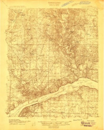
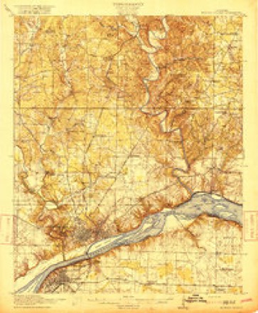
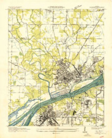
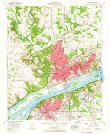
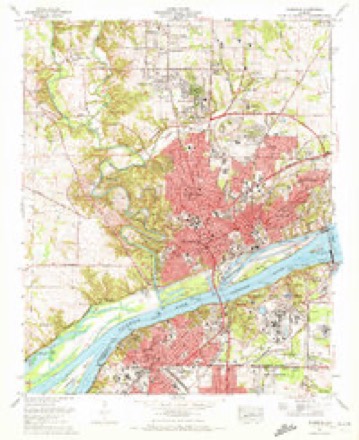
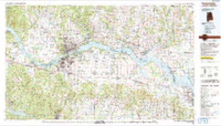
19 topographic sheets cover this place, the earliest surveyed in 1914 and the latest in 1986. It stands in the Florence census division. It lies in ZIP code area 35633. The Survey maps it on the Florence quadrangle.
Topographic sheets covering this place
10 surveys from 19 printed sheetsMatched by testing this settlement's coordinate against the published boundary of every sheet in the United States Geological Survey's historical collection. Each opens the scanned sheet at the Survey.
- 1914 USGS Muscle Shoals quadrangle1:48000
- 1916 USGS Muscle Shoals quadrangle1:62500, 2 printings
- 1936 USGS Florence quadrangle1:24000
- 1956 USGS Gadsden quadrangle1:250000, 3 printings
- 1957 USGS Florence quadrangle1:24000, 2 printings
- 1958 USGS Gadsden quadrangle1:250000
- 1960 USGS Gadsden quadrangle1:250000, 2 printings
- 1963 USGS Gadsden quadrangle1:250000
- 1971 USGS Florence quadrangle1:24000, 3 printings
- 1986 USGS Tuscumbia quadrangle1:100000, 3 printings




Fires near this place
182 since 1994Regional context, not property-specific evidence. The federal wildfire occurrence database lists 182 fires within 5 miles of Petersville between 1994 and 2019, burning about 519 acres in total. 1 started naturally. 58 were recorded as arson. Distance is straight-line from the map coordinates, so a fire counted here may appear on a neighbouring settlement's page as well.
| Reported cause | Fires |
|---|---|
| Debris and open burning | 74 |
| Arson/incendiarism | 58 |
| Smoking | 12 |
| Equipment and vehicle use | 11 |
| Misuse of fire by a minor | 10 |
| Missing data/not specified/undetermined | 10 |
| Recreation and ceremony | 3 |
| Power generation/transmission/distribution | 2 |
| Fireworks | 1 |
| Natural | 1 |
The most recent of them, most recent first, with the day each was reported and the service that recorded it.
| Date | Cause | Size | Reported by | Name on the report |
|---|---|---|---|---|
| 5 September 1999 | Misuse of fire by a minor | under an acre | Alabama Forestry Commission | not named |
| 5 September 1998 | Arson/incendiarism | 1.0 acres | Alabama Forestry Commission | not named |
| 29 September 2019 | Arson/incendiarism | under an acre | Alabama Forestry Commission | 20190929-11 |
| 29 September 2003 | Arson/incendiarism | under an acre | Alabama Forestry Commission | 115 COUNTY ROAD 249, AL |
| 28 September 2010 | Debris and open burning | under an acre | Alabama Forestry Commission | not named |
| 25 September 2008 | Smoking | under an acre | Alabama Forestry Commission | COUNTY ROAD 200, AL |
| 25 September 1999 | Arson/incendiarism | under an acre | Alabama Forestry Commission | not named |
| 22 September 2015 | Debris and open burning | 3.0 acres | Alabama Forestry Commission | NOR-20150922-001 |
Settlements close enough to share some of these fires:
Storms near this place
60 of 64 shownRegional context, not property-specific evidence. The National Weather Service names Petersville in 64 storm reports between 2000 and 2025: 35 thunderstorm wind, 13 flash flood, 9 hail, 3 flood. No death or injury is recorded in these reports. Each account below is quoted exactly as the forecast office filed it, from the NOAA Storm Events Database, and each date opens the federal record of that event.
| When | Event | Place named | Harm | What the report says |
|---|---|---|---|---|
| June 2010 | Lightning | Petersville | $30,000 | Lightning sparked a fire at an apartment complex on Chisholm road in Florence. The lightning hit the roof and caused wall at the end of the attic to be destroyed by fire. |
| August 2011 | Thunderstorm Wind | Petersville | $25,000 | Several trees were downed due to thunderstorm winds in a southeast path. |
| October 2004 | Tornado (F1) | Petersville | $20,000 | The tornado continued its path into Lauderdale county and heavily damaged two mobile homes, slightly injuring three people. A barn was also destroyed near where the mobile homes were damaged. Maximum wind speeds of the tornado where the most damage occurred was also at 100 mph. |
| February 2025 | Thunderstorm Wind | Petersville | $10,000 | A transformer and tree were knocked down onto the top of a house along Stovall Drive. |
| April 2025 | Thunderstorm Wind | Petersville | $5,000 | A tree and power pole were broken and knocked down at 2722 Little John Street. |
| December 2021 | Thunderstorm Wind | Petersville | $5,000 | Metal was torn off of a barn and trees were knocked down on Chisholm Road at Hensley Home. Time estimated by radar. |
| April 2014 | Thunderstorm Wind | Petersville | $4,000 | A few powerlines were downed on East Ranch road and large limbs were downed at the intersection of County road 30 and County Road 47 and 61 from 4 miles north through 4 miles east of Florence, Alabama. |
| April 2025 | Thunderstorm Wind | Petersville | $3,000 | A tree and power line was knocked down at Rose Drive at Helton Drive. |
| April 2025 | Thunderstorm Wind | Petersville | $3,000 | Trees were knocked down onto power lines at 103 Taylor Road. |
| August 2023 | Thunderstorm Wind | Petersville | $3,000 | Storm spotter reported trees snapped or uprooted near the Forest Hill subdivision in Florence. |
| December 2021 | Thunderstorm Wind | Petersville | $3,000 | Trees were knocked down at Rasch Road at Congress Street. Time estimated by radar. |
| December 2021 | Thunderstorm Wind | Petersville | $3,000 | A tree was knocked down onto a vehicle. |
| May 2003 | Thunderstorm Wind | Petersville | $3,000 | home with minor roof damage and numerous trees and power lines down. |
| February 2025 | Thunderstorm Wind | Petersville | $2,000 | Trees were knocked down at the intersection of CR 457 and CR 57. Time estimated by radar. |
| April 2025 | Thunderstorm Wind | Petersville | $2,000 | A large tree was knocked down at 223 Robinhood Drive. |
| August 2025 | Thunderstorm Wind | Petersville | $2,000 | At least two trees were knocked down blocking Rasch Road east of Cloverdale Road. Time estimated by radar. |
| August 2023 | Thunderstorm Wind | Petersville | $2,000 | Power lines were reported down on Byron Drive at this location. Time was estimated from radar. |
| December 2021 | Thunderstorm Wind | Petersville | $2,000 | Trees were knocked down on Augusta Street and Camellia Drive. Time estimated by radar. |
| December 2021 | Thunderstorm Wind | Petersville | $2,000 | A tree was knocked down onto a residence at 45 CR 57. Time estimated by radar. |
| June 2025 | Thunderstorm Wind | Petersville | $1,000 | A tree was knocked down blocking both lanes at the intersection of Glen Mary Drive and East Rasch Road. Time estimated by radar. |
| June 2025 | Thunderstorm Wind | Petersville | $1,000 | A tree was reported down on powerlines near the intersection of Wright Drive and Cloverdale Road. Time was estimated by radar. |
| June 2022 | Thunderstorm Wind | Petersville | $1,000 | A tree was reported down on CR 457 between Byron and Hayes streets. |
| May 2021 | Thunderstorm Wind | Petersville | $1,000 | Shingles were blown off of a house near the intersection of Helton Drive and Cox Creek Parkway. Time estimated by radar. |
| December 2021 | Thunderstorm Wind | Petersville | $1,000 | A tree was snapped at Rasch Road at Lanett Street. Time estimated by radar. |
| December 2021 | Thunderstorm Wind | Petersville | $1,000 | Power lines were knocked down on Rasch Road at Camellia. Time estimated by radar. |
| December 2021 | Thunderstorm Wind | Petersville | $1,000 | A powerline was on fire at 410 Robinwood Lane. Time estimated by radar. |
| August 2017 | Thunderstorm Wind | Petersville | $1,000 | A large tree branch was knocked down onto a car. |
| August 2000 | Hail | Petersville | $1,000 | One inch diameter size hail fell in the Petersville area. |
| June 2023 | Thunderstorm Wind | Petersville | $500 | Two trees were knocked down north of Florence. Time estimated by radar. |
| August 2023 | Thunderstorm Wind | Petersville | $500 | A tree was knocked down into the road along CR 57. Time estimated by radar. |
| May 2021 | Thunderstorm Wind | Petersville | $500 | A tree and power line were knocked down at 517 Sherwood Court in Florence. |
| December 2021 | Thunderstorm Wind | Petersville | $500 | Fencing was damaged along Greenfield Road at Britt Street. Time estimated by radar. |
| April 2011 | Lightning | Petersville | $500 | Lightning struck a tree down at 137 Stovall Drive. |
| June 2020 | Thunderstorm Wind | Petersville | $200 | Thunderstorm winds caused a low hanging power line. |
| February 2023 | Flood | Petersville | - | Report of flooding on Hwy 157 and County Road 57. Report relayed by EMA. |
| March 2023 | Flash Flood | Petersville | - | Several inches of water over Helton Drive near Cox Creek. Depth of water unknown. Report relayed via social media. |
| May 2023 | Flash Flood | Petersville | - | Gresham Road between Chisholm and Helton Drive is underwater. Estimated 6-12 inches of water covering road. Road being barricaded now and is a notorious low spot that floods in heavy rainfall events. |
| August 2022 | Flash Flood | Petersville | - | Intersection of Chisholm and Gresham Roads underwater. Depth estimated at 1-2 feet from earlier heavy rainfall. Elevation is in low spot. Report relayed via social media. |
| August 2022 | Flash Flood | Petersville | - | Side creeks overflowing, along with nearby cropland. A yard was covered with water and a basement was flooded. Depth of water unknown. |
| February 2020 | Flash Flood | Petersville | - | Vehicle stalled due to flash flooding at Gresham and Chisholm Roads in Florence. |
| February 2020 | Flood | Petersville | - | Gresham Road between Helton Road and Chisholm Road flooded. Florence Fire Dept blocking road at this time. |
| May 2020 | Thunderstorm Wind | Petersville | - | One inch tree limbs were broken and roof shingles blown off. Reported via mPING. |
| August 2020 | Flash Flood | Petersville | - | Flash flooding reported on Cloverdale Road. Water was up to exhaust on cars in the parking lot. This replaces a previous report on Cloverdale Road. |
| August 2020 | Flash Flood | Petersville | - | A few roads were closed due to flooding between Chisolm Road and Helton Drive in Florence. |
| August 2020 | Thunderstorm Wind | Petersville | - | Trees were knocked down in Underwood. |
| September 2020 | Flash Flood | Petersville | - | Portions of Heathrow Drive flooded. No depth of water given. |
| September 2020 | Flash Flood | Petersville | - | Three northbound lanes of Cloverdale Road reported flooded. Water of unknown depth. |
| February 2019 | Flood | Petersville | - | One person being rescued from vehicle driven into standing water near Elks Lodge on Highway 17. |
| August 2019 | Flash Flood | Petersville | - | Significant street flooding along Old Chisolm Road. |
| November 2019 | Flash Flood | Petersville | - | Flooding along Chisholm Road near the intersection of Gresham Road. |
| December 2019 | Thunderstorm Wind | Petersville | - | A power line was knocked down on Cloverdale Road around Heathrow. Time estimated by radar. |
| June 2018 | Thunderstorm Wind | Petersville | - | A tree was knocked down onto power lines sparking a fire of the tree at 329 Flurnoy Avenue. |
| November 2017 | Thunderstorm Wind | Petersville | - | A tin rood was torn off of the Advanced Auto Parts store along Cloverdale Road in Florence. Several windows were damaged. |
| March 2017 | Hail | Petersville | - | Golf ball sized hail was reported. |
| March 2017 | Hail | Petersville | - | Nickel sized hail was reported on Patsy DRive in the Forrest Hills subdivision in Florence. |
| August 2016 | Hail | Petersville | - | Penny sized hail was reported just north of Florence. |
| June 2014 | Flash Flood | Petersville | - | Flash flooding was reported along Gresham road in Florence, Alabama, with three feet of water over the road. |
| March 2012 | Hail | Petersville | - | Golf ball sized hail was reported. |
| March 2012 | Hail | Petersville | - | Penny sized hail was reported just north of Florence. |
| March 2011 | Hail | Petersville | - | Ping pong ball sized hail was reported in the Forest Hills neighborhood in Florence. |
Nearest settlements
The eight closest, with where each one stands in the county. Distances are straight-line, computed from the Geographic Names Information System coordinates.
| Map | Place | Distance | Sheets |
|---|---|---|---|
| Vestavia Gardens | 0.2 miles | 19 | |
| Northwood Hills | 0.2 miles | 19 | |
| Underwood Estates | 0.5 miles | 19 | |
| Forest Hills | 0.5 miles | 19 | |
| Heathrow | 0.6 miles | 19 | |
| Alexander Heights | 0.8 miles | 19 | |
| Sherwood Forest | 1.0 miles | 19 | |
| Cloverdale Heights | 1.0 miles | 19 |
Provenance
This settlement is recorded in the Geographic Names Information System as feature 124649. The sheet list is computed by point-in-boundary test against the United States Geological Survey's historical topographic inventory. Both are works of the United States government and carry no copyright under 17 U.S.C. 105.
Wildfire. Short, Karen C. 2022. Spatial wildfire occurrence data for the United States, 1992-2020 [FPA_FOD_20221014]. 6th Edition. Fort Collins, CO: Forest Service Research Data Archive. https://doi.org/10.2737/RDS-2013-0009.6 Collected with United States Government funding and usable without additional permissions or fees.
Storms. NOAA National Centers for Environmental Information, Storm Events Database https://www.ncei.noaa.gov/stormevents/ A work of the United States government, no copyright under 17 U.S.C. 105. Narratives are quoted verbatim from the National Weather Service report and are not edited or summarised.