 Block
Reedtown, Alabama
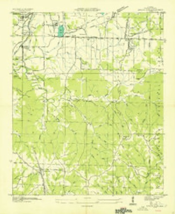
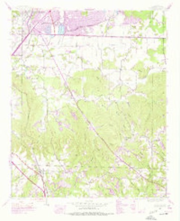
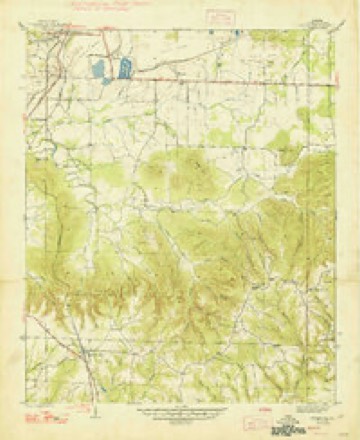
14 topographic sheets cover this place, the earliest surveyed in 1936 and the latest in 1980. It stands in the Russellville census division. It lies in ZIP code area 35653. The Survey maps it on the Spruce Pine quadrangle.
On record in Reedtown
Buildings and businesses the archive holds for this place. Each opens its own page, with the source record it came from.
On the National Register within a mile 1 record
The National Register names another town for these. They stand within one mile of this settlement's coordinate.
- Russellville Commercial Historic Districtlisted 2019 · 1.0 miles away
Topographic sheets covering this place
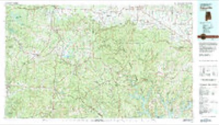
8 surveys from 14 printed sheetsMatched by testing this settlement's coordinate against the published boundary of every sheet in the United States Geological Survey's historical collection. Each opens the scanned sheet at the Survey.
- 1936 USGS Spruce Pine quadrangle1:24000
- 1945 USGS Spruce Pine quadrangle1:24000, 3 printings
- 1947 USGS Spruce Pine quadrangle1:24000, 2 printings
- 1956 USGS Gadsden quadrangle1:250000, 3 printings
- 1958 USGS Gadsden quadrangle1:250000
- 1960 USGS Gadsden quadrangle1:250000, 2 printings
- 1963 USGS Gadsden quadrangle1:250000
- 1980 USGS Haleyville quadrangle1:100000




Fires near this place
128 since 1997Regional context, not property-specific evidence. The federal wildfire occurrence database lists 128 fires within 5 miles of Reedtown between 1997 and 2020, burning about 1,485 acres in total. None started naturally. 53 were recorded as arson. Distance is straight-line from the map coordinates, so a fire counted here may appear on a neighbouring settlement's page as well.
| Reported cause | Fires |
|---|---|
| Arson/incendiarism | 53 |
| Debris and open burning | 42 |
| Missing data/not specified/undetermined | 24 |
| Equipment and vehicle use | 3 |
| Railroad operations and maintenance | 2 |
| Fireworks | 2 |
| Power generation/transmission/distribution | 1 |
| Smoking | 1 |
The most recent of them, most recent first, with the day each was reported and the service that recorded it.
| Date | Cause | Size | Reported by | Name on the report |
|---|---|---|---|---|
| 9 September 2010 | Arson/incendiarism | 17 acres | Alabama Forestry Commission | not named |
| 9 September 1999 | Arson/incendiarism | 20 acres | Alabama Forestry Commission | not named |
| 6 September 2019 | Debris and open burning | 2.0 acres | Alabama Forestry Commission | 20190906-1 |
| 5 September 1999 | Arson/incendiarism | 50 acres | Alabama Forestry Commission | not named |
| 4 September 2000 | Debris and open burning | 7.0 acres | Alabama Forestry Commission | not named |
| 22 September 2010 | Arson/incendiarism | 2.0 acres | Alabama Forestry Commission | not named |
| 22 September 2010 | Arson/incendiarism | 2.0 acres | Alabama Forestry Commission | not named |
| 21 September 2019 | Missing data/not specified/undetermined | 5.0 acres | Alabama Forestry Commission | 20190921-7 |
Settlements close enough to share some of these fires:
Mines and quarries near this place
10 of 153 shownRegional context, not property-specific evidence. The federal mineral resources record lists 153 workings within 5 miles of Reedtown: 125 unknowns, 17 occurrences, 6 past producers, 3 producers. 5 still produce. What was taken out: Iron, Limestone, Dimension, Stone, Crushed/Broken. Distance is straight-line from the map coordinates, so a quarry counted here may appear on a neighbouring settlement's page as well.
| Where | Site | Commodity | Status | Recorded |
|---|---|---|---|---|
| Russellville Quarry | Stone, Crushed/Broken | Producer | ||
| Rockwood Crushed Stone Plant | Limestone, Dimension | Plant | ||
| Rockwood Mine | Limestone, Dimension | Producer | ||
| Auxford | Iron | Unknown | ||
| Blackburn | Iron | Unknown | ||
| Cedar Creek | Iron | Unknown | ||
| Debardeleben | Iron | Unknown | ||
| Douglas | Iron | Unknown | ||
| Ensley-Sloss Number 1 | Iron | Unknown | ||
| Macy | Iron | Unknown |
Storms near this place
13 since 2012Regional context, not property-specific evidence. The National Weather Service names Reedtown in 13 storm reports between 2012 and 2026: 5 thunderstorm wind, 3 flash flood, 2 flood, 1 tornado. The reports record 1 injury. Each account below is quoted exactly as the forecast office filed it, from the NOAA Storm Events Database, and each date opens the federal record of that event.
| When | Event | Place named | Harm | What the report says |
|---|---|---|---|---|
| June 2025 | Lightning | Reedtown | 1 hurt | Lightning struck a home on Oak Hill Drive in Russellville. A 19 year old female was injured by the strike travelling through a cellular phone connected to a power outlet. The person was hospitalized. |
| June 2025 | Thunderstorm Wind | Reedtown | $6,000 | Powerlines were reported down in the Russellville area resulting in power outages. Time estimated based on radar. |
| May 2012 | Thunderstorm Wind | Reedtown | $1,000 | A tree was knocked down at 1044 County Road 624. |
| February 2026 | Hail | Reedtown | - | Half dollar sized hail was reported. |
| March 2023 | Thunderstorm Wind | Reedtown | - | Numerous locations reporting trees and power lines down near Russellville. |
| February 2019 | Flood | Reedtown | - | Washington Avenue closed at Town Branch. |
| March 2018 | Thunderstorm Wind | Reedtown | - | Damage was reported to a warehouse along Jackson Avenue South, just to the west of Walmart on Highway 43. |
| March 2018 | Tornado (EF1) | Reedtown | - | The tornado touched down in the Reedtown section of Russellville with EF-0 intensity, containing winds of 65-70 mph. The tornado caused minor roof and siding damage to a few single family homes. The tornado strengthened quickly to low-end EF-1 as it knocked down the chimney of a house and caused more extensive damage to the siding and metal roof of another. The tornado likely reached maximum intensity and width as it crossed Hwy 43 on the south side of Russellville. Here, the tornado was around 200 yards wide, with winds of 90 mph. A Waffle House restaurant had damage to its sign and roof. A warehouse and apartment complex also sustained some minor structural damage. The tornado then moved through a residential section of southeast Russellville, causing significant damage to a grove of pine and cedar trees and completely destroyed a small barn. However, only minor damage occurred at any of the one to two story homes, placing winds in the 80-90 mph range. The tornado then weakened further as it approached Highway 42 east of Russellville and lifted near Sloss Lake Park. |
| May 2017 | Thunderstorm Wind | Reedtown | - | Trees were knocked down behind the Walmart in Russellville. |
| July 2017 | Flood | Reedtown | - | Brief floodwaters at the intersection of Washington Avenue and Tuscaloosa Street, or Town Branch, caused part of the road to break away. The intersection was closed while repairs were made to the road. |
| November 2016 | Flash Flood | Reedtown | - | Four to five feet of water reported along the intersection of Tuscaloosa Street and Washington Avenue in Russellville. |
| May 2015 | Flash Flood | Reedtown | - | Flash flooding occurred near U.S. Highway 43 and Underwood road. High water between a foot and two feet entered the Dollar General store along U.S. Highway 43. There were several cars flooded along U.S. Highway 43, with Hal Kirby park flooded in the Russellville, Alabama area. |
| July 2013 | Flash Flood | Reedtown | - | Persistent heavy rainfall resulted in flash flooding around Russellville, Alabama, with portions of South Washington Avenue, Coffee and Adams Streets and along Walnut Gate Road having to be barricaded due to flash flooding. Between 12 and 24 inches of water was also reported flowing across these area roads with several homes in the area having nearly 12 inches of water entering them. |
Nearest settlements
The eight closest, with where each one stands in the county. Distances are straight-line, computed from the Geographic Names Information System coordinates.
| Map | Place | Distance | Sheets |
|---|---|---|---|
| Gravel Hill | 0.8 miles | 14 | |
| Russellville | 1.0 miles | 20 | |
| Woodlawn Heights | 2.5 miles | 20 | |
| Pleasant Ridge | 2.9 miles | 20 | |
| Isbell | 2.9 miles | 14 | |
| Hester Heights | 3.6 miles | 20 | |
| Rockwood | 3.7 miles | 14 | |
| Good Springs | 3.9 miles | 20 |
Provenance
This settlement is recorded in the Geographic Names Information System as feature 125519. The sheet list is computed by point-in-boundary test against the United States Geological Survey's historical topographic inventory. Both are works of the United States government and carry no copyright under 17 U.S.C. 105.
Wildfire. Short, Karen C. 2022. Spatial wildfire occurrence data for the United States, 1992-2020 [FPA_FOD_20221014]. 6th Edition. Fort Collins, CO: Forest Service Research Data Archive. https://doi.org/10.2737/RDS-2013-0009.6 Collected with United States Government funding and usable without additional permissions or fees.
Mines and quarries. USGS Mineral Resources Data System (MRDS) https://mrdata.usgs.gov/mrds/ A work of the United States government, no copyright under 17 U.S.C. 105.
Storms. NOAA National Centers for Environmental Information, Storm Events Database https://www.ncei.noaa.gov/stormevents/ A work of the United States government, no copyright under 17 U.S.C. 105. Narratives are quoted verbatim from the National Weather Service report and are not edited or summarised.