 Block
Rosedale, Alabama
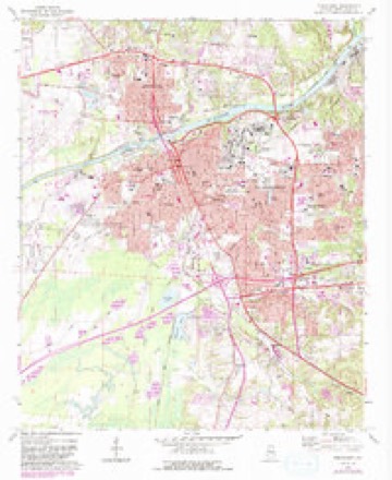
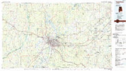
17 topographic sheets cover this place, the earliest surveyed in 1924 and the latest in 1984. It stands in the Tuscaloosa census division. It lies in ZIP code area 35401. It lies near Dalys Bottom. The Survey maps it on the Tuscaloosa quadrangle.
On record in Rosedale
Buildings and businesses the archive holds for this place. Each opens its own page, with the source record it came from.
On the National Register within a mile 3 records
The National Register names another town for these. They stand within one mile of this settlement's coordinate.
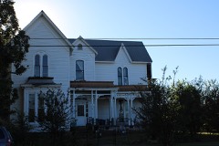 Kennedy-Foster Houselisted 2018 · 0.7 miles away
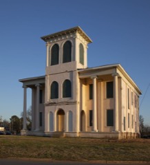 Jemison School-Drish Houselisted 2015 · 0.8 miles away
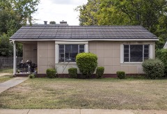 Margaret Quayle Lustron Houselisted 2000 · 1.0 miles away
Topographic sheets covering this place
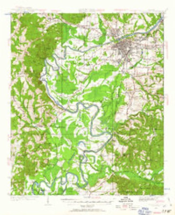
7 surveys from 17 printed sheetsMatched by testing this settlement's coordinate against the published boundary of every sheet in the United States Geological Survey's historical collection. Each opens the scanned sheet at the Survey.
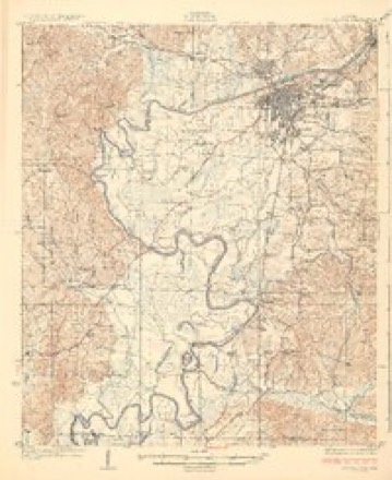
- 1924 USGS Tuscaloosa quadrangle1:62500
- 1926 USGS Tuscaloosa quadrangle1:62500, 3 printings
- 1953 USGS Birmingham quadrangle1:250000, 4 printings
- 1956 USGS Birmingham quadrangle1:250000
- 1957 USGS Birmingham quadrangle1:250000
- 1971 USGS Tuscaloosa quadrangle1:24000, 5 printings
- 1984 USGS Tuscaloosa quadrangle1:100000, 2 printings
Fires near this place
50 since 1995Regional context, not property-specific evidence. The federal wildfire occurrence database lists 50 fires within 5 miles of Rosedale between 1995 and 2014, burning about 429 acres in total. None started naturally. 15 were recorded as arson. Distance is straight-line from the map coordinates, so a fire counted here may appear on a neighbouring settlement's page as well.
| Reported cause | Fires |
|---|---|
| Arson/incendiarism | 15 |
| Debris and open burning | 13 |
| Railroad operations and maintenance | 8 |
| Missing data/not specified/undetermined | 6 |
| Misuse of fire by a minor | 3 |
| Recreation and ceremony | 2 |
| Equipment and vehicle use | 2 |
| Other causes | 1 |
The most recent of them, most recent first, with the day each was reported and the service that recorded it.
| Date | Cause | Size | Reported by | Name on the report |
|---|---|---|---|---|
| 18 September 2007 | Arson/incendiarism | 5.0 acres | Alabama Forestry Commission | not named |
| 31 August 2011 | Debris and open burning | under an acre | Alabama Forestry Commission | 4921 CUVER RD, AL |
| 30 August 2011 | Arson/incendiarism | 8.0 acres | Alabama Forestry Commission | 42 CR 82, AL |
| 3 August 2011 | Arson/incendiarism | 120 acres | Alabama Forestry Commission | CR 29, AL |
| 24 August 2007 | Arson/incendiarism | 2.0 acres | Alabama Forestry Commission | not named |
| 13 August 2004 | Equipment and vehicle use | under an acre | Alabama Forestry Commission | not named |
| 27 July 2000 | Debris and open burning | 1.0 acres | Alabama Forestry Commission | not named |
| 25 July 2006 | Misuse of fire by a minor | 3.0 acres | Alabama Forestry Commission | not named |
Settlements close enough to share some of these fires:
Mines and quarries near this place
10 of 11 shownRegional context, not property-specific evidence. The federal mineral resources record lists 11 workings within 5 miles of Rosedale: 9 producers, 2 past producers. 9 still produce. What was taken out: Sand and Gravel, Construction, Titanium, Metal, Zirconium, Kyanite, REE. Distance is straight-line from the map coordinates, so a quarry counted here may appear on a neighbouring settlement's page as well.
| Where | Site | Commodity | Status | Recorded |
|---|---|---|---|---|
| Airport Pit | Sand and Gravel, Construction, Titanium, Metal, Zirconium, Kyanite, REE | Producer | Placer | |
| American Mine | Sand and Gravel, Construction | Past Producer | ||
| Collins Pit | Sand and Gravel, Construction | Producer | ||
| Crabtree Pit | Sand and Gravel, Construction | Producer | Unconsolidated Sediments | |
| Crabtree Pit | Sand and Gravel, Construction | Producer | ||
| Holley Pit | Sand and Gravel, Construction | Producer | Unconsolidated Sediments | |
| Holley Pit | Sand and Gravel, Construction | Producer | ||
| No. 2 Pit | Sand and Gravel, Construction | Past Producer | ||
| Plant No. 2 | Sand and Gravel, Construction | Producer | ||
| Plant Operation | Sand and Gravel, Construction | Producer |
Storms near this place
14 since 2007Regional context, not property-specific evidence. The National Weather Service names Rosedale in 14 storm reports between 2007 and 2025: 7 thunderstorm wind, 3 hail, 2 heavy rain, 2 flash flood. The reports record 1 death and 1 injury. Each account below is quoted exactly as the forecast office filed it, from the NOAA Storm Events Database, and each date opens the federal record of that event.
| When | Event | Place named | Harm | What the report says |
|---|---|---|---|---|
| April 2014 | Heavy Rain | Rosedale | 1 killed, 1 hurt | Heavy rainfall briefly fell across the city of Tuscaloosa, with approximately 1.28 inches of rain in one hour. Two individuals sought shelter from an possible tornado in the undeveloped basement of their home on the 1400 block of 22nd Avenue. As water from the heavy rainfall leaked into the basement, the force of the water and intruding mud collapsed a retaining wall against them, resulting in one fatality. |
| April 2011 | Thunderstorm Wind | Rosedale | $50,000 | Thunderstorm winds blew down numerous trees and power lines along a several mile long swath across the city of Tuscaloosa, from Lurleen Wallace Blvd., eastward across the University of Alabama Campus, to the Green Grove Drive area northeast of downtown. A 74 mph wind gust was reported by unofficial wind equipment on top of the Tuscaloosa County courthouse. Several homes sustained damage due to the fallen trees. |
| October 2009 | Thunderstorm Wind | Rosedale | $2,000 | Several power lines were blown down in the city of Tuscaloosa. |
| February 2008 | Thunderstorm Wind | Rosedale | $2,000 | A few power lines were blown down on 12th Avenue in the city of Tuscaloosa. |
| February 2025 | Thunderstorm Wind | Rosedale | - | Several trees were downed across northern and eastern areas of Tuscaloosa. |
| December 2024 | Thunderstorm Wind | Rosedale | - | Several trees were downed across the county, including near Fosters, Gorgas Rd at Northside Rd, Boyd Rd near Echola, and Highway 69 near Rosser Rd. |
| July 2021 | Flash Flood | Rosedale | - | A cluster of slow moving thunderstorms containing heavy rain produced totals of 1 to 2 inches in a short period of time in the city of Tuscaloosa, resulting in flash flooding. Several roads flooded and impassable, including portions of McFarland Blvd and University Blvd, along with several stalled out vehicles. |
| August 2020 | Thunderstorm Wind | Rosedale | - | Several trees uprooted and power lines downed on Hargrove Road in the city of Tuscaloosa. |
| July 2018 | Flash Flood | Rosedale | - | Numerous streets flooded and impassable around the city of Tuscaloosa along with several submerged vehicles. |
| June 2013 | Heavy Rain | Rosedale | - | Up to 2 inches of rain fell in a short amount of time across the city of Tuscaloosa. This led to several roads becoming impassable with up to 5 inches of water across the road. Roads affected included McFarland Boulevard between University Boulevard and 13th Street East, the 1500 block of 29th Avenue, the 2200 block of 7th Street, the 900 block of 14th Avenue, and the 1400 block of Greensboro Avenue. The water receded quickly after the rain ended. |
| June 2010 | Hail | Rosedale | - | Three quarter inch hail was reported in Dearfield Place subdivision. |
| January 2007 | Thunderstorm Wind | Rosedale | - | Wind speed measured on top of Tuscaloosa County Courthouse. |
| March 2015 | Hail | Rosedale | - | no account filed |
| May 2010 | Hail | Rosedale | - | no account filed |
Nearest settlements
The eight closest, with where each one stands in the county. Distances are straight-line, computed from the Geographic Names Information System coordinates.
| Map | Place | Distance | Sheets |
|---|---|---|---|
| Rosedale Courts | 0.2 miles | 17 | |
| Parkwood | 0.3 miles | 17 | |
| Meadow Lawn | 0.4 miles | 17 | |
| The Downs | 0.5 miles | 17 | |
| Glendale Gardens | 0.6 miles | 17 | |
| Sahama Village | 0.7 miles | 17 | |
| Ingleside Village | 0.7 miles | 17 | |
| University Lane | 0.7 miles | 17 |
Provenance
This settlement is recorded in the Geographic Names Information System as feature 148503. The sheet list is computed by point-in-boundary test against the United States Geological Survey's historical topographic inventory. Both are works of the United States government and carry no copyright under 17 U.S.C. 105.
Wildfire. Short, Karen C. 2022. Spatial wildfire occurrence data for the United States, 1992-2020 [FPA_FOD_20221014]. 6th Edition. Fort Collins, CO: Forest Service Research Data Archive. https://doi.org/10.2737/RDS-2013-0009.6 Collected with United States Government funding and usable without additional permissions or fees.
Mines and quarries. USGS Mineral Resources Data System (MRDS) https://mrdata.usgs.gov/mrds/ A work of the United States government, no copyright under 17 U.S.C. 105.
Storms. NOAA National Centers for Environmental Information, Storm Events Database https://www.ncei.noaa.gov/stormevents/ A work of the United States government, no copyright under 17 U.S.C. 105. Narratives are quoted verbatim from the National Weather Service report and are not edited or summarised.