 Block
Samantha, Alabama
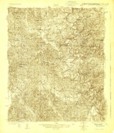
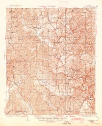
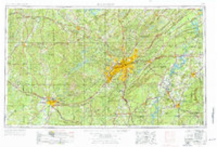
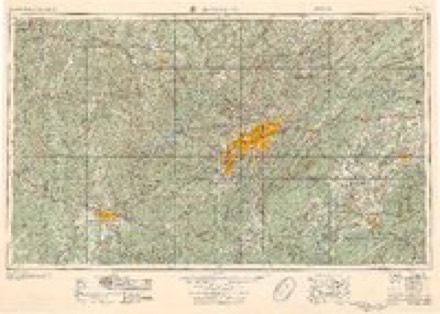
18 topographic sheets cover this place, the earliest surveyed in 1926 and the latest in 1984. It stands in the Samantha census division. It lies in ZIP code area 35475. It stands on Thomas Mill Branch. The Survey maps it on the Lake Tuscaloosa North quadrangle. It stands 394 feet above sea level.
Topographic sheets covering this place
7 surveys from 18 printed sheetsMatched by testing this settlement's coordinate against the published boundary of every sheet in the United States Geological Survey's historical collection. Each opens the scanned sheet at the Survey.
- 1926 USGS Samantha quadrangle1:48000
- 1928 USGS Samantha quadrangle1:62500, 6 printings
- 1953 USGS Birmingham quadrangle1:250000, 4 printings
- 1956 USGS Birmingham quadrangle1:250000
- 1957 USGS Birmingham quadrangle1:250000
- 1978 USGS Lake Tuscaloosa North quadrangle1:24000, 3 printings
- 1984 USGS Tuscaloosa quadrangle1:100000, 2 printings
Fires near this place
76 since 1994Regional context, not property-specific evidence. The federal wildfire occurrence database lists 76 fires within 5 miles of Samantha between 1994 and 2020, burning about 653 acres in total. 2 started naturally. 15 were recorded as arson. Distance is straight-line from the map coordinates, so a fire counted here may appear on a neighbouring settlement's page as well.
| Reported cause | Fires |
|---|---|
| Debris and open burning | 35 |
| Arson/incendiarism | 15 |
| Missing data/not specified/undetermined | 11 |
| Recreation and ceremony | 9 |
| Equipment and vehicle use | 2 |
| Natural | 2 |
| Misuse of fire by a minor | 1 |
| Power generation/transmission/distribution | 1 |
The most recent of them, most recent first, with the day each was reported and the service that recorded it.
| Date | Cause | Size | Reported by | Name on the report |
|---|---|---|---|---|
| 8 September 1999 | Debris and open burning | 6.0 acres | Alabama Forestry Commission | not named |
| 5 September 2000 | Natural | 20 acres | Alabama Forestry Commission | not named |
| 30 September 2010 | Debris and open burning | 59 acres | Alabama Forestry Commission | not named |
| 21 September 2004 | Missing data/not specified/undetermined | 4.0 acres | Alabama Forestry Commission | not named |
| 20 September 1997 | Arson/incendiarism | 2.0 acres | Alabama Forestry Commission | not named |
| 2 September 1997 | Debris and open burning | 5.0 acres | Alabama Forestry Commission | not named |
| 17 September 2003 | Arson/incendiarism | 10 acres | Alabama Forestry Commission | not named |
| 11 September 1995 | Debris and open burning | under an acre | Alabama Forestry Commission | not named |
Settlements close enough to share some of these fires:
Storms near this place
60 of 69 shownRegional context, not property-specific evidence. The National Weather Service names Samantha in 69 storm reports between 1995 and 2026: 31 thunderstorm wind, 20 hail, 12 tornado, 3 flash flood. The reports record 3 injuries. Each account below is quoted exactly as the forecast office filed it, from the NOAA Storm Events Database, and each date opens the federal record of that event.
| When | Event | Place named | Harm | What the report says |
|---|---|---|---|---|
| July 1997 | Lightning | Samantha | 3 hurt, $2,000 | Three men were struck by lightning while working outside near Whitsom, near the Walker/Tuscaloosa county line. They were putting pouring concrete when the lightning struck. They were all taken to the hospital with minor burns. |
| May 2009 | Tornado (EF1) | Samantha | $65,000 | The tornado touched down briefly near AL-13, south of the New Lexington Community. Two homes sustained moderate damage. One home had its garage door blown in and subsequently a wall blown out. Wind entered into another home's attic and blew out a portion of the roof. A wooden projectile (1 by 6) was blown approximately 100 yards and embedded into the side of a home. A pontoon boat was also overturned. |
| March 1995 | Tornado (F0) | Samantha | $56,000 | Numerous trees were downed, one mobile home was destroyed, six homes sustained roof damage, and two barns were totally destroyed by what was believed to be a small tornado. |
| March 2008 | Tornado (EF1) | Samantha | $50,000 | The tornado touched down in the Northside Community, in the northern portion of Tuscaloosa County. Along its short path, it affected areas along Old Fayette Road, CR-38, and Billy Bigham Road. At least six homes were damaged and one home sustained significant damage. At least one vehicle was badly damaged by a fallen tree. Several hundred trees were either snapped off or were blown down. |
| April 2007 | Lightning | Samantha | $50,000 | Lightning produced a house fire on Lake Tuscaloosa. |
| March 2007 | Tornado (EF1) | Samantha | $50,000 | The tornado touched down about 2 miles northwest of Samantha, near the intersection of Lesueur Road and Nazareth Church Road. It then tracked northeastward, crossed US Highway 43, and lifted near the intersection John Swindle Road and Joe Namath Road. Numerous trees were either snapped or uprooted along the path. One brick home lost a portion of its roof. |
| November 2001 | Tornado (F1) | Samantha | $25,000 | A supercell thunderstorm spawned an F1 tornado near Lake Lurleen State Park just northwest of Northport. The tornado began at 11:39 am about 10 miles northwest of Northport and just west of the intersection of Rue Road and CR 90. The tornado ended at 11:41 am near Pole Bridge Creek. The tornado mainly snapped off trees along its path but a home suffered damage at the intersection of CR 90 and Rue Road. The home sustained major roof damage and had its front porch totally removed. A few outbuildings were also destroyed on this same property. No injuries were reported. Storm spotters followed this storm near Buhl and Elrod and reported a wall cloud and funnel cloud prior to the development of a tornado. Beg: 33 21.600/87 40.314 End: 33 22.947/87 38.979 |
| June 1996 | Thunderstorm Wind | Samantha | $18,000 | no account filed |
| September 2005 | Tornado (F0) | Samantha | $17,000 | National Weather Service meteorologists performed aerial and ground surveys across northern Tuscaloosa County. It has been determined that a brief tornado occurred along Mormon Road. The tornado touched down just west of Mormon Road (County Road 35) just north of Northside Road (County Road 38). The tornado was on the ground for about 3/4 of a mile and crossed Mormon Road. At least two homes suffered minor roof damage. Several trees were snapped off along the short path. This was the same storm that produced the damage on Robertson Road. The tornado has been rated an F0 on the Fujita scale. The tornado damage path was 0.75 miles long and 50 yards wide at its widest point. This tornado was produced by the remnants of Hurricane Rita. Begin: 33 28.21/87 44.10 End: 33 28.79/87 43.65 |
| March 2006 | Thunderstorm Wind | Samantha | $10,000 | Numerous trees and power lines were downed across the northern end of Tuscaloosa County. |
| April 2006 | Thunderstorm Wind | Samantha | $10,000 | Numerous trees down near Wiley, on Brandon School Road. |
| September 2005 | Tornado (F0) | Samantha | $9,000 | The Lake Lurleen parent thunderstorm re-organized again and produced a weak tornado near Lake Tuscaloosa. The tornado touched down east of State Highway 171 near Rue Road at approximately 424 PM CDT. The tornado tracked northeast and crossed US Highway 43 before it lifted along the banks of Lake Tuscaloosa around 431 PM CDT. The tornado produced light tree damage along its path and one home suffered minor damage. The tornado damage path was 5 miles long and 60 yards wide at its widest point. This tornado was produced by the remnants of Hurricane Rita.Begin: 33 19.90/87 38.46 End: 33 23.68/87 35.97 |
| June 1996 | Hail | Samantha | $8,000 | no account filed |
| April 2009 | Tornado (EF1) | Samantha | $5,000 | The tornado touched down near the intersection of Lesueur Road and Old Fayette Road, near the Samantha community. It then moved northeastward for about one half of a mile, and lifted just north of Brady Montgomery Road. The most significant damage occurred as the tornado crossed Brady Montgomery Road. Numerous hardwood and softwood trees were snapped off and uprooted. |
| March 2007 | Thunderstorm Wind | Samantha | $5,000 | A few trees were blown down. |
| May 1997 | Thunderstorm Wind | Samantha | $5,000 | Several trees were blown down in Samantha. |
| February 2004 | Thunderstorm Wind | Samantha | $5,000 | no account filed |
| August 2006 | Thunderstorm Wind | Samantha | $3,000 | A few trees were blown down in the New Lexington Community. |
| July 1995 | Thunderstorm Wind | Samantha | $3,000 | Emergency management reported trees down across Highway 43 just north of Samantha. |
| November 2010 | Thunderstorm Wind | Samantha | $2,000 | Trees were blown down on Lary Lake Road, near Lake Tuscaloosa. |
| June 2009 | Thunderstorm Wind | Samantha | $2,000 | Trees were blown down on Tierce Patton Road, near Beacon Point Drive, near Lake Tuscaloosa. |
| June 2009 | Thunderstorm Wind | Samantha | $2,000 | Trees and power lines were blown down on Billy Bingham Road, and CR-38, near the Samantha community. |
| April 2006 | Thunderstorm Wind | Samantha | $2,000 | Trees down on Highway 171 in the Mayfield Community. |
| June 2004 | Thunderstorm Wind | Samantha | $2,000 | A few trees were knocked down in the town of Samantha. |
| December 2000 | Thunderstorm Wind | Samantha | $2,000 | Trees were blown down east of Samantha along Yellow Creek. |
| March 2006 | Tornado (F0) | Samantha | $2,000 | no account filed |
| June 2009 | Thunderstorm Wind | Samantha | $1,000 | A few trees were blown down in northern Tuscaloosa County, near Samantha. |
| August 2011 | Thunderstorm Wind | Samantha | $500 | A couple trees were knocked down around the Lake Tuscaloosa area. |
| March 2026 | Thunderstorm Wind | Samantha | - | Trees were downed on Ben Clements Rd. |
| March 2025 | Tornado (EF1) | Samantha | - | National Weather Service meteorologists surveyed damage|associated with a tornado in Tuscaloosa County that began around|4:00 PM on March 15, 2025. The tornado began along Highway|43 near Smith Landing Road, where a metal building lost part of|its roof. The tornado then crossed portions of Lake Tuscaloosa|and moved through a residential area along Tierce Patton Road,|where several trees were snapped or uprooted. The tornado then|continued northeastward, bringing down several trees on Turquoise|Lane. The tornado weakened and lifted in a wooded area east of|Highway 69 and north of Ben Clements Road around 4:14 PM.|Following inspection of post-storm satellite imagery, the maximum|wind was estimated to be 95 mph based on tree damage, and the|estimated width of the tornado was increased to 600 yards. |
| March 2025 | Tornado (EF1) | Samantha | - | The tornado first touched down just west of CR 69 in the Windham|Springs community. Here a few softwood trees sustained damage.|The tornado tracked northeast across approximately five miles of|inaccessible wooded areas before crossing Goodwater Road. Here|large tree branches were broken, a few trees were uprooted, and a|small farm building sustained damage. Minor and sporadic tree|damage continued across far northeast Tuscaloosa County with|uprooted trees along Blackburn Road. The tornado then crossed into Walker County. |
| May 2025 | Thunderstorm Wind | Samantha | - | Trees were downed along Highway 171 and along Tierce Patton Rd. |
| May 2025 | Thunderstorm Wind | Samantha | - | NWS Meteorologists surveyed extensive damage in Tuscaloosa County north of the city of Northport|and found damage consistent with high-end straight line winds. The communities of Clearwater |Estates, Four Winds, Vista Granda, east to Searles and Bull City were particularly hard hit.|The bulk of the damage likely occurred roughly between 550 AM CDT and 612 AM CDT.||The damage was very widespread from north to south starting west of U.S. Highway 43 extending|over to near Alabama Highway 59 in Bull City. The survey crew estimated a nearly solid 4-mile|swath north to south of extensive high end tree damage with embedded minor to moderate structural|damage. Extensive power line and infrastructure impacts were also observed. More sporadic damage|was observed up to 2 miles on either side of the primary swath of damage. The survey crew noted|a slightly more concentrated area of damage in the Tierce Patton Road area just south of where|a tornado tracked on 3/15 of this year. A large swath of trees was mowed down in this area and|some more notable structural damage was observed. The survey crew noted that all of the damage|was pointing generally in an east to east-northeast direction with limited debris lofting |or westward (upstream) facing debris. The extensive tree blowdown appeared to have been aided|by rain soaked and saturated soils, as a majority of the trees were uprooted.||Based on the widespread nature of the damage and the overall characteristics of the debris|observed, survey crews made the determination that straight-line winds likely caused the damage.|Maximum wind speeds based on the damage observed were estimated between 90 and 100 mph which matches|radar velocity estimates from KBMX radar. |
| June 2025 | Thunderstorm Wind | Samantha | - | Trees were downed in the Samantha area. |
| May 2024 | Hail | Samantha | - | Quarter-size hail was reported via broadcast media. |
| June 2024 | Thunderstorm Wind | Samantha | - | Several trees were uprooted in the Samantha area. |
| April 2023 | Hail | Samantha | - | Nickle size hail reported between Northport and Samantha along Highway 43. |
| June 2023 | Hail | Samantha | - | Quarter size hail reported near the intersection of Highway 69 and Yellow Creek Road. |
| April 2020 | Thunderstorm Wind | Samantha | - | Several dozen mature hardwood trees uprooted along leading edge of a bow echo. |
| August 2020 | Thunderstorm Wind | Samantha | - | Several trees uprooted near the intersection of Rue Road and Bone Camp Road. |
| June 2016 | Thunderstorm Wind | Samantha | - | Several trees uprooted along Highway 43 between Tierece Road and Old Fayette Road. |
| January 2015 | Thunderstorm Wind | Samantha | - | Several uprooted trees between the cities of Samantha and Coker. |
| August 2015 | Thunderstorm Wind | Samantha | - | Several trees uprooted near the intersection of Appling Drive and County Road 43. |
| October 2014 | Thunderstorm Wind | Samantha | - | Several trees uprooted and power lines down along 12000 block of Northside Road. |
| January 2013 | Flood | Samantha | - | Heavy rainfall fell across northern Tuscaloosa County over a period of several days. This caused minor flooding to occur across some roadways. Several of these roads had to be closed due to the flooding, including Commerce Road at the Big Creek Bridge, Old Fayette Road at Brady Montgomery Road, Harless Road at the Old Fayette Road intersection, and Fosters Loop Road. |
| December 2012 | Thunderstorm Wind | Samantha | - | Trees were uprooted near U.S. Highway 69 North and Tierce Patton Road. |
| July 2012 | Thunderstorm Wind | Samantha | - | Trees were reported down blocking Highway 69 at Tierce Patton Road. |
| June 2012 | Thunderstorm Wind | Samantha | - | A tree was reported down along Cripple Creek Road. |
| February 2009 | Flash Flood | Samantha | - | Old Fayette Road at Brady Montgomery Road became temporarily impassable and was closed due to high water. |
| December 2008 | Flash Flood | Samantha | - | Heavy rain caused water to flow over a bridge on CR-38, east of the Samantha Community. |
| March 2006 | Tornado (F0) | Samantha | - | An F0 tornado briefly touched down in rural northern Tuscaloosa County just east of US Highway 43. The tornado produced little to no damage. A storm spotter captured images of the tornado. |
| April 2006 | Hail | Samantha | - | The hail fell along State Highway 171 between Newtonville and Moores Bridge. |
| July 2006 | Flash Flood | Samantha | - | One road near Samantha was covered by high water, becoming temporarily impassable. |
| March 2005 | Hail | Samantha | - | Pea to penny size hail covered the ground in and around Samantha. |
| August 2000 | Hail | Samantha | - | Dime size hail was reported in northern Tuscaloosa County near Samantha. |
| June 1999 | Thunderstorm Wind | Samantha | - | Trees were blown down on SR 69 just north of Windham Springs. |
| April 1998 | Hail | Samantha | - | Dime size hail was reported in Samantha. |
| May 1998 | Hail | Samantha | - | Nickel size hail was reported by storm spotters at Northside High School in Samantha. |
| June 1995 | Hail | Samantha | - | Golf ball-size hail was reported at Samantha in north-central Tuscaloosa County. The State Water Patrol reported dime- to golf ball-size hail on the Tuscaloosa County side of the Warrior River in northeast Tuscaloosa County. |
| June 1995 | Hail | Samantha | - | Golf ball-size hail was reported at Samantha in north-central Tuscaloosa County. The State Water Patrol reported dime- to golf ball-size hail on the Tuscaloosa County side of the Warrior River in northeast Tuscaloosa County. |
Nearest settlements
The eight closest, with where each one stands in the county. Distances are straight-line, computed from the Geographic Names Information System coordinates.
| Map | Place | Distance | Sheets |
|---|---|---|---|
| Searcy Farms | 1.3 miles | 18 | |
| Binion Heights | 2.1 miles | 18 | |
| North River Shores | 2.1 miles | 18 | |
| Skelton Bend Estates | 2.3 miles | 18 | |
| North Riviera | 2.5 miles | 18 | |
| Hagler Mill Estates | 3.0 miles | 18 | |
| Holiday Shores | 3.1 miles | 18 | |
| Lake Cove | 3.8 miles | 18 |
Elsewhere
Matched on this settlement's Geographic Names Information System number rather than its name, so it cannot be a different place of the same name in another state.
| Wikipedia article on Samantha | An encyclopaedic summary. Its text is share-alike, so it is linked here rather than copied. |
| Wikidata item Q14679450 | The structured record the population and elevation above come from. Public domain (CC0). |
Provenance
This settlement is recorded in the Geographic Names Information System as feature 157010. The sheet list is computed by point-in-boundary test against the United States Geological Survey's historical topographic inventory. Both are works of the United States government and carry no copyright under 17 U.S.C. 105.
Wildfire. Short, Karen C. 2022. Spatial wildfire occurrence data for the United States, 1992-2020 [FPA_FOD_20221014]. 6th Edition. Fort Collins, CO: Forest Service Research Data Archive. https://doi.org/10.2737/RDS-2013-0009.6 Collected with United States Government funding and usable without additional permissions or fees.
Storms. NOAA National Centers for Environmental Information, Storm Events Database https://www.ncei.noaa.gov/stormevents/ A work of the United States government, no copyright under 17 U.S.C. 105. Narratives are quoted verbatim from the National Weather Service report and are not edited or summarised.