 Block
Spring Hill, Alabama
32 topographic sheets cover this place, the earliest surveyed in 1922 and the latest in 1994. It stands in the Mobile census division. It lies in ZIP code area 36608. It stands on Twelvemile Creek. The Survey maps it on the Spring Hill quadrangle.
On record in Spring Hill
Buildings and businesses the archive holds for this place. Each opens its own page, with the source record it came from.
On the National Register within a mile 12 of 14 shown
The National Register names another town for these. They stand within one mile of this settlement's coordinate.
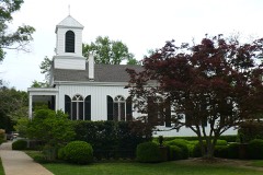 Saint Paul's Episcopal Chapellisted 1984 · 0.0 miles away
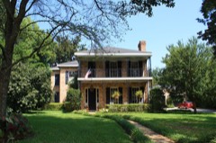 Center-Gaillard Houselisted 1984 · 0.3 miles away
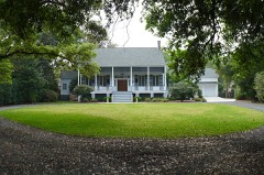 Beal-Gaillard Houselisted 1984 · 0.4 miles away
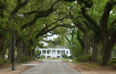 Stewartfieldlisted 1984 · 0.4 miles away
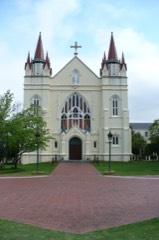 Spring Hill College Quadranglelisted 1973 · 0.4 miles away
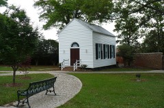 Sodality Chapellisted 1984 · 0.5 miles away
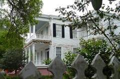 Carolina Halllisted 1973 · 0.5 miles away
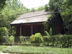 Pfau-Creighton Cottagelisted 1984 · 0.7 miles away
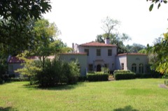 James Arthur Morrison Houselisted 1991 · 0.7 miles away
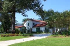 Robert L. Spotswood Houselisted 1991 · 0.8 miles away
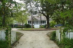 Collins-Robinson Houselisted 1984 · 0.8 miles away
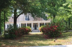 Collins-Marston Houselisted 1984 · 0.8 miles away
Every listing in Mobile County
Surveyed buildings and structures 5 records
- Azalea Grove, 55 South McGregor Avenue, Spring Hillfederal building survey, 21 photographs
- Spring Hill College, Infirmary, Old Shell Road, Spring Hillfederal building survey, 1 photograph
- Spring Hill College, Main Building, Old Shell Road, Spring Hillfederal building survey, 41 photographs
- Spring Hill College, Original Building, Old Shell Road, Spring Hillfederal building survey, 2 photographs
- Spring Hill College, Sodality Chapel, Old Shell Road, Spring Hillfederal building survey, 1 photograph
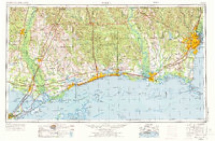
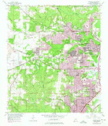
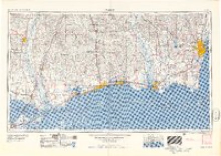
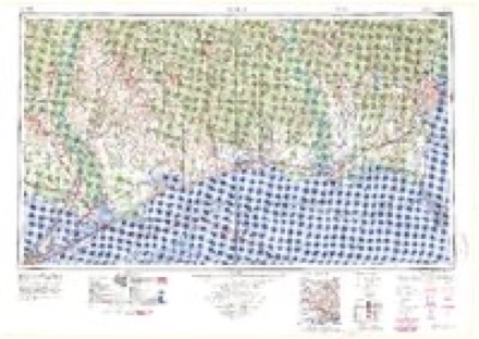
Topographic sheets covering this place
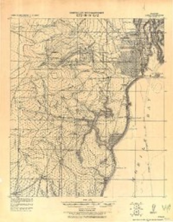
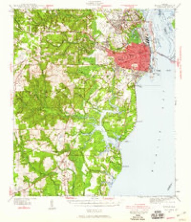
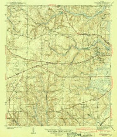
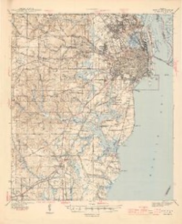
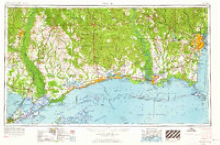
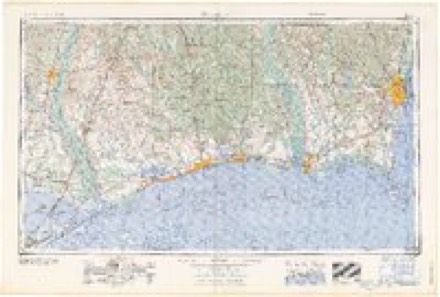
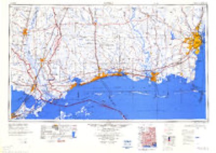
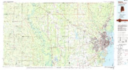
13 surveys from 32 printed sheetsMatched by testing this settlement's coordinate against the published boundary of every sheet in the United States Geological Survey's historical collection. Each opens the scanned sheet at the Survey.
- 1922 USGS Mobile quadrangle1:62500
- 1940 USGS Mobile quadrangle1:62500, 5 printings
- 1943 USGS Spring Hill quadrangle1:31680, 2 printings
- 1944 USGS Mobile quadrangle1:62500, 4 printings
- 1953 USGS Mobile quadrangle1:250000, 3 printings
- 1953 USGS Spring Hill quadrangle1:24000, 6 printings
- 1957 USGS Mobile quadrangle1:250000, 3 printings
- 1960 USGS Mobile quadrangle1:250000
- 1963 USGS Mobile quadrangle1:250000
- 1965 USGS Mobile quadrangle1:250000
- 1984 USGS Mobile quadrangle1:250000, 3 printings
- 1984 USGS Mobile quadrangle1:100000
- 1994 USGS Mobile quadrangle1:100000
Photographs
3 photographs, 1939Taken for the Office of War Information and the Farm Security Administration, who photographed the country between 1935 and 1944. Works of United States government photographers, with no known restriction on use. Each opens its catalogue record.
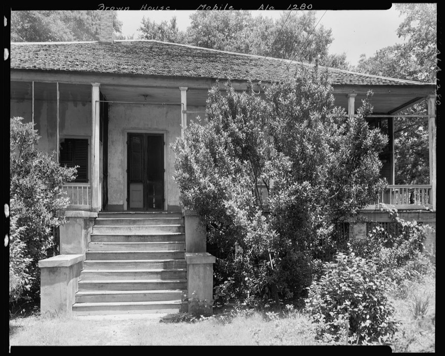
Johnston, Frances Benjamin, 1939. Library of Congress
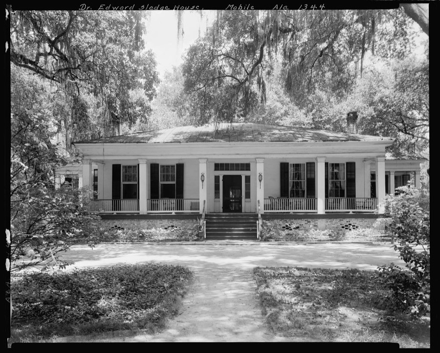
Johnston, Frances Benjamin, 1939. Library of Congress
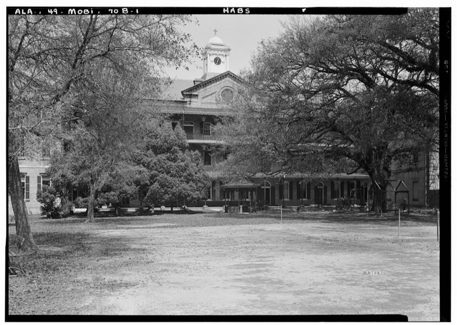
Photographer not recorded. Library of Congress
Fires near this place
56 since 1994Regional context, not property-specific evidence. The federal wildfire occurrence database lists 56 fires within 5 miles of Spring Hill between 1994 and 2017, burning about 564 acres in total. 2 started naturally. 21 were recorded as arson. Distance is straight-line from the map coordinates, so a fire counted here may appear on a neighbouring settlement's page as well.
| Reported cause | Fires |
|---|---|
| Arson/incendiarism | 21 |
| Missing data/not specified/undetermined | 20 |
| Debris and open burning | 7 |
| Recreation and ceremony | 3 |
| Natural | 2 |
| Railroad operations and maintenance | 1 |
| Equipment and vehicle use | 1 |
| Misuse of fire by a minor | 1 |
The most recent of them, most recent first, with the day each was reported and the service that recorded it.
| Date | Cause | Size | Reported by | Name on the report |
|---|---|---|---|---|
| 2 September 2015 | Missing data/not specified/undetermined | under an acre | Alabama Forestry Commission | SWR-20150902-001 |
| 19 August 1999 | Natural | under an acre | Alabama Forestry Commission | not named |
| 9 June 2000 | Debris and open burning | 5.0 acres | Alabama Forestry Commission | not named |
| 12 June 2011 | Debris and open burning | under an acre | Alabama Forestry Commission | 1675 CR 217, AL |
| 30 May 2001 | Missing data/not specified/undetermined | 1.0 acres | Alabama Forestry Commission | not named |
| 27 May 2014 | Missing data/not specified/undetermined | 3.0 acres | Alabama Forestry Commission | SWR-20140527-003 |
| 24 May 2011 | Debris and open burning | under an acre | Alabama Forestry Commission | 6371 COUNTY , RD 56, AL |
| 20 May 1999 | Arson/incendiarism | 6.0 acres | Alabama Forestry Commission | not named |
Settlements close enough to share some of these fires:
Mines and quarries near this place
9 within 5 milesRegional context, not property-specific evidence. The federal mineral resources record lists 9 workings within 5 miles of Spring Hill: 5 past producers, 4 producers. 4 still produce. What was taken out: Sand and Gravel, Construction, Clay, Clay, Sand and Gravel, Construction, Sand and Gravel, Construction, Clay. Distance is straight-line from the map coordinates, so a quarry counted here may appear on a neighbouring settlement's page as well.
| Where | Site | Commodity | Status | Recorded |
|---|---|---|---|---|
| Tommy Graham Pit No. 1 | Sand and Gravel, Construction, Clay | Past Producer | ||
| Harrison Pit | Clay | Past Producer | ||
| Laidlaw No. 1 Pit | Clay | Past Producer | ||
| Laidlaw Number 1 Quarry | Clay, Sand and Gravel, Construction | Producer | Unconsolidated Sediments | |
| Tommy Graham Pit No. 2 | Clay, Sand and Gravel, Construction | Past Producer | ||
| Eight Mine Pit | Sand and Gravel, Construction | Past Producer | ||
| Halls Mill Pit | Sand and Gravel, Construction | Producer | ||
| Unnamed Quarry | Sand and Gravel, Construction | Producer | Quartz | |
| Unnamed Quarry | Sand and Gravel, Construction | Producer | Quartz |
Storms near this place
23 since 1999Regional context, not property-specific evidence. The National Weather Service names Spring Hill in 23 storm reports between 1999 and 2024: 15 thunderstorm wind, 4 flash flood, 2 tornado, 1 hail. No death or injury is recorded in these reports. Each account below is quoted exactly as the forecast office filed it, from the NOAA Storm Events Database, and each date opens the federal record of that event.
| When | Event | Place named | Harm | What the report says |
|---|---|---|---|---|
| September 2015 | Flash Flood | Spring Hill | $200,000 | A series of slow moving thunderstorms produced several inches of rain in the Mobile metro in just a few hours. Mobile Regional Airport recorded a storm total of 7.79 inches. ||An off-duty employee reported 10-12 inches of water cover Airport Blvd just west of I-65. Numerous cars were flooded and people had to be rescued from their cars. Dauphin St near Du Rhu Dr was impassable. Flooding was also reported on parts of Old Shell Rd as well as near Grelot Rd and Hillcrest Rd. A parking lot at the University of South Alabama was severely flooded with water entering some parked vehicles. |
| March 1999 | Thunderstorm Wind | Spring Hill | $60,000 | High winds destroyed two portable classrooms at John Will Elementary School just off Ziegler Blvd and just west of the Springhill community. A brick wall was also destroyed either by the wind or by one of the destroyed portables slamming into it. There were also trees and large limbs blown down in the same general area. Wind speeds were estimated at 70 to 80 MPH. |
| July 2004 | Thunderstorm Wind | Spring Hill | $15,000 | High winds from a thunderstorm blew down several trees in the Spring Hill area. One of the trees damaged a car that was parked in the area. |
| April 2018 | Thunderstorm Wind | Spring Hill | $10,000 | Wind damage to the facade of the Burlington Coat Factory along with sporadic and tree billboard damage near the intersection of Airport Blvd and Interstate 65. |
| March 2016 | Thunderstorm Wind | Spring Hill | $10,000 | Winds estimated at 70 mph caused roof damage to apartments on the University of South Alabama campus. |
| April 2019 | Thunderstorm Wind | Spring Hill | $5,000 | Mesonet site EW8738. |
| April 2019 | Thunderstorm Wind | Spring Hill | $5,000 | High winds damaged an awning near Halls Motorsports storage building. |
| June 2008 | Flash Flood | Spring Hill | $5,000 | Heavy rains from stationary thunderstorms caused standing water near the mall area. The water was high enough to enter a few cars. |
| April 2019 | Thunderstorm Wind | Spring Hill | $2,000 | High winds downed a large tree, blocking the roadway at Old Shell and McGregor Ave. |
| September 2015 | Thunderstorm Wind | Spring Hill | $2,000 | Winds estimated at 60 mph downed a tree on Old Shell Road just east of University Blvd. |
| August 2011 | Thunderstorm Wind | Spring Hill | $2,000 | Winds estimated at 60 mph blew down trees onto power lines. |
| April 2015 | Thunderstorm Wind | Spring Hill | $1,000 | A large tree was downed by severe thunderstorm winds on the campus of the University of South Alabama. |
| April 2024 | Thunderstorm Wind | Spring Hill | - | High winds downed a large tree on the campus of the University of South Alabama. |
| January 2024 | Thunderstorm Wind | Spring Hill | - | Large tree uprooted and powerlines downed. |
| December 2024 | Tornado (EF0) | Spring Hill | - | A very brief EF0 tornado occurred on the University of South Alabama campus. This tornado began near USA South Drive where some outdoor portable restrooms were blown over facing due northwest to west along with some metal fence barricades. The tornado continued northwest to USA North Drive where more metal fence barricades were knocked over facing west. A single softwood tree uproot also occurred here facing due north. A radar indicated tornado debris signature was also evident at this location lending credence to this damage being done by a tornado. |
| August 2023 | Thunderstorm Wind | Spring Hill | - | Strong winds from a thunderstorm downed a large tree on Hawthrone Place near Bit and Spur Rd. |
| October 2022 | Tornado (EF0) | Spring Hill | - | A weak EF-0 tornado with peak winds of 75mph likely began in Pine|Grove along Threemile Creek and quickly moved north across|Moffett Road where a tornado debris signature became apparent on|radar. This tornado continued along Pine Grove Avenue where a|couple of older/dead trees were knocked down and healthier large|tree limbs were knocked down at the intersection of Pine Grove|Avenue and Pringle Drive. Due to limited road access north of|this point, the rest of the tornadoes path is approximated based|on radar tornado debris signature and rotational velocity. It is|likely the tornado ended just to the southeast of Laidlaw Lane|prior to reaching Wolf Ridge Road. |
| April 2021 | Thunderstorm Wind | Spring Hill | - | Sheds blown over on the I-65 Service Road. |
| April 2017 | Heavy Rain | Spring Hill | - | A total of 4.5 inches of rain measured at Stanky Field. |
| March 2014 | Flash Flood | Spring Hill | - | Heavy rain caused water to cover roadways at the University of South Alabama campus. |
| April 2011 | Thunderstorm Wind | Spring Hill | - | Large tree limbs and large branches blown out of trees by severe thunderstorm winds near 60 mph. Tree blown down by 60 mph winds on the University of South Alabama campus in front of the Administration Building. |
| January 2010 | Flash Flood | Spring Hill | - | Mobile Police reports numerous streets around the Montlimar Drive and Downtowner Boulevard areas just west of Interstate 65 in Mobile have high water covering the roadway. |
| May 1999 | Hail | Spring Hill | - | Dime to quarter size hail was reported from the Spring Hill Community to the Eight Mile Community. |
Nearest settlements
The eight closest, with where each one stands in the county. Distances are straight-line, computed from the Geographic Names Information System coordinates.
| Map | Place | Distance | Sheets |
|---|---|---|---|
| Pine Grove | 1.1 miles | 32 | |
| Country Club Estates | 1.2 miles | 32 | |
| Bellwood | 1.3 miles | 32 | |
| Forest Hill | 1.4 miles | 32 | |
| Country Club Village | 1.4 miles | 32 | |
| Deerwood | 1.5 miles | 32 | |
| Chesterfield Estates | 1.6 miles | 32 | |
| Crichton | 1.8 miles | 34 |
Provenance
This settlement is recorded in the Geographic Names Information System as feature 155253. The sheet list is computed by point-in-boundary test against the United States Geological Survey's historical topographic inventory. Both are works of the United States government and carry no copyright under 17 U.S.C. 105.
Wildfire. Short, Karen C. 2022. Spatial wildfire occurrence data for the United States, 1992-2020 [FPA_FOD_20221014]. 6th Edition. Fort Collins, CO: Forest Service Research Data Archive. https://doi.org/10.2737/RDS-2013-0009.6 Collected with United States Government funding and usable without additional permissions or fees.
Mines and quarries. USGS Mineral Resources Data System (MRDS) https://mrdata.usgs.gov/mrds/ A work of the United States government, no copyright under 17 U.S.C. 105.
Storms. NOAA National Centers for Environmental Information, Storm Events Database https://www.ncei.noaa.gov/stormevents/ A work of the United States government, no copyright under 17 U.S.C. 105. Narratives are quoted verbatim from the National Weather Service report and are not edited or summarised.