 Block
Stafford, Alabama
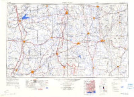
12 topographic sheets cover this place, the earliest surveyed in 1953 and the latest in 1984. It stands in the Ethelsville census division. It lies in ZIP code area 35461. The Survey maps it on the Ethelsville quadrangle.
Topographic sheets covering this place
5 surveys from 12 printed sheetsMatched by testing this settlement's coordinate against the published boundary of every sheet in the United States Geological Survey's historical collection. Each opens the scanned sheet at the Survey.
- 1953 USGS West Point quadrangle1:250000, 3 printings
- 1958 USGS West Point quadrangle1:250000
- 1963 USGS West Point quadrangle1:250000, 2 printings
- 1966 USGS Ethelsville quadrangle1:24000, 3 printings
- 1984 USGS West Point quadrangle1:250000, 3 printings
Fires near this place
83 since 1992Regional context, not property-specific evidence. The federal wildfire occurrence database lists 83 fires within 5 miles of Stafford between 1992 and 2019, burning about 658 acres in total. 1 started naturally. 24 were recorded as arson. Distance is straight-line from the map coordinates, so a fire counted here may appear on a neighbouring settlement's page as well.
| Reported cause | Fires |
|---|---|
| Debris and open burning | 27 |
| Arson/incendiarism | 24 |
| Railroad operations and maintenance | 12 |
| Missing data/not specified/undetermined | 8 |
| Recreation and ceremony | 6 |
| Equipment and vehicle use | 3 |
| Natural | 1 |
| Misuse of fire by a minor | 1 |
| Smoking | 1 |
The most recent of them, most recent first, with the day each was reported and the service that recorded it.
| Date | Cause | Size | Reported by | Name on the report |
|---|---|---|---|---|
| 8 September 2013 | Arson/incendiarism | 28 acres | Alabama Forestry Commission | NWR-20130908-001 |
| 8 September 2006 | Debris and open burning | 3.0 acres | Mississippi Forestry Commission | not named |
| 6 September 2002 | Railroad operations and maintenance | 48 acres | Alabama Forestry Commission | not named |
| 3 September 1999 | Arson/incendiarism | 2.0 acres | Alabama Forestry Commission | not named |
| 28 September 2000 | Arson/incendiarism | 10 acres | Alabama Forestry Commission | not named |
| 21 September 1999 | Equipment and vehicle use | under an acre | Alabama Forestry Commission | not named |
| 17 September 1998 | Debris and open burning | 2.0 acres | Alabama Forestry Commission | not named |
| 16 September 1999 | Arson/incendiarism | 5.0 acres | Alabama Forestry Commission | not named |
Settlements close enough to share some of these fires:
Storms near this place
9 since 1999Regional context, not property-specific evidence. The National Weather Service names Stafford in 9 storm reports between 1999 and 2023: 3 hail, 3 tornado, 3 thunderstorm wind. The reports record 5 injuries. Each account below is quoted exactly as the forecast office filed it, from the NOAA Storm Events Database, and each date opens the federal record of that event.
| When | Event | Place named | Harm | What the report says |
|---|---|---|---|---|
| April 2014 | Tornado (EF2) | Stafford | 5 hurt | A tornado initially touched down in Lowndes County, Mississippi, south of Columbus and traveled to the northeast, crossing the Alabama state line at County Road 30 in Pickens County. Tornado wind speeds were estimated at 115-120mph as it moved into Alabama. Along County Road 30, one site-built home was shifted off its foundation, trapping 10 people in the basement. There were also several mobile homes that were completely destroyed along with one small concrete building that had its roof removed and one exterior wall completely destroyed. The tornado continued northeast crossing U.S. Highway 82 and began to weaken along Bains Road, where several roofs sustained minor damage and several trees were uprooted. The tornado then rapidly dissipated near Tabernacle Road where only sporadic damage was found. It is also noteworthy that several damage points south of the tornado track were consistent with straight-line winds. |
| November 2002 | Tornado (F1) | Stafford | $5,000 | The third tornado of the evening in Alabama, the Stafford Tornado, moved into Pickens County from Mississippi, at 7:42 pm just northwest of Stafford. This tornado, rated an F1 in Alabama, stayed over mostly rural land downing trees. The path length in Alabama was 4.5 miles, and the width about 75 yards. No deaths or injuries were reported in Alabama.Beg: 33 27.623/88 17.036 End: 33 28.267/88 12.269 |
| July 2011 | Thunderstorm Wind | Stafford | $2,000 | Several trees were reported down along Bains Road. |
| June 2023 | Hail | Stafford | - | Baseball size hail reported along Highway 82 near the Mississippi State line. |
| June 2019 | Thunderstorm Wind | Stafford | - | Several trees uprooted near the Mississippi State line on Halbert Church Road. |
| March 2016 | Tornado (EF1) | Stafford | - | National Weather Service meteorologists surveyed damage in northwest Pickens County near Stafford and determined that the damage was consistent with an EF-1 tornado. Maximum winds were estimated to be around 100 mph. ||The tornado started in Mississippi and crossed the state line into Pickens County about 2.3 miles south of Highway 82. The tornado tracked northeast and crossed Eagle Road and County Road 30 before dissipating just north of Highway 82. The damage along the path consisted mainly of snapped and uprooted trees. There was some minor damage to a mobile home as the tornado approached County Road 30. |
| April 2014 | Thunderstorm Wind | Stafford | - | Several hardwood and softwood trees were uprooted on Bains and Caston Roads. Some minor roof damage also occurred in the area. This damage was immediately to the right of a tornado path and was believed to be caused by the rear flank downdraft. |
| January 1999 | Hail | Stafford | - | Nickel size hail was reported in northwest Pickens County. |
| March 2015 | Hail | Stafford | - | no account filed |
Nearest settlements
The eight closest, with where each one stands in the county. Distances are straight-line, computed from the Geographic Names Information System coordinates.
| Map | Place | Distance | Sheets |
|---|---|---|---|
| Ethelsville | 2.6 miles | 12 | |
| Forest | 3.5 miles | 12 | |
| Macedonia | 3.9 miles | 12 | |
| Liberty | 4.5 miles | 12 | |
| Delma | 5.3 miles | 12 | |
| Pine Grove | 6.9 miles | 11 | |
| McShan | 7.1 miles | 12 | |
| Melrose | 7.7 miles | 12 |
Provenance
This settlement is recorded in the Geographic Names Information System as feature 157099. The sheet list is computed by point-in-boundary test against the United States Geological Survey's historical topographic inventory. Both are works of the United States government and carry no copyright under 17 U.S.C. 105.
Wildfire. Short, Karen C. 2022. Spatial wildfire occurrence data for the United States, 1992-2020 [FPA_FOD_20221014]. 6th Edition. Fort Collins, CO: Forest Service Research Data Archive. https://doi.org/10.2737/RDS-2013-0009.6 Collected with United States Government funding and usable without additional permissions or fees.
Storms. NOAA National Centers for Environmental Information, Storm Events Database https://www.ncei.noaa.gov/stormevents/ A work of the United States government, no copyright under 17 U.S.C. 105. Narratives are quoted verbatim from the National Weather Service report and are not edited or summarised.