 Block
Summerdale, Alabama
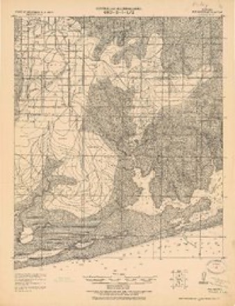
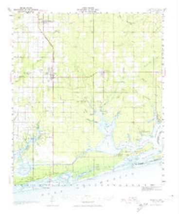
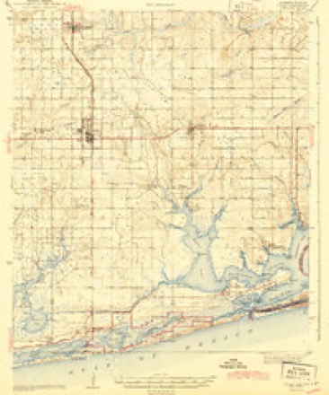
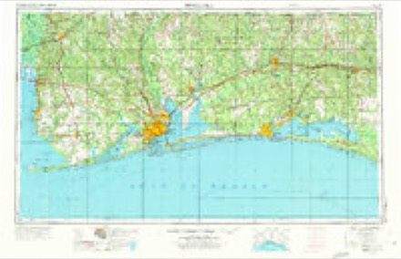
17 topographic sheets cover this place, the earliest surveyed in 1921 and the latest in 1980. It stands in the Summerdale census division. It lies in ZIP code area 36580. The Survey maps it on the Foley quadrangle. 1,468 people lived here at the 2020 count. It stands 115 feet above sea level.
Population over time
2 figuresSummerdale grew from 862 to 1,468 between 2010 and 2020. These are the recorded population figures Wikidata holds for this place, reached through the Geographic Names Information System number this page is keyed on rather than by name, so they belong to this place and not to another of the same name. Most are census counts, but not all are: an early figure may be a founding or settlement estimate, and an estimate published within five years of a census is left out. The change column is computed, and is left blank where more than 20 years separate a figure from the one before it, because a gap that long is not a change between two counts.
| Year | People | Change |
|---|---|---|
| 2010 | 862 | |
| 2020 | 1,468 | +606 (+70%) |
Topographic sheets covering this place
8 surveys from 17 printed sheetsMatched by testing this settlement's coordinate against the published boundary of every sheet in the United States Geological Survey's historical collection. Each opens the scanned sheet at the Survey.
- 1921 USGS Bon Secour quadrangle1:62500, 2 printings
- 1941 USGS Foley quadrangle1:62500, 3 printings
- 1943 USGS Foley quadrangle1:62500, 2 printings
- 1957 USGS Pensacola quadrangle1:250000, 3 printings
- 1959 USGS Pensacola quadrangle1:250000
- 1960 USGS Pensacola quadrangle1:250000
- 1978 USGS Pensacola quadrangle1:100000, 3 printings
- 1980 USGS Foley quadrangle1:24000, 2 printings
Fires near this place
45 since 1996Regional context, not property-specific evidence. The federal wildfire occurrence database lists 45 fires within 5 miles of Summerdale between 1996 and 2019, burning about 383 acres in total. None started naturally. 11 were recorded as arson. Distance is straight-line from the map coordinates, so a fire counted here may appear on a neighbouring settlement's page as well.
| Reported cause | Fires |
|---|---|
| Debris and open burning | 19 |
| Missing data/not specified/undetermined | 12 |
| Arson/incendiarism | 11 |
| Equipment and vehicle use | 2 |
| Recreation and ceremony | 1 |
The most recent of them, most recent first, with the day each was reported and the service that recorded it.
| Date | Cause | Size | Reported by | Name on the report |
|---|---|---|---|---|
| 25 September 2015 | Missing data/not specified/undetermined | under an acre | Alabama Forestry Commission | SWR-20150925-002 |
| 1 September 2010 | Equipment and vehicle use | under an acre | Alabama Forestry Commission | not named |
| 1 July 2011 | Debris and open burning | 5.8 acres | Alabama Forestry Commission | NIMPHS LANE, AL |
| 4 June 2011 | Missing data/not specified/undetermined | 6.8 acres | Alabama Forestry Commission | HALEY LANE, AL |
| 4 June 2002 | Debris and open burning | 3.0 acres | Alabama Forestry Commission | not named |
| 22 June 2015 | Missing data/not specified/undetermined | 2.0 acres | Alabama Forestry Commission | SWR-20150622-001 |
| 26 May 1996 | Recreation and ceremony | under an acre | Alabama Forestry Commission | not named |
| 19 May 2006 | Debris and open burning | under an acre | Alabama Forestry Commission | not named |
Settlements close enough to share some of these fires:
Mines and quarries near this place
1 within 5 milesRegional context, not property-specific evidence. The federal mineral resources record lists 1 working within 5 miles of Summerdale: 1 producer. All of them still produce. What was taken out: Sand and Gravel, Construction. Distance is straight-line from the map coordinates, so a quarry counted here may appear on a neighbouring settlement's page as well.
| Where | Site | Commodity | Status | Recorded |
|---|---|---|---|---|
| Baldwin County Plant Summerdale | Sand and Gravel, Construction | Producer |
Storms near this place
24 since 1996Regional context, not property-specific evidence. The National Weather Service names Summerdale in 24 storm reports between 1996 and 2024: 12 thunderstorm wind, 5 tornado, 3 hail, 2 flash flood. The reports record 4 injuries. Each account below is quoted exactly as the forecast office filed it, from the NOAA Storm Events Database, and each date opens the federal record of that event.
| When | Event | Place named | Harm | What the report says |
|---|---|---|---|---|
| November 2004 | Tornado (F2) | Summerdale | 4 hurt, $400,000 | An F2 touched down just west of Summerdale along County Road 32. The tornado then tracked east northeast and moved through downtown Summerdale. The tornado continued moving east and went back into the clouds east of Summerdale. Most of the damage from the tornado occurred in downtown Summerdale. Bleachers from a new ball field were found about a quarter mile away next to a house. A school bus was pushed sideways 15 to 20 feet by the winds. Five homes were destroyed with 35 to 40 homes suffering damage. Four minor injuries were reported. People heard the warning and took cover before the tornado hit. This same area was hit hard by Hurricane Ivan in September. |
| August 1996 | Thunderstorm Wind | Summerdale | $90,000 | no account filed |
| October 2001 | Thunderstorm Wind | Summerdale | $40,000 | High winds damaged a large Silo near Summerdale. |
| May 2008 | Thunderstorm Wind | Summerdale | $30,000 | no account filed |
| June 2022 | Lightning | Summerdale | $10,000 | House struck by lightning. |
| June 2007 | Thunderstorm Wind | Summerdale | $10,000 | Trees and power lines were blown down by high thunderstorm winds in Summerdale and also near Robertsdale. |
| December 2002 | Thunderstorm Wind | Summerdale | $10,000 | High winds from a thunderstorm blew down several trees near Summerdale. A couple of outbuildings in the same location suffered minor damage. |
| February 1999 | Tornado (F0) | Summerdale | $10,000 | An F0 tornado briefly touched down around Alabama 59 near Summerdale in a trailer park. Several trailers had minor damage to skirting and one was shifted off its blocks. One tree had a branch blown off and an abandoned trailer on blocks was turned over. The tornado then moved east and skipped along the ground briefly touching down along County Road 38 where small trees and a fence were blown down. A Weather Service employee followed the storm east and said the funnel was rotating but it never appeared to touch down. The tornado then went back into the cloud before reaching Seminole. |
| August 2003 | Thunderstorm Wind | Summerdale | $7,000 | High winds from a thunderstorm blew down trees and power lines near Summerdale. |
| July 2012 | Thunderstorm Wind | Summerdale | $5,000 | Winds estimated at 60 mph downed trees across County Road 28 and power lines down just west of County road 55. |
| July 2002 | Thunderstorm Wind | Summerdale | $5,000 | A strong thunderstorm blew down several trees about 4 miles northeast of Summerdale on County Road 36, just to the east of County Road 83. |
| March 2003 | Thunderstorm Wind | Summerdale | $3,000 | High winds from a thunderstorm blew an awning off a building. |
| September 1996 | Thunderstorm Wind | Summerdale | $2,500 | no account filed |
| January 2024 | Thunderstorm Wind | Summerdale | - | Power poles snapped at the base and lines down on AL-59. |
| May 2024 | Flash Flood | Summerdale | - | Heavy rain caused water over the roadway at Foley Beach express. |
| December 2024 | Tornado (EF1) | Summerdale | - | A tornado first touched down in a field approximately 100 yards|to the west of a home to the southwest of the intersection of N E|7th Street and E Greenwood Road in Summerdale. The tornado|destroyed a shed roof structure then struck the single family|brick home. Significant damage to the roof was observed with|destruction of a roof gable on both the front and rear of the|home and the roof decking was lifted and removed from the roof|framing resulting in large holes in a large portion of the roof.|A rear roofed screened patio was completely destroyed and a front|porch was heavily damaged. Large branches of two oak trees were|broken and deposited into the yard. There was also a large|section of fencing that was downed at this house and a|neighboring yard just to the south. The tornado was rated an EF-|1 at this location with winds of 95 mph. The tornado only briefly|touched down and was very intermittent along the entire 2.25 mile|track. EF-0 tornado damage occurred at the Graystone RV Park at|the intersection of E Greenwood Road and the Baldwin Beach|Express and to the northeast of the Baldwin Beach Express at a|mobile home community along County Road 38 S. A recreational|vehicle was blown over onto a pickup truck damaging both the RV|and a nearby pickup truck. A few additional recreation vehicles|were also shifted slightly from their resting locations. There|was minor tree damage at this location as well. The tornado|produced 70 to 75 mph winds at this location. To the northeast at|the mobile home community several mobile homes had damage to the|skirting along the bottom of the mobile homes. In addition, loose|objects to include patio furniture and children's toys were|thrown about. The tornado produced winds to 65 mph at the mobile|home community. The tornado again lifted and then again touchdown|to the northeast and struck a metal outbuilding removing large|portions of the metal roofing and bending and twisting the|roofing and side support beams. A large section of the metal roof|was also launched 75 yards over a nearby home and landed in the|front yard. A small tractor combine was also overturned. The|tornado had intensified at this location and was rated as an EF-|1 with winds estimated at 95 mph. The tornado lifted and rapidly|dissipated in an open field just beyond the damaged metal|outbuilding. |
| May 2022 | Hail | Summerdale | - | Quarter size hail was reported. First round of hail fell from 450 to 458 pm and resumed briefly at 507 pm. |
| March 2022 | Tornado (EF1) | Summerdale | - | A compact EF1 tornado touched down at approximately 11:07 PM CDT|3/22/22 on CR-34 S affecting a residence in Summerdale where a|storage building experienced damage to its walls and roofing|material removed. The tornado quickly moved north impacting a|wooded area just past the residence where multiple hardwood trees|were snapped/uprooted supporting its peak intensity around 90 mph.|This tornado then crossed Wynn Road before overturning/mangling a|couple irrigation systems. The tornado began to weaken after this|and damage became sporadic as it tracked north-northeast with|pockets of EF0 damage being done to residential structures and|trees until it reached Robertsdale. Once in Robertsdale the|tornado continued to produce EF0 damage peeling back roofing|material of small retail buildings by 11:14 PM CDT. The tornado|began to narrow considerably as it tracked into northeastern|Robertsdale knocking down large tree limbs and overturning a shed.|The tornado lifted in northeastern Robertsdale off of Baldwin|Street at 11:16 PM CDT. |
| April 2021 | Thunderstorm Wind | Summerdale | - | High winds blew roofs off the dugouts at the Summerdale ball park. |
| June 2021 | Flash Flood | Summerdale | - | Heavy rain caused water to cover the roadway at Highway 59 and CR 32. |
| June 2017 | Tornado (EF0) | Summerdale | - | A public video captured a brief tornado touchdown in an open field just north of Engel Road and west of the Baldwin Beach Express. |
| March 2014 | Flood | Summerdale | - | Heavy rain caused flooding on CR 32 near the Boy's Ranch. |
| June 2011 | Hail | Summerdale | - | no account filed |
| June 2011 | Hail | Summerdale | - | no account filed |
Nearest settlements
The eight closest, with where each one stands in the county. Distances are straight-line, computed from the Geographic Names Information System coordinates.
| Map | Place | Distance | Sheets |
|---|---|---|---|
| Robertsdale | 4.6 miles | 16 | |
| Silverhill | 4.8 miles | 18 | |
| Marlow | 5.6 miles | 18 | |
| Foley | 5.7 miles | 17 | |
| Clay City | 5.7 miles | 18 | |
| Blue Grass Recreational Vehicle Park | 5.9 miles | 17 | |
| River Park | 6.5 miles | 18 | |
| Magnolia Springs | 7.3 miles | 18 |
Elsewhere
Matched on this settlement's Geographic Names Information System number rather than its name, so it cannot be a different place of the same name in another state.
| Wikipedia article on Summerdale | An encyclopaedic summary. Its text is share-alike, so it is linked here rather than copied. |
| Wikidata item Q66937 | The structured record the population and elevation above come from. Public domain (CC0). |
Provenance
This settlement is recorded in the Geographic Names Information System as feature 155262. The sheet list is computed by point-in-boundary test against the United States Geological Survey's historical topographic inventory. Both are works of the United States government and carry no copyright under 17 U.S.C. 105.
Wildfire. Short, Karen C. 2022. Spatial wildfire occurrence data for the United States, 1992-2020 [FPA_FOD_20221014]. 6th Edition. Fort Collins, CO: Forest Service Research Data Archive. https://doi.org/10.2737/RDS-2013-0009.6 Collected with United States Government funding and usable without additional permissions or fees.
Mines and quarries. USGS Mineral Resources Data System (MRDS) https://mrdata.usgs.gov/mrds/ A work of the United States government, no copyright under 17 U.S.C. 105.
Storms. NOAA National Centers for Environmental Information, Storm Events Database https://www.ncei.noaa.gov/stormevents/ A work of the United States government, no copyright under 17 U.S.C. 105. Narratives are quoted verbatim from the National Weather Service report and are not edited or summarised.