 Block
Troy, Alabama
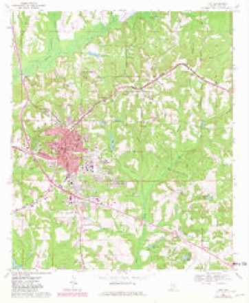
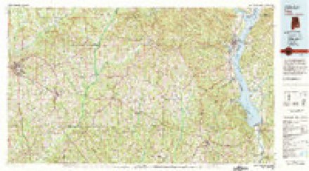
8 topographic sheets cover this place, the earliest surveyed in 1953 and the latest in 1981. It stands in the Troy census division. It lies in ZIP code area 36081. The Survey maps it on the Troy quadrangle. 17,727 people lived here at the 2020 count. It stands 541 feet above sea level.
Research this city
On record in Troy
Buildings and businesses the archive holds for this place. Each opens its own page, with the source record it came from.
On the National Register 3 records
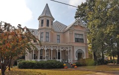 College Street Historic Districtlisted 1976
- Troy High Schoollisted 1984
- Troy Masonic Templelisted 2024
Population over time
4 figuresTroy grew from 600 to 17,727 between 1850 and 2020. These are the recorded population figures Wikidata holds for this place, reached through the Geographic Names Information System number this page is keyed on rather than by name, so they belong to this place and not to another of the same name. Most are census counts, but not all are: an early figure may be a founding or settlement estimate, and an estimate published within five years of a census is left out. The change column is computed, and is left blank where more than 20 years separate a figure from the one before it, because a gap that long is not a change between two counts.
| Year | People | Change |
|---|---|---|
| 1850 | 600 | |
| 2000 | 13,935 | |
| 2010 | 18,033 | +4,098 (+29%) |
| 2020 | 17,727 | -306 (-2%) |
Topographic sheets covering this place
5 surveys from 8 printed sheetsMatched by testing this settlement's coordinate against the published boundary of every sheet in the United States Geological Survey's historical collection. Each opens the scanned sheet at the Survey.
- 1953 USGS Dothan quadrangle1:250000, 3 printings
- 1954 USGS Dothan quadrangle1:250000
- 1955 USGS Dothan quadrangle1:250000
- 1968 USGS Troy quadrangle1:24000, 2 printings
- 1981 USGS Troy quadrangle1:100000
Fires near this place
46 since 1994Regional context, not property-specific evidence. The federal wildfire occurrence database lists 46 fires within 5 miles of Troy between 1994 and 2018, burning about 340 acres in total. 1 started naturally. 6 were recorded as arson. Distance is straight-line from the map coordinates, so a fire counted here may appear on a neighbouring settlement's page as well.
| Reported cause | Fires |
|---|---|
| Debris and open burning | 16 |
| Missing data/not specified/undetermined | 8 |
| Railroad operations and maintenance | 8 |
| Arson/incendiarism | 6 |
| Equipment and vehicle use | 2 |
| Recreation and ceremony | 2 |
| Misuse of fire by a minor | 2 |
| Smoking | 1 |
| Natural | 1 |
The most recent of them, most recent first, with the day each was reported and the service that recorded it.
| Date | Cause | Size | Reported by | Name on the report |
|---|---|---|---|---|
| 29 August 1994 | Railroad operations and maintenance | under an acre | Alabama Forestry Commission | not named |
| 21 July 2000 | Natural | under an acre | Alabama Forestry Commission | not named |
| 9 June 2000 | Debris and open burning | 1.0 acres | Alabama Forestry Commission | not named |
| 22 May 2011 | Missing data/not specified/undetermined | 2.0 acres | Alabama Forestry Commission | 1388 CO RD 7708, AL |
| 17 May 2000 | Railroad operations and maintenance | under an acre | Alabama Forestry Commission | not named |
| 13 May 2018 | Debris and open burning | 12 acres | Alabama Forestry Commission | 20180513-1 |
| 11 May 2011 | Missing data/not specified/undetermined | 8.0 acres | Alabama Forestry Commission | OLD HWY 231 N, AL |
| 30 April 2003 | Railroad operations and maintenance | 3.5 acres | Alabama Forestry Commission | not named |
Settlements close enough to share some of these fires:
Mines and quarries near this place
10 of 24 shownRegional context, not property-specific evidence. The federal mineral resources record lists 24 workings within 5 miles of Troy: 14 unknowns, 8 occurrences, 2 prospects. None of them still produces. What was taken out: Iron, Clay. Distance is straight-line from the map coordinates, so a quarry counted here may appear on a neighbouring settlement's page as well.
| Where | Site | Commodity | Status | Recorded |
|---|---|---|---|---|
| Pik 4 Clay Prospect | Clay | Prospect | ||
| J A Curtis Prospect | Iron | Prospect | ||
| Unnamed | Iron | Unknown | ||
| Unnamed | Iron | Unknown | ||
| Unnamed | Iron | Unknown | ||
| Unnamed | Iron | Unknown | ||
| Unnamed | Iron | Unknown | ||
| Unnamed | Iron | Unknown | ||
| Unnamed | Iron | Unknown | ||
| Unnamed | Iron | Unknown |
Storms near this place
47 since 1997Regional context, not property-specific evidence. The National Weather Service names Troy in 47 storm reports between 1997 and 2023: 23 thunderstorm wind, 11 hail, 8 tornado, 3 flash flood. The reports record 7 injuries. Each account below is quoted exactly as the forecast office filed it, from the NOAA Storm Events Database, and each date opens the federal record of that event.
| When | Event | Place named | Harm | What the report says |
|---|---|---|---|---|
| August 2015 | Tornado (EF1) | Troy | 7 hurt | National Weather Service meteorologists surveyed the damage in Troy and have confirmed that the damage was the result of an EF-1 Tornado. The tornado touched down just south of the Pike Liberal Arts School behind the Troy Walmart. Damage to the Walmart extended from the rear of the building to the front, with a portion of the roof collapsed. The damage was confined to a very narrow path, with other HVAC systems a few yards either side of the main damage area largely intact. Significant damage was caused to the entrances of the store as well. As the tornado crossed the parking lot, it pushed an empty tractor-trailer approximately 100 yards into a second tractor trailer, damaging both. A third tractor trailer was overturned, causing major damage. The tornado then clipped the south end of a strip mall, collapsing the front glass walls and a portion of a masonry wall on the side of Hibbett Sporting Goods. Minor damage was caused to the canopy of the Murphy USA gas station across the parking lot. The tornado crossed U.S. Highway 231 and weakened rapidly, with only minor damage caused to a convenience store across the highway before dissipating. Peak wind estimated at 100 mph. |
| November 2000 | Tornado (F1) | Troy | $95,000 | A weak tornado formed on a bow echo about 4.1 miles north-northeast of Troy just west of the intersection of CR 103 and CR 7. The tornado traveled on a northeasterly track crossing CR 103 and CR 7. The tornado dissipated just southeast of Needmore after traveling about 1.9 miles. One mobile home that was tied down was completely destroyed and was thrown over 100 feet. Another mobile home suffered significant damage when a tree fell on one end of it. Three other mobile homes suffered some damage. Five permanent homes also sustained damage mostly to the roofs. Numerous trees sustained damage including several that were uprooted. A number of outbuildings (sheds and the like) also were damaged by the storm. Beginning: 31 52.281/85 57.246 Ending: 31 53.402/85 55.727 |
| May 1998 | Hail | Troy | $60,000 | Baseball size hail that damaged cars was reported in Goshen. |
| August 2002 | Thunderstorm Wind | Troy | $40,000 | Numerous trees were blown down across the city of Troy. Five homes were damaged from fallen trees. Troy County Club had forty to fifty trees blown down just on its property. |
| June 2010 | Lightning | Troy | $25,000 | Lightning caused a fire at the substation resulting in numerous power outages across northern portions of the county. |
| September 1998 | Tornado (F0) | Troy | $25,000 | Hurricane Georges spawned tornadoes across southeast and south central Alabama on the 28th and 29th. The first tornado touched down in extreme southwest Pike County. Numerous trees and power lines down in the Camp Sharon and Fleetwood communities. This tornado continued into Crenshaw County and produced damage near Glenwood. |
| January 2000 | Thunderstorm Wind | Troy | $20,000 | Large tree limbs were knocked down onto power lines across the city causing numerous power outages. Newspaper reports indicated businesses along US 231 Bypass received minor roof and shutter damage and some signs were destroyed. |
| March 2005 | Hail | Troy | $18,000 | Golf ball size hail was observed from just south of the Ansley community to near CR 49 north of Orion. The hail producing thunderstorm affected areas in and around Ansley and Orion and crossedUS 231. |
| April 1999 | Thunderstorm Wind | Troy | $15,000 | Numerous trees and power lines blown down in the city of Troy. |
| June 1998 | Thunderstorm Wind | Troy | $15,000 | Trees and power lines were down in Troy and a trailer was cut in two by a falling tree. |
| September 1998 | Thunderstorm Wind | Troy | $12,000 | Wind associated with a thunderstorm downed trees near the intersection of SR 10 and CR 5 in western Pike County. |
| April 2011 | Thunderstorm Wind | Troy | $7,000 | Numerous trees were blown down around Troy. One tree fell on a house. |
| December 2008 | Thunderstorm Wind | Troy | $5,000 | Numerous trees were blown down around Troy, and other portions of the county. |
| January 1997 | Hail | Troy | $5,000 | no account filed |
| September 1998 | Tornado (F0) | Troy | $4,000 | A tornado knocked trees down in Shiloh and Monticello as it moved northward across eastern Pike County. |
| September 1998 | Tornado (F0) | Troy | $4,000 | A tornado moved northward across southeastern Pike county and knocked trees down east of Hamilton Crossroads. |
| June 2010 | Thunderstorm Wind | Troy | $3,000 | Several trees were blown down. |
| April 2004 | Hail | Troy | $3,000 | Half dollar size hail was observed by State Troopers along US 231 in southeastern Pike County. |
| June 2009 | Thunderstorm Wind | Troy | $2,000 | Trees were blown down in several locations around the city of Troy. |
| September 2004 | Tornado (F0) | Troy | $2,000 | A brief weak tornado was reported east of Troy. Several trees were blown down at the touchdown spot. This weak tornado was associated with an outer rain band of the tropical system Ivan. Approximate location 31.78N/85.74W. |
| September 2004 | Tornado (F0) | Troy | $2,000 | A brief weak tornado was reported just east of Troy. Several trees were blown down over a short distance. This weak tornado was associated with an outer rain band of the tropical system Ivan. Approximate brief touchdown location 31.80N/85.97W. |
| August 2003 | Thunderstorm Wind | Troy | $2,000 | A few trees were knocked down in the city of Troy. |
| January 2002 | Thunderstorm Wind | Troy | $2,000 | Trees and power lines were blown down in Troy. |
| July 2000 | Thunderstorm Wind | Troy | $2,000 | Several trees were knocked down near CR 69 and CR 25. |
| October 1997 | Hail | Troy | $2,000 | Three-quarter inch hail was reported on the Troy State University campus. |
| February 2011 | Thunderstorm Wind | Troy | $750 | Strong winds brought down cable and telephone lines near the intersection of Highway 231 and George Wallace Drive. |
| April 2023 | Thunderstorm Wind | Troy | - | Several trees uprooted in the city of Troy. |
| June 2023 | Thunderstorm Wind | Troy | - | A long-lived bow echo uprooted numerous trees in Troy and Spring Hill. |
| June 2023 | Thunderstorm Wind | Troy | - | Numerous reports of trees uprooted in the city of Troy and around Pike County. |
| August 2023 | Thunderstorm Wind | Troy | - | Several trees uprooted around the city of Troy. |
| May 2022 | Thunderstorm Wind | Troy | - | Several trees uprooted in the city of Troy. |
| January 2020 | Thunderstorm Wind | Troy | - | Numerous tree uprooted and power lines downed throughout the city of Troy. |
| September 2020 | Thunderstorm Wind | Troy | - | Several trees uprooted in the city of Troy and across Pike County. |
| April 2019 | Tornado (EF1) | Troy | - | National Weather Service meteorologists surveyed damage in Pike County and determined that it was consistent with an EF1 tornado, with maximum sustained winds near 95 mph.||The tornado touched down in a mobile home community named Hunters Mountain Mobile Estates. Several mobile homes sustained major damage. Around one dozen mobile homes were moved off their foundations, while several were observed to have rolled multiple times. Several of these mobile homes were occupied, but only minor injuries were reported. Two cars were also rolled in the area of greatest damage. The tornado tracked northeast crossing Highway 231, where power poles were snapped and several businesses sustained minor damage. It then tracked just west of downtown Troy, where trees were uprooted and large branches were broken. The tornado crossed Highway 29 where additional businesses sustained minor damage, including an awning and several roofs. Several homes north of downtown sustained minor roof damage along with nearby uprooted trees. The tornado then tracked northeast and lifted near Gibbs Street, just southwest of Troy Elementary School. |
| June 2018 | Thunderstorm Wind | Troy | - | Numerous trees uprooted and power lines downed in the city of Troy and across Pike County. |
| April 2017 | Thunderstorm Wind | Troy | - | George Wallace Drive in the city of Troy closed due to numerous trees uprooted. Numerous trees uprooted across the city of Troy. |
| January 2013 | Thunderstorm Wind | Troy | - | Strong winds blew roof shingles off a home. |
| July 2013 | Flash Flood | Troy | - | Several hours of heavy rainfall led to rainfall accumulations of approximately 3.57 inches. This led to about 6 inches of flowing water over several roadways in downtown Troy, including Elm Street, which was temporarily impassable due to the high water. |
| March 2012 | Flash Flood | Troy | - | Several hours of heavy rainfall caused flash flooding in the city of Troy, leading to several roads becoming impassable. |
| August 2008 | Flash Flood | Troy | - | A few roads in the city of Troy became temporarily impassable due to heavy rainfall associated with the remnants of Tropical Storm Fay. |
| May 2006 | Hail | Troy | - | Reported along CR 7 northeast of Troy. |
| April 2004 | Hail | Troy | - | Quarter size hail was reported near Troy. |
| April 2003 | Hail | Troy | - | Nickel to quarter size hail was reported west and northwest of Troy. |
| April 2003 | Hail | Troy | - | Penny size hail was reported by a motorists traveling along US 231 near Troy. |
| April 2003 | Hail | Troy | - | Penny size hail fell along the Pike and Bullock County line north of the Linwood Community. |
| April 2002 | Funnel Cloud | Troy | - | A funnel cloud was reported just west of Troy. |
| May 2011 | Hail | Troy | - | no account filed |
Nearest settlements
The eight closest, with where each one stands in the county. Distances are straight-line, computed from the Geographic Names Information System coordinates.
| Map | Place | Distance | Sheets |
|---|---|---|---|
| College Park | 0.4 miles | 8 | |
| Westview | 0.6 miles | 8 | |
| Oaks Heights | 0.7 miles | 8 | |
| Northdale | 0.7 miles | 8 | |
| Green Oaks | 0.8 miles | 8 | |
| Mountainbrook | 1.1 miles | 8 | |
| Forest Circle | 1.1 miles | 8 | |
| Trojan Terrace | 1.2 miles | 8 |
Elsewhere
Matched on this settlement's Geographic Names Information System number rather than its name, so it cannot be a different place of the same name in another state.
| Wikipedia article on Troy | An encyclopaedic summary. Its text is share-alike, so it is linked here rather than copied. |
| Wikidata item Q79862 | The structured record the population and elevation above come from. Public domain (CC0). |
Provenance
This settlement is recorded in the Geographic Names Information System as feature 153725. The sheet list is computed by point-in-boundary test against the United States Geological Survey's historical topographic inventory. Both are works of the United States government and carry no copyright under 17 U.S.C. 105.
Wildfire. Short, Karen C. 2022. Spatial wildfire occurrence data for the United States, 1992-2020 [FPA_FOD_20221014]. 6th Edition. Fort Collins, CO: Forest Service Research Data Archive. https://doi.org/10.2737/RDS-2013-0009.6 Collected with United States Government funding and usable without additional permissions or fees.
Mines and quarries. USGS Mineral Resources Data System (MRDS) https://mrdata.usgs.gov/mrds/ A work of the United States government, no copyright under 17 U.S.C. 105.
Storms. NOAA National Centers for Environmental Information, Storm Events Database https://www.ncei.noaa.gov/stormevents/ A work of the United States government, no copyright under 17 U.S.C. 105. Narratives are quoted verbatim from the National Weather Service report and are not edited or summarised.