 Block
Tysonville, Alabama
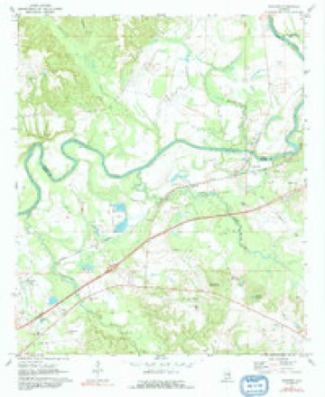
9 topographic sheets cover this place, the earliest surveyed in 1955 and the latest in 1981. It stands in the Shorter-Hardaway census division. It lies in ZIP code area 36075. The Survey maps it on the Shorter quadrangle.
Topographic sheets covering this place
5 surveys from 9 printed sheetsMatched by testing this settlement's coordinate against the published boundary of every sheet in the United States Geological Survey's historical collection. Each opens the scanned sheet at the Survey.
- 1955 USGS Phenix City quadrangle1:250000, 3 printings
- 1957 USGS Phenix City quadrangle1:250000
- 1958 USGS Phenix City quadrangle1:250000
- 1971 USGS Shorter quadrangle1:24000, 2 printings
- 1981 USGS Tuskegee quadrangle1:100000, 2 printings
Fires near this place
115 since 1994Regional context, not property-specific evidence. The federal wildfire occurrence database lists 115 fires within 5 miles of Tysonville between 1994 and 2019, burning about 1,857 acres in total. 2 started naturally. 20 were recorded as arson. Distance is straight-line from the map coordinates, so a fire counted here may appear on a neighbouring settlement's page as well.
| Reported cause | Fires |
|---|---|
| Debris and open burning | 51 |
| Missing data/not specified/undetermined | 21 |
| Arson/incendiarism | 20 |
| Smoking | 9 |
| Recreation and ceremony | 6 |
| Equipment and vehicle use | 3 |
| Railroad operations and maintenance | 3 |
| Natural | 2 |
The most recent of them, most recent first, with the day each was reported and the service that recorded it.
| Date | Cause | Size | Reported by | Name on the report |
|---|---|---|---|---|
| 5 September 2002 | Arson/incendiarism | 10 acres | Alabama Forestry Commission | not named |
| 17 September 2000 | Debris and open burning | 5.0 acres | Alabama Forestry Commission | not named |
| 16 September 1998 | Debris and open burning | 1.0 acres | Alabama Forestry Commission | not named |
| 14 September 2019 | Debris and open burning | 10 acres | Alabama Forestry Commission | 20190914-2 |
| 13 September 2019 | Missing data/not specified/undetermined | 2.5 acres | Alabama Forestry Commission | 20190913-4 |
| 11 September 2019 | Missing data/not specified/undetermined | under an acre | Alabama Forestry Commission | 20190911-6 |
| 27 August 2011 | Natural | 35 acres | Alabama Forestry Commission | 1616 ALEXANDER RD, AL |
| 26 August 1996 | Missing data/not specified/undetermined | 3.0 acres | Alabama Forestry Commission | not named |
Settlements close enough to share some of these fires:
Mines and quarries near this place
10 of 20 shownRegional context, not property-specific evidence. The federal mineral resources record lists 20 workings within 5 miles of Tysonville: 16 producers, 2 occurrences, 1 unknown, 1 past producer. 16 still produce. What was taken out: Sand and Gravel, Construction, Titanium, Metal, Zirconium, Kyanite, REE. Distance is straight-line from the map coordinates, so a quarry counted here may appear on a neighbouring settlement's page as well.
| Where | Site | Commodity | Status | Recorded |
|---|---|---|---|---|
| Shorter Pits | Sand and Gravel, Construction, Titanium, Metal, Zirconium, Kyanite, REE | Producer | Placer | |
| B. & W. Shorter Mine | Sand and Gravel, Construction | Producer | ||
| Calloway Pit | Sand and Gravel, Construction | Unknown | ||
| Chapman Pit | Sand and Gravel, Construction | Producer | Quartz | |
| Milstead Quarry | Sand and Gravel, Construction | Producer | Unconsolidated Sediments | |
| Mitylene Quarry | Sand and Gravel, Construction | Producer | Unconsolidated Sediments | |
| Mount Meigs Pit | Sand and Gravel, Construction | Producer | ||
| Mount Meigs Quarry | Sand and Gravel, Construction | Producer | Quartz | |
| Mount Meigs Quarry | Sand and Gravel, Construction | Producer | Quartz | |
| Mt Meigis | Sand and Gravel, Construction | Producer |
Storms near this place
5 since 2022Regional context, not property-specific evidence. The National Weather Service names Tysonville in 5 storm reports between 2022 and 2025: 3 tornado, 1 flash flood, 1 hail. No death or injury is recorded in these reports. Each account below is quoted exactly as the forecast office filed it, from the NOAA Storm Events Database, and each date opens the federal record of that event.
| When | Event | Place named | Harm | What the report says |
|---|---|---|---|---|
| February 2025 | Tornado (EF1) | Tysonville | - | National Weather Service meteorologists surveyed damage in Macon|County and determined that an EF-1 tornado occurred to the north|of straight line wind damage within a bowing segment. The tornado|began just east of the Macon/Montgomery county line, where a|couple pines were snapped along Barganier Road. It continued|moving eastward, reaching its peak intensity along County Road|2 and Keys Court where numerous hardwoods were snapped and|uprooted a couple hundred yards south of the road. Several homes|and outbuildings suffered roof damage as it paralleled County|Road 20, before the tornado dissipated as it crossed County Road|13. Maximum winds were estimated at 110 mph. |
| December 2024 | Tornado (EF0) | Tysonville | - | A tornado began south of U.S. 80 in a wooded area and moved northeast. Several trees and tree limbs were downed across Jackson Rd. Further northeast, along Old Federal Rd, numerous trees were uprooted behind the Shorter Post Office and Town Hall. Minor roof damage occurred to the post office building. A couple fences and signs were blown down as well. Tree damage continued across U.S. 80, where the Shorter Lodge building sustained minor roof damage and had a tree fall onto a ramp and porch overhang. An adjacent church had minor roof and siding damage as well. Minor tree damage continued into a wooded area east of County Road 40. A tornado debris signature was observed on KMXX (Maxwell Air Force Base) radar. Maximum winds were estimated at 80 mph. |
| March 2023 | Tornado (EF2) | Tysonville | - | National Weather Service meteorologists surveyed damage in northwest Macon County and determined that it was consistent with an EF2 tornado, with maximum winds near 125 mph. The tornado touched down in the area of Tysonville Road, with only sporadic tree limbs and small trees uprooted. Damage became more concentrated along County Road 138, where the attached carport of a house was ripped away and destroyed. Numerous trees, mostly pine, were uprooted along a path of several hundred yards. On County Road 40, the damage became more intense, with dozens of trees uprooted.|The top of a grain silo was blown off, with roofing material scattered southward, before the tornado reached the cotton gin in Milstead. Here, the main structure sustained significant damage, with failure of the roofing system and outer walls of the structure, earning the EF2 rating. Most of the inner walls remained standing, and two large buildings adjacent to the main structure only sustained comparatively minor roof and siding damage. Just east of the structures, significant tree damage was observed around a small lake. Along the road and railroad immediately south of the cotton gin, numerous concrete power poles were pulled down in a northward direction across the railroad tracks, and a pivot irrigation system was flipped in a large field. The tornado continued eastward, where the Auburn University E.V. Smith Research Center sustained damage to several buildings on the property, with one farm shed partially collapsing and roofing material blown northward across the road. Widespread tree damage continued along County Road 9 for around three miles, although most of the trees that were uprooted were pine trees. There was also occasional minor damage to roofing on homes, mostly caused by trees. Damage became much more sporadic as the tornado passed through the Franklin community, with only a few trees uprooted. There was a slight uptick of more concentrated tree damage on the east side of County Road 27 before the tornado dissipated. |
| March 2023 | Hail | Tysonville | - | Ping pong ball size hail reported near Shorter. |
| September 2022 | Flash Flood | Tysonville | - | Bridge flooded and impassable on County Road 13 at Thobolocco Creek. |
Nearest settlements
The eight closest, with where each one stands in the county. Distances are straight-line, computed from the Geographic Names Information System coordinates.
Provenance
This settlement is recorded in the Geographic Names Information System as feature 155282. The sheet list is computed by point-in-boundary test against the United States Geological Survey's historical topographic inventory. Both are works of the United States government and carry no copyright under 17 U.S.C. 105.
Wildfire. Short, Karen C. 2022. Spatial wildfire occurrence data for the United States, 1992-2020 [FPA_FOD_20221014]. 6th Edition. Fort Collins, CO: Forest Service Research Data Archive. https://doi.org/10.2737/RDS-2013-0009.6 Collected with United States Government funding and usable without additional permissions or fees.
Mines and quarries. USGS Mineral Resources Data System (MRDS) https://mrdata.usgs.gov/mrds/ A work of the United States government, no copyright under 17 U.S.C. 105.
Storms. NOAA National Centers for Environmental Information, Storm Events Database https://www.ncei.noaa.gov/stormevents/ A work of the United States government, no copyright under 17 U.S.C. 105. Narratives are quoted verbatim from the National Weather Service report and are not edited or summarised.