 Block
Vinemont, Alabama
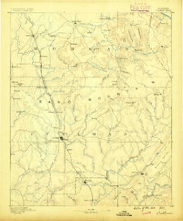
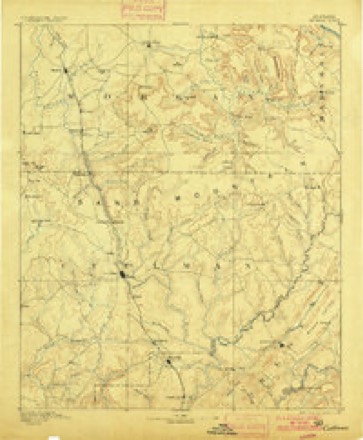
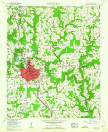
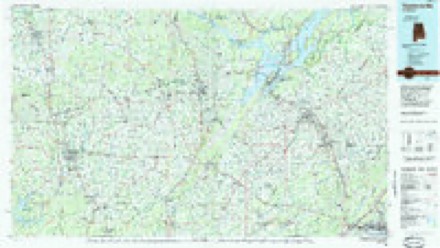
19 topographic sheets cover this place, the earliest surveyed in 1888 and the latest in 1984. It stands in the Vinemont census division. It lies in ZIP code area 35179. It stands on Adams Branch. The Survey maps it on the Cullman quadrangle. It stands 1,007 feet above sea level.
Topographic sheets covering this place
8 surveys from 19 printed sheetsMatched by testing this settlement's coordinate against the published boundary of every sheet in the United States Geological Survey's historical collection. Each opens the scanned sheet at the Survey.
- 1888 USGS Cullman quadrangle1:125000
- 1892 USGS Cullman quadrangle1:125000, 4 printings
- 1956 USGS Gadsden quadrangle1:250000, 3 printings
- 1957 USGS Cullman quadrangle1:24000, 5 printings
- 1958 USGS Gadsden quadrangle1:250000
- 1960 USGS Gadsden quadrangle1:250000, 2 printings
- 1963 USGS Gadsden quadrangle1:250000
- 1984 USGS Guntersville quadrangle1:100000, 2 printings




Fires near this place
78 since 1997Regional context, not property-specific evidence. The federal wildfire occurrence database lists 78 fires within 5 miles of Vinemont between 1997 and 2020, burning about 307 acres in total. None started naturally. 9 were recorded as arson. Distance is straight-line from the map coordinates, so a fire counted here may appear on a neighbouring settlement's page as well.
| Reported cause | Fires |
|---|---|
| Debris and open burning | 40 |
| Missing data/not specified/undetermined | 18 |
| Arson/incendiarism | 9 |
| Equipment and vehicle use | 7 |
| Misuse of fire by a minor | 2 |
| Railroad operations and maintenance | 2 |
The most recent of them, most recent first, with the day each was reported and the service that recorded it.
| Date | Cause | Size | Reported by | Name on the report |
|---|---|---|---|---|
| 7 September 1998 | Debris and open burning | 1.0 acres | Alabama Forestry Commission | not named |
| 6 September 1999 | Debris and open burning | 5.0 acres | Alabama Forestry Commission | not named |
| 6 September 1999 | Debris and open burning | 1.0 acres | Alabama Forestry Commission | not named |
| 4 September 2000 | Debris and open burning | under an acre | Alabama Forestry Commission | not named |
| 24 September 2014 | Missing data/not specified/undetermined | 2.0 acres | Alabama Forestry Commission | NER-20140924-002 |
| 23 September 2010 | Arson/incendiarism | 1.2 acres | Alabama Forestry Commission | not named |
| 22 September 2019 | Debris and open burning | 5.0 acres | Alabama Forestry Commission | 20190922-7 |
| 22 September 2019 | Equipment and vehicle use | 7.0 acres | Alabama Forestry Commission | 20190922-11 |
Settlements close enough to share some of these fires:
Storms near this place
34 since 2000Regional context, not property-specific evidence. The National Weather Service names Vinemont in 34 storm reports between 2000 and 2025: 16 thunderstorm wind, 12 hail, 5 tornado, 1 flood. No death or injury is recorded in these reports. Each account below is quoted exactly as the forecast office filed it, from the NOAA Storm Events Database, and each date opens the federal record of that event.
| When | Event | Place named | Harm | What the report says |
|---|---|---|---|---|
| April 2008 | Tornado (EF0) | Vinemont | $2,000,000 | An EF-0 Tornado with maximum winds of 60 mph, maximum path width of 10 yards, and path length of less than 1/4 of a mile developed briefly near the Vinemont area. This tornado produced tree and power line damage. |
| November 2001 | Tornado (F1) | Vinemont | $75,000 | North of Cullman damage was reported at Terri Pines Country Club and in the town of Vinemont. At Terri Pines several tall trees were damaged, either uprooted or snapped off at mid-trunk. One witness at the golf course reportedly saw a funnel; another witness reported a sudden end to a downpour, the sky turning black, then a sudden return of the downpour with the sky becoming lighter. From the golf course, the storm moved northeast. The tornado appeared to have lifted or weakened as it crossed I-65 with only minimal debris from the trees along the road. The tornado continued northeasterly to Vinemont just west of US 31 and south of CR 1292. The tornado reached F1 strength destroying 2 chicken barns and severely damaging a third, scattering debris at least a mile away. A mobile home downhill from the chicken barns had parts of it's roof torn off, and there were several holes in the side of the mobile home caused by debris projectiles. The final damage along the track was to a frame garage which was shifted off it's slab in a twisting motion causing it to collapse on itself. Witnesses at this location reported hearing a load roaring noise similar to a jet aircraft. At it's widest point, the tornado was approximately 200 yards wide. The total length of the path was about 2.1 miles. Beg: 33 13.049/86 53.578 End: 34 14.568/86 52.260 |
| August 2023 | Thunderstorm Wind | Vinemont | $12,000 | Several trees were reported down in the Vinemont community. |
| September 2012 | Flood | Vinemont | $10,000 | County road 1223 at the Longview Church had a partial road wash out due to flooding, near Vinemont. |
| June 2007 | Thunderstorm Wind | Vinemont | $5,000 | Thunderstorm winds blew down large trees at a residence causing damage to a mobile home. |
| July 2001 | Thunderstorm Wind | Vinemont | $5,000 | Several trees were blown down in the Gold Ridge community. One residence had minor roof damage. |
| April 2025 | Thunderstorm Wind | North Vinemont | $2,000 | Trees were knocked down into the roadway blocking both lanes at 2553 CR 1371. |
| April 2025 | Thunderstorm Wind | North Vinemont | $2,000 | Trees and power lines were knocked down at 435 CR 1391. |
| August 2023 | Thunderstorm Wind | Vinemont | $2,000 | Large trees were uprooted at the intersection of Highway 157 and St. Joseph Drive. Time estimated by radar. |
| June 2009 | Thunderstorm Wind | Vinemont | $2,000 | Thunderstorm winds knocked trees down in Vinemont. |
| August 2002 | Hail | Vinemont | $2,000 | Golf ball size hail was reported near South Vinemont. |
| June 2025 | Thunderstorm Wind | North Vinemont | $1,000 | A pine tree was reported down across the road at 2524 CR1371. |
| July 2024 | Thunderstorm Wind | North Vinemont | $1,000 | A tree was reported down along county road 1386. |
| July 2001 | Thunderstorm Wind | Vinemont | $1,000 | Trees were blown down across US 31 near Vinemont. |
| August 2002 | Thunderstorm Wind | Vinemont | $1,000 | no account filed |
| June 2019 | Thunderstorm Wind | Vinemont | $200 | A tree was knocked down. |
| February 2024 | Hail | Vinemont | - | Hail with a diameter of quarters was reported in Vinemont. Time estimated by radar. |
| April 2021 | Hail | Vinemont | - | Hail up to quarter size was reported via a social media photo in Vinemont. Time estimated by radar. |
| August 2020 | Thunderstorm Wind | North Vinemont | - | Trees were knocked down north of the airport in Vinemont. |
| March 2018 | Tornado (EF0) | North Vinemont | - | A tornado continued from Morgan into Cullman County crossing CR 1375 and CR 1442 and lifted just south of the East Fork of Flint Creek. A few trees and branches were snapped along this path. |
| March 2018 | Tornado (EF0) | North Vinemont | - | A tornado continued from Morgan into Cullman County crossing CR 1375 and CR 1442 and lifted just south of the East Fork of the Flint Creek. A few trees and branches were snapped along this path. |
| May 2017 | Thunderstorm Wind | Vinemont | - | A spotter measured a 78 mph wind gust and reported dime sized hail near Vinemont. Equipment not verified. |
| March 2017 | Hail | Vinemont | - | Hail up to quarter size was reported in south Vinemont. |
| April 2017 | Tornado (EF0) | Vinemont | - | A NWS survey team determined the minor damage across portions of northern Cullman County was attributed to an EF-0 tornado with peak winds of 75 MPH.||A strong, bowing line of storms moved quickly through Cullman County during the afternoon of April 30. Within the bowing segment, rotation was detected on radar which tracked through the north central portions of the county. ||The damage team found several EF-0 damage indicators in the Vinemont area in the form of uprooted softwood trees and large limb damage. General storm motion from the severe line was northeast. Debris was observed either in a convergent pattern or|oriented in sporadic directions.||The tornado continued north of CR 1422 and CR 1518 toward the Cullman-Morgan Co. line, south of Eva. In this area, the most concentrated area of damage was observed near CR 1526. Amongst several trees uprooted, a metal roof was blown off a large garage/barn and pushed into a single family residence. Additionally, minor roof shingle damage was reported further north on CR 1526. The tornado likely dissipated near CR 1527. |
| July 2015 | Thunderstorm Wind | Vinemont | - | Numerous trees were uprooted in and around South Vinemont. |
| June 2011 | Hail | North Vinemont | - | Nickel sized hail was reported. |
| April 2009 | Hail | North Vinemont | - | Golf ball size hail fell at the Cullman Regional Airport. |
| April 2009 | Hail | Vinemont | - | Nickel size hail was reported in Vinemont. |
| July 2004 | Hail | Vinemont | - | Penny size hail reported. |
| July 2004 | Hail | Vinemont | - | Penny size hail was reported. |
| May 2003 | Thunderstorm Wind | Vinemont | - | numerous trees and power lines down. |
| November 2002 | Hail | Vinemont | - | Dime size hail fell near Folsom Field. |
| August 2000 | Hail | Vinemont | - | Nickel size hail was reported in Vinemont. |
| August 2002 | Hail | Vinemont | - | no account filed |
Nearest settlements
The eight closest, with where each one stands in the county. Distances are straight-line, computed from the Geographic Names Information System coordinates.
| Map | Place | Distance | Sheets |
|---|---|---|---|
| South Vinemont | 0.2 miles | 19 | |
| Longview | 1.2 miles | 20 | |
| Southern Pines | 1.9 miles | 17 | |
| Northwood | 1.9 miles | 19 | |
| Pine Hill | 2.2 miles | 17 | |
| Dyers Crossroads | 2.5 miles | 19 | |
| North Vinemont | 2.6 miles | 17 | |
| Terrace Heights | 2.8 miles | 19 |
Elsewhere
Matched on this settlement's Geographic Names Information System number rather than its name, so it cannot be a different place of the same name in another state.
| Wikipedia article on Vinemont | An encyclopaedic summary. Its text is share-alike, so it is linked here rather than copied. |
| Wikidata item Q7932455 | The structured record the population and elevation above come from. Public domain (CC0). |
Provenance
This settlement is recorded in the Geographic Names Information System as feature 128463. The sheet list is computed by point-in-boundary test against the United States Geological Survey's historical topographic inventory. Both are works of the United States government and carry no copyright under 17 U.S.C. 105.
Wildfire. Short, Karen C. 2022. Spatial wildfire occurrence data for the United States, 1992-2020 [FPA_FOD_20221014]. 6th Edition. Fort Collins, CO: Forest Service Research Data Archive. https://doi.org/10.2737/RDS-2013-0009.6 Collected with United States Government funding and usable without additional permissions or fees.
Storms. NOAA National Centers for Environmental Information, Storm Events Database https://www.ncei.noaa.gov/stormevents/ A work of the United States government, no copyright under 17 U.S.C. 105. Narratives are quoted verbatim from the National Weather Service report and are not edited or summarised.