 Block
Waterloo, Alabama
18 topographic sheets cover this place, the earliest surveyed in 1911 and the latest in 1994. It stands in the Waterloo census division. It lies in ZIP code area 35677. It lies near Keaton Hollow. The Survey maps it on the Waterloo quadrangle. 178 people lived here at the 2020 count. It stands 466 feet above sea level.
Population over time
2 figuresWaterloo fell from 203 to 178 between 2010 and 2020. These are the recorded population figures Wikidata holds for this place, reached through the Geographic Names Information System number this page is keyed on rather than by name, so they belong to this place and not to another of the same name. Most are census counts, but not all are: an early figure may be a founding or settlement estimate, and an estimate published within five years of a census is left out. The change column is computed, and is left blank where more than 20 years separate a figure from the one before it, because a gap that long is not a change between two counts.
| Year | People | Change |
|---|---|---|
| 2010 | 203 | |
| 2020 | 178 | -25 (-12%) |
Topographic sheets covering this place
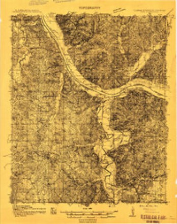
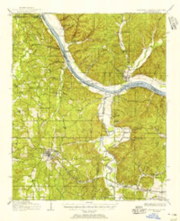
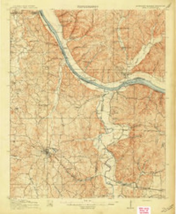
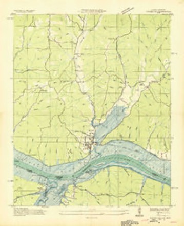
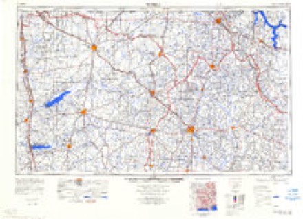
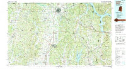
10 surveys from 18 printed sheetsMatched by testing this settlement's coordinate against the published boundary of every sheet in the United States Geological Survey's historical collection. Each opens the scanned sheet at the Survey.
- 1911 USGS Iuka quadrangle1:48000
- 1911 USGS Iuka quadrangle1:62500
- 1914 USGS Iuka quadrangle1:62500, 4 printings
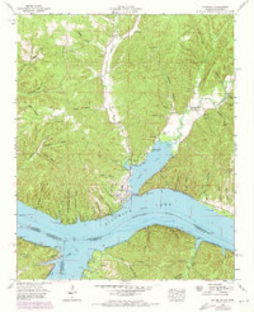
- 1936 USGS Waterloo quadrangle1:24000
- 1953 USGS Waterloo quadrangle1:24000, 3 printings
- 1956 USGS Tupelo quadrangle1:250000, 2 printings
- 1958 USGS Tupelo quadrangle1:250000
- 1984 USGS Corinth quadrangle1:100000
- 1984 USGS Tupelo quadrangle1:250000, 3 printings
- 1994 USGS Corinth quadrangle1:100000
Fires near this place
101 since 1994Regional context, not property-specific evidence. The federal wildfire occurrence database lists 101 fires within 5 miles of Waterloo between 1994 and 2018, burning about 2,725 acres in total. 1 started naturally. 60 were recorded as arson. Distance is straight-line from the map coordinates, so a fire counted here may appear on a neighbouring settlement's page as well.
| Reported cause | Fires |
|---|---|
| Arson/incendiarism | 60 |
| Missing data/not specified/undetermined | 17 |
| Debris and open burning | 15 |
| Smoking | 3 |
| Recreation and ceremony | 2 |
| Other causes | 1 |
| Equipment and vehicle use | 1 |
| Misuse of fire by a minor | 1 |
| Natural | 1 |
The most recent of them, most recent first, with the day each was reported and the service that recorded it.
| Date | Cause | Size | Reported by | Name on the report |
|---|---|---|---|---|
| 8 September 2006 | Arson/incendiarism | under an acre | Alabama Forestry Commission | not named |
| 8 September 1999 | Arson/incendiarism | 2.0 acres | Alabama Forestry Commission | not named |
| 7 September 2007 | Arson/incendiarism | 1.5 acres | Alabama Forestry Commission | not named |
| 7 September 1999 | Missing data/not specified/undetermined | 300 acres | Alabama Forestry Commission | not named |
| 3 September 2018 | Arson/incendiarism | 1.5 acres | Alabama Forestry Commission | 20180903-5 |
| 3 September 2007 | Arson/incendiarism | 2.7 acres | Alabama Forestry Commission | not named |
| 23 September 2010 | Arson/incendiarism | 40 acres | Alabama Forestry Commission | not named |
| 2 September 1998 | Arson/incendiarism | 3.0 acres | Alabama Forestry Commission | not named |
Settlements close enough to share some of these fires:
Mines and quarries near this place
7 within 5 milesRegional context, not property-specific evidence. The federal mineral resources record lists 7 workings within 5 miles of Waterloo: 4 prospects, 2 past producers, 1 occurrence. None of them still produces. What was taken out: Aluminum, Kaolin, Silica. Distance is straight-line from the map coordinates, so a quarry counted here may appear on a neighbouring settlement's page as well.
| Where | Site | Commodity | Status | Recorded |
|---|---|---|---|---|
| Bumpass Creek Tripoli | Silica | Occurrence | 1962 | |
| Tripoli | Silica | Past Producer | Sedimentary | |
| H Prospect | Aluminum, Kaolin | Prospect | ||
| K Prospect | Aluminum, Kaolin | Prospect | ||
| Tva Pit | Aluminum, Kaolin | Past Producer | ||
| I Prospect | Aluminum | Prospect | ||
| L Prospect | Aluminum | Prospect |
Storms near this place
60 of 74 shownRegional context, not property-specific evidence. The National Weather Service names Waterloo in 74 storm reports between 1994 and 2025: 48 thunderstorm wind, 14 hail, 5 flash flood, 3 tornado. The reports record 1 death and 2 injuries. Each account below is quoted exactly as the forecast office filed it, from the NOAA Storm Events Database, and each date opens the federal record of that event.
| When | Event | Place named | Harm | What the report says |
|---|---|---|---|---|
| March 2015 | Flash Flood | Waterloo | 1 killed | A local Lauderdale county man drowned after he was stuck in his truck while attempting to cross high waters along Panther Creek near County Road 105 in Waterloo, Alabama. |
| December 2015 | Tornado (EF2) | Waterloo | 1 hurt | A tornado touched down initially near the intersection of Country Road 14 and County Road 54 north of Waterloo, in extreme western Lauderdale County. Multiple trees were snapped and uprooted along the nearby creek and along CR 54.||The next available damage was viewed along CR 1 south of CR 40. Many softwood and hardwood trees were snapped and uprooted along the hillside into the neighboring valley. The tornado damaged a single family home, removing large portions of the roofing marterial, and damaged the Williams Chapel Presbyterian Church where nearby residents were taking shelter. The tornado crossed CR 1, leaving almost no tree untouched in a large stand of pine trees.||The tornado continued over the hill to CR 40 where the most significant damage was observed. The tornado snapped numerous hardwood trees south of CR 40, caused minor damage to a single family residence, and pushed a mobile home off its foundation. Upon crossing CR 40, the tornado tore almost the entire roofing structure off a single family home, injuring one inhabitant, and tossing the debris into the trees behind it. The tornado continued over a small hill into a hollow, snapping and uprooting numerous trees along its path. The tornado continued into Wayne County Tennessee, approximately 1/2 mile north of CR 40. |
| July 2001 | Lightning | Waterloo | 1 hurt | A man was struck by lightning near Waterloo. This man was taken to the hospital with injuries but the extent of those injuries was unknown. |
| April 2011 | Thunderstorm Wind | Waterloo | $100,000 | A narrow swath of damaging thunderstorm winds began in Waterloo, pushed through Oakland, Underwood-Petersville, then subsided after hitting Saint Florian. The path of damage was not continuous. However, the winds knocked numerous trees down, including two on homes. One was at the 25000 block of County Road 14 in Oakland. Another was along Rasch Road in Underwood-Petersville where a resident escaped harm. The tree destroyed several rooms in the home. Dozens of nearby trees were uprooted. Some of the trees were large pines and oaks. Minor structural damage was also reported to an industrial plant in Underwood-Petersville. |
| June 2011 | Thunderstorm Wind | Waterloo | $50,000 | Several trees were blown down across the county. Some areas impacted include Rasch road, Huntsville road, Patsy drive, Goose Shoals bridge, Ramblewood drive, CR 68, Second Creek bridge, and CR 70 near Anderson Creek bridge. |
| April 1996 | Thunderstorm Wind | Waterloo | $50,000 | no account filed |
| June 2014 | Thunderstorm Wind | Waterloo | $40,000 | Several trees were downed by thunderstorm winds from just east of Waterloo, Alabama to Tombigbee street in Florence, Alabama. A county school bus barn was also extensively damaged in Florence, Alabama due to the thunderstorm winds. |
| January 1999 | Hail | Waterloo | $25,000 | Golfball size hail was reported near Waterloo. |
| December 2013 | Thunderstorm Wind | Waterloo | $10,000 | Several trees were downed by thunderstorm winds along County Road 14. |
| June 2012 | Thunderstorm Wind | Waterloo | $10,000 | A tree was blown down onto a house on Riverton Rose Trail. |
| May 2008 | Thunderstorm Wind | Waterloo | $5,000 | Thunderstorm winds knocked down trees and powerlines in Macedonia resulting in power outages. |
| July 1995 | Thunderstorm Wind | Waterloo | $4,000 | Large trees were down across County Road 10, five miles east of Waterloo in the extreme western part of the county. |
| May 2022 | Thunderstorm Wind | Waterloo | $3,000 | A tree was reported down near Waterloo boat ramp on county road 14 east of Main Street. A tree was also blown down on power lines in the same general area. |
| July 2009 | Thunderstorm Wind | Waterloo | $3,000 | A tree was blown down on CR 90. |
| January 2008 | Thunderstorm Wind | Waterloo | $3,000 | Thunderstorm winds knocked down trees in the downtown area of Waterloo at the intersection of county roads 45 and 14. |
| January 2008 | Thunderstorm Wind | Waterloo | $3,000 | A severe thunderstorm knocked down a few trees down along county road 14. |
| May 2023 | Thunderstorm Wind | Waterloo | $2,000 | Trees were blown down at Waterloo High School. |
| December 2017 | Thunderstorm Wind | Waterloo | $2,000 | A few trees were knocked down on CR 14 east of Waterloo. Time estimated by radar. |
| June 2016 | Thunderstorm Wind | Waterloo | $2,000 | A few trees and powerlines were knocked down near 2390 CR 14 north of Waterloo. Time estimated by radar. |
| April 2010 | Thunderstorm Wind | Waterloo | $2,000 | Trees were knocked down on County Road 1. |
| November 2001 | Thunderstorm Wind | Waterloo | $2,000 | A few trees were blown down in and around the city of Waterloo. One large tree fell and temporarily blocked a road. Power was reported out for a few hours. |
| August 2025 | Thunderstorm Wind | Waterloo | $1,000 | A tree was knocked down blocking both lanes of the roadway at the intersection of CR 54 and CR 14. Time estimated by radar. |
| August 2023 | Thunderstorm Wind | Waterloo | $1,000 | A tree was reported down at the intersection of CR 1 and CR 14. Time was estimated from radar. |
| August 2023 | Thunderstorm Wind | Waterloo | $1,000 | A tree was reported down a this location on CR 1. Time was estimated from radar. |
| June 2016 | Thunderstorm Wind | Waterloo | $1,000 | Two trees were knocked down along CR 14 in Waterloo. |
| July 2011 | Thunderstorm Wind | Waterloo | $1,000 | Two trees were knocked down. |
| May 2010 | Flash Flood | Waterloo | $1,000 | Portions of County Road 14 were reported impassable due to flooding, particularly near Threets park. |
| June 2009 | Thunderstorm Wind | Waterloo | $1,000 | Thunderstorm winds knocked a large tree onto Fire Station #1 in Waterloo. Time estimated by radar. |
| October 2001 | Thunderstorm Wind | Waterloo | $1,000 | Several trees were blown down in Waterloo. |
| August 2023 | Thunderstorm Wind | Waterloo | $500 | A tree was knocked down on CR 14 at the rock wall. Time estimated by radar. |
| June 2021 | Thunderstorm Wind | Waterloo | $500 | A large tree was knocked down by thunderstorm winds covering both lanes of Dear Lane in Waterloo. Time estimated by radar. |
| December 2021 | Thunderstorm Wind | Waterloo | $500 | A tree was knocked down near CR 14 and CR 90. Time estimated by radar. |
| January 2020 | Thunderstorm Wind | Waterloo | $500 | A tree was knocked down along CR 45 with live wires across the road. |
| June 2021 | Thunderstorm Wind | Waterloo | $200 | A tree was knocked down on CR 1 south of Second Creek Recreation Area. Time estimated by radar. |
| May 2021 | Thunderstorm Wind | Waterloo | $200 | A tree was knocked down in the roadway on CR 14 in Waterloo. |
| May 2021 | Thunderstorm Wind | Waterloo | $200 | A tree was knocked down in the roadway at CR 5 and CR 14 in Waterloo. |
| May 2021 | Thunderstorm Wind | Waterloo | $200 | A tree was knocked down at 2855 CR 1. |
| February 2020 | Thunderstorm Wind | Waterloo | $200 | A tree was knocked down on CR 1 at Second Creek Recreation Campgrounds. |
| May 2020 | Thunderstorm Wind | Waterloo | $200 | A tree was knocked down into the road at 805 CR 40 in Waterloo. |
| November 2018 | Thunderstorm Wind | Waterloo | $200 | A tree was knocked down on CR 14 near CR 1. |
| May 2017 | Thunderstorm Wind | Waterloo | $200 | Power lines were knocked down and debris in the road along CR 14 in front of the Rock Wall. |
| April 2025 | Tornado (EF1) | Waterloo | - | A tornado crossed over from Tishomingo County across the Tennessee River into Lauderdale County where it intensified into an EF-1. Drone imagery courtesy of Lauderdale County EMA showed large swaths of tree damage through far northwestern Lauderdale County, typically not accessible through traditional road networks. The damage continued along portions of County Road 3, at which point it was at its widest. As the tornado tracked toward the Tennessee state line, it was still uprooting and snapping several large trees before entering Hardin County in Tennessee. |
| April 2020 | Hail | Waterloo | - | Golf ball sized hail was reported. |
| June 2019 | Thunderstorm Wind | Waterloo | - | Multiple trees were knocked down in Waterloo. |
| April 2018 | Thunderstorm Wind | Waterloo | - | Trees and utility lines were knocked down near Waterloo. |
| June 2018 | Thunderstorm Wind | Waterloo | - | Multiple trees and power lines were knocked down at the 1500 block of CR 14. |
| June 2015 | Thunderstorm Wind | Waterloo | - | A few power lines and a tree were downed by thunderstorm winds along Lauderdale County Road 14. |
| June 2015 | Thunderstorm Wind | Waterloo | - | A few power lines were downed by thunderstorm winds in front of Waterloo, Alabama fire station number one. |
| March 2015 | Hail | Waterloo | - | Golf ball sized hail was reported on main street in Waterloo, Alabama. |
| March 2015 | Hail | Waterloo | - | Nickel sized hail was reported. |
| March 2015 | Hail | Waterloo | - | Golf ball sized hail was reported. Relayed through social media via Broadcast media. |
| March 2015 | Hail | Waterloo | - | Quarter sized hail was reported on the northwest side of Waterloo. |
| March 2015 | Hail | Waterloo | - | Nickel sized hail was reported on Main street in Waterloo. |
| December 2013 | Thunderstorm Wind | Waterloo | - | CWOP Station DW9506 reported a wind gust at 63 mph. |
| April 2011 | Tornado (EF1) | Waterloo | - | A tornado of EF-1 intensity produced peak wind speeds up to 110 mph. The tornado touched down along County Road 90, 1 mile north-northeast of Waterloo. Here, numerous trees were snapped on the hillside along County Roads 90 and 78. Two docks along Second Creek sustained damage.||Just southeast of the intersection of County Roads 90 and 21, 3 residences sustained minor damage. The first home had its windows blown out on the upper floor. The second sustained shingle damage and had the rear wall of a garage blown out. The third had a portion of a garage picked up and thrown over the house about 75 yards. A brick was thrown through the back window of the residence. Numerous trees were snapped immediately to the southeast of this home.||The tornado continued along County Road 90. Near the intersection of Lester Hollow Road, several large/wide trees were snapped off from 8 to 15 feet off the base. To the east along Lester Hollow Road, trees were knocked onto 3 homes. The tornado produced significant tree damage as it progressed northeastward. At the intersection of State Highway 20 and County Road 40, a building had 3 awnings blown off, with one being deposited across Highway 20. The tornado then tracked into a wooded area and moved into Tennessee. |
| May 2010 | Flash Flood | Waterloo | - | Portions of CR 90 in Waterloo were reported impassable due to flooding. |
| May 2010 | Hail | Waterloo | - | Quarter sized hail was reported. |
| May 2009 | Flood | Waterloo | - | Heavy rainfall from strong to severe thunderstorms caused closed numerous roads across the county. Water was even reported covering a portion of US Hwy 72 in the Rogersville community. |
| September 2009 | Flash Flood | Waterloo | - | Roads were reported flooded in the Waterloo community. |
| June 2008 | Hail | Waterloo | - | A severe thunderstorm produced nickel size hail near Waterloo. |
Nearest settlements
The eight closest, with where each one stands in the county. Distances are straight-line, computed from the Geographic Names Information System coordinates.
| Map | Place | Distance | Sheets |
|---|---|---|---|
| Mathews (historical) | 1.8 miles | 18 | |
| Mount Olive (historical) | 2.0 miles | 18 | |
| Wright | 4.0 miles | 18 | |
| Shaw (historical) | 6.8 miles | 21 | |
| Haddock (historical) | 6.9 miles | 21 | |
| Gravelly Springs | 8.6 miles | 18 | |
| Dart | 9.1 miles | 18 | |
| Murphy Cross Roads | 9.8 miles | 18 |
Elsewhere
Matched on this settlement's Geographic Names Information System number rather than its name, so it cannot be a different place of the same name in another state.
| Wikipedia article on Waterloo | An encyclopaedic summary. Its text is share-alike, so it is linked here rather than copied. |
| Wikidata item Q68241 | The structured record the population and elevation above come from. Public domain (CC0). |
Provenance
This settlement is recorded in the Geographic Names Information System as feature 128626. The sheet list is computed by point-in-boundary test against the United States Geological Survey's historical topographic inventory. Both are works of the United States government and carry no copyright under 17 U.S.C. 105.
Wildfire. Short, Karen C. 2022. Spatial wildfire occurrence data for the United States, 1992-2020 [FPA_FOD_20221014]. 6th Edition. Fort Collins, CO: Forest Service Research Data Archive. https://doi.org/10.2737/RDS-2013-0009.6 Collected with United States Government funding and usable without additional permissions or fees.
Mines and quarries. USGS Mineral Resources Data System (MRDS) https://mrdata.usgs.gov/mrds/ A work of the United States government, no copyright under 17 U.S.C. 105.
Storms. NOAA National Centers for Environmental Information, Storm Events Database https://www.ncei.noaa.gov/stormevents/ A work of the United States government, no copyright under 17 U.S.C. 105. Narratives are quoted verbatim from the National Weather Service report and are not edited or summarised.