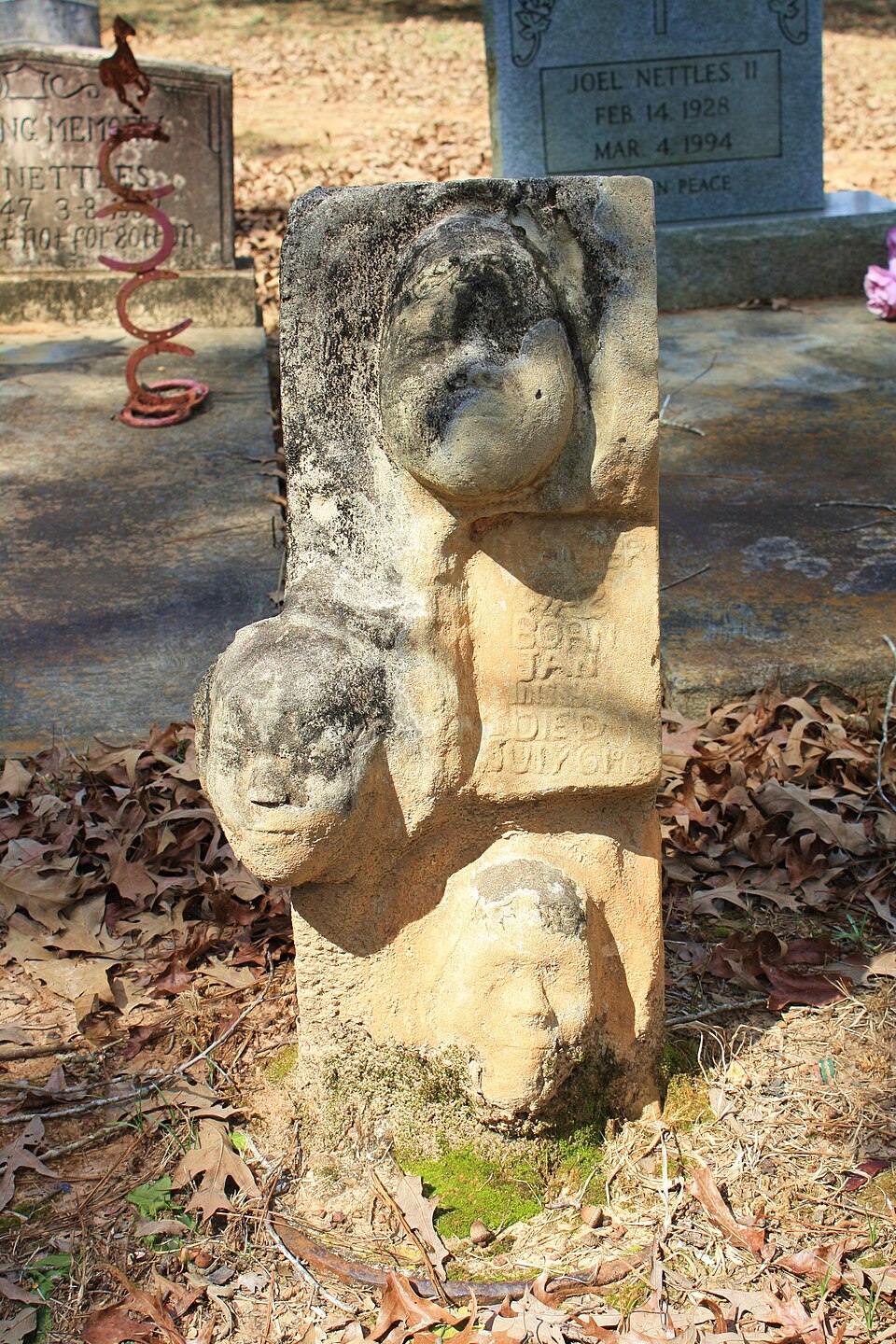
Listed on the National Register of Historic Places in 2000.
From the record
“The Isaac Nettles Gravestones are four unusual headstones in the Mount Nebo Baptist Church Cemetery near Carlton in rural Clarke County, Alabama, United States. Surveyed for the National Register of Historic Places' Clarke County Multiple Property Submission, they were added to the register on February 24, 2000.”
Wikipedia article Isaac Nettles Gravestones, CC BY-SA 4.0.
One of 21 National Register listings published here for Clarke County · listed in 2000 · category: Object.
National Register reference number.00000141- the number the National Park Service assigned this property when it was listed, and the key its nomination file is catalogued under at the National Archives.
Fires near this property
26 since 1995
Regional context, not property-specific
evidence. The
federal wildfire occurrence database
lists 26 fires within 5 miles of Isaac Nettles Gravestones
between 1995 and 2020, burning about 410 acres in total. 4 started naturally. 2 were recorded as arson.
Distance is straight-line from the map coordinates, so a fire counted
here may appear on a neighbouring settlement's page as well.
Reported cause
Fires
Debris and open burning
11
Missing data/not specified/undetermined
8
Natural
4
Arson/incendiarism
2
Misuse of fire by a minor
1
The most recent of
them, most recent first, with the day each was reported and the service
that recorded it.
Regional context, not property-specific
evidence. The federal mineral resources record lists
1 working within 5 miles of Isaac Nettles Gravestones: 1 occurrence.
None of them still produces. What was taken out: Bromine. Distance is straight-line from the
map coordinates, so a quarry counted here may appear on a neighbouring
settlement's page as well.
Regional context, not property-specific
evidence. The National Weather Service names
Carlton, the town this property stands in, in 9 storm reports between 1998 and 2025: 4 hail, 3 thunderstorm wind, 2 tornado.
No death or injury is recorded in these reports. Each account below is quoted exactly as the forecast office
filed it, from the NOAA Storm Events Database, and each date
opens the federal record of that event.
Aerial survey by Alabama Forestry Commission indicated a 300 to 600 yard wide path of trees snapped or blown over on the Fred T. Stimpson State Game Preserve. Several power poles and lines were snapped, and a storage shed was destroyed. The timber losses of large longleaf pine and slash pine were estimated to be close to 3 million dollars.
An EF0 tornado began near Choctaw bluff tracking northeast tracking along the Alabama River. Sentinel and Planet satellite imagery revealed a narrow discontinuous path of tree damage, likely in the form of tree top snaps and/or uproots. This path tracks into the one building that sustained damage east of Walker Springs Road where some of the metal roofing material was removed towards the northwest. The tornado becomes untraceable after this point from satellite imagery, and will serve as the end point.||Utilized imagery and derived products made available through the NASA Commercial Satellite Data Acquisition (CSDA) Program, NASA Marshall Space Flight Center, and the NASA Disasters Program.||Update May 15th, 2025: After further review of high-resolution satellite imagery that became available, it was determined this tornado began earlier to the south of Carlton where it was at its strongest point wiping out a large portion of forest west of Oil Well Road. Concentrated, weaker damage was evident all the way back to Belgreen Road which will serve as the starting point for this tornado. The intensity has been bumped to EF1 to match other corroborated ground and satellite survey tornadoes within the region. The tornadoes width was also increased to 240 yards which occurred back where it reached its peak intensity.
No historic map-sheet match is published
for this property yet. That does not mean no map exists. This record needs
a coordinate-quality review before it can be joined to a sheet boundary.
Browse the county's mapped places while that work is
pending.
Listing record. National Park Service National Register of Historic Places, listed-properties dataset, current to 2026-05-22.
Map join. Address geocoded through the United States Census geocoder, then tested against the published boundary of every sheet in the USGS Historical Topographic Map Collection.
How this page is made. Listing fields come from federal records; map-sheet coverage is a labelled coordinate-to-boundary calculation, not a source-field claim.
Wildfire. Short, Karen C. 2022. Spatial wildfire occurrence data for the United States, 1992-2020 [FPA_FOD_20221014]. 6th Edition. Fort Collins, CO: Forest Service Research Data Archive. https://doi.org/10.2737/RDS-2013-0009.6 Collected with United States Government funding and usable without additional permissions or fees.
Mines and quarries. USGS Mineral Resources Data System (MRDS) https://mrdata.usgs.gov/mrds/ A work of the United States government, no copyright under 17 U.S.C. 105.
Storms. NOAA National Centers for Environmental Information, Storm Events Database https://www.ncei.noaa.gov/stormevents/ A work of the United States government, no copyright under 17 U.S.C. 105. Narratives are quoted verbatim from the National Weather Service report and are not edited or summarised.
 Block