 Block
From the record
One of 26 National Register listings published here for Lee County · listed in 2001 · category: District.
Sources: the case file at the National Archives · the National Register database, National Park Service
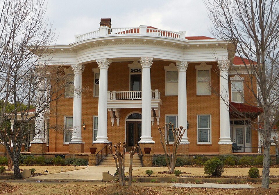
Listed on the National Register of Historic Places in 2001.
One of 26 National Register listings published here for Lee County · listed in 2001 · category: District.
Sources: the case file at the National Archives · the National Register database, National Park Service
Regional context, not property-specific evidence. The federal wildfire occurrence database lists 16 fires within 5 miles of Northside Historic District between 1994 and 2013, burning about 381 acres in total. None started naturally. 2 were recorded as arson. Distance is straight-line from the map coordinates, so a fire counted here may appear on a neighbouring settlement's page as well.
| Reported cause | Fires |
|---|---|
| Debris and open burning | 4 |
| Equipment and vehicle use | 3 |
| Recreation and ceremony | 3 |
| Arson/incendiarism | 2 |
| Misuse of fire by a minor | 2 |
| Missing data/not specified/undetermined | 2 |
The most recent of them, most recent first, with the day each was reported and the service that recorded it.
| Date | Cause | Size | Reported by | Name on the report |
|---|---|---|---|---|
| 7 September 2010 | Equipment and vehicle use | 35 acres | Alabama Forestry Commission | not named |
| 10 September 2011 | Debris and open burning | 2.0 acres | Alabama Forestry Commission | 3590 CR 38, AL |
| 9 August 2000 | Arson/incendiarism | under an acre | Alabama Forestry Commission | not named |
| 9 August 2000 | Arson/incendiarism | 2.0 acres | Alabama Forestry Commission | not named |
| 31 August 1998 | Debris and open burning | 1.0 acres | Alabama Forestry Commission | not named |
| 12 August 1995 | Recreation and ceremony | 3.0 acres | Alabama Forestry Commission | not named |
| 2 June 2011 | Missing data/not specified/undetermined | 125 acres | Alabama Forestry Commission | HWY 15 OFF N.29, AL |
| 15 June 1995 | Misuse of fire by a minor | 25 acres | Alabama Forestry Commission | not named |
Regional context, not property-specific evidence. The federal mineral resources record lists 4 workings within 5 miles of Northside Historic District: 2 occurrences, 1 prospect, 1 unknown. None of them still produces. What was taken out: Mica, Aluminum, Feldspar, Mica, Iron. Distance is straight-line from the map coordinates, so a quarry counted here may appear on a neighbouring settlement's page as well.
| Where | Site | Commodity | Status | Recorded |
|---|---|---|---|---|
| Hilyer-Knight Prospect | Iron | Occurrence | ||
| North Opelika Gibbsite Prospect | Aluminum | Occurrence | 1977 | |
| T H Clower Prospect | Feldspar, Mica | Unknown | ||
| Yarborough-Smith-Neighbor Prospect | Mica | Prospect |
Regional context, not property-specific evidence. The National Weather Service names Opelika, the town this property stands in, in 60 storm reports between 1994 and 2025: 28 hail, 23 thunderstorm wind, 5 tornado, 3 lightning. The reports record 1 death. Each account below is quoted exactly as the forecast office filed it, from the NOAA Storm Events Database, and each date opens the federal record of that event.
| When | Event | Place named | Harm | What the report says |
|---|---|---|---|---|
| March 1996 | Thunderstorm Wind | Opelika | 1 killed, $50,000 | no account filed |
| March 1996 | Thunderstorm Wind | Opelika | $80,000 | no account filed |
| July 2002 | Lightning | Opelika | $75,000 | A lightning strike caused significant damage to an Opelika Power Substation. The lightning set a fire in the substation in which flames reached heights of over 50 feet. Six hundred gallons of mineral oil subsequently leaked out of the substation. |
| August 1994 | Tornado (F0) | Opelika | $50,000 | Thunderstorm wind and what appears to have been a small tornado caused structural damage and downed trees along Highway 51 in the Beauregard area about 8.5 miles south of Opelika. Several houses sustained some damage along with numerous uprooted trees. A car was damaged by flying tin from an out-building that was destroyed. |
| January 2003 | Thunderstorm Wind | Opelika | $35,000 | Numerous trees and power lines were blown down near Opelika and Auburn. A few automobiles were damaged by falling trees. |
| July 2005 | Tornado (F0) | Opelika | $34,000 | National Weather Service meteorologists surveyed the damage just east of Opelika and determined the damage was the result of a tornado. The tornado touched down at approximately 340 PM CDT 8.5 miles east of Opelika, along County Road 158 just east of Lee Road 269. At least two mobile homes sustained minor damage, dozens of trees and power lines were snapped off or blown down, and a spare tire was removed from a vehicle and thrown several yards away. The tornado damage path was 1.2 miles long and 200 yards wide at its widest point. This tornado was spawned during Tropical Storm Cindy.Begin: 32 39.81/85 14.07 End: 32 40.79/85 14.49 |
| November 2004 | Tornado (F0) | Opelika | $28,000 | no account filed |
| January 1996 | Thunderstorm Wind | Opelika | $15,000 | no account filed |
| July 1997 | Tornado (F0) | Opelika | $12,000 | What was believed to be a weak tornado touched down briefly near the intersection of US 280 and Interstate 85 moving northerly for about 3- tenths of a mile. Damage was minimal. A fence was blown down at a motel, a couple of cars had windows broken out, and air conditioning units on a retail complex were moved. |
| May 2003 | Thunderstorm Wind | Opelika | $8,000 | Trees were blown down just off of CR 112 in Beauregard. |
| November 1997 | Hail | Opelika | $8,000 | Golf ball size hail was reported just south of Opelika. |
| October 2004 | Thunderstorm Wind | Opelika | $8,000 | no account filed |
| September 1996 | Thunderstorm Wind | Opelika | $8,000 | no account filed |
| December 2002 | Lightning | Opelika | $7,000 | Lightning struck a communications tower owned by Lee County damaging public service radios operated by the county and the State of Alabama, computers, and telephone equipment. The tower is the site of the only EMWIN re-broadcast station in Alabama, and it was taken off the air by the lightning strike. |
| March 2006 | Thunderstorm Wind | Opelika | $5,000 | Trees were downed in several locations around the city. |
| June 2011 | Thunderstorm Wind | Opelika | $3,000 | Trees were blown down across numerous locations around the city of Opelika. |
| May 2002 | Lightning | Opelika | $3,000 | A lightning strike caused minor damage to a home in Opelika. |
| July 1997 | Hail | Opelika | $3,000 | Dime size hail was reported in Beauregard, south of Opelika. |
| June 2009 | Thunderstorm Wind | Opelika | $2,000 | Several power lines were blown down in the city of Opelika. |
| June 2009 | Thunderstorm Wind | Opelika | $2,000 | Trees were blown down onto power lines in the city of Opelika. |
| May 2006 | Thunderstorm Wind | Opelika | $2,000 | Trees were blown down on Lee Road. |
| January 2001 | Thunderstorm Wind | Opelika | $2,000 | Trees were blown down in the Beauregard area. |
| July 1995 | Thunderstorm Wind | Opelika | $2,000 | Several trees were reported down in southern sections of Opelika. |
| October 2004 | Hail | Opelika | $2,000 | no account filed |
| February 2025 | Thunderstorm Wind | Opelika | - | Numerous trees were downed in the Auburn and Opelika areas of Lee County. |
| April 2025 | Thunderstorm Wind | Opelika | - | Trees were downed in Opelika, including on Highway 80, Highway 51, and Lee Road 40. |
| January 2023 | Thunderstorm Wind | Opelika | - | Several uprooted trees and downed power lines in Opelika. |
| August 2023 | Thunderstorm Wind | Opelika | - | Multiple trees uprooted in the area of Uniroyal Road and Ridge Road, causing power outages. |
| August 2023 | Thunderstorm Wind | Opelika | - | A second round of storms resulted in more trees being knocked down in Opelika. |
| July 2018 | Tornado (EF0) | Opelika | - | National Weather Service meteorologists surveyed damage in central Lee County and determined that it was consistent with an EF0 tornado, with maximum sustained winds near 85 mph. The tornado touched down in the city of Opelika near the intersection of South 3rd Street and Avenue D. The tornado tracked south and snapped or uprooted many trees before crossing Interstate 85. It then shifted towards the southeast as it crossed Chewacla Road, where it continued to snap or uproot trees. The tornado shifted back to a southerly track and crossed Highway 69 and Royal Drive. It then took a southwest track before lifting near Stringfellow Road. |
| December 2015 | Thunderstorm Wind | Opelika | - | Several trees uprooted and some windows were blown out just east of the town of Opelika. |
| July 2013 | Thunderstorm Wind | Opelika | - | Trees were uprooted in several locations in and around Opelika. |
| May 2009 | Thunderstorm Wind | Opelika | - | The East Alabama Medical Center recorded a peak wind gust of 61 mph. |
| March 2006 | Hail | Opelika | - | Quarter sized hail was reported in the northern part of the city. |
| April 2006 | Hail | Opelika | - | Reported near Fox Run. |
| May 2006 | Hail | Opelika | - | Quarter sized hail fell for several minutes in and around Opelika. |
| May 2006 | Hail | Opelika | - | Reported on the northern side of Opelika. |
| October 2006 | Funnel Cloud | Opelika | - | A funnel cloud was reported just north of Opelika. |
| March 2003 | Hail | Opelika | - | Pea to penny size hail fell across the Opelika area. |
| August 2002 | Hail | Opelika | - | Pea to dime size hail was reported in and around the city of Opelika. |
| February 2000 | Hail | Opelika | - | Dime size hail was reported in Beauregard. |
| February 2000 | Hail | Opelika | - | Nickel size hail was reported near the intersection of CR 166 and CR 146 near Parker Crossroads. |
| February 2000 | Hail | Opelika | - | Quarter size hail fell in Opelika. |
| March 2000 | Hail | Opelika | - | Dime size hail was reported in Opelika. |
| February 1999 | Hail | Opelika | - | Dime sized hail was reported near Opelika. |
| May 1999 | Hail | Opelika | - | Nickel to quarter size hail was reported in Beauregard. |
| June 1999 | Hail | Opelika | - | Dime size hail was reported in Opelika and also in the Plainview area. |
| June 1999 | Hail | Opelika | - | Quarter size hail fell just south of Opelika. |
| April 1998 | Hail | Opelika | - | Dime size hail was reported in Opelika. |
| May 1998 | Hail | Opelika | - | Dime size hail was reported in Opelika. |
| October 1998 | Hail | Opelika | - | Dime to nickel sized hail was reported north of Phenix City in extreme southeast Lee county. |
| March 1995 | Hail | Opelika | - | Three-quarter inch hail was reported at Opelika. |
| May 1995 | Thunderstorm Wind | Opelika | - | A wind gust to 57 miles an hour was reported at the East Alabama Medical Center on their measuring equipment in Opelika. Trees were downed in scattered areas across the county. One tree fell and blocked a road for a short time on the Auburn University campus. |
| April 2017 | Hail | Opelika | - | no account filed |
| May 2012 | Hail | Opelika | - | no account filed |
| May 2012 | Hail | Opelika | - | no account filed |
| April 2008 | Hail | Opelika | - | no account filed |
| June 2007 | Hail | Opelika | - | no account filed |
| April 1998 | Hail | Opelika | - | no account filed |
| June 1998 | Hail | Opelika | - | no account filed |
1 paper published in this town, digitised by the Library of Congress and free to read. Every page is searchable, so a name or a street can be looked for directly in what the town printed about itself at the time.
| Newspaper | Published |
|---|---|
| Der Querschnitt | 1945 to 194? |
No historic map-sheet match is published for this property yet. That does not mean no map exists. This record needs a coordinate-quality review before it can be joined to a sheet boundary. Browse the county's mapped places while that work is pending.
Other National Register properties close enough to walk or drive between, ordered by distance from this one. Both positions come from the same geocoding pass that matched these properties to their map sheets.
| Photograph | Property | Distance | Listed |
|---|---|---|---|
 | Railroad Avenue Historic District | 0.3 miles | 1984 |
 | U.S. Post Office | 0.4 miles | 1976 |
 | Lee County Courthouse | 0.4 miles | 1973 |
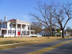 | Geneva Street Historic District | 0.7 miles | 1987 |
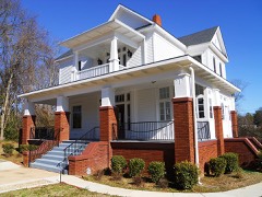 | Dr. J.W. Darden House | 0.9 miles | 2009 |
 | Pepperell Mill and Mill Village Historic District | 2.3 miles | 2014 |
| National Archives record | The nomination case file for reference 01001409 in Record Group 79. |
| Lee County | All 26 listed properties in this county. |