 Block
From the record
One of 13 National Register listings published here for Elmore County · listed in 2008 · category: Building.
Sources: the case file at the National Archives · the National Register database, National Park Service
Listed on the National Register of Historic Places in 2008.
One of 13 National Register listings published here for Elmore County · listed in 2008 · category: Building.
Sources: the case file at the National Archives · the National Register database, National Park Service
Regional context, not property-specific evidence. The federal wildfire occurrence database lists 122 fires within 5 miles of Abel Hagerty House between 1994 and 2019, burning about 554 acres in total. 5 started naturally. 15 were recorded as arson. Distance is straight-line from the map coordinates, so a fire counted here may appear on a neighbouring settlement's page as well.
| Reported cause | Fires |
|---|---|
| Debris and open burning | 49 |
| Arson/incendiarism | 15 |
| Missing data/not specified/undetermined | 15 |
| Equipment and vehicle use | 15 |
| Recreation and ceremony | 13 |
| Natural | 5 |
| Misuse of fire by a minor | 3 |
| Smoking | 3 |
| Railroad operations and maintenance | 3 |
| Fireworks | 1 |
The most recent of them, most recent first, with the day each was reported and the service that recorded it.
| Date | Cause | Size | Reported by | Name on the report |
|---|---|---|---|---|
| 23 September 2010 | Debris and open burning | 4.6 acres | Alabama Forestry Commission | not named |
| 19 September 2011 | Equipment and vehicle use | 1.5 acres | Alabama Forestry Commission | 834 CO RD 4, AL |
| 15 September 2015 | Debris and open burning | 2.0 acres | Alabama Forestry Commission | ECR-20150915-001 |
| 15 September 1999 | Debris and open burning | 10 acres | Alabama Forestry Commission | not named |
| 7 August 1999 | Arson/incendiarism | 10 acres | Alabama Forestry Commission | not named |
| 5 August 2007 | Natural | 2.0 acres | Alabama Forestry Commission | not named |
| 28 August 2014 | Missing data/not specified/undetermined | under an acre | Alabama Forestry Commission | ECR-20140828-002 |
| 28 August 2000 | Debris and open burning | 2.0 acres | Alabama Forestry Commission | not named |
Regional context, not property-specific evidence. The federal mineral resources record lists 13 workings within 5 miles of Abel Hagerty House: 9 producers, 4 past producers. 9 still produce. What was taken out: Sand and Gravel, Construction, Silica, Clay. Distance is straight-line from the map coordinates, so a quarry counted here may appear on a neighbouring settlement's page as well.
| Where | Site | Commodity | Status | Recorded |
|---|---|---|---|---|
| Hillabee Pit No 2 | Clay | Producer | ||
| Hodson Pit | Silica, Sand and Gravel, Construction | Producer | Quartz | |
| Brannon Pit | Sand and Gravel, Construction | Producer | Quartz | |
| Dredge Quarry | Sand and Gravel, Construction | Producer | Unconsolidated Sediments | |
| Johnson Pit | Sand and Gravel, Construction | Past Producer | ||
| Nichols/Poundstone | Sand and Gravel, Construction | Producer | ||
| Oliver Mine | Sand and Gravel, Construction | Producer | ||
| Oliver Pit | Sand and Gravel, Construction | Producer | Unconsolidated Sediments | |
| River Pit Quarry | Sand and Gravel, Construction | Producer | Unconsolidated Sediments | |
| Robinson Pit | Sand and Gravel, Construction | Producer | Quartz |
Regional context, not property-specific evidence. The National Weather Service names Wetumpka, the town this property stands in, in 106 storm reports between 1995 and 2026: 56 thunderstorm wind, 27 hail, 8 tornado, 8 flash flood. The reports record 4 injuries. Each account below is quoted exactly as the forecast office filed it, from the NOAA Storm Events Database, and each date opens the federal record of that event.
| When | Event | Place named | Harm | What the report says |
|---|---|---|---|---|
| January 2019 | Tornado (EF2) | Wetumpka | 4 hurt | National Weather Service meteorologists surveyed damage in Elmore County and determined that it was consistent with an EF2 tornado, with maximum sustained winds near 135 mph. The tornado began near the Coosa River just southwest of downtown Wetumpka. It quickly intensified as it moved northeast into downtown Wetumpka. The extent of damage done to multiple structures in Wetumpka indicated a tornado with high-end EF2 wind speeds. The damage included: collapse/failure of exterior walls, significant damage to interior walls, roof failures, shifting of structures, and collapse of structures due to direct and indirect causes. Several vehicles were also tossed or rolled, with debris puncturing framing. Trees were also snapped and uprooted. The First Presbyterian Church was heavily damaged, but rescue/clean-up efforts precluded an accurate assessment of damage.||The tornado continued northeastward, crossed the Coosa River, and then paralleled State Route 170 as it continued to damage structures and snap and uproot trees. The tornado cycled as it moved northeast into the northern portions of the town of Eclectic, evident via a new radar TDS (tornado debris signature) and fluctuating degree of damage. The tornado dissipated just before Lake Martin, near Holly Mill Road. |
| March 1996 | Tornado (F1) | Wetumpka | $150,000 | no account filed |
| May 2008 | Lightning | Wetumpka | $50,000 | A tree that was struck by lightning fell onto a house and briefly trapped its occupants. |
| June 1998 | Thunderstorm Wind | Wetumpka | $45,000 | Trees were down and part of a roof was blown off at the Jordan Lake Marina. |
| November 2010 | Tornado (EF0) | Wetumpka | $35,000 | The tornado touched down west of US 231, north of Wetumpka. Some homes suffered shingle damage along River Falls Road. The tornado moved northeastward and as it approached US Highway 231, a roof of a large hay barn collapsed. The tornado then crossed CR-209 near Fortner Road, where several trees were uprooted. The tornado finally lifted near the intersection of Balm Road and Mt Zion Road. |
| July 2000 | Thunderstorm Wind | Wetumpka | $30,000 | Trees and power lines were blown down in and around Wetumpka. One vehicle was totally destroyed by a falling tree. |
| August 1995 | Thunderstorm Wind | Wetumpka | $22,000 | Thunderstorm winds downed trees in Elmore County. Considerable damage was caused in the Red Hill area in the northeast part of the county along Lake Martin. The Red Hill Volunteer Fire Department reported damage to 16 lakefront homes, two of the houses had their roofs blown completely off. Wetumpka Police reported trees and power lines down. Trees fell on two houses. |
| May 2019 | Lightning | Wetumpka | $20,000 | Lightning produced a house fire on River Ridge Street. |
| May 2006 | Lightning | Wetumpka | $20,000 | Lightning caused a fire that heavily damaged the attic of a home in the Redland Community. |
| September 1998 | Tornado (F0) | Wetumpka | $18,000 | A tornado moved northwest across western Elmore county from just northeast of Wetumka to just northwest of the Wallsboro community. Some minor damage was reported at the Julia Tutwiler Prison . Trees and power lines were down in Wallsboro and a doctor's office was damaged. |
| November 2005 | Tornado (F0) | Wetumpka | $11,000 | National Weather Service meteorologists surveyed the damage that affected a small area just west of Weoka. It has been determined that the damage was the result of a tornado. The tornado has been rated an F0 on the Fujita Damage Intensity Scale. A weak tornado briefly touched down near the intersection of Woods Road and Grass Farm Road. This location is approximately 1.4 miles southwest of Weoka or 11.7 miles north of Wetumpka. A few trees were snapped off along the short path. The tornado damage path was only 0.1 miles long and 30 yards wide at its widest point. The tornado was on the ground at 730 PM CST. Begin/End: 32.7121/86.2078 |
| August 2009 | Thunderstorm Wind | Wetumpka | $10,000 | Several trees and power lines were blown down, causing damage to the roof of at least one home. |
| August 2009 | Thunderstorm Wind | Wetumpka | $10,000 | A large tree was blown down onto AL-14, west of Wetumpka. Two vehicles subsequently ran into the fallen tree, although the occupants were not injured. |
| May 2009 | Thunderstorm Wind | Wetumpka | $10,000 | Trees and power lines were blown down in several locations around Elmore County, including Wetumpka. A few vehicles were damaged by the fallen trees. |
| July 2004 | Flash Flood | Wetumpka | $10,000 | Numerous roads were covered with water and temporarily impassable. |
| May 1998 | Hail | Wetumpka | $10,000 | Golf ball size hail was reported near Emerald Mountain. |
| May 1996 | Thunderstorm Wind | Wetumpka | $10,000 | no account filed |
| June 1996 | Hail | Wetumpka | $10,000 | no account filed |
| March 1996 | Hail | Wetumpka | $10,000 | no account filed |
| March 1996 | Hail | Wetumpka | $10,000 | no account filed |
| June 2005 | Flash Flood | Wetumpka | $8,000 | Several roadways across central Elmore County were covered with water and were temporarily impassable. |
| November 2004 | Thunderstorm Wind | Wetumpka | $8,000 | Several trees wee blown down on US 231 just south of Wetumpka. A few large signs were also damaged. |
| January 1996 | Thunderstorm Wind | Wetumpka | $8,000 | no account filed |
| April 2011 | Thunderstorm Wind | Wetumpka | $7,000 | A tree fell on a trailer on Wigwam Way in Wetumpka. |
| July 1995 | Thunderstorm Wind | Wetumpka | $7,000 | Trees and power lines were reported down in and around Wetumpka. |
| August 2011 | Thunderstorm Wind | Wetumpka | $5,000 | The south end zone fence was blown down and stadium lights received damage at the Hohenburg Football stadium. |
| April 2007 | Tornado (EF0) | Wetumpka | $5,000 | A brief tornado touched down near Ridgefield Drive in the New Bingham Community. The tornado caused minor damage to at least one home and knocked a few trees over. |
| March 2006 | Thunderstorm Wind | Wetumpka | $5,000 | Several trees and power lines were blown down. |
| March 2001 | Flash Flood | Wetumpka | $5,000 | Roads were flooded and temporarily impassible on the western side of Wetumpka. |
| June 1998 | Thunderstorm Wind | Wetumpka | $5,000 | Trees were down in Wetumpka. |
| April 1997 | Thunderstorm Wind | Wetumpka | $5,000 | Trees were blown down and a trailer was overturned in Titus, in the northwest part of the county. |
| June 1998 | Thunderstorm Wind | Wetumpka | $5,000 | no account filed |
| August 2006 | Thunderstorm Wind | Wetumpka | $4,000 | Trees and power lines were blown down. |
| April 1997 | Hail | Wetumpka | $4,000 | Dime to quarter sized hail was reported in Wetumpka. |
| July 1995 | Thunderstorm Wind | Wetumpka | $4,000 | Power lines and small trees were reported down just south of Wetumpka. |
| January 2010 | Thunderstorm Wind | Wetumpka | $3,000 | Several trees and power lines were blown down. |
| August 2009 | Thunderstorm Wind | Wetumpka | $3,000 | Trees were blown down at several locations near the city of Wetumpka. One large tree brought down power lines and poles, which blocked a portion of Willow Springs Road. |
| March 2000 | Thunderstorm Wind | Wetumpka | $3,000 | Trees were blown down near the intersection of Redland Road and Starr Road in Wetumpka. |
| June 2001 | Thunderstorm Wind | Wetumpka | $3,000 | no account filed |
| June 2009 | Thunderstorm Wind | Wetumpka | $2,000 | Several trees were blown down around the city of Wetumpka. |
| June 2001 | Hail | Wetumpka | $2,000 | no account filed |
| July 2011 | Thunderstorm Wind | Wetumpka | $1,000 | A portion of a privacy fence was blown over. |
| June 2011 | Thunderstorm Wind | Wetumpka | $1,000 | Several trees were blown down on AL-170, northeast of Wetumpka. |
| July 2008 | Thunderstorm Wind | Wetumpka | $1,000 | Trees were blown down at several locations in and around Wetumpka. |
| April 2005 | Hail | Wetumpka | $1,000 | Quarter size hail was reported in the Holtville area. |
| April 2005 | Hail | Wetumpka | $1,000 | Quarter size hail was observed just north of Wetumpka. |
| April 2005 | Hail | Wetumpka | $1,000 | Numerous reports of quarter size hail were received from in and around Wetumpka. |
| March 2003 | Thunderstorm Wind | Wetumpka | $1,000 | A few trees were blown down near Wetumpka. Pea size hail also fell during the storm. |
| June 2001 | Thunderstorm Wind | Wetumpka | $1,000 | no account filed |
| January 2026 | Thunderstorm Wind | Wetumpka | - | Trees and power lines were downed in the Wetumpka area. |
| March 2026 | Thunderstorm Wind | Wetumpka | - | Numerous trees were downed on Flatwood Rd, Chapel Rd, and Holtville Rd northwest of Wetumpka. |
| February 2025 | Thunderstorm Wind | Wetumpka | - | Trees and power lines were downed in the Wetumpka area. |
| April 2025 | Thunderstorm Wind | Wetumpka | - | Multiple trees and power lines were downed across Elmore County. |
| May 2024 | Hail | Wetumpka | - | Ping pong ball-size hail reported near Elmore County EMA office. |
| August 2023 | Thunderstorm Wind | Wetumpka | - | Trees uprooted in various parts of Elmore County. |
| August 2023 | Thunderstorm Wind | Wetumpka | - | Trees uprooted around and north of Wetumpka, including at Chapel Road and Crenshaw Drive, Rea Road and Weoka Road, and U.S. Highway 231 and Green Street. |
| July 2023 | Thunderstorm Wind | Wetumpka | - | Several trees uprooted and power lines downed in Wetumpka. |
| July 2023 | Thunderstorm Wind | Wetumpka | - | Several trees uprooted in the Wetumpka area. |
| April 2022 | Tornado (EF2) | Wetumpka | - | National Weather Service meteorologists surveyed damage in southern Elmore County and determined that it was consistent with an EF2 tornado, with maximum winds near 134 mph. The tornado touched down on Harrogate Springs Road and tracked northeast snapping and uprooting trees. It strengthened to EF2 as it crossed Wildwood Lane where a large swath of trees were snapped and one residence suffered significant damage. The tornado weakened as it crossed Jimshill Road and dissipated near Firetower Road. |
| June 2022 | Thunderstorm Wind | Wetumpka | - | Several trees uprooted along Central Plank Road. |
1 paper published in this town, digitised by the Library of Congress and free to read: 42 issues, 168 pages. Every page is searchable, so a name or a street can be looked for directly in what the town printed about itself at the time.
| Newspaper | Published |
|---|---|
| The State Guard | 1847 to 18?? |
No historic map-sheet match is published for this property yet. That does not mean no map exists. This record needs a coordinate-quality review before it can be joined to a sheet boundary. Browse the county's mapped places while that work is pending.
Other National Register properties close enough to walk or drive between, ordered by distance from this one. Both positions come from the same geocoding pass that matched these properties to their map sheets.
| Photograph | Property | Distance | Listed |
|---|---|---|---|
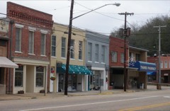 | East Wetumpka Commercial Historic District (Boundary Increase) | 4.5 miles | 1999 |
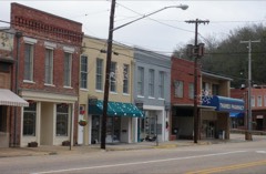 | East Wetumpka Commercial Historic District | 4.5 miles | 1992 |
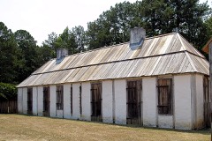 | Fort Toulouse | 4.7 miles | 1966 |
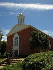 | First Baptist Church of Wetumpka | 4.7 miles | 2008 |
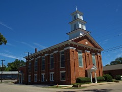 | First United Methodist Church | 4.7 miles | 1973 |
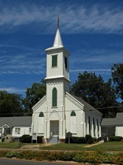 | First Presbyterian Church Of Wetumpka | 4.7 miles | 1976 |
| National Archives record | The nomination case file for reference 07001389 in Record Group 79. |
| Elmore County | All 13 listed properties in this county. |