 Block
From the record
One of 61 National Register listings published here for Baldwin County · listed in 2023 · category: District.
Sources: the National Register database, National Park Service
Listed on the National Register of Historic Places in 2023.
One of 61 National Register listings published here for Baldwin County · listed in 2023 · category: District.
Sources: the National Register database, National Park Service
Regional context, not property-specific evidence. The federal wildfire occurrence database lists 145 fires within 5 miles of Jenkins Farm and House (Boundary Increase) between 1994 and 2020, burning about 1,444 acres in total. 5 started naturally. 24 were recorded as arson. Distance is straight-line from the map coordinates, so a fire counted here may appear on a neighbouring settlement's page as well.
| Reported cause | Fires |
|---|---|
| Debris and open burning | 59 |
| Arson/incendiarism | 24 |
| Missing data/not specified/undetermined | 16 |
| Recreation and ceremony | 14 |
| Equipment and vehicle use | 13 |
| Misuse of fire by a minor | 8 |
| Natural | 5 |
| Smoking | 2 |
| Railroad operations and maintenance | 2 |
| Other causes | 1 |
| Fireworks | 1 |
The most recent of them, most recent first, with the day each was reported and the service that recorded it.
| Date | Cause | Size | Reported by | Name on the report |
|---|---|---|---|---|
| 29 September 2006 | Arson/incendiarism | 15 acres | Alabama Forestry Commission | not named |
| 27 September 1999 | Arson/incendiarism | under an acre | Alabama Forestry Commission | not named |
| 24 September 2010 | Debris and open burning | under an acre | Alabama Forestry Commission | not named |
| 19 September 2015 | Missing data/not specified/undetermined | 2.0 acres | Alabama Forestry Commission | SWR-20150919-002 |
| 19 September 2005 | Equipment and vehicle use | under an acre | Alabama Forestry Commission | not named |
| 5 August 2004 | Equipment and vehicle use | under an acre | Alabama Forestry Commission | not named |
| 26 August 1994 | Recreation and ceremony | 3.0 acres | Alabama Forestry Commission | not named |
| 24 August 1994 | Recreation and ceremony | 3.0 acres | Alabama Forestry Commission | not named |
Regional context, not property-specific evidence. The federal mineral resources record lists 1 working within 5 miles of Jenkins Farm and House (Boundary Increase): 1 producer. All of them still produce. What was taken out: Sand and Gravel, Construction, Clay. Distance is straight-line from the map coordinates, so a quarry counted here may appear on a neighbouring settlement's page as well.
| Where | Site | Commodity | Status | Recorded |
|---|---|---|---|---|
| Unnamed Quarry | Sand and Gravel, Construction, Clay | Producer | Clay, Quartz |
Regional context, not property-specific evidence. The National Weather Service names Loxley, the town this property stands in, in 41 storm reports between 1994 and 2026: 16 thunderstorm wind, 13 hail, 5 lightning, 3 tornado. No death or injury is recorded in these reports. Each account below is quoted exactly as the forecast office filed it, from the NOAA Storm Events Database, and each date opens the federal record of that event.
| When | Event | Place named | Harm | What the report says |
|---|---|---|---|---|
| January 1997 | Lightning | Loxley | $90,000 | no account filed |
| February 2008 | Thunderstorm Wind | Loxley | $55,000 | A thunderstorm wind gust blew part of the roof off of a house and also destroyed a barn west of Wilcox Road. |
| October 2017 | Flash Flood | Loxley | $30,000 | Multiple areas of County Road 64 west of Highway 59 under water due to heavy rain. |
| April 1996 | Lightning | Loxley | $25,000 | no account filed |
| April 2005 | Thunderstorm Wind | Loxley | $15,000 | High winds from a thunderstorm blew down several trees and damaged a manufactured home near Loxley. |
| July 2011 | Thunderstorm Wind | Loxley | $10,000 | Winds estimates at 70 mph caused the roof of the Exxon station on hwy 59 to collapse. |
| March 2005 | Thunderstorm Wind | Loxley | $10,000 | no account filed |
| June 2007 | Hail | Loxley | $8,000 | Quarter to golfball size hail fell from a severe thunderstorm and lasted several minutes and damaged some automobiles. |
| September 2000 | Thunderstorm Wind | Loxley | $5,000 | Several pecan trees were blown down by high winds. |
| July 1999 | Lightning | Loxley | $5,000 | A barn on US Hwy 59 in Loxley was reported struck by lightning. |
| August 1997 | Thunderstorm Wind | Loxley | $5,000 | Several trees and power lines were blown down near Loxley. |
| September 1998 | Tornado (F0) | Loxley | $3,000 | A tornado briefly touched down just north of I-10 near the Loxley exit. The only damage was to trees and power lines. |
| June 2012 | Funnel Cloud | Loxley | $2,000 | Funnel cloud observed 3 times by fire dept near County Roads 64 and 65. Tree limbs were also down in the area. |
| August 1994 | Thunderstorm Wind | Loxley | $500 | Thunderstorm wind destroyed a metal shed and downed some tree limbs at Loxley in central Baldwin County. |
| August 1996 | Thunderstorm Wind | Loxley | $500 | no account filed |
| March 2026 | Thunderstorm Wind | Loxley | - | Straight line winds resulted in damage to roofs at a nursery. A trailer was also blown over. Time estimated. |
| May 2025 | Thunderstorm Wind | Loxley | - | Several trees down on Barlow Rd. |
| July 2023 | Thunderstorm Wind | Loxley | - | High winds downed trees and powerlines on CR66. |
| June 2023 | Tornado (EF0) | Loxley | - | A brief EF-0 tornado touched down on the south side of County|Road 64, just west of the County Road 66 intersection. The|tornado moved southeast and stayed to the south of County Road|64. The end point is estimated. Spotty tree damage was noted|along the path, including two large hardwood trees that were|uprooted and facing back toward the west. |
| June 2023 | Flash Flood | Loxley | - | Heavy rain caused flooding on CR 64. |
| June 2023 | Thunderstorm Wind | Loxley | - | High winds downed tress on CR 68 near Loxley. |
| May 2022 | Thunderstorm Wind | Loxley | - | A wooded porch was lifted and thrown across the yard. |
| May 2022 | Thunderstorm Wind | Loxley | - | Measured by the USA Chili mesonet. |
| April 2020 | Thunderstorm Wind | Loxley | - | USA CHILI mesonet site in Loxley measured a thunderstorm wind gust of 74 mph. |
| March 2009 | Flash Flood | Loxley | - | Heavy rains caused widespread flooding of road ways around Loxley. |
| September 2000 | Hail | Loxley | - | Thunderstorm produced nickel sized hail. |
| August 2000 | Hail | Loxley | - | Dime size hail was reported in Loxley. |
| March 1999 | Lightning | Loxley | - | Lighting struck a radio transmission tower in Loxley. The tower housed three different stations and knocked them all off for two days. Someone at the tower reported that they had sixteen lightning hits in just a few minutes. |
| March 1999 | Lightning | Loxley | - | Lightning hit the broadcast tower of WPMI-TV (Channel 15) in Loxley and knocked their broadcast off the air for several hours. |
| July 1999 | Hail | Loxley | - | Dime size hail was reported along US Highway 90 just west of Loxley. |
| April 1995 | Tornado (F0) | Loxley | - | A tornado briefly touched down between Loxley and Stapleton. No damage was found. The length and width of the tornado were estimated. |
| April 2023 | Thunderstorm Wind | Loxley | - | no account filed |
| May 2022 | Hail | Loxley | - | no account filed |
| July 2020 | Hail | Loxley | - | no account filed |
| June 2012 | Hail | Loxley | - | no account filed |
| July 2011 | Hail | Loxley | - | no account filed |
| April 2009 | Hail | Loxley | - | no account filed |
| August 2006 | Hail | Loxley | - | no account filed |
| March 2005 | Hail | Loxley | - | no account filed |
| April 2003 | Hail | Loxley | - | no account filed |
| May 2002 | Hail | Loxley | - | no account filed |
No historic map-sheet match is published for this property yet. That does not mean no map exists. This record needs a coordinate-quality review before it can be joined to a sheet boundary. Browse the county's mapped places while that work is pending.
Other National Register properties close enough to walk or drive between, ordered by distance from this one. Both positions come from the same geocoding pass that matched these properties to their map sheets.
| Photograph | Property | Distance | Listed |
|---|---|---|---|
| Jenkins Farm and House (Additional Documentation) | 0.4 miles | 2016 | |
| Malbis Plantation | 2.8 miles | 2011 | |
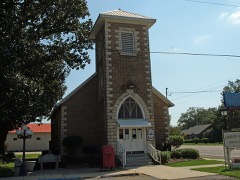 | St. Patrick's Catholic Church | 3.5 miles | 1988 |
| Lewis Starke House | 6.7 miles | 1990 | |
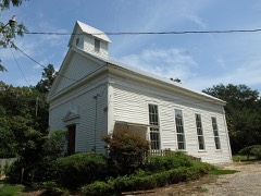 | Methodist Episcopal Church, South | 6.8 miles | 1980 |
| George W. Cullum House | 6.8 miles | 1990 |
| National Archives record | The nomination case file for reference 100009548 in Record Group 79. |
| Baldwin County | All 61 listed properties in this county. |