 Block
From the record
One of 29 National Register listings published here for Colbert County · listed in 2025 · category: Building.
Sources: the National Register database, National Park Service
Listed on the National Register of Historic Places in 2025.
One of 29 National Register listings published here for Colbert County · listed in 2025 · category: Building.
Sources: the National Register database, National Park Service
Regional context, not property-specific evidence. The federal wildfire occurrence database lists 120 fires within 5 miles of WZZA Radio Station between 1994 and 2020, burning about 639 acres in total. None started naturally. 24 were recorded as arson. Distance is straight-line from the map coordinates, so a fire counted here may appear on a neighbouring settlement's page as well.
| Reported cause | Fires |
|---|---|
| Debris and open burning | 51 |
| Arson/incendiarism | 24 |
| Missing data/not specified/undetermined | 19 |
| Equipment and vehicle use | 14 |
| Recreation and ceremony | 4 |
| Railroad operations and maintenance | 3 |
| Misuse of fire by a minor | 3 |
| Smoking | 2 |
The most recent of them, most recent first, with the day each was reported and the service that recorded it.
| Date | Cause | Size | Reported by | Name on the report |
|---|---|---|---|---|
| 9 September 2002 | Equipment and vehicle use | under an acre | Alabama Forestry Commission | not named |
| 9 September 1998 | Arson/incendiarism | 4.0 acres | Alabama Forestry Commission | not named |
| 8 September 1999 | Arson/incendiarism | 2.0 acres | Alabama Forestry Commission | not named |
| 6 September 1995 | Recreation and ceremony | under an acre | Alabama Forestry Commission | not named |
| 29 September 1994 | Smoking | under an acre | Alabama Forestry Commission | not named |
| 29 September 1994 | Debris and open burning | under an acre | Alabama Forestry Commission | not named |
| 28 September 2000 | Debris and open burning | under an acre | Alabama Forestry Commission | not named |
| 27 September 1999 | Arson/incendiarism | 1.5 acres | Alabama Forestry Commission | not named |
Regional context, not property-specific evidence. The federal mineral resources record lists 2 workings within 5 miles of WZZA Radio Station: 1 producer, 1 plant. All of them still produce. What was taken out: Sand and Gravel, Construction, Silica, Aluminum. Distance is straight-line from the map coordinates, so a quarry counted here may appear on a neighbouring settlement's page as well.
| Where | Site | Commodity | Status | Recorded |
|---|---|---|---|---|
| Colbert County Hwy. Dept. Pit | Sand and Gravel, Construction | Producer | ||
| Lister Hill Reduction Plant | Silica, Aluminum | Plant |
Regional context, not property-specific evidence. The National Weather Service names Tuscumbia, the town this property stands in, in 121 storm reports between 1994 and 2025: 75 thunderstorm wind, 24 flash flood, 17 hail, 2 lightning. The reports record 1 death and 2 injuries. Each account below is quoted exactly as the forecast office filed it, from the NOAA Storm Events Database, and each date opens the federal record of that event.
| When | Event | Place named | Harm | What the report says |
|---|---|---|---|---|
| August 2011 | Thunderstorm Wind | Tuscumbia | 1 killed, $125,000 | Several trees were uprooted and power lines were downed by thunderstorm winds in the Locust Shores community. Along the 500 block of Locust Road, a large oak tree fell onto a mobile home, killing a female resident who was sleeping. |
| October 2014 | Tornado (EF1) | Tuscumbia | 1 hurt | A tornado initially touched down in downtown Tuscumbia, near the intersection of 6th Street and Main Street, where two roofs were peeled off nearby businesses. The brick facade of a small retail building was torn off across 5th Street, and it's roof was partially torn off and roofing material vaulted into nearby power lines. The path continued northeast to High Street between 3rd and 4th Streets, where a very old pecan tree was uprooted and fell onto an historic home causing injury to the resident. In this residential area, multiple trees were snapped and uprooted or had large limbs broken off. Several power poles were snapped. Many more old trees were snapped an uprooted across the road along Commons Street between Mulberry and Hickory Streets.||At this point, the tornado appeared to weaken somewhat as it crossed a large corn field between Commons Street and King Avenue. It snapped branches upon reaching King Avenue and toppled Bradford pear trees on the grounds of Shoals Hospital along Billy Bowling Drive. As the tornado moved across Grand, Pasadena, and Ford Avenues and Ford Street in Muscle Shoals, it did significant damage to multiple trees throughout the neighborhood. Very minor damage was noted to a couple of houses, but nearly all damage was to trees or power poles.||The tornado intensified as it crossed Ford Street and moved into a commercial district along Woodward Avenue near 2nd Street. There was widespread structural damage to businesses and a church in this area. Numerous awnings were damaged or destroyed, roofs were partly torn off of strip malls, a few windows were broken, and several large signs along the road were blown down. Roofing was peeled off of a used car dealership and gas station and vaulted across the street into a wooded area and another nearby gas station. Power poles were snapped, and two metal power poles were bent, damaging the traffic lights at the intersection. The tornado continued across 2nd Street onto the Tennessee Valley Authority Reservation, where it snapped multiple trees along Garage Road. The tornado lifted before reaching Reservation Road, and little to no damage was noted thereafter. Minor straight-line wind damage was observed farther northeast, near Grandview Drive near the Tennessee River, but this was not associated with the tornado. |
| July 2003 | Lightning | Tuscumbia | 1 hurt | lightning struck a truck and destroyed truck tire and exploded asphalt with a six foot by one foot trench in the asphalt produced. one 14 year old male was slightly injured by debris from the flying asphalt. |
| August 2011 | Thunderstorm Wind | Tuscumbia | $150,000 | Numerous trees and powerlines were down between Tuscumbia, Muscle Shoals and Leighton. Several power poles were snapped and a few roofs of homes sustained minor shingle damage. Peak winds were estimated to be around 80 mph along and just ahead the bowing line of severe thunderstorms. |
| April 2006 | Tornado (F1) | Tuscumbia | $125,000 | A tornado produced scattered damage from just southwest of Tuscumbia through Tuscumbia. The tornado had an estimated maximum wind speed of around 90 miles an hour before it weakened and eventually dissipated. A gas station on the southwest portion of Tuscumbia suffered extensive damage, where a 50 foot billboard sign was twisted backwards and several of the gas pumps were heavily damaged. One of the gas pumps was dislodged from the pavement. Eight homes suffered minor to moderate roof and structural damage in and around Tuscumbia. |
| February 2025 | Thunderstorm Wind | Tuscumbia | $25,000 | A church steeple was knocked off of Westside Baptist Church. The trees on the property were all knocked down. Time estimated by radar. |
| February 2025 | Thunderstorm Wind | Tuscumbia | $25,000 | Multiple trees and power lines were knocked down on East 6th Street near Commons and Jefferson Street. Transformers were blown in the vicinity. Time estimated by radar. |
| August 2005 | Thunderstorm Wind | Tuscumbia | $25,000 | A tree blew down on to a house. |
| July 1999 | Thunderstorm Wind | Tuscumbia | $25,000 | Numerous trees and power lines were knocked down by thunderstorm winds. Several trees fell onto houses and mobile homes in the southern part of Tuscumbia. Numerous customers were temporarily without power. |
| July 1995 | Thunderstorm Wind | Tuscumbia | $15,000 | The Spring Valley Volunteer Fire Department reported wind damage to their fire station roof. |
| April 2025 | Thunderstorm Wind | Tuscumbia | $10,000 | A tree was knocked down onto a home at 119 Kentucky Drive. |
| October 2014 | Thunderstorm Wind | Tuscumbia | $10,000 | Several trees were downed by thunderstorm winds. |
| June 2013 | Thunderstorm Wind | Tuscumbia | $10,000 | A few power lines were downed by thunderstorm winds. |
| June 2009 | Thunderstorm Wind | Tuscumbia | $10,000 | Thunderstorm winds knocked several trees down in and around Tuscumbia. |
| May 2008 | Thunderstorm Wind | Tuscumbia | $10,000 | Several trees and power lines were blown down by thunderstorm winds on Highway 72 west of Highway 43. |
| April 1998 | Hail | Tuscumbia | $10,000 | Golf ball size hail was reported in Colbert Heights. |
| March 1995 | Thunderstorm Wind | Tuscumbia | $10,000 | Emergency management reported a home and a shed were damaged by strong thunderstorm winds in the western part of Tuscumbia in the Valdosta area. |
| March 1996 | Hail | Tuscumbia | $10,000 | no account filed |
| August 2023 | Thunderstorm Wind | Tuscumbia | $7,500 | A power pole was down or leaning at this location on Memory Lane. Time was estimated from radar. |
| December 2021 | Thunderstorm Wind | Tuscumbia | $7,500 | A power pole was knocked down at the Emergency Management Agency office. |
| February 2025 | Thunderstorm Wind | Tuscumbia | $5,000 | Three large trees were knocked down with live wires and road blockage on Davis Court. Time estimated by radar. |
| February 2025 | Thunderstorm Wind | Tuscumbia | $5,000 | Three large trees were knocked down with live wires and road blockage on Davis Court. Time estimated by radar. |
| June 2024 | Thunderstorm Wind | Tuscumbia | $5,000 | A power pole was knocked down at 530 South Blackwell Road in Sheffield. Time estimated by radar. |
| February 2011 | Thunderstorm Wind | Tuscumbia | $5,000 | Roof damage to JJS restaurant and People's Drug Storm on Highway 72 in Cherokee. Multiple power outages in Barton, Crooked Oak, Locust Shores, New Bethel, and Tuscumbia. |
| June 2009 | Thunderstorm Wind | Tuscumbia | $5,000 | The public reported a large tree was blown down on power lines at S Jefferson Street and 7th Street. |
| June 2009 | Thunderstorm Wind | Tuscumbia | $5,000 | A large tree was blown down on power lines at the intersection of 6th Street and Cave Street. |
| November 2005 | Thunderstorm Wind | Tuscumbia | $5,000 | A tree was blown onto a home on Georgetown lane by thunderstorm winds. |
| January 1999 | Hail | Tuscumbia | $5,000 | One inch diameter hail was reported in Tuscumbia. |
| April 1997 | Hail | Tuscumbia | $5,000 | Nickel sized hail was reported in Tuscumbia. |
| June 1995 | Thunderstorm Wind | Tuscumbia | $5,000 | Wind gusted to 60 mph with a thunderstorm. Several large trees were reported blown down by the wind. |
| May 1994 | Thunderstorm Wind | Tuscumbia | $5,000 | Three-quarter inch hail was reported in the western sections of Colbert County and large trees were blown down across power lines in the Cherokee community. Three-quarter inch hail and high wind was reported five miles south of Tuscumbia. |
| May 1997 | Hail | Tuscumbia | $5,000 | no account filed |
| June 2025 | Thunderstorm Wind | Tuscumbia | $4,000 | Trees were reported down west of Tuscumbia. |
| July 2009 | Thunderstorm Wind | Tuscumbia | $4,000 | A tree was blown down onto a car at Timberline Apartments. |
| May 1997 | Hail | Tuscumbia | $4,000 | no account filed |
| August 2021 | Thunderstorm Wind | Tuscumbia | $2,000 | A tree and power lines were knocked down onto a house near the intersection of 2nd Street and Indian Street. Report relayed via social media. Time estimated by radar and a report of power outages from Emergency Management. |
| June 2011 | Thunderstorm Wind | Tuscumbia | $2,000 | A tree was blown down on Hillandale Drive. |
| February 2000 | Hail | Tuscumbia | $2,000 | Dime to quarter size hail fell in Tuscumbia. |
| May 2000 | Hail | Tuscumbia | $2,000 | Quarter size hail fell just west of Tuscumbia. |
| April 2025 | Thunderstorm Wind | Tuscumbia | $1,000 | A tree was knocked down at 804 SW 13th Avenue. |
| May 2025 | Thunderstorm Wind | Tuscumbia | $1,000 | A tree was reported down at 1300 S Montgomery Avenue. |
| June 2023 | Thunderstorm Wind | Tuscumbia | $1,000 | A tree was reported down near the intersection of Nashville Avenue and E Saywell Street. |
| June 2023 | Thunderstorm Wind | Tuscumbia | $1,000 | A tree was blown down at the following location: 913 SW 12th Avenue. |
| August 2023 | Thunderstorm Wind | Tuscumbia | $1,000 | A tree was knocked down at this location on West Douglas Street. Time was estimated from radar. |
| August 2023 | Thunderstorm Wind | Tuscumbia | $1,000 | A tree was reported down on North Hook street at this location. Time was estimated from radar. |
| August 2023 | Thunderstorm Wind | Tuscumbia | $1,000 | A tree was reported down near Ridge Pointe. |
| June 2023 | Thunderstorm Wind | Tuscumbia | $1,000 | A tree was reported down at 911 Montgomery Avenue. |
| May 2021 | Thunderstorm Wind | Tuscumbia | $1,000 | A tree was knocked down on a house on Cave Street in Tuscumbia. Time estimated by radar. |
| May 2021 | Thunderstorm Wind | Tuscumbia | $1,000 | A tree was knocked down onto a house at 705 East Moore Street. |
| May 2021 | Thunderstorm Wind | Tuscumbia | $1,000 | A tree was knocked down onto a house at 2000 Oak Drive. |
| December 2021 | Thunderstorm Wind | Tuscumbia | $1,000 | Power lines were knocked down in Tuscumbia. |
| January 2012 | Flash Flood | Tuscumbia | $1,000 | Flash flooding was reported at North Jackson Highway at the Oakwood Cemetary in Sheffield, at the intersection of Avalon Avenue and Woodward Avenue in Muscle Shoals, and at the intersection of Cave Street and 1st Street in Tuscumbia. |
| June 2011 | Thunderstorm Wind | Tuscumbia | $1,000 | Power lines were knocked down on Cave Street in Tuscumbia. Time estimated by radar and other reports. |
| June 2010 | Thunderstorm Wind | Tuscumbia | $1,000 | A tree was blown onto a power line in Tuscumbia. |
| September 2007 | Flash Flood | Tuscumbia | $1,000 | Minor flooding was reported in some low-lying residential areas of Tuscumbia. Street flooding was also reported in downtown Tuscumbia. |
| August 2023 | Thunderstorm Wind | Tuscumbia | $500 | A tree was knocked down by gust front winds at Keller Lane at West Moore Street. Time estimated by radar. |
| July 2023 | Thunderstorm Wind | Tuscumbia | $500 | A tree was knocked down at 100 West 5th Street. Time estimated by radar. |
| December 2021 | Thunderstorm Wind | Tuscumbia | $500 | A tree was knocked down at the intersection of South Blackwell Road and East Wheeler Avenue. |
| December 2021 | Thunderstorm Wind | Tuscumbia | $500 | A tree was knocked down near the intersection of Guntersville Street and Wilson Dam Avenue. |
| June 2023 | Thunderstorm Wind | Tuscumbia | $200 | A tree was knocked down on Pine Street. |
No historic map-sheet match is published for this property yet. That does not mean no map exists. This record needs a coordinate-quality review before it can be joined to a sheet boundary. Browse the county's mapped places while that work is pending.
Other National Register properties close enough to walk or drive between, ordered by distance from this one. Both positions come from the same geocoding pass that matched these properties to their map sheets.
| Photograph | Property | Distance | Listed |
|---|---|---|---|
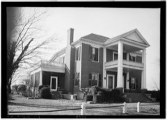 | John and Archibald Christian House | 0.9 miles | 1982 |
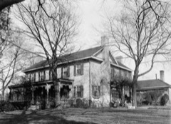 | John Daniel Rather House | 1.6 miles | 1982 |
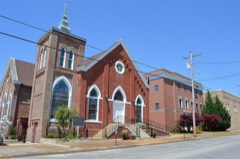 | Tuscumbia Historic District | 1.8 miles | 1985 |
 | Colbert County Courthouse Square Historic District | 1.8 miles | 1973 |
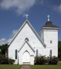 | St. John's Episcopal Church | 1.9 miles | 2018 |
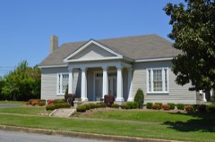 | Felix Grundy Norman House | 2.0 miles | 1984 |
| National Archives record | The nomination case file for reference 100011916 in Record Group 79. |
| Colbert County | All 29 listed properties in this county. |