 Block
From the record
One of 20 National Register listings published here for Barbour County · listed in 1972 · category: Building.
Sources: the case file at the National Archives · the National Register database, National Park Service
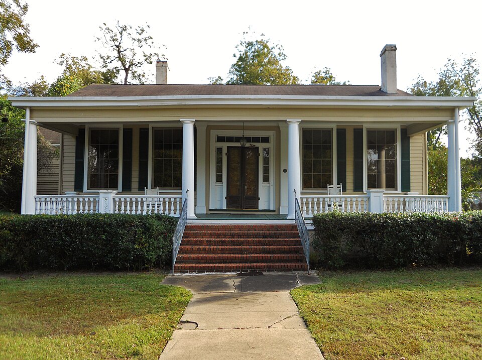
Listed on the National Register of Historic Places in 1972.
One of 20 National Register listings published here for Barbour County · listed in 1972 · category: Building.
Sources: the case file at the National Archives · the National Register database, National Park Service
Regional context, not property-specific evidence. The federal wildfire occurrence database lists 93 fires within 5 miles of Gov. Chauncy Sparks House between 1992 and 2020, burning about 428 acres in total. 2 started naturally. 8 were recorded as arson. Distance is straight-line from the map coordinates, so a fire counted here may appear on a neighbouring settlement's page as well.
| Reported cause | Fires |
|---|---|
| Debris and open burning | 53 |
| Missing data/not specified/undetermined | 11 |
| Equipment and vehicle use | 8 |
| Arson/incendiarism | 8 |
| Misuse of fire by a minor | 5 |
| Smoking | 3 |
| Recreation and ceremony | 2 |
| Natural | 2 |
| Railroad operations and maintenance | 1 |
The most recent of them, most recent first, with the day each was reported and the service that recorded it.
| Date | Cause | Size | Reported by | Name on the report |
|---|---|---|---|---|
| 29 September 2016 | Debris and open burning | under an acre | Georgia Forestry Commission | FY2017-QUITMAN-002 |
| 17 September 1999 | Debris and open burning | 2.5 acres | Alabama Forestry Commission | not named |
| 12 September 1999 | Debris and open burning | 1.6 acres | Georgia Forestry Commission | not named |
| 4 August 2011 | Debris and open burning | under an acre | Georgia Forestry Commission | FY2012-QUITMAN-001 |
| 28 August 1997 | Equipment and vehicle use | under an acre | Georgia Forestry Commission | not named |
| 28 August 1997 | Equipment and vehicle use | under an acre | Georgia Forestry Commission | not named |
| 26 August 1997 | Debris and open burning | under an acre | Georgia Forestry Commission | not named |
| 16 August 2000 | Railroad operations and maintenance | 3.0 acres | Georgia Forestry Commission | FY2001-QUITMAN-003 |
Regional context, not property-specific evidence. The federal mineral resources record lists 7 workings within 5 miles of Gov. Chauncy Sparks House: 4 producers, 2 past producers, 1 unknown. 4 still produce. What was taken out: Sand and Gravel, Construction, Kaolin, Iron, Aluminum. Distance is straight-line from the map coordinates, so a quarry counted here may appear on a neighbouring settlement's page as well.
| Where | Site | Commodity | Status | Recorded |
|---|---|---|---|---|
| Eufaula Pit | Aluminum, Kaolin | Past Producer | ||
| Unnamed | Iron | Unknown | ||
| Barbour Operation Wilson-Snead Mill | Kaolin | Producer | ||
| Eufaula Mine | Sand and Gravel, Construction | Producer | ||
| McKenzie No. 2 Pit | Sand and Gravel, Construction | Past Producer | ||
| Unnamed Quarry | Sand and Gravel, Construction | Producer | Quartz | |
| Unnamed Quarry | Sand and Gravel, Construction | Producer | Quartz |
Regional context, not property-specific evidence. The National Weather Service names Eufaula, the town this property stands in, in 45 storm reports between 1997 and 2026: 28 thunderstorm wind, 11 hail, 2 funnel cloud, 2 tornado. No death or injury is recorded in these reports. Each account below is quoted exactly as the forecast office filed it, from the NOAA Storm Events Database, and each date opens the federal record of that event.
| When | Event | Place named | Harm | What the report says |
|---|---|---|---|---|
| April 2010 | Lightning | Eufaula | $100,000 | A lightning strike led to the complete loss of a home on AL-30, near the city of Eufaula. A resident of the home was able to escape unharmed. |
| August 1999 | Thunderstorm Wind | Eufaula | $60,000 | Numerous trees were knocked down or uprooted. Numerous power lines were blown down. The Barbour County Bank had its roof torn off. A roof ripped off a store in downtown Eufaula and landed on a car. Three cars were damaged when a portable building was thrown into the air and landed on them. |
| December 2009 | Flash Flood | Eufaula | $25,000 | A portion of Cotton Hill Road, near the intersection with AL-30, became partially washed out due to water flowing over it. |
| July 2000 | Thunderstorm Wind | Eufaula | $15,000 | Several trees were blown down just north of Eufaula near the intersection of US 431 and CR 97. One home was heavily damaged when a tree fell on it. One building in Eufaula had a heating unit damaged on the top of the structure. Several other reports of minor roof damage and trees blown down were received from the eastern part of Barbour County. |
| August 2006 | Thunderstorm Wind | Eufaula | $10,000 | Multiple trees were blown down, resulting in damage to homes. |
| April 1999 | Thunderstorm Wind | Eufaula | $10,000 | Several trees were knocked down in northern Barbour County. The most concentrated damage was near Lugo. |
| July 2003 | Thunderstorm Wind | Eufaula | $8,000 | A few trees and power lines were blown down in Eufaula. |
| September 2001 | Thunderstorm Wind | Eufaula | $5,000 | One large pine tree fell on a carport in Eufaula. The tree destroyed the carport and much of its contents. |
| June 1998 | Thunderstorm Wind | Eufaula | $5,000 | A few large limbs were down in the Eufaula area. |
| June 1998 | Thunderstorm Wind | Eufaula | $5,000 | Numerous trees were blown down in Eufaula. |
| June 1998 | Thunderstorm Wind | Eufaula | $5,000 | Trees and power lines were down in Eufaula. |
| January 1997 | Hail | Eufaula | $5,000 | no account filed |
| November 1997 | Hail | Eufaula | $5,000 | no account filed |
| November 1997 | Thunderstorm Wind | Eufaula | $5,000 | no account filed |
| June 2009 | Thunderstorm Wind | Eufaula | $3,000 | Trees and power lines were blown down at several locations around the city of Eufaula. |
| April 2011 | Thunderstorm Wind | Eufaula | $2,000 | Several trees were blown down on Highway 431. |
| May 1999 | Hail | Eufaula | $2,000 | Quarter size hail was reported in Eufaula. |
| November 1997 | Hail | Eufaula | $2,000 | Dime size hail was reported in Eufaula. |
| March 2026 | Thunderstorm Wind | Eufaula | - | Power lines were downed on Highway 431 on Barbour Creek bridge, blocking all four lanes. |
| May 2025 | Thunderstorm Wind | Eufaula | - | Trees and power lines were downed in Eufaula, including Barbour Ln, South Randolph Ave, and West Broad at Doren Dr. |
| June 2023 | Tornado (EF1) | Eufaula | - | National Weather Service meteorologists surveyed damage in far eastern Barbour County and determined that it was consistent with an EF1 tornado, with maximum winds near 110 mph. The tornado touched down in a forested area between Sandy Lane west of Highway 30. The tornado quickly intensified and snapped or uprooted a number of large pine trees on the south side of Highway 30. The tornado crossed Highway 30 and uprooted another grove of pine trees and causing damage to a church. The tornado weakened slightly as it crossed US Highway 431, then rapidly intensified and caused the most significant tree damage along the path on the western banks of Barbour Creek, with snapped and uprooted trees, some of which caused major damage to a home. The tornado continued east-northeast and crossed Paul Lee Parkway and State Docks Road, where more trees were uprooted, the side of a metal building structure was removed, and three units of an apartment complex sustained partial roof damage. The tornado then caused another area of significant tree damage between Cypress Cove Drive and Inlet Road. The tornado weakened after moving over the waters of the Walter F George Reservoir and likely dissipated. |
| June 2023 | Thunderstorm Wind | Eufaula | - | Several trees uprooted on Five Mile Road. |
| June 2023 | Thunderstorm Wind | Eufaula | - | Numerous trees uprooted in Eufaula. |
| August 2023 | Thunderstorm Wind | Eufaula | - | Multiple trees uprooted around the city of Eufaula. |
| August 2023 | Thunderstorm Wind | Eufaula | - | Several trees uprooted along Woodhill Circle and Patricia Lane, causing power outages. |
| April 2022 | Tornado (EF1) | Eufaula | - | National Weather Service meteorologists surveyed damage in northeastern Barbour County and determined that it was consistent with an EF1 tornado, with maximum winds near 95 mph. The tornado touched down near the northern point of the Walter F George Reservoir and tracked northeast and crossed Highway 82, where a few trees were uprooted and snapped. The tornado then crossed Highway 431, where a large pecan tree was uprooted and fell on a house, rendering it unlivable. The tornado began to weaken once it crossed Highway 431, producing mainly tree limb damage before dissipating. |
| June 2022 | Thunderstorm Wind | Eufaula | - | Several trees uprooted in the city of Eufaula. |
| November 2022 | Thunderstorm Wind | Eufaula | - | Several trees uprooted and on a home on Monroe Street in the city of Eufaula. |
| May 2021 | Thunderstorm Wind | Eufaula | - | Several trees uprooted and power lines downed on South Eufaula Avenue and Dale Road. |
| April 2020 | Thunderstorm Wind | Eufaula | - | Several trees uprooted along Fox Ridge Road near the Eufaula Country Club. |
| August 2020 | Thunderstorm Wind | Eufaula | - | Several trees uprooted near McCoo High School. |
| April 2017 | Thunderstorm Wind | Eufaula | - | Several trees uprooted and power lines downed along State Docks Road. |
| April 2017 | Thunderstorm Wind | Eufaula | - | Reports of trees snapped and uprooted in the city of Eufaula. Power poles also snapped. |
| February 2016 | Thunderstorm Wind | Eufaula | - | Numerous trees uprooted around the city of Eufaula. |
| July 2012 | Thunderstorm Wind | Eufaula | - | Trees were reported down along US 431, south of Eufaula. |
| July 2012 | Thunderstorm Wind | Eufaula | - | Powerlines were reported down along Barbour Lane near Eufaula. |
| December 2005 | Funnel Cloud | Eufaula | - | A funnel cloud was observed moving over Lake Eufaula. |
| December 2005 | Hail | Eufaula | - | Quarter size hail was observed just south of Eufaula. |
| April 2003 | Hail | Eufaula | - | Nickel size hail was observed just south of Eufaula. |
| March 2002 | Hail | Eufaula | - | Nickel size hail was observed northwest of Eufaula near the Barbour and Russell County line. |
| March 1999 | Hail | Eufaula | - | Dime sized hail reported between Clayton and Eufaula. |
| May 1999 | Funnel Cloud | Eufaula | - | A funnel cloud was reported by the Alabama Highway Patrol 5 miles south of Eufaula. |
| April 2017 | Hail | Eufaula | - | no account filed |
| March 2011 | Hail | Eufaula | - | no account filed |
| March 2011 | Hail | Eufaula | - | no account filed |
No historic map-sheet match is published for this property yet. That does not mean no map exists. This record needs a coordinate-quality review before it can be joined to a sheet boundary. Browse the county's mapped places while that work is pending.
Other National Register properties close enough to walk or drive between, ordered by distance from this one. Both positions come from the same geocoding pass that matched these properties to their map sheets.
| Photograph | Property | Distance | Listed |
|---|---|---|---|
 | Shorter Mansion | 0.1 miles | 1972 |
| Lore, Seth and Irwinton Historic District (Boundary Increase) | 0.1 miles | 1986 | |
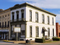 | McNab Bank Building | 0.2 miles | 1971 |
| Lore Historic District | 0.2 miles | 1973 | |
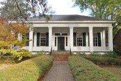 | Bray-Barron House | 0.2 miles | 1971 |
 | Tavern, The | 0.3 miles | 1970 |
| National Archives record | The nomination case file for reference 72000157 in Record Group 79. |
| Barbour County | All 20 listed properties in this county. |