 Block
From the record
One of 27 National Register listings published here for Talladega County · listed in 1972 · category: District.
Sources: the case file at the National Archives · the National Register database, National Park Service
Listed on the National Register of Historic Places in 1972.
One of 27 National Register listings published here for Talladega County · listed in 1972 · category: District.
Sources: the case file at the National Archives · the National Register database, National Park Service
Regional context, not property-specific evidence. The federal wildfire occurrence database lists 376 fires within 5 miles of Talladega Courthouse Square Historic District between 1994 and 2020, burning about 3,268 acres in total. 4 started naturally. 122 were recorded as arson. Distance is straight-line from the map coordinates, so a fire counted here may appear on a neighbouring settlement's page as well.
| Reported cause | Fires |
|---|---|
| Debris and open burning | 132 |
| Arson/incendiarism | 122 |
| Missing data/not specified/undetermined | 50 |
| Recreation and ceremony | 27 |
| Railroad operations and maintenance | 17 |
| Equipment and vehicle use | 10 |
| Misuse of fire by a minor | 9 |
| Natural | 4 |
| Smoking | 3 |
| Other causes | 1 |
| Fireworks | 1 |
The most recent of them, most recent first, with the day each was reported and the service that recorded it.
| Date | Cause | Size | Reported by | Name on the report |
|---|---|---|---|---|
| 9 September 2002 | Debris and open burning | 3.0 acres | Alabama Forestry Commission | not named |
| 8 September 2007 | Misuse of fire by a minor | under an acre | Alabama Forestry Commission | not named |
| 8 September 2002 | Arson/incendiarism | 20 acres | Alabama Forestry Commission | not named |
| 8 September 2002 | Arson/incendiarism | 3.0 acres | Alabama Forestry Commission | not named |
| 7 September 2002 | Natural | 20 acres | Alabama Forestry Commission | not named |
| 6 September 2020 | Missing data/not specified/undetermined | under an acre | Alabama Forestry Commission | 20200906-3 |
| 5 September 1995 | Recreation and ceremony | under an acre | Alabama Forestry Commission | not named |
| 30 September 2007 | Arson/incendiarism | 5.0 acres | Alabama Forestry Commission | not named |
Regional context, not property-specific evidence. The federal mineral resources record lists 13 workings within 5 miles of Talladega Courthouse Square Historic District: 9 unknowns, 4 past producers. None of them still produces. What was taken out: Iron, Aluminum. Distance is straight-line from the map coordinates, so a quarry counted here may appear on a neighbouring settlement's page as well.
| Where | Site | Commodity | Status | Recorded |
|---|---|---|---|---|
| Parsons Mine | Aluminum, Iron | Past Producer | ||
| Lawson Limonite Banks | Iron | Past Producer | Residual | |
| No Name | Iron | Past Producer | Residual | |
| Poor House Limonite Banks | Iron | Past Producer | Residual | |
| Unnamed | Iron | Unknown | ||
| Unnamed | Iron | Unknown | ||
| Unnamed | Iron | Unknown | ||
| Unnamed | Iron | Unknown | ||
| Unnamed | Iron | Unknown | ||
| Unnamed | Iron | Unknown |
Regional context, not property-specific evidence. The National Weather Service names Talladega, the town this property stands in, in 68 storm reports between 1994 and 2026: 40 thunderstorm wind, 22 hail, 2 flash flood, 2 funnel cloud. No death or injury is recorded in these reports. Each account below is quoted exactly as the forecast office filed it, from the NOAA Storm Events Database, and each date opens the federal record of that event.
| When | Event | Place named | Harm | What the report says |
|---|---|---|---|---|
| June 2010 | Thunderstorm Wind | Talladega | $250,000 | An apparent downburst caused an swath of intense damage across the southern portion of the city of Talladega. Around 100 trees were blown down, with some of them falling onto homes causing varying degrees of damage. In addition, hundreds of limbs were broken off, many of them also large enough to cause damage to homes as they fell. Structural damage not the result of falling trees or limbs was confined to outbuildings containing lumber at a hardware store. The total damage swath was more than 2.5 miles long, and up to 100 yards wide, with peak wind gusts estimated around 80 mph. |
| July 1999 | Thunderstorm Wind | Talladega | $75,000 | Two large mobile homes were ripped in half when damaging winds moved along SR 21 in Talladega. A large tent was blown over damaging four automobiles. A few vehicles were also blown off the road while moving. No injuries were reported. |
| November 2004 | Tornado (F0) | Talladega | $50,000 | no account filed |
| May 2006 | Hail | Talladega | $20,000 | Several cars were damaged by hail in the Wal-Mart parking lot. |
| June 1996 | Thunderstorm Wind | Talladega | $20,000 | no account filed |
| August 2002 | Lightning | Talladega | $17,000 | A few trees were knocked down in Talladega. One of the trees landed on a home and caused major damage. The trees fell due to lightning strikes. No injuries were reported. |
| July 2003 | Thunderstorm Wind | Talladega | $16,000 | Several trees and power lines were blown down across the city of Talladega. One large tree temporarily blocked train tracks. |
| April 2009 | Thunderstorm Wind | Talladega | $15,000 | Several trees were blown down in the city of Talladega. At least two trees fell onto houses, and another fell onto a car. |
| May 2004 | Thunderstorm Wind | Talladega | $14,000 | Power lines were blown down across the city of Talladega. |
| August 1995 | Thunderstorm Wind | Talladega | $12,000 | Shingles were ripped from a structure in the Country Club Estates area near Renfroe about 10 miles west of Talladega. Trees were reported down in Sylacauga along with damage to several signs including one bank sign. |
| May 2006 | Thunderstorm Wind | Talladega | $10,000 | A total of 10 trees were blown down in the city. One home was damaged by a fallen tree. |
| June 2005 | Flash Flood | Talladega | $10,000 | Several streets were impassable and subsequently closed in Talladega due to flooding. |
| July 2000 | Thunderstorm Wind | Talladega | $10,000 | Trees and power lines were knocked down in Talladega. Thousands of customers were without power for several hours. A steeple of a church was blown off and destroyed in Renfroe. |
| April 2005 | Hail | Talladega | $9,000 | Large hail up to the size of golf balls fell across northern Talladega County. Some locations that reported large hail include Stemley, Talladega, Lincoln and Munford. |
| June 1997 | Hail | Talladega | $9,000 | Quarter to baseball sized hail was reported just north of Talladega. |
| June 1999 | Hail | Talladega | $8,000 | Golfball size hail was reported just east of the city of Talladega. |
| May 1997 | Thunderstorm Wind | Talladega | $7,000 | Trees and power lines were down throughout the city. |
| April 2011 | Thunderstorm Wind | Talladega | $5,000 | Numerous trees were knocked down across the city. |
| August 2007 | Thunderstorm Wind | Talladega | $5,000 | Trees and power lines were blown down at Brecon Mobile Home Park, in the city of Talladega. |
| March 2007 | Thunderstorm Wind | Talladega | $5,000 | Power lines were blown down along Shocco Springs Road, in the city of Talladega. |
| June 2002 | Hail | Talladega | $5,000 | Golf ball size hail was reported in the Brecon community, just south of Talladega. |
| June 1994 | Thunderstorm Wind | Talladega | $5,000 | Trees were reported down just south of Talladega on Highway 21. |
| January 1997 | Hail | Talladega | $5,000 | no account filed |
| January 1997 | Hail | Talladega | $5,000 | no account filed |
| April 2009 | Thunderstorm Wind | Talladega | $3,000 | In the city of Talladega, a power line was blown down and caused a minor fire, on Hill Street. Trees and power lines were also blown down in several other locations around the city. |
| February 1998 | Thunderstorm Wind | Talladega | $3,000 | A few trees were down in Talladega including one on a car. |
| June 2009 | Thunderstorm Wind | Talladega | $2,000 | Trees were blown down and blocked the road, at the intersection of Patricia Avenue and Glenwood Drive, in the city of Talladega. |
| April 2006 | Thunderstorm Wind | Talladega | $2,000 | Trees and power lines down on Highway 207 at Alpine Bridge. |
| July 2004 | Thunderstorm Wind | Talladega | $2,000 | A few trees were blown down in Talladega. |
| April 2011 | Thunderstorm Wind | Talladega | $1,000 | A tree was blown down onto the administration building of an apartment complex on Broadway Avenue, in Talladega. |
| June 2009 | Thunderstorm Wind | Talladega | $1,000 | A large tree and power lines were blown on Battle Street and Martin Luther King Jr. Drive, in the city of Talladega. |
| August 2000 | Hail | Talladega | $1,000 | Dime to quarter size hail was reported in Talladega. |
| January 2026 | Thunderstorm Wind | Talladega | $500 | Trees were downed around Talladega, Alpine, and Munford, including Cheaha Rd, Alpine Winterboro Rd, Renfroe Rd, and Grizzle Ln. |
| June 2011 | Thunderstorm Wind | Talladega | $500 | A tree was blown down onto Mountain View Road, just off of AL-77. |
| June 2009 | Thunderstorm Wind | Talladega | $500 | A single tree was blown down and blocked Crest Drive, in the city of Talladega. |
| March 2026 | Thunderstorm Wind | Talladega | - | A tree fell on a house in Talladega and another tree fell across Ironaton Rd east of town. |
| March 2025 | Thunderstorm Wind | Talladega | - | Multiple trees and power lines were downed across Talladega County. |
| March 2025 | Thunderstorm Wind | Talladega | - | Several trees and power lines were downed in the south and southeast sides of Talladega, including along Marble Quarry Rd, West Parkway Ave, Mountain View Rd, Mount Olive Cir, Grogan Rd, Gentry Dr, and Ashland Highway. |
| May 2025 | Thunderstorm Wind | Talladega | - | Several trees were downed across Talladega County, including around Talladega and Sylacauga. |
| May 2025 | Thunderstorm Wind | Talladega | - | Several trees were downed across Talladega County, including along Stemley Rd, Chastain Rd, Willingham Rd, Renfroe Rd, and Kentuck Rd. |
| April 2025 | Thunderstorm Wind | Talladega | - | Numerous trees were downed across Talladega. |
| June 2025 | Thunderstorm Wind | Talladega | - | Trees were downed in the Talladega area. |
| June 2025 | Thunderstorm Wind | Talladega | - | Several trees were downed around Talladega County, mainly in and around the city of Talladega. |
| July 2022 | Thunderstorm Wind | Talladega | - | Numerous reports of uprooted trees and downed power lines in the city of Talladega. |
| January 2020 | Thunderstorm Wind | Talladega | - | Roof off house on Grogan Road in the city of Talladega. |
| March 2017 | Thunderstorm Wind | Talladega | - | Numerous trees uprooted at the Timber Ridge Golf Course. |
| January 2013 | Flash Flood | Talladega | - | Flooding was reported along many roads in Talladega. Court St and Mosley St were reported as impassable. Other flooded streets included Isabell Circle, North St E, Scott St, and 8th Ave. |
| March 2013 | Thunderstorm Wind | Talladega | - | Trees were reported down in multiple locations blocking roadways in the city of Talladega. Some of the roads blocked include Cherry Street, Taylors Mill Road, Mountain View Road, and East Street South. Approximately 3 trees fell on houses. |
| March 2012 | Thunderstorm Wind | Talladega | - | Several trees and power lines were blown down. |
| May 2012 | Thunderstorm Wind | Talladega | - | A tree was uprooted and feel across a driveway of a residence. |
| April 2012 | Thunderstorm Wind | Talladega | - | Several trees were blown down in and around Talladega, including along Chaffey Street. |
| August 2007 | Hail | Talladega | - | Quarter size hail was reported on Brecon Access Road, in the city of Talladega. |
| April 2006 | Hail | Talladega | - | Reported in the Providence Community. |
| July 2006 | Funnel Cloud | Talladega | - | Two reports of funnel clouds in and around Waldo. |
| March 2003 | Hail | Talladega | - | Penny size hail was observed in Talladega. |
| May 2003 | Hail | Talladega | - | Penny size hail was observed in the city of Talladega. |
| May 2003 | Hail | Talladega | - | Penny size hail was reported near and around Talladega. Wind gusts were estimated at 58 miles an hour. |
| May 2003 | Hail | Talladega | - | Penny to quarter size hail fell in and around the city of Talladega. |
| April 2001 | Hail | Talladega | - | Dime size hail fell near Talladega and in several other locations in Talladega County. |
| March 2000 | Hail | Talladega | - | Dime size hail was observed in Talladega on SR 21. |
No historic map-sheet match is published for this property yet. That does not mean no map exists. This record needs a coordinate-quality review before it can be joined to a sheet boundary. Browse the county's mapped places while that work is pending.
Other National Register properties close enough to walk or drive between, ordered by distance from this one. Both positions come from the same geocoding pass that matched these properties to their map sheets.
| Photograph | Property | Distance | Listed |
|---|---|---|---|
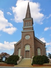 | First Presbyterian Church | 0.1 miles | 1983 |
| Talladega Courthouse Square Historic District (Boundary Increase) | 0.3 miles | 1988 | |
| Silk Stocking District | 0.4 miles | 1979 | |
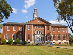 | Swayne Hall | 0.6 miles | 1990 |
| Foster Hall | 0.7 miles | 1990 |
| Talladega College Historic District (Boundary Increase) | 0.8 miles | 2021 |
| National Archives record | The nomination case file for reference 72000181 in Record Group 79. |
| Talladega County | All 27 listed properties in this county. |