 Block
From the record
One of 26 National Register listings published here for Lee County · listed in 1973 · category: District.
Sources: the case file at the National Archives · the National Register database, National Park Service
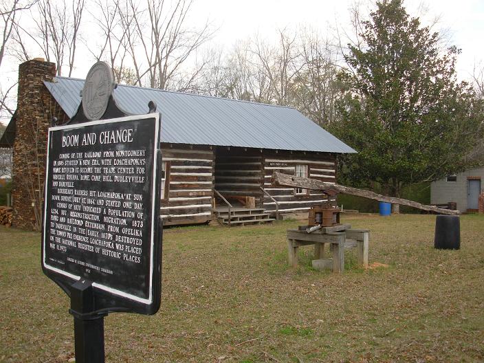
Listed on the National Register of Historic Places in 1973.
One of 26 National Register listings published here for Lee County · listed in 1973 · category: District.
Sources: the case file at the National Archives · the National Register database, National Park Service
Regional context, not property-specific evidence. The federal wildfire occurrence database lists 50 fires within 5 miles of Loachapoka Historic District between 1994 and 2019, burning about 580 acres in total. 2 started naturally. 10 were recorded as arson. Distance is straight-line from the map coordinates, so a fire counted here may appear on a neighbouring settlement's page as well.
| Reported cause | Fires |
|---|---|
| Debris and open burning | 16 |
| Missing data/not specified/undetermined | 10 |
| Arson/incendiarism | 10 |
| Equipment and vehicle use | 5 |
| Recreation and ceremony | 3 |
| Power generation/transmission/distribution | 2 |
| Natural | 2 |
| Railroad operations and maintenance | 1 |
| Smoking | 1 |
The most recent of them, most recent first, with the day each was reported and the service that recorded it.
| Date | Cause | Size | Reported by | Name on the report |
|---|---|---|---|---|
| 20 September 2010 | Debris and open burning | 54 acres | Alabama Forestry Commission | not named |
| 29 August 2003 | Debris and open burning | 3.0 acres | Alabama Forestry Commission | not named |
| 11 August 2007 | Debris and open burning | 2.0 acres | Alabama Forestry Commission | not named |
| 10 August 2007 | Debris and open burning | 2.0 acres | Alabama Forestry Commission | not named |
| 8 July 2002 | Natural | 4.0 acres | Alabama Forestry Commission | not named |
| 6 July 2000 | Arson/incendiarism | 75 acres | Alabama Forestry Commission | not named |
| 24 July 2012 | Missing data/not specified/undetermined | 6.0 acres | Alabama Forestry Commission | ECR-20120724-001 |
| 21 July 2000 | Arson/incendiarism | 4.5 acres | Alabama Forestry Commission | not named |
Regional context, not property-specific evidence. The federal mineral resources record lists 1 working within 5 miles of Loachapoka Historic District: 1 past producer. None of them still produces. What was taken out: Stone, Dimension. Distance is straight-line from the map coordinates, so a quarry counted here may appear on a neighbouring settlement's page as well.
| Where | Site | Commodity | Status | Recorded |
|---|---|---|---|---|
| James Dimension Stone Quarry | Stone, Dimension | Past Producer |
Regional context, not property-specific evidence. The National Weather Service names Loachapoka, the town this property stands in, in 19 storm reports between 1999 and 2025: 8 thunderstorm wind, 8 hail, 2 tornado, 1 flash flood. The reports record 2 injuries. Each account below is quoted exactly as the forecast office filed it, from the NOAA Storm Events Database, and each date opens the federal record of that event.
| When | Event | Place named | Harm | What the report says |
|---|---|---|---|---|
| November 2011 | Tornado (EF1) | Loachapoka | 2 hurt, $4,000,000 | A tornado initially touched down in Macon County Alabama and crossed into Lee County approximately 1 mile southwest of Lee Road 3. It continued its northeastward path causing extensive tree damage across western Lee County. Dozens of houses and mobile homes on the western side of Auburn were heavily damaged due to falling trees. Several residences were destroyed. One female and one child were injured when trees fell on a mobile home. Significant damage was also noted in the Terrace Acres neighborhood, where homes were heavily damaged from falling trees. The tornado crossed the southern edge of Auburn University's campus and caused damage to the baseball facilities at Auburn High School and nearby homes. The tornado crossed interstate 85 at US highway 280 and continued moving to the northeast toward Lake Harding. Along the lake, extensive tree damage and damage to numerous homes and boathouses occurred. Several residences were destroyed or sustained complete roof loss. The tornado continued into Harris County Georgia (See November Storm Data from WFO Peachtree City). |
| April 2003 | Hail | Loachapoka | $250,000 | The long track, steady state supercell maintained its fairly slow track east southeast across southern Lee County. Hail was reported up to baseball size near Beauregard. Several automobiles and homes were damaged. A few trees were also blown down along the path. |
| April 2009 | Tornado (EF1) | Loachapoka | $150,000 | The tornado touched down just west of the town of Loachapoka along CR-64. It then moved through Loachapoka, and nearly paralleled AL-14 for several miles, before lifting just south of AL-14 east of CR-51. Hundreds of trees were snapped off and uprooted along the path. In Loachapoka, a church sustained moderate roof damage, several barns and outbuildings suffered varying degrees of damage, and a few vehicles were damaged by the fallen trees. |
| March 2005 | Hail | Loachapoka | $23,000 | no account filed |
| October 2004 | Thunderstorm Wind | Loachapoka | $17,000 | no account filed |
| June 2003 | Thunderstorm Wind | Loachapoka | $4,000 | A few trees were blown down in and near Loachapoka. One of the trees temporarily blocked CR 20. |
| March 2001 | Thunderstorm Wind | Loachapoka | $2,000 | Several trees were knocked down along SR 14 and also on Lee Road. |
| April 2005 | Hail | Loachapoka | $1,000 | Hail up to the size of quarters fell in and near Interstate 85 across much of Lee County. The stormalso knocked several trees down near Beauregard. |
| September 1999 | Thunderstorm Wind | Loachapoka | $1,000 | Trees were knocked down and pea sized hail was reported in Loachapoka. |
| April 2025 | Thunderstorm Wind | Loachapoka | - | Trees were downed across Lee County. |
| April 2025 | Flash Flood | Loachapoka | - | Various roadways around Auburn and Opelika became impassable due to floodwaters. |
| June 2022 | Thunderstorm Wind | Loachapoka | - | Several trees uprooted and power lines downed in Loachapoka. |
| April 2021 | Hail | Loachapoka | - | Quarter size hail reported in the town of Loachpoka. |
| December 2021 | Hail | Loachapoka | - | Quarter size hail reported in the town of Loachapoka. |
| December 2021 | Thunderstorm Wind | Loachapoka | - | Several trees uprooted along Highway 14. |
| June 2016 | Thunderstorm Wind | Loachapoka | - | Several trees uprooted in the town of Loachapoka. |
| March 2005 | Hail | Loachapoka | - | Penny size hail was reported along CR 188 north of Loachapoka. |
| July 2001 | Hail | Loachapoka | - | Quarter size hail was reported in western Lee County near Loachapoka. |
| October 2006 | Hail | Loachapoka | - | no account filed |
No historic map-sheet match is published for this property yet. That does not mean no map exists. This record needs a coordinate-quality review before it can be joined to a sheet boundary. Browse the county's mapped places while that work is pending.
Other National Register properties close enough to walk or drive between, ordered by distance from this one. Both positions come from the same geocoding pass that matched these properties to their map sheets.
| Photograph | Property | Distance | Listed |
|---|---|---|---|
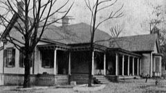 | Robert Wilton Burton House | 4.4 miles | 1980 |
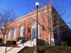 | U.S. Post Office | 5.9 miles | 1983 |
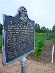 | Old Rotation | 6.3 miles | 1988 |
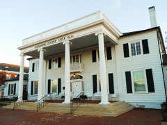 | President's Mansion, Old | 6.3 miles | 2003 |
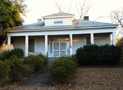 | Sunny Slope | 6.4 miles | 2009 |
 | Auburn University Historic District | 6.4 miles | 1976 |
| National Archives record | The nomination case file for reference 73000352 in Record Group 79. |
| Lee County | All 26 listed properties in this county. |