 Block
From the record
One of 20 National Register listings published here for Morgan County · listed in 1983 · category: District.
Sources: the case file at the National Archives · the National Register database, National Park Service
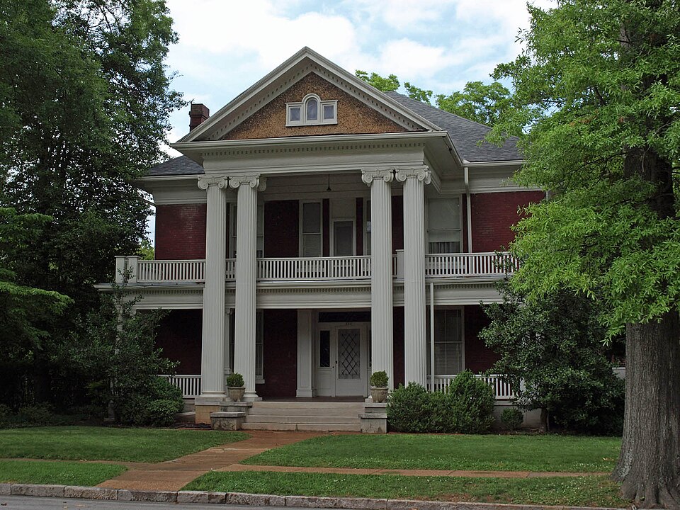
Listed on the National Register of Historic Places in 1983.
One of 20 National Register listings published here for Morgan County · listed in 1983 · category: District.
Sources: the case file at the National Archives · the National Register database, National Park Service
Regional context, not property-specific evidence. The federal wildfire occurrence database lists 39 fires within 5 miles of Albany Heritage Neighborhood Historic District between 1996 and 2016, burning about 231 acres in total. 1 started naturally. 8 were recorded as arson. Distance is straight-line from the map coordinates, so a fire counted here may appear on a neighbouring settlement's page as well.
| Reported cause | Fires |
|---|---|
| Missing data/not specified/undetermined | 12 |
| Arson/incendiarism | 8 |
| Debris and open burning | 7 |
| Equipment and vehicle use | 4 |
| Recreation and ceremony | 3 |
| Misuse of fire by a minor | 2 |
| Smoking | 1 |
| Natural | 1 |
| Railroad operations and maintenance | 1 |
The most recent of them, most recent first, with the day each was reported and the service that recorded it.
| Date | Cause | Size | Reported by | Name on the report |
|---|---|---|---|---|
| 7 September 2015 | Misuse of fire by a minor | under an acre | Alabama Forestry Commission | NOR-20150908-001 |
| 4 September 2007 | Debris and open burning | 10 acres | Alabama Forestry Commission | not named |
| 15 September 1999 | Debris and open burning | 35 acres | Alabama Forestry Commission | not named |
| 14 September 1998 | Arson/incendiarism | under an acre | Alabama Forestry Commission | not named |
| 12 August 1999 | Debris and open burning | 1.1 acres | Wheeler National Wildlife Refuge | WWSSPOTNOD |
| 8 July 2008 | Smoking | under an acre | Wheeler National Wildlife Refuge | CUTOFF ROAD 08 |
| 3 July 2012 | Missing data/not specified/undetermined | under an acre | Alabama Forestry Commission | NOR-20120703-005 |
| 23 June 2016 | Equipment and vehicle use | under an acre | Wheeler National Wildlife Refuge | ALWLR-FY16-WF-I65 BRIDGE FIRE |
Regional context, not property-specific evidence. The federal mineral resources record lists 1 working within 5 miles of Albany Heritage Neighborhood Historic District: 1 producer. All of them still produce. What was taken out: Stone, Crushed/Broken. Distance is straight-line from the map coordinates, so a quarry counted here may appear on a neighbouring settlement's page as well.
| Where | Site | Commodity | Status | Recorded |
|---|---|---|---|---|
| Plant 1 Pit | Stone, Crushed/Broken | Producer |
Regional context, not property-specific evidence. The National Weather Service names Decatur, the town this property stands in, in 128 storm reports between 1995 and 2025: 71 thunderstorm wind, 23 hail, 22 flash flood, 8 lightning. The reports record 2 injuries. Each account below is quoted exactly as the forecast office filed it, from the NOAA Storm Events Database, and each date opens the federal record of that event.
| When | Event | Place named | Harm | What the report says |
|---|---|---|---|---|
| July 1999 | Lightning | Decatur | 1 hurt, $10,000 | Lightning struck a metal awning at a large home supply store and traveled down a metal pole into the parking lot shocking a man who was loading lumber under the awning. The man was temporarily blinded by the lightning strike but was able to transport himself to a nearby hospital. Doctors kept him overnight but he displayed no serious injuries other than a small exit wound on his left ear. The telephone system in the store was damaged by the lightning strike. |
| March 1996 | Lightning | Decatur | 1 hurt, $2,000 | no account filed |
| July 1996 | Thunderstorm Wind | Decatur | $30,000 | no account filed |
| April 1996 | Thunderstorm Wind | Decatur | $28,000 | no account filed |
| June 2011 | Thunderstorm Wind | Decatur | $25,000 | Trees and power lines were reported down on the 1700 block of Beltline road. A roof was also taken off of an Asian Grill restaurant by the winds. |
| August 2012 | Flash Flood | Decatur | $20,000 | Rainfall of 2 to 3 inches in less than one hour, much of it occurring in less than one half hour, fell across downtown Decatur and nearby areas causing flash flooding. Several roads were closed or were impassible. A mother and child were stranded in their vehicle in flood water at the intersection of Eighth Street and Church Street Northeast. Flood water was up to the base of car windows on Lee Street at the Courthouse. The City Hall basement had flooding as well. |
| April 2006 | Hail | Decatur | $20,000 | Hail two inches in diameter produced damage to several vehicles and minor roof damage to three homes. |
| June 2002 | Lightning | Decatur | $20,000 | Two adjacent homes were struck by lightning in Decatur. Fires were ignited in both homes and each sustained damage. |
| April 1998 | Thunderstorm Wind | Decatur | $20,000 | no account filed |
| July 1997 | Flash Flood | Decatur | $18,000 | Heavy rains, about an inch in 15 minutes, snarled traffic and flooded many downtown roads in Decatur. Numerous cars were flooded out and water reportedly got into the city hall and courthouse buildings but not significant damage occurred. |
| May 2024 | Thunderstorm Wind | Decatur | $15,000 | Several trees and powerlines were reported down in Decatur. |
| June 2014 | Thunderstorm Wind | Decatur | $15,000 | Several trees and power lines were downed by thunderstorm winds. |
| September 2002 | Lightning | Decatur | $15,000 | Lightning struck two homes in the Decatur area. Both homes caught on fire and sustained varying degrees of damage. No injuries were reported. |
| January 1997 | Thunderstorm Wind | Decatur | $15,000 | no account filed |
| April 2011 | Thunderstorm Wind | Decatur | $10,000 | The roof of Emmanuel church was lifted and torn off and blown into the adjacent parking lot. |
| April 1998 | Thunderstorm Wind | Decatur | $10,000 | Trees and power lines were reported down southwest of Decatur. |
| May 1996 | Thunderstorm Wind | Decatur | $10,000 | no account filed |
| April 1996 | Thunderstorm Wind | Decatur | $10,000 | no account filed |
| July 1997 | Lightning | Decatur | $8,000 | A nearly direct lightning strike to an electrical substation blew out power to about 15 percent of Decatur for almost an hour. |
| April 2009 | Thunderstorm Wind | Decatur | $6,000 | A tree was uprooted and fell on a house at 606 Ferry Street. |
| May 1997 | Thunderstorm Wind | Decatur | $6,000 | Several trees were uprooted in Decatur and Hartselle. There were also some power outages due to trees falling on the lines. |
| April 2025 | Thunderstorm Wind | Decatur | $5,000 | A tree fell on a house along 5th Avenue. |
| April 2014 | Thunderstorm Wind | Decatur | $5,000 | A tree was downed onto a powerline by thunderstorm winds on Chapel Hill Road, near Decatur, Alabama. |
| October 2014 | Thunderstorm Wind | Decatur | $5,000 | Power lines were downed due to thunderstorm winds. |
| September 2012 | Thunderstorm Wind | Decatur | $5,000 | A tree was downed by thunderstorm winds just north of Decatur. |
| January 1997 | Hail | Decatur | $5,000 | no account filed |
| November 1996 | Thunderstorm Wind | Decatur | $5,000 | no account filed |
| April 2009 | Thunderstorm Wind | Decatur | $4,000 | A tree was blown down on Johnston Street SE onto a house. |
| June 2001 | Thunderstorm Wind | Decatur | $4,000 | Several trees were blown down in and around the city of Decatur. |
| February 1997 | Thunderstorm Wind | Decatur | $4,000 | no account filed |
| February 1997 | Lightning | Decatur | $4,000 | no account filed |
| October 2001 | Thunderstorm Wind | Decatur | $3,000 | Numerous trees were blown down just southwest of the city of Decatur. |
| July 2000 | Thunderstorm Wind | Decatur | $3,000 | Trees and power lines were knocked down across the city of Decatur. |
| April 1999 | Thunderstorm Wind | Decatur | $3,000 | The Emergency Management Agency reported at least one telephone pole holding a warning siren was snapped off during a thunderstorm. Time is estimated. |
| June 2017 | Thunderstorm Wind | Decatur | $2,000 | Multiple trees were knocked down in Decatur. |
| June 2014 | Lightning | Decatur | $2,000 | Lightning struck and damaged a barn. |
| May 2002 | Thunderstorm Wind | Decatur | $2,000 | A few trees were blown down in Decatur. |
| September 2000 | Thunderstorm Wind | Decatur | $2,000 | A few trees were blown down in and around the city of Decatur. |
| April 1998 | Hail | Decatur | $2,000 | no account filed |
| October 1997 | Hail | Decatur | $2,000 | no account filed |
| August 2024 | Thunderstorm Wind | Decatur | $1,000 | A tree was reported down in the roadway on Jackson Street at this location. Time was estimated from radar. |
| May 2022 | Thunderstorm Wind | Decatur | $1,000 | A tree was reported down near the intersection of 3rd Avenue and 4th Street. |
| June 2013 | Thunderstorm Wind | Decatur | $1,000 | Thunderstorm winds knocked trees down at Vine Street and Ferry Street. |
| July 2008 | Thunderstorm Wind | Decatur | $1,000 | A few trees and power lines were downed by thunderstorm winds. |
| April 2006 | Tornado (F0) | Decatur | $1,000 | A tornado briefly touched down just east of Decatur along highway 20 and produced some light tree damage and heavily damaged a large billboard sign near Interstate 65 before dissipating. |
| October 1997 | Thunderstorm Wind | Decatur | $1,000 | no account filed |
| May 2024 | Thunderstorm Wind | Decatur | $500 | A tree was reported down on a house on Oak Street in NE Decatur. |
| August 2023 | Thunderstorm Wind | Decatur | $500 | A tree was knocked down blocking the road on Finley Drive NW at the railroad track. Time estimated by radar. |
| July 2020 | Thunderstorm Wind | Decatur | $500 | A thunderstorm produced isolated wind damage between Grove Street and Madison Street Northwest. Two portions of a very large tree were blown down, knocking down adjacent power lines. This same thunderstorm produced a waterspout on nearby Lake Wheeler. Time estimated by radar. |
| March 2006 | Thunderstorm Wind | Decatur | $500 | Trees were blown down along Highway 36 between Highway 67 and Interstate 65. A billboard sign was blown onto a mobile home on Sixth Avenue. |
| May 2021 | Thunderstorm Wind | Decatur | $200 | A tree was knocked down at Banks-Caddell Elementary School. Time estimated by radar. |
| August 2023 | Flood | Decatur | - | Lee Street blocked due to flooding. Depth of water unknown. |
| July 2021 | Flash Flood | Decatur | - | Flooding reported at the intersection of Church and 6th Avenue in Decatur. |
| September 2021 | Flash Flood | Decatur | - | Lee Street in front of the Courthouse is under water. Parts of Church Street also underwater, affecting businesses. Fire and Police Dept assisting motorists in the area. Depth of water unknown. |
| February 2019 | Flood | Decatur | - | Church Street and east of 6th Avenue flooded in Decatur. Several other streets locally flooding, but water depth unknown at this time. |
| August 2019 | Thunderstorm Wind | Decatur | - | A large 100 year old oak tree was uprooted onto a 1903 home at 722 Ferry Street in Decatur. |
| August 2019 | Thunderstorm Wind | Decatur | - | There are multiple reports of trees and power lines down throughout the city limits of Decatur. Numerous power outages reported by broadcast media. |
| April 2018 | Thunderstorm Wind | Decatur | - | Roof damage was reported to a building on 2nd Avenue SE. |
| April 2018 | Thunderstorm Wind | Decatur | - | Numerous trees were knocked down on 4th Avenue NW. |
| April 2018 | Thunderstorm Wind | Decatur | - | Several trees were knocked down. One tree was knocked down onto a house on 8th Avenue SE. |
No historic map-sheet match is published for this property yet. That does not mean no map exists. This record needs a coordinate-quality review before it can be joined to a sheet boundary. Browse the county's mapped places while that work is pending.
Other National Register properties close enough to walk or drive between, ordered by distance from this one. Both positions come from the same geocoding pass that matched these properties to their map sheets.
| Photograph | Property | Distance | Listed |
|---|---|---|---|
| New Decatur-Albany Residential Historic District (Boundary Increase) | under 500 feet | 2004 | |
| Simpson's Florist (Additional Documentation) | 0.4 miles | 2023 | |
| Princess Theatre | 0.5 miles | 2025 | |
 | Princess Theater | 0.5 miles | 1995 |
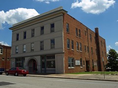 | Cotaco Opera House | 0.5 miles | 1986 |
 | New Decatur-Albany Historic District (Boundary Increase) | 0.6 miles | 1999 |
| National Archives record | The nomination case file for reference 83002981 in Record Group 79. |
| Morgan County | All 20 listed properties in this county. |