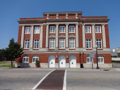
| March 2025 | Tornado (EF1) | Dothan | 5 hurt, $500,000 | A tornado touched down in Dothan, AL and produced EF-1 damage along its entire length. The maximum winds were estimated to be 105 mph. The tornado initially touched down near Rimson Rd. and then travelled east northeast along Southland Dr. Damage began to become less scattered as the tornado crossed South Bell Dr., continuing to snap and uproot trees, a few of which fell on homes. The tornado then entered a business district where it did substantial damage to the Dothan Preparatory Academy. Several sections of the roof were removed and several windows were broken. Unfortunately, a few students suffered minor injuries when a portion of the gymnasium s roof was removed. Some of the roof was found blocks away. The tornado was at its widest after crossing U.S. 231. Several small businesses and a warehouse had windows blown out and sections of their roofs removed. There were also several power poles snapped in this vicinity. The tornado then proceeded east northeast through residential neighborhoods, snapping and uprooting trees. Once again, some fell on houses and one crushed a car. The track went down Chalker St. and then along or north of East Selma St. The tornado damaged the roof of a doctor s office on Haven Dr. and then uprooted a few trees before lifting just shy of Southeast Alabama Medical Center. |
| April 2011 | Thunderstorm Wind | Dothan | 2 hurt, $100,000 | Numerous trees and power lines were blown down across the county. Ten structures were damaged and 2 minor injuries occurred from trees falling on homes. The monetary damage figure provided is a rough estimate. |
| October 1995 | Tornado (F1) | Dothan | 2 hurt, $90,000 | A tornado downed trees and damaged two businesses. A person was injured at each business. (Length and width are estimated.) |
| May 1994 | Thunderstorm Wind | Dothan | 1 hurt, $50,000 | Five trees were reported downed on Highway 109 south of Dothan with a minor injury to the occupant of a car. |
| September 2011 | Thunderstorm Wind | Dothan | 1 hurt, $5,000 | A tree was blown down onto a house with injuries on Ross Clark Circle SE. The monetary damage figure provided is a rough estimate. |
| April 2015 | Thunderstorm Wind | Dothan | $2,200,000 | Numerous trees and power lines were blown down across Dothan. At the peak, 40,000 customers were without power. Structural damage occurred to Houston County Farm Center with a preliminary damage assessment of major damage to 33 homes and minor damage to 115 homes. Also some cars had trees on them. The assessment listed the damage total at over $2.2 million. No injuries occurred in the storm itself, but 3 minor injuries occurred during cleanup. |
| August 2023 | Thunderstorm Wind | Dothan | $100,000 | There were at least 25 areas with trees down within the city of Dothan. |
| February 2013 | Flash Flood | Dothan | $50,000 | Multiple road were closed due to flash flood damage. The bulk of the road closures were from near Dothan southeastward through Ashford to Gordon. Some roads include Bruner Pond, Fowler, Womack, Pineview, and Turnpike. Monetary damage was estimated. |
| August 2009 | Thunderstorm Wind | Dothan | $50,000 | Five vehicles were damaged and minor structural damage occurred at the Houston County Road Department facility on East Webb Road and Ross Clark Circle. |
| July 1994 | Thunderstorm Wind | Dothan | $50,000 | Thunderstorm winds uprooted a number of trees and downed power lines in the Rehobeth community located about 8 miles south-southeast of Dothan. One 100-year-old pecan tree fell on a house causing minor damage. |
| July 2012 | Thunderstorm Wind | Dothan | $30,000 | A large oak tree blew down in Dothan and damaged a building and two ambulances. Monetary damage was estimated. |
| July 1995 | Thunderstorm Wind | Dothan | $30,000 | Dothan State Police reported two houses with roof damage in the southeast corner of the city of Dothan. Trees, power lines, and wooden fences were also reported downed by the wind. |
| January 1997 | Thunderstorm Wind | Dothan | $30,000 | no account filed |
| April 2015 | Thunderstorm Wind | Dothan | $25,000 | A large tree was blown down onto Church street with a car demolished. |
| June 2013 | Thunderstorm Wind | Dothan | $25,000 | A tree fell on the roof of a home on Wheat Street. Monetary damage was estimated. |
| June 2013 | Thunderstorm Wind | Dothan | $25,000 | A tree fell on the roof of a home on Galaxie Drive. Monetary damage was estimated. |
| June 2006 | Thunderstorm Wind | Dothan | $25,000 | A county official reported numerous trees and power lines down throughout the city. |
| June 2002 | Lightning | Dothan | $25,000 | Lightning sparked a house fire. Reported by the Houston County EMA. |
| January 2022 | Thunderstorm Wind | Dothan | $20,000 | A snapped power pole landed on a car in Dothan. |
| June 2000 | Thunderstorm Wind | Dothan | $15,000 | Numerous trees and power lines down with scattered power outages. Reported by the Houston County EMA. |
| March 2025 | Thunderstorm Wind | Dothan | $10,000 | Several trees were blown down on Memphis Street, impacting at least one home. |
| May 2019 | Tornado (EF0) | Dothan | $10,000 | An EF0 tornado touched down near the Dothan City Cemetary and moved to the northeast for about one mile before lifting right before Highway 431 and 210. It knocked down a few gravestones before producing minor damage to a nearby building and trees. It crossed Main Street and impacted another business producing minor roof and pillar damage along with snapped trees. It continued to move northeast with minor roof damage to a building and produced a clear, narrow path through a wooded area and across an open field. Max winds were estimated near 80 mph. |
| July 2004 | Thunderstorm Wind | Dothan | $10,000 | A satellite dish on the roof of the WDHN-TV building was blown off. Downed trees around the building. Reported by a WDHN-TV meteorologist. |
| August 1999 | Thunderstorm Wind | Dothan | $10,000 | Houston County EMA reported numerous downed trees and power lines with scattered power outages in west Dothan. |
| April 2015 | Thunderstorm Wind | Dothan | $5,000 | A large awning was blown into the median of Ross Tucker Circle from a nearby structure. A picture was posted via WDHN-TV facebook. |
| April 2015 | Thunderstorm Wind | Dothan | $5,000 | Two trees and a power pole were down on Tate Drive near Rip Hewes stadium. |
| July 2015 | Lightning | Dothan | $5,000 | Lightning struck a transformer near the 1100 block of Valley Forge Road, igniting the transformer on fire. Damage was estimated. |
| April 2013 | Thunderstorm Wind | Dothan | $5,000 | Numerous trees and power lines were blown down around Dothan and across northern Houston county. Monetary damage was estimated. |
| August 2011 | Thunderstorm Wind | Dothan | $5,000 | A tree was blown down onto a house in downtown Dothan. The monetary damage figure provided is a rough estimate. |
| June 2002 | Thunderstorm Wind | Dothan | $5,000 | A large tree fell on a vehicle at a trailer park. Some trees were knocked down across the city. Reported by the Houston County Sheriff. |
| January 1999 | Thunderstorm Wind | Dothan | $5,000 | Downed trees blew two transformers disrupting power to 30 Dothan residents. |
| November 1995 | Tornado (F0) | Dothan | $5,000 | A small tornado downed trees and power lines and overturned a travel trailer. |
| July 2012 | Thunderstorm Wind | Dothan | $4,000 | Numerous trees were blown down near Dothan. Monetary damage was estimated. |
| June 2018 | Thunderstorm Wind | Dothan | $3,000 | Scattered trees and power lines were blown down. |
| June 2013 | Thunderstorm Wind | Dothan | $3,000 | Trees were blown down at the Dothan Country Club downtown and along main street downtown. |
| June 2012 | Thunderstorm Wind | Dothan | $3,000 | Multiple trees were blown down in the Dothan area. Monetary damage was estimated. |
| February 2012 | Thunderstorm Wind | Dothan | $3,000 | A trained spotter reported large oak trees snapped in half around Dothan. Monetary damage was estimated. |
| June 2008 | Thunderstorm Wind | Dothan | $3,000 | Several trees and power lines were down on Omussee Road. |
| August 2006 | Thunderstorm Wind | Dothan | $3,000 | The Alabama DOT reported several downed trees and utility poles. |
| February 2003 | Thunderstorm Wind | Dothan | $3,000 | Trees and power lines down. Reported by the Houston County EMA. |
| March 2026 | Thunderstorm Wind | Dothan | $2,000 | Power lines were down near the intersection of Floyd and South Lena. |
| March 2026 | Thunderstorm Wind | Dothan | $2,000 | A power line was down on South Lena Street in Dothan. |
| July 2024 | Thunderstorm Wind | Dothan | $2,000 | A resident living by the Harley Davidson reported on social media that a large tree knocked over a power line. |
| May 2022 | Thunderstorm Wind | Dothan | $2,000 | A tree fell onto a power line on Denton Road and Junaluska Ave in north Dothan resulted in the closure of Denton Road. |
| July 2014 | Thunderstorm Wind | Dothan | $2,000 | Power lines were blown down around Dothan. |
| June 2014 | Thunderstorm Wind | Dothan | $2,000 | The public reported the awning of the Fast Stop Gas Station was blown down. |
| March 2012 | Thunderstorm Wind | Dothan | $2,000 | The windows were knocked out of sliding glass doors of an apartment complex as well as the back window of a car in a parking lot on Sioux Street. This was reported by the public on the WTVY-TV facebook page. Monetary damage was estimated. |
| August 2010 | Lightning | Dothan | $2,000 | A house was struck by lightning, which resulted in a hole in the roof and the loss of 4 to 5 shingles. The monetary damage figure provided is a rough estimate. |
| August 2007 | Thunderstorm Wind | Dothan | $2,000 | Several trees and power lines were down. |
| June 2000 | Thunderstorm Wind | Dothan | $2,000 | A tin shed was destroyed and a few trees down on WG Bond Road. Reported by the Houston County EMA. |
| June 2000 | Thunderstorm Wind | Dothan | $2,000 | A storage shed was blown over. Reported by the Houston County EMA. |
| August 2000 | Thunderstorm Wind | Dothan | $2,000 | Power lines down at State Road 52 East and Livingston Loop. Reported by the Houston County EMA. |
| January 2020 | Thunderstorm Wind | Dothan | $1,000 | A screen door was ripped off due to strong winds in the Dothan Garden District. |
| February 2013 | Flash Flood | Dothan | $1,000 | Water flowed into the garage of a residence in the Lavor Hills subdivision in Dothan. There was also flooding of low lying areas and some roads ongoing. Monetary damage was estimated. |
| August 2002 | Thunderstorm Wind | Dothan | $1,000 | Several downed trees along U.S. Highway 84. Reported by the Houston County EMA. |
| May 2001 | Thunderstorm Wind | Dothan | $1,000 | Several large trees down in Dothan. Reported by local media. |
| May 1999 | Thunderstorm Wind | Dothan | $1,000 | Downed trees reported by Houston County EMA. |
| May 1999 | Thunderstorm Wind | Dothan | $1,000 | Trees down reported by Houston County EMA. |
| July 2014 | Thunderstorm Wind | Dothan | $500 | A tree was blown down near the intersection of Moore Street and South Park Street. |
| July 2007 | Thunderstorm Wind | Dothan | $500 | A few trees and utility poles were down. There were numerous downed branches throughout the city. |
 Block