| September 1996 | Flash Flood | Cullman | 1 hurt, $30,000 | no account filed |
| March 2015 | Lightning | Cullman | 1 hurt | A 27 year old female was struck by lightning while leaning against a metal door frame. Victim was transported to a local hospital with non-life threatening injuries. |
| April 2008 | Thunderstorm Wind | Cullman | 1 hurt | Several homes and businesses were heavily damaged in the downtown area, including the Cullman Shopping Center. Several power lines and large trees were also blown down. Some trees fell on houses and vehicles, heavily damaging them. A fuel tank spill resulted due to roof debris falling from a nearby building. The spill required a temporary closure of a one half mile radius near the intersection of Highways 278 and 31. Locations affected by the heaviest damage included the St. Joseph area of Cullman county near Katherine and Ann Street, locations along 278 north, and Arnold Street. Power outages affected as many as 4800 customers in Cullman County. An EMS/weather spotter reported that a female resident experienced a minor injury when a tree limb fell into the home and struck her on the head. |
| October 2010 | Thunderstorm Wind | Cullman | $200,000 | Significant building and roof damage occurred in downtown Cullman. Windows and some walls were blown out. Power lines were knocked down and numerous power outages resulted. At Sports Center on highway 31N, Seadoos and Four-Wheelers were flipped over. Big trees were also blown down near the Catholic Church. |
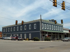
| August 2006 | Thunderstorm Wind | Cullman | $200,000 | A microburst produced brief but damaging winds up to 80 mph within the historic warehouse district of downtown Cullman. The tin roof on the north side of one building was peeled off. Several bricks were blown off of a retaining wall of another building. The high winds also blew out several windows, damaged signage along highway 31 and a garage door at an area business. |
| April 2006 | Tornado (F1) | Cullman | $125,000 | A short lived F1 tornado struck a chicken farm near the Pleasant grove community. Two well built chicken houses were collapsed with most of the metal roofing flung into nearby trees and twisted around their branches approximately 40 to 50 yards away. A third chicken house was also moderately damaged. A small wooden shed was completely demolished and a feed bin attached to one of the chicken houses was completely toppled over. |
| March 1996 | Thunderstorm Wind | Cullman | $100,000 | no account filed |
| January 1997 | Thunderstorm Wind | Cullman | $80,000 | no account filed |
| August 2000 | Thunderstorm Wind | Cullman | $70,000 | Numerous trees and power lines were blown down near Cullman. The Wal-Mart store sustained damage when wind destroyed the metal framed Garden Center. The flying debris damaged a dozen vehicles in the parking lot. |
| October 1997 | Hail | Cullman | $65,000 | no account filed |
| June 2025 | Thunderstorm Wind | Cullman | $50,000 | Trees and power lines were knocked down in a swath across central through east central Cullman. This includes Ward Avenue, Swafford Circle SW, Parker Circle SW, Katie Lane SW, Logan Street SW, Interbitzen Street at Hickory Avenue, 2nd Street at Cleveland Avenue SW, Tidwell Street, 4th Avenue SE, 9th Street SE, Morningside Drive SW, Elm Drive SE, and Welti Road SE. |
| April 1998 | Hail | Cullman | $50,000 | no account filed |
| August 1996 | Thunderstorm Wind | Cullman | $45,000 | no account filed |
| April 2006 | Hail | Cullman | $30,000 | Golf ball size hail was reported at the intersection of U.S. highway 278 and Interstate 65 interchange. The hail produced slight to moderate damage to several vehicles and to roofs of five homes in this vicinity. |
| May 1998 | Thunderstorm Wind | Cullman | $20,000 | Minor damage was done to a residence and a boat shed in the Trimble area. |
| April 1996 | Thunderstorm Wind | Cullman | $20,000 | no account filed |
| March 1997 | Thunderstorm Wind | Cullman | $18,000 | no account filed |
| September 1996 | Thunderstorm Wind | Cullman | $18,000 | no account filed |
| June 2011 | Thunderstorm Wind | Cullman | $15,000 | Three or four large oak trees were blown down. Power lines were brought down as well in the area. |
| June 1999 | Thunderstorm Wind | Cullman | $15,000 | Several trees were blown down in Cullman. One mobile home had its roof ripped off and at least one vehicle was severely damaged from falling debris. |
| October 1997 | Thunderstorm Wind | Cullman | $15,000 | no account filed |
| June 1996 | Hail | Cullman | $15,000 | no account filed |
| June 2025 | Thunderstorm Wind | Cullman | $10,000 | Trees and power lines were knocked down on Highland Drive, Demorie Avenue, Regalwood Circle, and Mitchell Road on the north side of Cullman. Time estimated by radar. |
| March 2023 | Thunderstorm Wind | Cullman | $10,000 | Widespread trees were knocked down across the city of Cullman. |
| August 2023 | Thunderstorm Wind | Cullman | $10,000 | Windows were blown out in the public library, damaging shelves and books inside. Time estimated by radar. |
| May 2008 | Thunderstorm Wind | Cullman | $10,000 | Thunderstorm winds knocked trees on power lines resulting in power outages in the Bethel community. |
| May 1998 | Hail | Cullman | $10,000 | Golf ball size was reported in Cullman. |
| July 1995 | Thunderstorm Wind | Cullman | $10,000 | Power lines and trees were knocked down by the wind west of Cullman on United States 278. Lightning struck the Cullman County courthouse damaging emergency management and law enforcement radio equipment. Wind destroyed a shed and damaged a barn at Holly Pond on County Road 91. |
| July 1996 | Thunderstorm Wind | Cullman | $10,000 | no account filed |
| January 1997 | Hail | Cullman | $9,000 | no account filed |
| June 1995 | Thunderstorm Wind | Cullman | $8,000 | Trees were reported down in the Guthrie Crossroads area about 10 miles west of Cullman and in the area six miles north of Cullman. |
| June 1995 | Thunderstorm Wind | Cullman | $6,000 | Trees were reported down in the Guthrie Crossroads area about 10 miles west of Cullman and in the area six miles north of Cullman. |
| June 2025 | Thunderstorm Wind | Cullman | $5,000 | Trees were knocked down on County Road 1408 in Cullman. |
| May 2025 | Thunderstorm Wind | Cullman | $5,000 | Multiple trees were knocked down into the roadway blocking Sprit Life Church. Time estimated by radar. |
| March 2023 | Thunderstorm Wind | Cullman | $5,000 | A tree was knocked down across the road on Rosemont Avenue. |
| August 2015 | Thunderstorm Wind | Cullman | $5,000 | A couple of trees were downed by thunderstorm winds. |
| April 1994 | Thunderstorm Wind | Cullman | $5,000 | Thunderstorm winds damaged a house and barn and destroyed a mobile home just west of Holly Pond. Three-quarter inch hail was reported at Fairview about 10 miles northeast of Cullman. |
| January 1997 | Hail | Cullman | $5,000 | no account filed |
| January 2013 | Thunderstorm Wind | Cullman | $4,000 | Trees were knocked down by thunderstorm winds onto St Joseph Drive and Scenic Lane in Cullman, Alabama. The time was estimated by radar. |
| April 2001 | Hail | Cullman | $4,000 | Golf ball size hail was reported at the intersection of Interstate 65 and US 278 near Cullman. |
| July 1995 | Thunderstorm Wind | Cullman | $4,000 | Numerous trees were blown down in the city of Cullman. Torrential rain with between four and six inches falling in three hours forced the evacuation of several families from the Homewood Trailer Park and closed U. S. Highway 31 on the south side of Cullman. Waters had receded by 2000 CDT. |
| April 1998 | Hail | Cullman | $3,000 | Quarter size hail was reported in Cullman. |
| June 2025 | Thunderstorm Wind | Cullman | $2,000 | Power lines were knocked down at 255 CR 1435. Time estimated by radar. |
| June 2011 | Thunderstorm Wind | Cullman | $2,000 | A tree was knocked down on Hickory Avenue. |
| May 2010 | Thunderstorm Wind | Cullman | $2,000 | Trees were blown down near Eva Road and Forrest Avenue. |
| July 2008 | Thunderstorm Wind | Cullman | $2,000 | A tree was downed by thunderstorm winds along highway 278 near Cullman. This storm continued to move east southeast and downed large limbs, which damaged a carport in the Spring Hill community. |
| April 2006 | Lightning | Cullman | $2,000 | Lightning struck a home, producing minor damage due to a fire that was started by the strike. |
| July 2001 | Thunderstorm Wind | Cullman | $2,000 | Trees were blown down just west and southwest of the city of Cullman. Some trees were also knocked down near Holly Pond. |
| June 2000 | Thunderstorm Wind | Cullman | $2,000 | Trees were blown down near Cullman. |
| August 2000 | Thunderstorm Wind | Cullman | $2,000 | A plate glass window was blown out of a restaurant on US 31 and SR 157 in Cullman. |
| February 1997 | Flash Flood | Cullman | $2,000 | no account filed |
| June 2025 | Thunderstorm Wind | Cullman | $1,000 | A large hardwood tree was knocked down on Angie Drive. |
| June 2025 | Thunderstorm Wind | Cullman | $1,000 | A large hardwood tree was knocked down adjacent to a home. |
| August 2023 | Thunderstorm Wind | Cullman | $1,000 | A large tree was knocked down on a vehicle on Lakehill street near Highland Drive. Time was estimated from radar data. |
| August 2023 | Thunderstorm Wind | Cullman | $1,000 | Trees were knocked down at 1425 CR 110. Time estimated by radar. |
| August 2023 | Thunderstorm Wind | Cullman | $1,000 | Trees were knocked down at 103 U.S. Highway 278 West. Time estimated by radar. |
| August 2023 | Thunderstorm Wind | Cullman | $1,000 | Trees were knocked down at 3820 CR 509. Time estimated by radar. |
| August 2023 | Thunderstorm Wind | Cullman | $1,000 | Trees were knocked down at 112 Veterans Drive. Time estimated by radar. |
| January 2017 | Thunderstorm Wind | Cullman | $1,000 | One small tree and one large tree down near the intersection of Denson Ave and Beth St in Cullman. |
| June 2017 | Thunderstorm Wind | Cullman | $1,000 | Numerous trees were knocked down in Cullman. |
 Block