 Block
From the record
One of 15 National Register listings published here for Limestone County · listed in 1985 · category: Building.
Sources: the case file at the National Archives · the National Register database, National Park Service
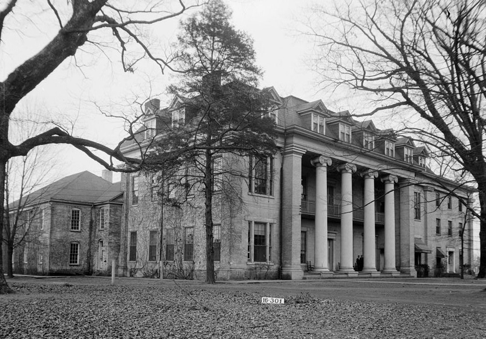
Listed on the National Register of Historic Places in 1985.
One of 15 National Register listings published here for Limestone County · listed in 1985 · category: Building.
Sources: the case file at the National Archives · the National Register database, National Park Service
Regional context, not property-specific evidence. The federal wildfire occurrence database lists 76 fires within 5 miles of Founders Hall between 1994 and 2020, burning about 292 acres in total. None started naturally. 3 were recorded as arson. Distance is straight-line from the map coordinates, so a fire counted here may appear on a neighbouring settlement's page as well.
| Reported cause | Fires |
|---|---|
| Debris and open burning | 38 |
| Equipment and vehicle use | 10 |
| Missing data/not specified/undetermined | 10 |
| Recreation and ceremony | 6 |
| Smoking | 5 |
| Misuse of fire by a minor | 3 |
| Arson/incendiarism | 3 |
| Power generation/transmission/distribution | 1 |
The most recent of them, most recent first, with the day each was reported and the service that recorded it.
| Date | Cause | Size | Reported by | Name on the report |
|---|---|---|---|---|
| 5 September 1999 | Misuse of fire by a minor | 30 acres | Alabama Forestry Commission | not named |
| 29 September 2016 | Equipment and vehicle use | under an acre | Alabama Forestry Commission | 20160929-7 |
| 25 September 2019 | Arson/incendiarism | 2.0 acres | Alabama Forestry Commission | 20190925-15 |
| 23 September 1999 | Debris and open burning | under an acre | Alabama Forestry Commission | not named |
| 20 September 2019 | Equipment and vehicle use | under an acre | Alabama Forestry Commission | 20190920-5 |
| 2 September 2015 | Missing data/not specified/undetermined | under an acre | Alabama Forestry Commission | NOR-20150902-001 |
| 2 September 2006 | Debris and open burning | 5.0 acres | Alabama Forestry Commission | not named |
| 13 September 1998 | Equipment and vehicle use | 5.0 acres | Alabama Forestry Commission | not named |
Regional context, not property-specific evidence. The federal mineral resources record lists 1 working within 5 miles of Founders Hall: 1 producer. All of them still produce. What was taken out: Phosphorus-Phosphates. Distance is straight-line from the map coordinates, so a quarry counted here may appear on a neighbouring settlement's page as well.
| Where | Site | Commodity | Status | Recorded |
|---|---|---|---|---|
| Gilbert Mine | Phosphorus-Phosphates | Producer |
Regional context, not property-specific evidence. The National Weather Service names Athens, the town this property stands in, in 182 storm reports between 1994 and 2026: 100 thunderstorm wind, 41 hail, 15 lightning, 13 flash flood. The reports record 15 injuries. Each account below is quoted exactly as the forecast office filed it, from the NOAA Storm Events Database, and each date opens the federal record of that event.
| When | Event | Place named | Harm | What the report says |
|---|---|---|---|---|
| May 1997 | Tornado (F2) | Athens | 12 hurt, $2,300,000 | A tornado, rated at F2 on the Fujita scale, struck the southern and eastern sections of Athens in Limestone County. The tornado path began about 2 miles south-southwest of Athens near the intersection of Sanderfer Road and County Road 45. The tornado moved northeasterly crossing through southern and eastern sections of Athens. It crossed the intersection of State Road 127 and US 72 where several businesses were damaged. Some damage was caused at Athens Middle School.The tornado continued northeast dissipating near the intersection of Proyr Street and US 31 near Athens High School.According to EMA officals, siz homes were destroyed, 14 homes sustained major damage, and an additional 14 homes had minor damage. Three apartment buildings, each with eight units, were damaged, 13 businesses had major damage, and two businesses reported minor damage.Of the 12 injuries, two were described as serious. |
| July 2010 | Lightning | Athens | 1 hurt | One female was struck and injured by lightning while on Highway 31 North. |
| October 1997 | Lightning | Athens | 1 hurt | Lightning struck a utility worker repairing a damaged utility pole. He was knocked unconscious for several minutes. |
| October 1997 | Lightning | Athens | 1 hurt | A man was struck by lightning in Elkmont. He was treated and released from the hospital. |
| June 1994 | Thunderstorm Wind | Athens | $5,000,000 | no account filed |
| December 2024 | Tornado (EF1) | Athens | $2,400,000 | The tornado began by snapping a few large softwood branches on Sanderfer Road just west of the intersection with Jefferson Street. From there, the tornado skipped north-northeast, snapping several|larger hardwood trees just south of an apartment complex on Southwind Drive. The tornado continued northward, snapping softwood branches and a few trees on Commercial Drive, south of Highway 72. The tornado produced its first building damage at the KFC restaurant at this location, blowing a portion of the roof off and strewing it across the highway and into the parking lot of the Taco Bell across the street. The tornado moved northward into downtown Athens. Several power poles were snapped along Madison Street and Jefferson Stret. Quite a few large soft and hardwood trees were snapped and uprooted in this area as well, beginning the EF1 damage portion of the path. Considerable roof damage and debris was then strewn throughout the square near the Courthouse in downtown Athens. Several buildings on every side of the square had portions of their roof removed, beginning with the roof completely torn off of the CEI Bookstore at the intersection of Green Street and Marion Street. From there, numerous other buildings downtown had at least some form of roof damage, with debris strewn to the north-northeast one to two blocks, between the intersections of Washington and Market Streets along Marion Street. Though the Limestone County Courthouse thankfully didn't sustain any damage other than their weathervane on the dome of the roof being bent, the very large oak tree beside the staircase wasn't as fortunate; the 100-year old tree was uprooted. From here, the tornado caused major damage just north-northeast at the Veterans Memorial Park, downing iron fencing and hurling a helicopter that was anchored to a metal pole about 50-60 feet to the west. The worst-looking building damage occurred at the intersection of Monroe and Pryor Streets, where an old warehouse was completely destroyed. It was determined that no anchor bolts were noted along the base of the cinderblock walls of the warehouse with the exception of some rebar that was found near where the overhead doors were located. Winds peaked at 100 mph with a peak path width of 160 yards at the destroyed warehouse location, with additional roof damage observed that followed the train tracks moving north-northeast. Several other businesses in this area had 20-50% (at least) of their roofs destroyed or blown off, strewing tin and debris downstream. Sporadic softwood trees were snapped or uprooted toward the end of the tornado path, along with snapping of large branches on Wilkinson Street just southwest of Airport Road. |
| August 2007 | Thunderstorm Wind | Athens | $1,000,000 | Large oak tree and other smaller trees were blown down on highway 72 just west of the Athens city limits. |
| August 2011 | Lightning | Athens | $500,000 | A lightning strike from severe thunderstorms moving through Limestone county caused a fire that burned the Athens Church of God to the ground. |
| December 2000 | Tornado (F2) | Athens | $150,000 | A second tornado began 5.1 miles west-northwest of Athens just south of O'Neal. The tornado travelled in a northeasterly direction crossing SR 99 where several houses were damaged heavily. Continuing northeast the tornado crossed CR 63 and damaged several houses and destroyed three mobile homes just south of Cross Key. The tornado then crossed CR 26 and SR 127 before dissipating about 5.0 miles north of Athens. The tornado was rated an F2 with no known injuries reported. The total tornado path was 4.8 miles long and about 60 yards wide. The tornado began at 12:38 PM and dissipated at 12:44 PM. Beginning: 34 50.326/87 03.032 Ending: 34 52.552/86 58.748 |
| February 1998 | Lightning | Athens | $95,000 | Lightning struck a tree starting a fire that spread to a house. The house was completely destroyed. |
| April 2006 | Lightning | Athens | $50,000 | Lightning struck a home along Nick Davis road in eastern Limestone county. The lightning started a fire at the residence, which produced extensive damage to the home. |
| April 1998 | Thunderstorm Wind | Athens | $50,000 | A carport was blown down on top of a car. Numerous trees and power lines were down west of Athens along US 72. |
| April 1994 | Thunderstorm Wind | Athens | $50,000 | Thunderstorm winds took part of the roof off a house under construction and blew away a utility building. A resident reported seeing a "strange looking black thing" in the sky but damage was consistent with straight winds. |
| July 2010 | Thunderstorm Wind | Athens | $35,000 | A gas station suffered heavy roof damage. In the vicinity, some trees were nearly uprooted and other large tree limbs were knocked down. There was also minor damage to homes and other small structures. |
| August 1999 | Thunderstorm Wind | Athens | $35,000 | Trees and power lines were blown down throughout the city of Athens. One light pole was broken in half by the high wind. A few homes had minor roof damage when shingles were blown off. One home had its siding torn off. The Cloverleaf Apartments had a minor fire when a tree fell onto the power lines and ignited the fire. |
| May 2006 | Thunderstorm Wind | Athens | $30,000 | Twenty mobile unit buildings of a business on Elm Street were heavily damaged due to high winds. A few of these were turned over. |
| February 2001 | Thunderstorm Wind | Athens | $30,000 | A mobile home was destroyed on US 31 between Athens and Decatur. No injuries were reported. |
| April 1996 | Thunderstorm Wind | Athens | $30,000 | no account filed |
| June 1999 | Thunderstorm Wind | Athens | $25,000 | Strong thunderstorm wind downed trees and power lines in and around Athens. Downed power lines contributed to power outages for about 6,000 customers of the Athens Utilities. |
| April 1996 | Thunderstorm Wind | Athens | $25,000 | no account filed |
| June 2014 | Thunderstorm Wind | Athens | $20,000 | Five mobile homes were damaged by thunderstorm winds in the Coffman mobile home estates community. One mobile home had a good portion of its roof blown off. Some steel tin was blown off of a barn in the same area. |
| June 2014 | Thunderstorm Wind | Athens | $20,000 | Several trees and a electrical transformer was blown due to thunderstorm winds. |
| February 2005 | Thunderstorm Wind | Athens | $20,000 | Thirteen power poles snapped by thunderstorm winds. Damage occurred along Lucas Ferry Road. |
| April 1996 | Thunderstorm Wind | Athens | $20,000 | no account filed |
| July 2001 | Thunderstorm Wind | Athens | $15,000 | About 3 to 4 miles northwest of downtown Athens, thunderstorm wind caused widespread tree damage, mainly uprooted trees, along and mainly east of Edgewood Road to Cross Key Road. Just east of Edgewood Road on Greenhaw Way, several 75-foot tall pine trees were uprooted. One tree landed on a house, producing moderate damage. The trees were knocked down from north to south displaying a definite fan shape or diffluent pattern to the alignment of the fallen trees. Estimated swath of wind damage was about 1/2 mile wide and 1.5 miles long. |
| January 1999 | Thunderstorm Wind | Athens | $15,000 | A wind gust damaged two homes in Capshaw and a few outbuildings were overturned. A few power lines were also downed. |
| September 1996 | Thunderstorm Wind | Athens | $15,000 | no account filed |
| July 1996 | Lightning | Athens | $15,000 | no account filed |
| January 1997 | Thunderstorm Wind | Athens | $14,000 | no account filed |
| August 2010 | Thunderstorm Wind | Athens | $12,000 | Several trees and limbs were blown down on Cambridge Lane. |
| May 2025 | Thunderstorm Wind | Athens | $10,000 | A tree was knocked down on a house behind the Staples in Athens. Time estimated by radar. |
| July 2023 | Thunderstorm Wind | Athens | $10,000 | A roof was partially torn off of Athens Renaissance Middle School resulting in classrooms being flooded. |
| September 2012 | Thunderstorm Wind | Athens | $10,000 | A few trees were downed by thunderstorm winds across Baker hill road near the intersection of Elk River Mills road, about 9 miles north-northwest of Athens. |
| September 2012 | Thunderstorm Wind | Athens | $10,000 | A few power lines were downed by thunderstorm winds at Piney Chapel road and Elkton road, about five miles north-northeast of Athens. |
| September 2012 | Thunderstorm Wind | Athens | $10,000 | A few trees and power lines were downed by thunderstorm winds, just northwest of Athens. |
| July 2012 | Thunderstorm Wind | Athens | $10,000 | Portions of the roof were torn off of Athens Bible School. |
| August 2011 | Thunderstorm Wind | Athens | $10,000 | A tree and a few power lines were downed by thunderstorm winds on Tillman Mill road near New Cut road. |
| March 2006 | Lightning | Athens | $10,000 | Lightning struck a new house causing damage to an attic. |
| February 2005 | Thunderstorm Wind | Athens | $10,000 | A mobile home had its roof blown off along Ed Ray Road in Athens. |
| May 1998 | Hail | Athens | $10,000 | Golf ball size hail was reported north of Athens. |
| April 1997 | Lightning | Athens | $10,000 | Lightning hit an apartment building and started a fire that damaged the roof and attic of one building. |
| May 1996 | Thunderstorm Wind | Athens | $10,000 | no account filed |
| March 1996 | Hail | Athens | $10,000 | no account filed |
| July 1996 | Lightning | Athens | $10,000 | no account filed |
| March 1996 | Thunderstorm Wind | Athens | $10,000 | no account filed |
| August 1996 | Thunderstorm Wind | Athens | $10,000 | no account filed |
| July 1996 | Thunderstorm Wind | Athens | $10,000 | no account filed |
| August 1996 | Hail | Athens | $10,000 | no account filed |
| June 1997 | Thunderstorm Wind | Athens | $7,000 | Trees were down south of Athens. |
| June 1997 | Thunderstorm Wind | Athens | $6,000 | no account filed |
| October 2012 | Lightning | Athens | $5,000 | Lightning struck a home in the Indian Trace neighborhood near Athens and produced minor damage to the residence. |
| March 2012 | Lightning | Athens | $5,000 | Lightning sparked a small fire behind a closet in an upstairs bedroom of a home on High Point Street in Athens. Damages not specified. |
| June 2012 | Thunderstorm Wind | Athens | $5,000 | A tree was knocked down onto a home and car. |
| July 2012 | Thunderstorm Wind | Athens | $5,000 | Multiple trees were knocked down in the Athens area. |
| July 2012 | Thunderstorm Wind | Athens | $5,000 | Trees were knocked down on north Jefferson street, Lucas Street, and onto a home at Crutcher Circle. Power lines were knocked down on Elm Street. |
| May 2006 | Lightning | Athens | $5,000 | At the same business location where high winds struck, lightning struck a building damaging the air conditioning system and computers. |
| February 2005 | Thunderstorm Wind | Athens | $5,000 | A barn had its roof blown off in Oakdale. |
| May 1999 | Thunderstorm Wind | Athens | $5,000 | Trees and power lines were blown down in the city of Athens and also south of the city. |
| May 1998 | Thunderstorm Wind | Athens | $5,000 | no account filed |
| March 2023 | Thunderstorm Wind | Athens | $4,000 | A power pole and lines were knocked down at 3025 U.S. Highway 31. |
No historic map-sheet match is published for this property yet. That does not mean no map exists. This record needs a coordinate-quality review before it can be joined to a sheet boundary. Browse the county's mapped places while that work is pending.
Other National Register properties close enough to walk or drive between, ordered by distance from this one. Both positions come from the same geocoding pass that matched these properties to their map sheets.
| Photograph | Property | Distance | Listed |
|---|---|---|---|
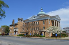 | George S. Houston Historic District | 0.3 miles | 1989 |
 | Athens Courthouse Square Commercial Historic District | 0.3 miles | 1997 |
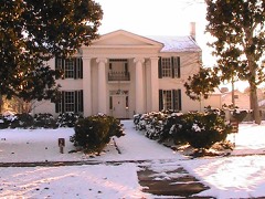 | Robert Beaty Historic District | 0.4 miles | 1984 |
 | Old Athens, Alabama Main Post Office | 0.4 miles | 1982 |
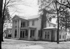 | Governor George Smith Houston House | 0.7 miles | 1986 |
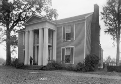 | Robert Donnell House | 0.7 miles | 1973 |
| National Archives record | The nomination case file for reference 85000254 in Record Group 79. |
| Limestone County | All 15 listed properties in this county. |