| March 2012 | Lightning | Greenville | 1 killed | A 12 year old boy was killed when the tree he was standing under was struck by lightning. |
| October 2006 | Heavy Rain | Greenville | 1 hurt, $60,000 | Heavy rains caused a roof to collapse on a recently built building near Butler. The roof was not draining properly and the weight of the accumulated rainfall caused to roof to collapse. One person was injured when the roof collapsed. |
| January 2012 | Thunderstorm Wind | Greenville | 1 hurt, $3,000 | Winds estimated at 60 mph damaged a small building resulting in 1 minor injury. |
| July 1994 | Thunderstorm Wind | Greenville | $50,000 | High winds with a thunderstorm raked the Kolb City area of Greenville downing a number of trees. One tree fell on a house causing extensive damage to the roof of one corner. |
| April 2009 | Thunderstorm Wind | Greenville | $30,000 | Winds estimated at 70 mph downed a 2 foot diameter oak tree onto a single wide mobile home and split it in half. |
| July 2007 | Thunderstorm Wind | Greenville | $25,000 | High winds from a thunderstorm damaged a radio tower and knocked the station off the air. |
| May 2003 | Thunderstorm Wind | Greenville | $25,000 | High thunderstorm winds blew down several trees and power lines near Greenville. One of the trees fell on on a house, producing minor roof damage. |
| February 2008 | Thunderstorm Wind | Greenville | $25,000 | no account filed |
| October 2001 | Thunderstorm Wind | Greenville | $20,000 | High winds, along the leading edge of a squall line, blew down several trees and power lines from Greenville to McKenzie. |
| December 2012 | Thunderstorm Wind | Greenville | $15,000 | Winds estimated at 70 mph caused a modular home porch to be blown off and roof peeled off. Several trees and power lines were also downed in the area. |
| May 1998 | Thunderstorm Wind | Greenville | $15,000 | The county sheriff's office estimated thunderstorm winds near 80 mph in the community with reports of several trees down and some homes suffered window damage. |
| January 2007 | Thunderstorm Wind | Greenville | $12,000 | High winds from a thunderstorm blew down several trees and power lines near Greenville. |
| August 2007 | Thunderstorm Wind | Greenville | $12,000 | High winds from a thunderstorm blew down several trees near Greenville. |
| April 2019 | Thunderstorm Wind | Greenville | $10,000 | High winds downed multiple trees in and around Greenville. |
| April 2014 | Thunderstorm Wind | Greenville | $10,000 | A porch was blown off of a residence and a tree was blown onto a police car. Many trees were reported down throughout the county. |
| December 2012 | Thunderstorm Wind | Greenville | $10,000 | Winds estimated at 70 mph destroyed a barn. |
| June 2007 | Thunderstorm Wind | Greenville | $10,000 | Strong thunderstorm winds blew down trees in Greenville. |
| April 2006 | Thunderstorm Wind | Greenville | $10,000 | High winds from a thunderstorm blew down several trees and power lines near Greenville. |
| October 2001 | Thunderstorm Wind | Greenville | $10,000 | High winds blew down several trees east of Greenville. |
| November 2001 | Flash Flood | Greenville | $10,000 | A small earthen dam broke west of Greenville. The dam was located near Highway 10, just to the west of Interstate 65. Some side roads in the area were closed. |
| March 2000 | Thunderstorm Wind | Greenville | $10,000 | Thunderstorm winds blew down trees and power lines just west of the community along State Highway 10. |
| January 2008 | Thunderstorm Wind | Greenville | $10,000 | no account filed |
| May 2008 | Thunderstorm Wind | Greenville | $10,000 | no account filed |
| August 2003 | Thunderstorm Wind | Greenville | $8,000 | High winds from a thunderstorm blew down several trees near Greenville. An awning over a trailer was damaged from the high wind. |
| February 2019 | Thunderstorm Wind | Greenville | $5,000 | High winds caused roof damage to a barn, blew shingles off a home, and downed trees near Greenville. |
| June 2018 | Thunderstorm Wind | Greenville | $5,000 | Winds estimated at 70 mph downed numerous trees in the Greenville area. |
| February 2012 | Thunderstorm Wind | Greenville | $5,000 | Winds estimated at 70 mph downed numerous trees along I-65 near Greenville. |
| June 2011 | Thunderstorm Wind | Greenville | $5,000 | Winds estimated at 60 mph downed numerous trees around the county causing power outages. |
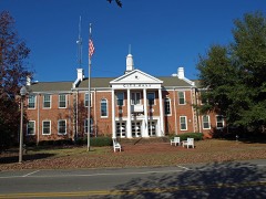
| August 2011 | Lightning | Greenville | $5,000 | Lightning struck the Butler County Courthouse and knocked out phone and electric service. |
| August 2011 | Thunderstorm Wind | Greenville | $5,000 | Winds estimated at 60 mph downed several trees and powerlines. |
| June 2001 | Thunderstorm Wind | Greenville | $5,000 | Several trees were blown down around the community as thunderstorms moved through the area. |
| February 2000 | Thunderstorm Wind | Greenville | $5,000 | Trees were blown down just north of Greenville |
| July 2000 | Thunderstorm Wind | Greenville | $5,000 | Trees were blown down by high thunderstorm winds southeast of the community. |
| October 1997 | Tornado (F0) | Greenville | $4,000 | An F0 tornado touched down about five miles northwest of Greenville along State Road 185. The tornado began about a mile west of State Road 185 and moved toward 185 then went back into the cloud near State road 185. The weak tornado skipped along the ground for about one mile and damage was about 150 yards wide along the track. Most of the damage was to trees. A metal garage along Highway 185 was the only structure to suffer major damage. No one was injured. |
| January 1998 | Thunderstorm Wind | Greenville | $3,500 | Trees and power lines were blown down in Greenville. |
| April 2016 | Thunderstorm Wind | Greenville | $3,000 | Winds estimated at 60 mph downed trees on Cahaba Road and Wildforks Road. |
| March 1998 | Thunderstorm Wind | Greenville | $3,000 | Trees and power lines were blown down just west of Greenville. |
| November 1997 | Thunderstorm Wind | Greenville | $2,500 | Trees and power lines were blown down in the city of Greenville. |
| March 2016 | Thunderstorm Wind | Greenville | $2,000 | Winds estimated at 60 mph downed tree across Mashville Road. |
| December 1996 | Thunderstorm Wind | Greenville | $1,500 | no account filed |
| May 2012 | Thunderstorm Wind | Greenville | $1,000 | Winds estimated at 60 mph blew a tree on to power lines. |
| March 2003 | Hail | Greenville | $1,000 | Golfball size hail fell across the northeast part of Butler county. A couple of automobile windshields were cracked by the large hail. |
| June 2023 | Thunderstorm Wind | Greenville | - | High winds downed numerous trees across Greenville. |
| June 2023 | Thunderstorm Wind | Greenville | - | A house was damaged from a fallen tree. |
| June 2023 | Thunderstorm Wind | Greenville | - | Trees were reportedly blocking Manningham Road near Woodvalley Road. |
| March 2021 | Thunderstorm Wind | Greenville | - | High winds downed trees on south Mount Zion Road. |
| April 2021 | Hail | Greenville | - | Social media report of golf ball size hail. |
| May 2021 | Thunderstorm Wind | Greenville | - | High winds downed trees across multiple roads in Greenville. |
| May 2020 | Thunderstorm Wind | Greenville | - | Gusty winds downed trees and small hail was also reported. |
| January 2020 | Thunderstorm Wind | Greenville | - | Numerous trees and power lines down in and around Greenville. |
| April 2020 | Thunderstorm Wind | Greenville | - | Severe thunderstorm wind gusts downed power lines on Highway 10 near Sand Cut Rd. |
| June 2020 | Thunderstorm Wind | Greenville | - | High wind downed numerous trees just east of Greenville. |
| June 2020 | Thunderstorm Wind | Greenville | - | High wind downed trees along Burgamy Swamp Road and Highway 97. |
| August 2019 | Thunderstorm Wind | Greenville | - | Strong winds downed trees and branches near Cahaba Road. |
| September 2012 | Flash Flood | Greenville | - | Heavy rains caused flooding on Highway 185. |
| September 2012 | Flash Flood | Greenville | - | Water over highway 50 east of highway 10. |
| February 2000 | Hail | Greenville | - | Dime size hail was reported just north of Greenville. |
| March 1998 | Hail | Greenville | - | Dime size hail was reported just south of Greenville. |
| March 1998 | Hail | Greenville | - | Dime size hail was reported along I-65 near Greenville. |
| March 2017 | Hail | Greenville | - | no account filed |
 Block