 Block
From the record
One of 189 National Register listings published here for Jefferson County · listed in 1994 · category: Building.
Sources: the case file at the National Archives · the National Register database, National Park Service
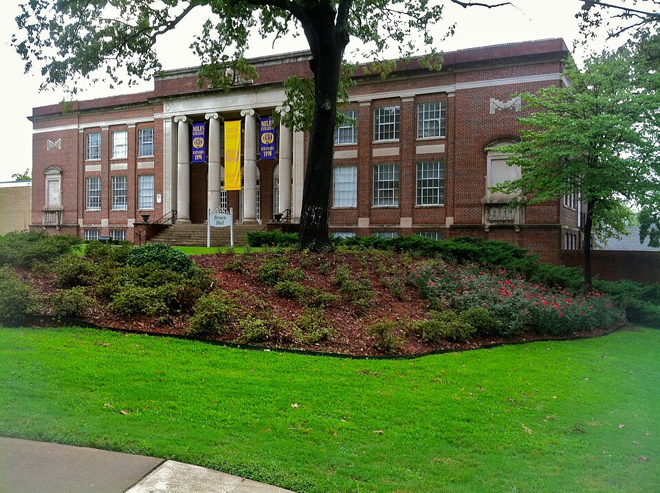
Listed on the National Register of Historic Places in 1994.
One of 189 National Register listings published here for Jefferson County · listed in 1994 · category: Building.
Sources: the case file at the National Archives · the National Register database, National Park Service
Regional context, not property-specific evidence. The federal wildfire occurrence database lists 101 fires within 5 miles of Williams Hall between 1993 and 2019, burning about 782 acres in total. None started naturally. 50 were recorded as arson. Distance is straight-line from the map coordinates, so a fire counted here may appear on a neighbouring settlement's page as well.
| Reported cause | Fires |
|---|---|
| Arson/incendiarism | 50 |
| Debris and open burning | 24 |
| Missing data/not specified/undetermined | 14 |
| Recreation and ceremony | 4 |
| Misuse of fire by a minor | 4 |
| Railroad operations and maintenance | 2 |
| Equipment and vehicle use | 2 |
| Smoking | 1 |
The most recent of them, most recent first, with the day each was reported and the service that recorded it.
| Date | Cause | Size | Reported by | Name on the report |
|---|---|---|---|---|
| 6 September 1998 | Arson/incendiarism | 5.0 acres | Alabama Forestry Commission | not named |
| 3 September 1998 | Arson/incendiarism | 40 acres | Alabama Forestry Commission | not named |
| 29 September 1995 | Debris and open burning | 1.0 acres | Alabama Forestry Commission | not named |
| 28 September 2016 | Misuse of fire by a minor | 2.0 acres | Alabama Forestry Commission | 20160928-8 |
| 26 September 2019 | Arson/incendiarism | 3.0 acres | Alabama Forestry Commission | 20190926-16 |
| 18 September 1999 | Debris and open burning | 6.0 acres | Alabama Forestry Commission | not named |
| 18 September 1996 | Railroad operations and maintenance | under an acre | Alabama Forestry Commission | not named |
| 15 September 1995 | Debris and open burning | 1.0 acres | Alabama Forestry Commission | not named |
Regional context, not property-specific evidence. The federal mineral resources record lists 33 workings within 5 miles of Williams Hall: 21 past producers, 5 producers, 3 occurrences, 2 plants. 7 still produce. What was taken out: Iron, Clay, Stone, Stone, Crushed/Broken. Distance is straight-line from the map coordinates, so a quarry counted here may appear on a neighbouring settlement's page as well.
| Where | Site | Commodity | Status | Recorded |
|---|---|---|---|---|
| Alpha Portland Cement Company Plant | Stone | Plant | ||
| East Thomas Quarry & Plant | Stone, Crushed/Broken | Producer | ||
| Wade Sand & Gravel Co. Pit | Sand and Gravel, Construction | Producer | ||
| Shannon Pit | Clay | Producer | ||
| Watkins Number 1 Pit | Clay | Producer | ||
| Birmingham Red Ore Dist. | Iron | Producer | ||
| Birmingham Red Ore Mines District | Iron | Past Producer | 1864, 1972 | |
| Green Spring Mine | Iron | Past Producer | ||
| Ishkooda Mines | Iron | Past Producer | 1863, 1969 | |
| Sloss No. 2 Mine | Iron | Past Producer |
Regional context, not property-specific evidence. The National Weather Service names Fairfield, the town this property stands in, in 10 storm reports between 1995 and 2022: 5 thunderstorm wind, 3 hail, 1 lightning, 1 flash flood. No death or injury is recorded in these reports. Each account below is quoted exactly as the forecast office filed it, from the NOAA Storm Events Database, and each date opens the federal record of that event.
| When | Event | Place named | Harm | What the report says |
|---|---|---|---|---|
| April 1995 | Thunderstorm Wind | Fairfield | $65,000 | A wind gust to 60 mph was reported by a television station located on Red Mountain overlooking downtown Birmingham. The local emergency management office reported trees and power lines down around the city and county. In Irondale, the roof was blown off an electronics store. In Fairfield, numerous buildings sustained minor damage in the Fairfield Heights and Rutledge Hills areas. Glass doors were blown out and skylights were damaged at Western Hills Mall. A tree reportedly fell on a car in Ketona and the occupant was briefly trapped. Alabama Power reported 38,400 people were without power at one point. In Ensley, a man died in a house fire that apparently started when candles were used while the electricity was out. In the Leeds area, a woman was briefly trapped in her house when a tree fell on it. |
| June 1998 | Thunderstorm Wind | Fairfield | $30,000 | no account filed |
| July 2003 | Lightning | Fairfield | $12,000 | A store was struck by lightning in Fairfield. The store suffered minor damage. |
| April 1998 | Hail | Fairfield | $3,000 | no account filed |
| April 2008 | Thunderstorm Wind | Fairfield | $2,000 | Several trees were blown down in the western portion of the county. |
| July 2022 | Hail | Fairfield | - | Quarter size hail reported in Fairfield. |
| July 2020 | Thunderstorm Wind | Fairfield | - | Several trees uprooted and on a house in the city of Fairfield. |
| June 2016 | Thunderstorm Wind | Fairfield | - | Several trees uprooted between the cities of Pleasant Grove and Farfield. |
| January 2013 | Flash Flood | Fairfield | - | The intersection at E.J. Oliver Blvd and Valley Road in Fairfield was impassable due to high waters. |
| May 1995 | Hail | Fairfield | - | Dime-size hail was reported by the Jefferson County Sheriff's Department at Fairfield. |
No historic map-sheet match is published for this property yet. That does not mean no map exists. This record needs a coordinate-quality review before it can be joined to a sheet boundary. Browse the county's mapped places while that work is pending.
Other National Register properties close enough to walk or drive between, ordered by distance from this one. Both positions come from the same geocoding pass that matched these properties to their map sheets.
| Photograph | Property | Distance | Listed |
|---|---|---|---|
 | Parham Apothecary Building | 0.4 miles | 1996 |
 | Flintridge Building | 0.8 miles | 2004 |
 | Belview Heights Historic District | 1.2 miles | 2000 |
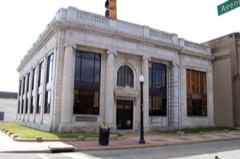 | Bank of Ensley | 1.8 miles | 1984 |
| Wylam Fire Station | 1.8 miles | 1990 | |
| Downtown Ensley Historic District | 2.3 miles | 2010 |
| National Archives record | The nomination case file for reference 93001031 in Record Group 79. |
| Jefferson County | All 189 listed properties in this county. |