 Block
From the record
One of 61 National Register listings published here for Baldwin County · listed in 1997 · category: Building.
Sources: the case file at the National Archives · the National Register database, National Park Service
Listed on the National Register of Historic Places in 1997.
One of 61 National Register listings published here for Baldwin County · listed in 1997 · category: Building.
Sources: the case file at the National Archives · the National Register database, National Park Service
Regional context, not property-specific evidence. The federal wildfire occurrence database lists 34 fires within 5 miles of Axil Johnson House between 1995 and 2018, burning about 361 acres in total. 1 started naturally. 12 were recorded as arson. Distance is straight-line from the map coordinates, so a fire counted here may appear on a neighbouring settlement's page as well.
| Reported cause | Fires |
|---|---|
| Debris and open burning | 15 |
| Arson/incendiarism | 12 |
| Missing data/not specified/undetermined | 3 |
| Recreation and ceremony | 2 |
| Misuse of fire by a minor | 1 |
| Natural | 1 |
The most recent of them, most recent first, with the day each was reported and the service that recorded it.
| Date | Cause | Size | Reported by | Name on the report |
|---|---|---|---|---|
| 30 September 2003 | Arson/incendiarism | 1.0 acres | Alabama Forestry Commission | not named |
| 31 July 2010 | Natural | 25 acres | Alabama Forestry Commission | not named |
| 10 June 1999 | Debris and open burning | under an acre | Alabama Forestry Commission | not named |
| 19 May 2000 | Debris and open burning | 3.0 acres | Alabama Forestry Commission | not named |
| 14 May 2001 | Arson/incendiarism | 5.0 acres | Alabama Forestry Commission | not named |
| 22 April 2010 | Debris and open burning | 4.0 acres | Alabama Forestry Commission | not named |
| 10 April 1995 | Debris and open burning | 5.0 acres | Alabama Forestry Commission | not named |
| 9 March 2000 | Debris and open burning | under an acre | Alabama Forestry Commission | not named |
Regional context, not property-specific evidence. The federal mineral resources record lists 3 workings within 5 miles of Axil Johnson House: 2 past producers, 1 producer. 1 still produces. What was taken out: Sand and Gravel, Construction, Clay, Sand and Gravel, Construction. Distance is straight-line from the map coordinates, so a quarry counted here may appear on a neighbouring settlement's page as well.
| Where | Site | Commodity | Status | Recorded |
|---|---|---|---|---|
| Unnamed Quarry | Clay, Sand and Gravel, Construction | Producer | Clay, Quartz | |
| Dand Pit | Sand and Gravel, Construction | Past Producer | ||
| Palmer Pit | Sand and Gravel, Construction | Past Producer |
Regional context, not property-specific evidence. The National Weather Service names Fairhope, the town this property stands in, in 50 storm reports between 1995 and 2025: 23 thunderstorm wind, 9 flash flood, 5 hail, 4 tornado. No death or injury is recorded in these reports. Each account below is quoted exactly as the forecast office filed it, from the NOAA Storm Events Database, and each date opens the federal record of that event.
| When | Event | Place named | Harm | What the report says |
|---|---|---|---|---|
| May 2022 | Flash Flood | Fairhope | $250,000 | Partial road collapse on North Bancroft Street between Oak Street and Bayou Drive. |
| July 2007 | Lightning | Fairhope | $250,000 | Lightning struck a home causing a fire. The home was a complete loss. |
| November 2000 | Tornado (F1) | Fairhope | $200,000 | A tornado, the third in Baldwin county in a 45 minute time period, developed and followed a path very similar to a weaker tornado that occurred about 20 minutes earlier. This tornado touched down near the intersection of Highway 27 and Highway 32, moved northeast into the Woodmere subdivision (the same subdivision affected by a weaker tornado some 20 minutes earlier). This tornado produced moderate roof and structural damage to several homes in the Woodmere subdivision. The tornado then continued northeast into the Quail Creek subdivision, where it produced minor damage to a few homes, mainly to garage doors. The damage path through the two subdivisions was intermittent, suggesting that the tornado skipped across the ground. As the tornado moved out of the Quail Creek subdivision, it lifted off the ground, but continued moving northeast as a funnel cloud. Reports of a funnel cloud, not in contact with the ground, were received as the parent thunderstorm moved northeast toward Interstate 10 and then east of Bay Minette. No additional damage was reported. |
| October 2007 | Flash Flood | Fairhope | $100,000 | no account filed |
| April 2015 | Thunderstorm Wind | Fairhope | $90,000 | The University of South Alabama mesonet recorded a 58 mph wind gust associated with severe thunderstorms. Numerous trees and power lines were downed around the city of Fairhope. Baldwin County EMA reports 5 homes and 1 commercial building were damaged. |
| October 2001 | Tornado (F1) | Fairhope | $50,000 | An F1 tornado touched down for a short time near Fairhope. The tornado caused major damage to a warehouse roof and two large metal doors were blown in. Several trees and a fence were also blown down. |
| March 2016 | Thunderstorm Wind | Fairhope | $30,000 | Winds estimated at 70 mph downed a tree on a home at mobile Street and White Avenue. Another home in the area suffered shingle damage. Numerous tents at the Arts and Craft festival were damaged. |
| March 1999 | Thunderstorm Wind | Fairhope | $30,000 | Strong thunderstorm winds did damage to portable toilets and seating areas in the City Park on the west side of Highway 98. A light pole was blown down onto a car wash business at the intersection of County Road 44 and Highway 98, causing structural damage. Also a home at County Road 44, east of Engle Side Drive, had a porch collapse. |
| June 2008 | Thunderstorm Wind | Fairhope | $25,000 | High winds from a thunderstorm, that moved in from the bay, blew down several pecan trees along U. S. Highway 98. The trees were blown down in a three mile wide area. Some outbuildings also suffered damage. Quarter size hail was also reported. |
| April 2002 | Thunderstorm Wind | Fairhope | $15,000 | Trees were blown down and a travel trailer was turned over from high winds as a line of thunderstorms moved through the area. |
| May 2008 | Thunderstorm Wind | Fairhope | $12,000 | no account filed |
| July 2007 | Thunderstorm Wind | Fairhope | $10,000 | A thunderstorm produced high winds that downed trees on County Road 32. |
| October 2001 | Thunderstorm Wind | Fairhope | $10,000 | Trees were blown down near Fairhope. |
| November 2000 | Tornado (F0) | Fairhope | $10,000 | A tornado, the second in Baldwin county in a 20 minute time period, formed just south of Fairhope. The tornado touched down just south of the intersection of Highway 27 and Highway 32, narrowly missing a trailer park and a nearby school, but producing some tree damage and minor damage to one trailer just south of the intersection. The tornado then skipped along Highway 27 for about one mile, where it caused minor damage to one home in the Woodmere subdivision. |
| April 2008 | Flash Flood | Fairhope | $10,000 | no account filed |
| February 2003 | Thunderstorm Wind | Fairhope | $5,000 | High winds from a thunderstorm blew down a couple of trees near the Fairhope Pier. Wind speeds at the pier were estimated at 60 mph. |
| January 1995 | Thunderstorm Wind | Fairhope | $5,000 | Wind with a thunderstorm downed a huge water oak in downtown Fairhope around noon. The tree fell on a late model car damaging the hood and windshield. A wheelbarrow load of shingles were torn off the roof of a school building in Robertsdale at Robertsdale Elementary School. Heavy rain late in the afternoon also added to problems by pouring through the wind damaged roof. |
| July 2013 | Thunderstorm Wind | Fairhope | $4,500 | Trees blown down by severe thunderstorm winds on Morphey Road and Topson Road. |
| July 1997 | Thunderstorm Wind | Fairhope | $3,000 | Several trees were blown down near the Fish River at Highway 98. |
| April 2013 | Thunderstorm Wind | Fairhope | $2,000 | Winds estimated at 60 mph downed a tree on Route 104. |
| May 1995 | Thunderstorm Wind | Fairhope | $1,000 | Several trees and power lines were blown down in the Fairhope area. |
| May 2025 | Thunderstorm Wind | Fairhope | - | Weather Station at Fairhope Yacht Club measures thunderstorm wind gust to 67mph. |
| May 2024 | Thunderstorm Wind | Fairhope | - | Power lines down on Dyer Rd. |
| May 2024 | Thunderstorm Wind | Fairhope | - | Fairhope Public Utilities reports two broken power poles around Perdido Avenue. |
| January 2023 | Thunderstorm Wind | Fairhope | - | High winds downed power lines. |
| May 2022 | Hail | Fairhope | - | Quarter size hail reported via social media. |
| April 2022 | Thunderstorm Wind | Fairhope | - | High winds damaged a shed and fence and blew a large trampoline against a house. |
| April 2022 | Thunderstorm Wind | Fairhope | - | High winds downed a tree on CR 34 west of Highway 181. |
| June 2022 | Thunderstorm Wind | Fairhope | - | High winds downed trees and powerlines in Fairhope. |
| October 2021 | Flash Flood | Fairhope | - | Heavy rain caused a few roads in Fairhope to be closed due to flooding. |
| July 2020 | Thunderstorm Wind | Fairhope | - | Severe thunderstorm winds downed multiple trees. |
| July 2019 | Heavy Rain | Fairhope | - | Total rainfall of 6 inches. |
| April 2014 | Heavy Rain | Fairhope | - | Fairhope mesonet recorded 7.09 inches of rain in 3 hours. |
| April 2014 | Flash Flood | Fairhope | - | Heavy rain caused street flooding southeast of Fairhope on Highway 181. |
| April 2014 | Flash Flood | Fairhope | - | Heavy rain caused street flooding on Satsuma Street. |
| April 2014 | Flash Flood | Fairhope | - | Heavy rain caused street flooding on Norman Lane. |
| April 2014 | Heavy Rain | Fairhope | - | USA mesonet recorded 7.09 inches of rain in 3 hours. |
| April 2014 | Heavy Rain | Fairhope | - | A CoCoRaHS 24 hour rainfall total of 9.79 inches. |
| May 2014 | Flash Flood | Fairhope | - | Heavy rain caused water to cover the road at Alabama highway 181 and CR 32 and at Fairhope Ave near the school. |
| July 2013 | Flood | Fairhope | - | Water at least 6 inches in depth flowing over the intersection of Highway 181 and Highway 48 near Fairhope. |
| November 2004 | Tornado (F0) | Fairhope | - | The large waterspout that moved across Mobile Bay moved ashore near Fairhope and quickly dissipated. No damage from the weak tornado was found. |
| June 2003 | Funnel Cloud | Fairhope | - | A couple of funnel clouds were observed near Fairhope. The funnel clouds dissipated without ever reaching the ground. |
| July 2001 | Waterspout | Fairhope | - | A waterspout was observed over Mobile Bay, east of Fairhope. The waterspout remained over the Bay and dissipated over the water. |
| July 1999 | Waterspout | Fairhope | - | A waterspout was reported over Mobile Bay, approximately 9 miles southwest of Fairhope. The waterspout soon dissipated. |
| July 1997 | Flash Flood | Fairhope | - | Torrential rains from Hurricane Danny started falling in Baldwin county Saturday evening and the Fish river came out of its banks and remained out of its banks for several days. People living along the river were forced to evacuate and numerous homes sustained major water damage. Most of the roads in the south part of the county, generally south of U. S. Highway 98, had to be closed due to high water. Many of the roads in this area were closed into Monday evening to allow the water to recede. Some roads had to be closed for several weeks before crews had time to get them in a condition to allow traffic on them again. The heaviest rainfall in this area was estimated to be 30 to 35 inches with some estimations of even higher amounts near Weeks Bay. |
| March 2022 | Thunderstorm Wind | Fairhope | - | no account filed |
| April 2006 | Hail | Fairhope | - | no account filed |
| January 1997 | Hail | Fairhope | - | no account filed |
| January 1997 | Hail | Fairhope | - | no account filed |
| January 1997 | Hail | Fairhope | - | no account filed |
No historic map-sheet match is published for this property yet. That does not mean no map exists. This record needs a coordinate-quality review before it can be joined to a sheet boundary. Browse the county's mapped places while that work is pending.
Other National Register properties close enough to walk or drive between, ordered by distance from this one. Both positions come from the same geocoding pass that matched these properties to their map sheets.
| Photograph | Property | Distance | Listed |
|---|---|---|---|
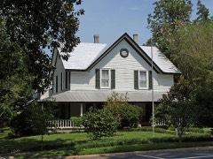 | Whittier Hall | 0.4 miles | 1985 |
| Golf, Gun & Country Club | 0.4 miles | 1988 | |
| School of Organic Education | 0.8 miles | 1988 | |
| Fairhope Downtown Historic District | 0.8 miles | 2006 | |
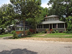 | White Avenue Historic District | 0.9 miles | 1988 |
 | Bank of Fairhope | 0.9 miles | 1988 |
| National Archives record | The nomination case file for reference 97000649 in Record Group 79. |
| Baldwin County | All 61 listed properties in this county. |