| August 2014 | Lightning | Grove Hill | $65,000 | Lightning struck a 911 tower and caused 65 thousand dollars in damage to the tower and phone system. |
| April 2014 | Lightning | Grove Hill | $25,000 | Lightning struck a house and started a fire. |
| July 2009 | Thunderstorm Wind | Grove Hill | $25,000 | Winds estimated at 70 mph downed a large limb on a vehicle on Highway 43. It caused two injuries and one of them was transported to a hospital. |
| July 2020 | Lightning | Grove Hill | $22,000 | A lightning strike to the 911 center damaged multiple radios. |
| December 2000 | Lightning | Grove Hill | $20,000 | Lightning struck an abandoned house near Grove Hill. The house caught on fire and most of it was destroyed before the fire department could put the fire out. |
| May 2009 | Thunderstorm Wind | Grove Hill | $15,000 | Winds estimated at 60 mph caused widespread tree and power line damage across the county. |
| July 2007 | Lightning | Grove Hill | $15,000 | A lightning strike damaged communications equipment in Grove Hill. The 911 system was also knocked off line for a couple of hours. |
| April 2004 | Thunderstorm Wind | Grove Hill | $15,000 | In addition to a large amount of hail near Grove Hill, high winds from the thunderstorm blew down several trees and power lines. A couple of frame buildings also had some minor damage from the high winds. No injuries were reported. |
| March 2008 | Thunderstorm Wind | Grove Hill | $12,000 | no account filed |
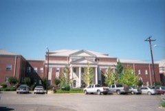
| September 2018 | Flash Flood | Grove Hill | $10,000 | Flood water entered the Library at Wilson Hall Middle School. |
| June 2016 | Thunderstorm Wind | Grove Hill | $10,000 | Winds estimated near 70 mph downed many trees and power lines near the city of Grove Hill. |
| August 2011 | Lightning | Grove Hill | $10,000 | A house fire was started by a lightning strike. |
| June 1999 | Thunderstorm Wind | Grove Hill | $10,000 | High winds blew numerous trees and power lines down along US HWY 84 between Grove Hill and Gosport. |
| July 2012 | Thunderstorm Wind | Grove Hill | $8,000 | Winds estimated at 70 mph downed trees and power lines along Allen Walker Road. Trees and power lines down at 500 Archie Schultz Road and a small outbuilding was destroyed. |
| December 2000 | Thunderstorm Wind | Grove Hill | $8,000 | High winds from a thunderstorm blew several trees and power lines down near Grove Hill. |
| June 2018 | Thunderstorm Wind | Grove Hill | $5,000 | Winds estimated at 70 mph downed several trees. |
| February 2016 | Thunderstorm Wind | Grove Hill | $5,000 | Winds estimated at 60 mph downed trees along Mile marker 13/14 on Highway 69. |
| July 2013 | Thunderstorm Wind | Grove Hill | $5,000 | Winds estimated at 60 mph downed a tree on a building with other trees down on Church Street. Trees down on Mount Vine Road and Salt Works Road. |
| July 2013 | Thunderstorm Wind | Grove Hill | $5,000 | Winds estimated at 60 mph downed at tree on a car on Cobb St. and tree down on Clark St. |
| September 2013 | Thunderstorm Wind | Grove Hill | $5,000 | Winds estimated at 70 mph downed numerous trees and powerlines from near Toddtown to Grove Hill and from Highway 43 eastward to Whatley. |
| March 2003 | Thunderstorm Wind | Grove Hill | $5,000 | High winds from a thunderstorm blew down several trees near Grove Hill. |
| December 2002 | Thunderstorm Wind | Grove Hill | $5,000 | High winds from a thunderstorm blew down several trees near Grove Hill. |
| October 2002 | Thunderstorm Wind | Grove Hill | $5,000 | Trees were blown down by high winds from a thunderstorm near Grove Hill. Dime size hail was also reported with the storm. |
| July 1997 | Thunderstorm Wind | Grove Hill | $5,000 | Several trees and power lines were blown down around Grove Hill. |
| May 1994 | Thunderstorm Wind | Grove Hill | $5,000 | Numerous trees and power lines were downed in the city of Grove Hill by thunderstorm winds. |
| October 1997 | Thunderstorm Wind | Grove Hill | $2,500 | Several trees were blown down just southwest of Grove Hill. A tin roof was also blown from an outbuilding. |
| July 2013 | Thunderstorm Wind | Grove Hill | $2,000 | Winds estimated at 60 mph downed at tree on Brookville Road. |
| February 1997 | Thunderstorm Wind | Grove Hill | $2,000 | no account filed |
| July 1996 | Thunderstorm Wind | Grove Hill | $2,000 | no account filed |
| January 1997 | Thunderstorm Wind | Grove Hill | $1,500 | no account filed |
| April 1997 | Thunderstorm Wind | Grove Hill | $1,000 | A couple of trees were blown down in Grove Hill. |
| February 2025 | Thunderstorm Wind | Grove Hill | - | Numerous trees and power lines down across Clarke County. |
| May 2024 | Thunderstorm Wind | Grove Hill | - | High winds downed numerous trees in and around Grove Hill. |
| December 2024 | Thunderstorm Wind | Grove Hill | - | Measured at the Clarke County EMA office. Three buildings next to the county courthouse also have damage, including the roof off one of the businesses. |
| January 2023 | Thunderstorm Wind | Grove Hill | - | High winds downed trees across Highway 84, two miles west of the Highway 84/Highway 43 intersection. |
| June 2023 | Thunderstorm Wind | Grove Hill | - | High winds downed trees blocking both lanes. Multiple power outages in the area as well. |
| June 2023 | Thunderstorm Wind | Grove Hill | - | High winds downed numerous trees and power lines. |
| June 2023 | Thunderstorm Wind | Grove Hill | - | High winds downed a large tree on Church Street. |
| February 2022 | Flash Flood | Grove Hill | - | Heavy rain caused water to cover the road near Grove Hill. |
| April 2022 | Thunderstorm Wind | Grove Hill | - | High winds downed numerous trees in the Grove Hill area. |
| August 2022 | Flash Flood | Grove Hill | - | Heavy rain caused numerous roads to flood across portions of Clarke County. |
| May 2021 | Thunderstorm Wind | Grove Hill | - | High winds downed trees along west Cobb Road blocking the roadway. |
| May 2021 | Thunderstorm Wind | Grove Hill | - | High winds downed trees and power lines near Wilson Hall Middle School. |
| February 2020 | Thunderstorm Wind | Grove Hill | - | High winds from a thunderstorm downed a tree on a mobile home. |
| February 2013 | Heavy Rain | Grove Hill | - | Storm total rainfall of 5.36 inches. |
| February 2013 | Heavy Rain | Grove Hill | - | Storm total rainfall of 6.5 inches recorded at the county EMA office. |
| December 2012 | Hail | Grove Hill | - | Quarter size hail. |
| April 2011 | Thunderstorm Wind | Grove Hill | - | A large tree was blown down by severe thunderstorm winds near 60 mph falling across Highway 43 in Grove Hill near Chilton Road. |
| April 2011 | Funnel Cloud | Grove Hill | - | Spotter reports funnel cloud northwest of Grove Hill moving towards Thomasville. |
| April 2004 | Hail | Grove Hill | - | Penny to nickel size hail fell near Grove Hill for about twenty minutes. Hail covered the ground up to six inches in depth in some areas. Hail was still visible the next morning along areas that were not exposed to the sun. Many residents said it looked like snow. |
| April 1997 | Hail | Grove Hill | - | Dime size hail was reported in the Grove Hill area. |
| October 1995 | Hail | Grove Hill | - | Dime-size hail was reported along U.S. Highway 84 west of Grove hill near the city of Zimco. |
| June 2023 | Hail | Grove Hill | - | no account filed |
| June 2023 | Hail | Grove Hill | - | no account filed |
| May 2021 | Thunderstorm Wind | Grove Hill | - | no account filed |
| June 2020 | Hail | Grove Hill | - | no account filed |
| March 2019 | Hail | Grove Hill | - | no account filed |
| May 2011 | Hail | Grove Hill | - | no account filed |
| May 2011 | Hail | Grove Hill | - | no account filed |
| May 2009 | Hail | Grove Hill | - | no account filed |
 Block