Block
From the record
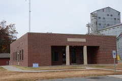
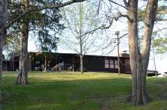
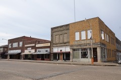
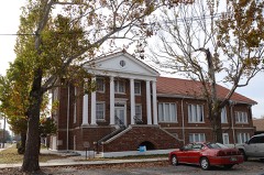
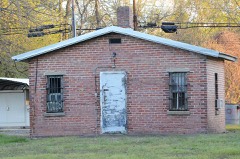
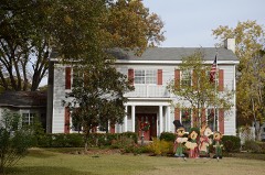
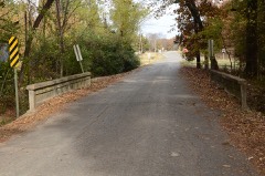
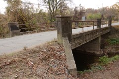
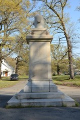
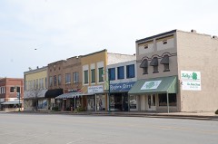
24 National Register listings published here, 1 of them a National Historic Landmark.
Sources: the National Register database, National Park Service
97 topographic sheets cover 58 settlements here, and 24 properties are on the National Register of Historic Places.
24 National Register listings published here, 1 of them a National Historic Landmark.
Sources: the National Register database, National Park Service
Every property in this county listed on the National Register of Historic Places, with the year it was listed and the federal nomination document.
Every wildfire the federal occurrence database records inside this county: 46 of them, burning about 606 acres. 1 started naturally and 7 were recorded as arson. Each settlement page carries the fires within five miles of it.
| Reported cause | Fires |
|---|---|
| Debris and open burning | 26 |
| Missing data/not specified/undetermined | 7 |
| Arson/incendiarism | 7 |
| Smoking | 3 |
| Recreation and ceremony | 2 |
| Natural | 1 |
The five largest, by the area the report gives. Two of them were set deliberately.
| Date | Cause | Size | Reported by | Name on the report |
|---|---|---|---|---|
| 25 January 2003 | Debris and open burning | 70 acres | Arkansas Forestry Commission | not named |
| 11 March 2004 | Debris and open burning | 69 acres | Arkansas Forestry Commission | not named |
| 23 March 2018 | Missing data/not specified/undetermined | 50 acres | Arkansas Forestry Commission | not named |
| 4 November 2003 | Debris and open burning | 50 acres | Arkansas Forestry Commission | not named |
| 12 March 2005 | Arson/incendiarism | 40 acres | Arkansas Forestry Commission | not named |
| 14 October 2000 | Debris and open burning | 36 acres | Arkansas Forestry Commission | not named |
| 23 March 2017 | Missing data/not specified/undetermined | 32 acres | Arkansas Forestry Commission | not named |
| 1 November 2016 | Arson/incendiarism | 30 acres | Arkansas Forestry Commission | not named |
Every settlement page carries the fires within five miles of it - see the settlement index below.
The NOAA Storm Events Database holds 482 reports for this county, causing 2 deaths, 34 injuries and about $91,331,500 in recorded property damage. Each settlement page carries the reports that name it.
| Kind of event | Reports |
|---|---|
| Thunderstorm Wind | 219 |
| Hail | 134 |
| Tornado | 49 |
| Flash Flood | 48 |
| Flood | 18 |
| Heavy Rain | 8 |
| Funnel Cloud | 5 |
| Lightning | 1 |
The most serious of them, by death, then injury, then recorded damage. The accounts are quoted exactly as the forecast office filed them.
| When | Event | Place named | Harm | What the report says |
|---|---|---|---|---|
| May 1984 | Thunderstorm Wind | not stated | 1 killed, 1 hurt | no account filed |
| April 2017 | Thunderstorm Wind | De Witt | 1 killed | Several large trees downed. One tree fell on a mobile home and a woman inside was killed. |
| May 2008 | Tornado (EF3) | Fuess | 9 hurt, $75,000,000 | A tornado touched down west of Stuttgart, near the Arkansas/Prairie County line. The tornado then moved toward the east-southeast, passing through the southern sections of Stuttgart. Most of the damage in the city was along and a few blocks to the north of 22nd Street (Arkansas Highway 130). The tornado then passed through the southern part of the Country Club Estates area and moved out across farmsteads, finally taking a turn toward the southeast and ending northeast of Almyra. Altogether, some 800 homes were damaged, along with 82 businesses, and approximately 750 vehicles. Two schools, a community college's training center, a nursing home, and a sports complex were also damaged. Six people had to be rescued after the building housing a dollar store collapsed, trapping the people inside. About 3800 customers lost electric service in the Stuttgart area, and about 2000 customers were without telephone service. Seventy-five animals were treated for minor injuries at Stuttgart's animal shelter. |
| August 1950 | Tornado (F2) | not stated | 7 hurt, $25,000 | no account filed |
| March 1961 | Tornado (F2) | not stated | 6 hurt, $250,000 | no account filed |
| February 1965 | Tornado (F3) | not stated | 4 hurt, $250,000 | no account filed |
| November 1994 | Tornado (F1) | DeWitt to 3.5 SSE St. | 3 hurt, $5,000,000 | An F1 tornado touched down 4 miles south southwest of DeWitt, near the Indiana community, and traveled 16 miles on the ground before lifting in the White River National Wildlife Refuge. The worst damage occurred at the DeWitt airport, where four planes were destroyed and two others were damaged. Three people were injured 3.5 miles south of St. Charles when the house trailer that they were in was thrown against a large tree, nearly splitting the trailer in half. Elsewhere, another house trailer was overturned, two trailers and a house lost their roofs, and several other houses were damaged. Several outbuildings were blown away, a couple of farm shops were destroyed, and a large barn lost part of its roof. Trees and power lines were blown down all along the tornado's path. Total damage was around $700,000. |
| July 2000 | Thunderstorm Wind | De Witt | 2 hurt | no account filed |
| November 2010 | Thunderstorm Wind | Ona | 1 hurt, $5,000 | Thunderstorm winds blew down a sales tent at a large hunting supply store just north of Stuttgart. Winds at the Stuttgart airport, about 5 miles to the north, were measured at 49 mph. There was one minor injury. |
| April 1968 | Tornado (F2) | not stated | 1 hurt, $2,500 | no account filed |
| May 2009 | Thunderstorm Wind | Stuttgart | $1,500,000 | Numerous large trees were down. Also, 30 to 40 homes were damaged by trees. |
| March 2008 | Flood | St Charles | $1,500,000 | Heavy rain caused the White River at St. Charles to flood. Approximately 20 homes were affected. Jack's Bay Road, Ander's Bay Lane, Shepherd Point Lane, Hays Lake Lane, Nady Road, Arkansas Highway 17 at Ethel, Gander Street Road and Refuge Road were closed due to flooding. Numerous hunting properties also were flooded. The flooding continued into April. |
| January 2012 | Tornado (EF2) | Olena | $1,000,000 | Initially, the tornado badly damaged an old barn and tore the tin off a tractor shed. North of DeWitt, four large, steel transmission towers were blown down, an elevator was blown off some grain bins, a roof was damaged, and a travel trailer was overturned. Farther to the northeast, a truck trailer was blown over, trees were blown down, and tin was blown off roofs. |
| May 2011 | Flood | Stuttgart | $1,000,000 | Parts of Arkansas Highways 1, 17, 144, and 146 were closed due to flooding. Lock 2, in a canal connecting the Arkansas and White Rivers, was closed more than two weeks. The lock was forced shut after the overflowing White and Mississippi rivers rose to levels greater than that on the Arkansas. This prevented the canal from emptying into the Mississippi. As a result, barge traffic on the Arkansas was stalled, being unable to reach the Mississippi. Flooding in Arkansas County continued into June. |
| July 2009 | Tornado (EF2) | Arkansas Post | $850,000 | A tornado began in southeastern Arkansas County, northeast of Arkansas Post. Initially, the tornado was weak and its track was mostly over open farm land. The porch of an old mobile home, being used as a hunting camp, was torn off. The tornado soon moved into the White River National Wildlife Refuge and intensified greatly. The U.S. Fish and Wildlife Service estimated that 1750 acres of timber were destroyed within the refuge. Most of these old-growth trees were snapped off. Three families were camping at Jacks Bay in the refuge. No one was injured, but the campers were unable to exit the refuge because Jacks Bay Road, the only road out of that section of the refuge, was blocked by fallen trees. It took several hours for county, state, and federal crews to reopen the road. Altogether, they had to cut trees off 2537 feet of roadway. A few of the falling trees knocked down power lines. The tornado crossed the White River, into Phillips County, east-northeast of Weber. ||This tornado was destined to be one for the record books. The total path length in Arkansas and Phillips counties was by far the longest tornado track ever recorded in Arkansas during the month of July. Also, it was only the eighth tornado in Arkansas history to achieve a rating of F2/EF2 in the month of July. |
| April 2011 | Thunderstorm Wind | Stuttgart | $650,000 | Thunderstorm winds blew down numerous large trees and power lines. Nine houses suffered major damage and five houses had minor damage due to the falling trees. The major area of damage encompassed more than 90 blocks in Stuttgart. |
| April 2008 | Flood | Nady | $500,000 | Prolonged river flooding became worse on the lower White River as heavy rain on the tributaries, along with large releases from flood control reservoirs, caused successive flood waves to progress to the lower portions of the river. This was the highest stage at St. Charles since 1973. Also, high stages on the Mississippi River compounded the problems as backwater flooding developed. A few permanent homes and many recreational cabins and hunting camps were inundated. The flooding continued into May as high stages on the Mississippi River persisted which held back the recession of the White River. |
| April 2008 | Flood | Gillett | $500,000 | Moderate flooding at the Pendleton stream gage on the Arkansas River occurred for over three days. The crest in April was higher than the March crest, primarily due to the high Mississippi River stages. Property within the levee system, such as hunting and fishing camps, was flooded. The combined lower Arkansas, White, and Mississippi River floodplain contains some exclusive hunting camps and all were flooded by the three rivers within the vast expanse of floodplain. The crest at Pendleton was the highest since May, 1990, and the fourth highest of record. |
| January 2012 | Tornado (EF1) | One Horse Store | $250,000 | The tornado initially destroyed a shed and carport. Farther to the northeast, windows were broken in a house and pieces of wood were driven into the house's siding, and a shed was destroyed. A mobile home was rolled over, causing its destruction. Many of its contents were thrown out into a field. Near the DeWitt airport, a metal building was destroyed, the wall of a second metal building was pushed in, and much of the roof was torn off a tractor shed. Near the end of the tornado's path, trees and power poles were blown down. |
| May 1983 | Tornado (F3) | not stated | $250,000 | no account filed |
| May 1967 | Tornado (F2) | not stated | $250,000 | no account filed |
| November 1966 | Tornado (F1) | not stated | $250,000 | no account filed |
| August 1964 | Tornado (F2) | not stated | $250,000 | no account filed |
| July 1960 | Tornado (F1) | not stated | $250,000 | no account filed |
| May 2022 | Thunderstorm Wind | Plainview | $100,000 | This powerful microburst destroyed a large, well-built metal storage building. The buildiing was anchored at 10 points with concrete around each post, and it appears initial damage on one side of the building caused the interior of the building to become exposed to the wind. The structural soundness of the building allowed wind energy to build up inside until the entire structure was violently lifted from the ground. Aside from minor shingle damage to a nearby roof, surrounding structures were undamaged. Debris from the metal building was carried approximately 700 yards downstream with evidence of ground scarring, indicating winds were strong enough to cause heavy debris to tumble. There was a narrow damage swath on the order of 150 yards in width. |
| June 2021 | Flash Flood | Stuttgart | $100,000 | There was widespread flooding of the roads across the area. Several businesses were flooded with numerous cars stranded as well. |
| April 2011 | Flood | Stuttgart | $100,000 | Widespread areal flooding occurred. A portion of Arkansas Highway 17 was closed from the afternoon of the 30th through the end of the month. |
| September 2008 | Flash Flood | De Witt | $100,000 | At least one home was flooded. |
| February 2007 | Tornado (EF1) | Gillett | $100,000 | The tornado moved from Desha County into Arkansas County about 8.3 miles south-southeast of Gillett. A few homes sustained minor damage, along with several camping trailers. Several sheds and outbuildings were destroyed. A mobile home and several metal shop buildings were also damaged. A number of trees and power lines were also blown down. The tornado eventually dissipated about 6.2 miles south-southeast of Tichnor. |
| October 2014 | Thunderstorm Wind | Stuttgart | $75,000 | Trees were blown down, causing damage to some houses. |
| January 2012 | Tornado (EF1) | Hamptons Res | $75,000 | This tornado exited Jefferson County west-northwest of Anrep and entered Arkansas County southwest of Hamptons Reservoir. In Arkansas County, much of the track of the tornado was through the Bayou Meto Wildlife Management Area. Many trees were blown down. Two mobile homes suffered damage, power poles were blown down, and a farm equipment building was damaged. |
| August 2009 | Thunderstorm Wind | De Witt | $75,000 | Fallen trees blocked roads and power lines were down. Trees were also down on fences. A tree fell on a house and several were down in yards. |
| May 2022 | Tornado (EF2) | Lodges Corners | $50,000 | A large pole barn was completely destroyed and electrical transmission line towers were knocked down. The likely cause of damage that initiated the collapse of the electrical transmission line towers was a large lofted shipping container that collided with the base of one of the towers. Other damage included downed smaller power poles and minor roof damage to a home. |
| July 2011 | Lightning | Gillett | $50,000 | Lightning struck two houses in Gillett, starting fires. |
| May 2011 | Thunderstorm Wind | Gillett | $50,000 | Trees, power lines, and power poles were blown down. Some houses suffered roof damage. |
| October 2009 | Flash Flood | Casscoe | $50,000 | U.S. Highway 165 was flooded between DeWitt and Gillett, causing several vehicles to be swept off the road. Arkansas Highways 11, 276, and 153 were flooded as well. A water rescue was necessary on Pittman Road southeast of DeWitt. The county judge estimated that 90% of county roads had water on them. |
| January 1993 | Thunderstorm Wind | Stuttgart | $50,000 | Thunderstorm winds knocked down some trees and power lines. |
| January 1993 | Thunderstorm Wind | DeWitt | $50,000 | Some trees and power lines were blown down. |
| February 1993 | Thunderstorm Wind | Stuttgart | $50,000 | Thunderstorm winds knocked down some trees and power lines, as well as a few highway signs. |
| June 2019 | Thunderstorm Wind | Pocahontas | $30,000 | Trees and power lines were blown down and a tree was down on a truck. |
| July 2011 | Thunderstorm Wind | Gillett | $30,000 | Trees were blown down, with some of the trees falling on a house. |
| April 2011 | Thunderstorm Wind | Stuttgart | $30,000 | Trees were blown down, as were a couple of power lines. One house was damaged by a falling tree. |
| October 2010 | Hail | Deluce | $30,000 | Hail up to golf ball size caused damage to vehicles just north of DeLuce. |
| January 2013 | Thunderstorm Wind | Stinking Bay | $25,000 | A tree fell on a truck, and a shed and chicken coop were destroyed. |
| May 2011 | Thunderstorm Wind | Gillett | $25,000 | Trees and power lines were blown down. Gillett had no electricity. |
| December 1978 | Tornado (F1) | not stated | $25,000 | no account filed |
| January 1975 | Tornado (F1) | not stated | $25,000 | no account filed |
| November 1970 | Tornado (F2) | not stated | $25,000 | no account filed |
| May 1961 | Tornado (F2) | not stated | $25,000 | no account filed |
| January 1952 | Tornado (F1) | not stated | $25,000 | no account filed |
| January 1952 | Tornado (F1) | not stated | $25,000 | no account filed |
| March 2015 | Thunderstorm Wind | Gillett | $20,000 | A shed was blown across a field, a mobile home lost siding, some homes lost shingles, and several trees were uprooted. |
| August 2014 | Thunderstorm Wind | De Witt | $20,000 | A tree fell on a carport, which partially collapsed and landed on a vehicle. |
| February 2012 | Thunderstorm Wind | Parham | $20,000 | Power poles were broken off, and trees and power lines were blown down on U.S. 79 between Stuttgart and Ulm. |
| April 2011 | Thunderstorm Wind | De Witt | $20,000 | A tree was uprooted and fell on a vehicle. |
| April 2011 | Thunderstorm Wind | St Charles | $20,000 | Trees were blown down onto roads and there was minor damage to houses. |
| January 2013 | Thunderstorm Wind | Gillett | $15,000 | Trees and power lines were blown down in the Gillett area. |
| January 2013 | Thunderstorm Wind | Almyra | $15,000 | Trees and power lines were blown down. |
| June 2012 | Thunderstorm Wind | Stuttgart | $15,000 | A power pole was blown down onto a car and several tree limbs were knocked down. |
| June 2012 | Thunderstorm Wind | Tichnor | $15,000 | A tree fell on a pickup truck. |
The Survey's mineral resources record lists 5 workings inside this county. None of them still produces: all are closed or unrecorded. Each settlement page carries the workings within five miles of it.
| Commodity | Workings |
|---|---|
| Sand and Gravel, Construction | 5 |
The least common of them first, because a county's hundredth gravel pit says nothing its first ten did not.
Named settlements recorded in the Geographic Names Information System, each with the topographic sheets covering it. Villages, hamlets and abandoned places alike. Each is shown with the nearest named watercourse or landform and the survey quadrangle it falls on.
Henton township · 72073 · Stuttgart South quadrangle
14 sheets, 1941 to 1986
No longer a settlement
Arkansas township · 72055 · By Ecores Rouges · Arkansas Post quadrangle
12 sheets, 1935 to 1986
No longer a settlement
Arkansas township · 72055 · By Ecores Rouges · Arkansas Post quadrangle
12 sheets, 1935 to 1986
Crockett township · 72038 · On Poplar Creek · Crocketts Bluff quadrangle
17 sheets, 1939 to 1986
Arkansas township · 72055 · On Bells Gulley · Gillett quadrangle
12 sheets, 1935 to 1986
No longer a settlement
Prairie township · 72048 · On Panther Branch · Indian Bay SE quadrangle
17 sheets, 1939 to 1986
Chester township · 72166 · On La Grue Bayou · Henrico SW quadrangle
16 sheets, 1939 to 1986
La Grue township · 72042 · De Witt SW quadrangle
14 sheets, 1941 to 1986
No longer a settlement
Gum Pond township · 72160 · Stuttgart North quadrangle
15 sheets, 1937 to 1990
No longer a settlement
Gum Pond township · 72160 · Stuttgart North quadrangle
15 sheets, 1937 to 1990
No longer a settlement
Chester township · 72166 · On La Grue Bayou · Henrico SW quadrangle
16 sheets, 1939 to 1986
Keaton township · 72026 · By Preston Bluff · Aberdeen quadrangle
16 sheets, 1935 to 1990
Henton township · 72073 · Humphrey quadrangle
15 sheets, 1941 to 1986
No longer a settlement
Keaton township · 72003 · De Witt NE quadrangle
13 sheets, 1941 to 1986
No longer a settlement
Point Deluce township · 72042 · By Mays Bluff · Weber quadrangle
15 sheets, 1939 to 1986
Gum Pond township · 72160 · Stuttgart North quadrangle
15 sheets, 1937 to 1990
No longer a settlement
La Grue township · 72042 · De Witt quadrangle
13 sheets, 1941 to 1986
No longer a settlement
Brewer township · 72073 · On Bubbling Slough · Humphrey SW quadrangle
15 sheets, 1941 to 1986
No longer a settlement
The vanished settlements of Arkansas County: the places named above that are no longer on the map.