 Block
From the record
16 National Register listings published here.
Sources: the National Register database, National Park Service
63 topographic sheets cover 47 settlements here, and 16 properties are on the National Register of Historic Places.
16 National Register listings published here.
Sources: the National Register database, National Park Service
Every property in this county listed on the National Register of Historic Places, with the year it was listed and the federal nomination document.
| Photograph | Property | Type | Listed | Reference |
|---|---|---|---|---|
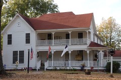 | Adams-Leslie House | building | 1979 | 79000433 |
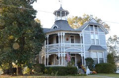 | Bailey House | building | 1975 | 75000375 |
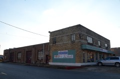 | Blankinship Motor Company Building | building | 2001 | 01001190 |
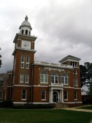 | Bradley County Courthouse and Clerk's Office | building | 1976 | 76000389 |
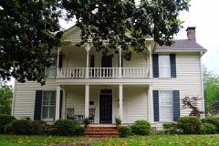 | Davis-Adams House | building | 1999 | 99000224 |
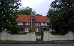 | Ederington House | building | 1984 | 84000660 |
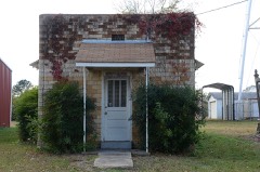 | Hermitage City Hall and Jail | building | 2007 | 07000956 |
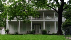 | Dr. John Wilson Martin House | building | 1990 | 90001948 |
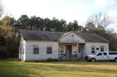 | Mt. Olive Rosenwald School | building | 2004 | 03001454 |
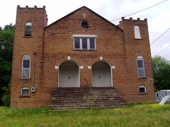 | New Zion AME Zion Church | building | 2000 | 00000628 |
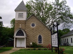 | St. Luke's Catholic Church | building | 1998 | 98000581 |
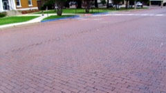 | Warren Brick Streets | structure | 2007 | 06001277 |
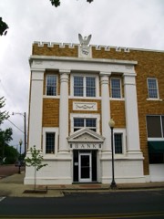 | Warren Commercial Historic District | district | 2016 | 16000433 |
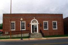 | Warren Post Office | building | 2004 | 03001460 |
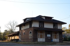 | Warren and Ouachita Valley Railway Station | building | 1977 | 77000244 |
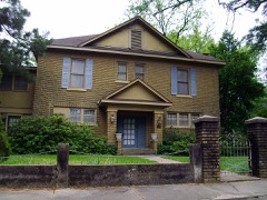 | Wilson-Martin House | building | 2006 | 06000827 |
Every wildfire the federal occurrence database records inside this county: 483 of them, burning about 6,436 acres. 52 started naturally and 55 were recorded as arson. Each settlement page carries the fires within five miles of it.
| Reported cause | Fires |
|---|---|
| Missing data/not specified/undetermined | 180 |
| Debris and open burning | 118 |
| Equipment and vehicle use | 60 |
| Arson/incendiarism | 55 |
| Natural | 52 |
| Railroad operations and maintenance | 8 |
| Recreation and ceremony | 6 |
| Smoking | 3 |
| Power generation/transmission/distribution | 1 |
The five largest, by the area the report gives. None of them was recorded as arson.
| Date | Cause | Size | Reported by | Name on the report |
|---|---|---|---|---|
| 17 September 2013 | Missing data/not specified/undetermined | 1,509 acres | Arkansas Forestry Commission | SINGLETON CREEK |
| 6 August 2011 | Natural | 310 acres | Arkansas Forestry Commission | MORO BAY |
| 5 August 2011 | Natural | 300 acres | Arkansas Forestry Commission | HERMITAGE 1 |
| 14 July 2008 | Railroad operations and maintenance | 215 acres | Arkansas Forestry Commission | BRADLEY |
| 3 October 2011 | Debris and open burning | 209 acres | Felsenthal National Wildlife Refuge | BRADLEY 53 |
| 4 October 2011 | Debris and open burning | 200 acres | Felsenthal National Wildlife Refuge | DELTIC TIMBER SITE PREP |
| 26 October 2010 | Natural | 192 acres | Arkansas Forestry Commission | THREE MILE BRANCH |
| 22 August 2011 | Natural | 129 acres | Arkansas Forestry Commission | BADCAW 2 |
Every settlement page carries the fires within five miles of it - see the settlement index below.
The NOAA Storm Events Database holds 269 reports for this county, causing 7 deaths, 60 injuries and about $33,252,500 in recorded property damage. Each settlement page carries the reports that name it.
| Kind of event | Reports |
|---|---|
| Thunderstorm Wind | 115 |
| Hail | 89 |
| Flash Flood | 27 |
| Tornado | 21 |
| Flood | 12 |
| Heavy Rain | 4 |
| Lightning | 1 |
The most serious of them, by death, then injury, then recorded damage. The accounts are quoted exactly as the forecast office filed them.
| When | Event | Place named | Harm | What the report says |
|---|---|---|---|---|
| March 1975 | Tornado (F4) | not stated | 7 killed, 51 hurt, $25,000,000 | no account filed |
| February 2007 | Tornado (EF2) | Ingalls | 6 hurt, $200,000 | A strong tornado touched down in Bradley County, about 11 miles southwest of Ingalls. Tornado damage occurred in the Mt. Olive community, about 13 miles south of Warren. A house suffered major damage and a mobile home was destroyed. An elderly woman was injured in the house, and a family of five was injured in the mobile home. Three other homes had minor damage, and several sheds and outbuildings were destroyed. Thousands of trees were blown down, as were a number of power poles and power lines. The tornado continued to move northeastward into Drew County. |
| October 2009 | Thunderstorm Wind | Cloquet | 1 hurt, $250,000 | Thunderstorm winds downed dozens of large trees, power lines and power poles in Warren. Trees fell on several houses causing minor roof damage. The falling trees were also responsible for two gas leaks. Two buildings had much of their metal roofs blown off. Damage was generally in a path from the northwest side of Warren on toward the center of town. One person in Warren was injured when he was hit in the head by flying debris. |
| February 1965 | Tornado (F3) | not stated | 1 hurt, $250,000 | no account filed |
| February 1975 | Tornado (F1) | not stated | 1 hurt, $25,000 | no account filed |
| April 1979 | Tornado (F3) | not stated | $2,500,000 | no account filed |
| September 2008 | Flash Flood | Banks | $1,540,000 | Numerous paved and gravel roads washed out and flooded throughout the county. Arkansas Highway 160 at U.S. Highway 63 was closed due to flooding. |
| April 2014 | Thunderstorm Wind | Farmville | $500,000 | One chicken house collapsed and three others were damaged. Many hundreds of chickens were killed. Numerous trees and power lines were blown down, with some houses and outbuildings damaged by falling trees. A camping trailer tipped over against a power pole. |
| December 2009 | Flood | Blue Spgs | $500,000 | Flash flooding, which developed on the morning of the 24th, became widespread areal flooding later on the 24th and continued into Christmas morning. |
| December 2009 | Flash Flood | Blue Spgs | $500,000 | Widespread heavy rain flooded many roads. U.S. Highway 63 was flooded north of Warren. A swift water rescue was necessary on Bradley 22 near Warren. U.S. Highway 63 was flooded at its intersection with Arkansas Highway 160. |
| May 2009 | Flood | Harmony | $400,000 | Within Bradley County, flooding of the Saline River damaged roads and impacted cabins and residences along the river. Major impacts were noted in the Longview community in southeastern Bradley County at the Arkansas Highway 8 bridge. As many as 25 structures were impacted by the high river stages. |
| October 2009 | Flash Flood | Blue Spgs | $350,000 | Numerous county roads were damaged by flash flooding. |
| May 2011 | Flood | Warren | $250,000 | Flooding in Bradley County continued into June. |
| May 2009 | Thunderstorm Wind | Warren | $150,000 | Trees were down across Warren. One tree fell on a house. A tree limb fell on a police car, causing damage. |
| August 2013 | Thunderstorm Wind | Warren | $125,000 | Parts of metal roofs were torn off several buildings, including the tomato sheds at the Warren Tomato Market. Roof damage occurred at some homes and apartment buildings. Trees, power lines, and power poles were blown down. |
| April 2011 | Flood | Warren | $100,000 | Widespread areal flooding occurred. |
| December 2015 | Tornado (EF1) | Hermitage | $75,000 | A metal roof of a sidewalk awning was removed at the Hermitage School. Part of the roof of a chicken house was peeled back north of Hermitage. A shed was destroyed near Farmville along with some minor damage to a home. Many trees were either snapped or uprooted. |
| November 1994 | Thunderstorm Wind | Warren | $50,000 | Thunderstorm winds damaged the roofs of several homes. |
| June 2009 | Thunderstorm Wind | Warren | $30,000 | An oak tree fell on top of a car on South Myrtle. The tree also slightly damaged the roof of the home. |
| April 2014 | Thunderstorm Wind | Warren | $25,000 | Many trees were blown down in Warren and elsewhere in the county. |
| January 2012 | Thunderstorm Wind | Warren | $25,000 | Thunderstorm wind damage occurred several places in Warren. An awning was blown off a store, trees and power lines were blown down, part of a metal roof was blown off a house, and a canoe was blown off a storage rack at a business. |
| May 2010 | Tornado (EF1) | Moro Bay | $25,000 | This tornado exited Calhoun County southeast of Artesian and entered Bradley County north-northwest of Moro Bay. Trees were blown down on timber land owned by a large timber company. |
| April 2008 | Flood | Parnell Spgs | $25,000 | The Saline River flood wave from the Benton gage progressed downstream to Bradley County by the second week of April. Minor flooding at the Rye gage occurred during this time and caused some county roads to flood. Also, some pastures were flooded and access to timber was cut off. |
| September 1985 | Tornado (F1) | not stated | $25,000 | no account filed |
| June 1972 | Tornado (F3) | not stated | $25,000 | no account filed |
| April 1954 | Tornado (F2) | not stated | $25,000 | no account filed |
| March 2016 | Flash Flood | Blue Spgs | $20,000 | Emergency manager reports that Bradley county road 52 southeast of Hermitage washed away by flash flooding. Several other roads in the county have water over them and have been barricaded. |
| July 2014 | Thunderstorm Wind | Banks | $20,000 | A tree fell on a car on U.S. 278. No one was injured. |
| July 2010 | Lightning | Warren | $20,000 | Lightning struck the power source at the city water plant in Warren, causing the plant to stop pumping water. |
| May 2009 | Thunderstorm Wind | Warren | $20,000 | A roof was blown off a house. |
| June 2009 | Thunderstorm Wind | Warren | $20,000 | Trees were down across the area. |
| April 2011 | Thunderstorm Wind | Banks | $15,000 | Trees were blown down, causing severe damage to a mobile home. There were no injuries. |
| May 2009 | Flood | Harmony | $15,000 | A car traveling on U.S. Highway 278 a few miles east of Warren left the highway around 4:30 AM CDT. The car went airborne, landing in flood waters from Flat Branch Creek and the Saline River. The passenger in the car drowned. This is an indirect fatality since the initial event was the auto accident. |
| June 2009 | Thunderstorm Wind | Sumpter | $15,000 | Trees were down across the area. |
| October 2009 | Thunderstorm Wind | Parnell Spgs | $15,000 | A number of large trees were down. One tree fell on a vehicle causing minor damage. |
| April 2018 | Thunderstorm Wind | Sumpter | $10,000 | National Weather Service damage survey concludes tree damage near Sumpter, AR was the result of damaging thunderstorm winds. Damage was concentrated near the intersection of Arkansas Hwy 8, Bradley County Rd 42, and Jimmy Senn Rd. Several trees were uprooted, mostly east of Arkansas Hwy 8, with a couple of trees snapped. A metal outbuilding was damaged at a home across from Sumpter Methodist Church. Some fence damage was noted as well, but no other significant structural damage was observed. Estimated maximum wind speed is 90 mph. |
| March 2014 | Thunderstorm Wind | Hermitage | $10,000 | Trees were blown down on Bradley Roads 5, 32, and 41. |
| June 2013 | Thunderstorm Wind | Warren | $10,000 | Trees were blown down onto power lines. |
| August 2012 | Thunderstorm Wind | Hermitage | $10,000 | Trees were blown down on Arkansas 160. Power outages occurred in Hermitage. |
| May 2009 | Flash Flood | Mc Kinney | $10,000 | Street flooding occurred in Warren. |
| July 2009 | Thunderstorm Wind | Hermitage | $10,000 | Trees were down on Arkansas Highway 160 near Hermitage. |
| August 2012 | Thunderstorm Wind | Johnsville | $5,000 | Trees were blown down. |
| July 2011 | Thunderstorm Wind | Warren | $5,000 | A small tree was blown down on N. Main St. Small pieces of the roof were blown off a supermarket on E. Pine St. |
| July 2009 | Thunderstorm Wind | Cloquet | $5,000 | Trees were down on Arkansas Highway 8. |
| October 2009 | Thunderstorm Wind | Warren | $5,000 | A few large trees were blown down. |
| June 1994 | Thunderstorm Wind | Warren | $5,000 | Thunderstorm winds downed some trees. Also a funnel cloud was sighted by the public. |
| June 1994 | Thunderstorm Wind | Warren | $5,000 | Thunderstorm winds downed several trees. |
| August 1993 | Thunderstorm Wind | Jersey | $5,000 | Thunderstorm winds downed some trees. |
| August 1993 | Thunderstorm Wind | Hermitage | $5,000 | Thunderstorm winds tore the roof off a barn and downed some power lines. |
| May 2011 | Flood | Harmony | $5,000 | no account filed |
| May 2013 | Thunderstorm Wind | Cloquet | $3,000 | Trees were blown down on Arkansas 8. |
| May 2013 | Thunderstorm Wind | Warren | $3,000 | Trees were blown down on U.S. 63. |
| March 1972 | Tornado (F0) | not stated | $2,500 | no account filed |
| April 2010 | Thunderstorm Wind | Hermitage | $2,000 | The roof of a storage shed was blown into the street. |
| May 2010 | Thunderstorm Wind | Lacy | $2,000 | A tree was blocking U.S. Highway 278 east of Banks. |
| September 2008 | Tornado (EF0) | Vick | $2,000 | This tornado was spawned by Tropical Storm Ike. A few trees were blown down. The intermittent nature of the tornado's path indicated that the tornado was ill-formed and dipped up and down. |
| December 2014 | Thunderstorm Wind | Banks | $1,000 | Large limbs were blown down. |
| July 2010 | Flash Flood | Hermitage | $1,000 | Widespread street flooding occurred. |
| May 1994 | Thunderstorm Wind | Hermitage | $500 | Thunderstorm winds blew down a few trees. |
| May 1994 | Thunderstorm Wind | Warren | $500 | Thunderstorm winds downed a large tree onto Highway 8. |
The Survey's mineral resources record lists 60 workings inside this county. 59 still produce and 1 is closed or unrecorded. Each settlement page carries the workings within five miles of it.
| Commodity | Workings |
|---|---|
| Sand and Gravel, Construction | 59 |
| Gemstone | 1 |
The least common of them first, because a county's hundredth gravel pit says nothing its first ten did not.
| Where | Site | Commodity | Status | Recorded |
|---|---|---|---|---|
| Unk Gravel Pit | Gemstone | Producer | ||
| Bradley County Pit | Sand and Gravel, Construction | Producer | ||
| H L O'Neill Sand & Gravel | Sand and Gravel, Construction | Producer | ||
| Hopewell Pit | Sand and Gravel, Construction | Producer | ||
| O'Neal Bros. | Sand and Gravel, Construction | Past Producer | ||
| Unk Gravel Pit | Sand and Gravel, Construction | Producer | ||
| Unk Gravel Pit | Sand and Gravel, Construction | Producer | ||
| Unk Gravel Pit | Sand and Gravel, Construction | Producer | ||
| Unk Gravel Pit | Sand and Gravel, Construction | Producer | ||
| Unk Gravel Pit | Sand and Gravel, Construction | Producer | ||
| Unk Gravel Pit | Sand and Gravel, Construction | Producer | ||
| Unk Gravel Pit | Sand and Gravel, Construction | Producer | ||
| Unk Gravel Pit | Sand and Gravel, Construction | Producer | ||
| Unk Gravel Pit | Sand and Gravel, Construction | Producer | ||
| Unk Gravel Pit | Sand and Gravel, Construction | Producer | ||
| Unk Gravel Pit | Sand and Gravel, Construction | Producer | ||
| Unk Gravel Pit | Sand and Gravel, Construction | Producer | ||
| Unk Gravel Pit | Sand and Gravel, Construction | Producer | ||
| Unk Gravel Pit | Sand and Gravel, Construction | Producer | ||
| Unk Gravel Pit | Sand and Gravel, Construction | Producer | ||
| Unk Gravel Pit | Sand and Gravel, Construction | Producer | ||
| Unk Gravel Pit | Sand and Gravel, Construction | Producer | ||
| Unk Gravel Pit | Sand and Gravel, Construction | Producer | ||
| Unk Gravel Pit | Sand and Gravel, Construction | Producer | ||
| Unk Gravel Pit | Sand and Gravel, Construction | Producer | ||
| Unk Gravel Pit | Sand and Gravel, Construction | Producer | ||
| Unk Gravel Pit | Sand and Gravel, Construction | Producer | ||
| Unk Gravel Pit | Sand and Gravel, Construction | Producer | ||
| Unk Gravel Pit | Sand and Gravel, Construction | Producer | ||
| Unk Gravel Pit | Sand and Gravel, Construction | Producer | ||
| Unk Gravel Pit | Sand and Gravel, Construction | Producer | ||
| Unk Gravel Pit | Sand and Gravel, Construction | Producer | ||
| Unk Gravel Pit | Sand and Gravel, Construction | Producer | ||
| Unk Gravel Pit | Sand and Gravel, Construction | Producer | ||
| Unk Gravel Pit | Sand and Gravel, Construction | Producer | ||
| Unk Gravel Pit | Sand and Gravel, Construction | Producer | ||
| Unk Gravel Pit | Sand and Gravel, Construction | Producer | ||
| Unk Gravel Pit | Sand and Gravel, Construction | Producer | ||
| Unk Gravel Pit | Sand and Gravel, Construction | Producer | ||
| Unk Gravel Pit | Sand and Gravel, Construction | Producer | ||
| Unk Gravel Pit | Sand and Gravel, Construction | Producer | ||
| Unk Gravel Pit | Sand and Gravel, Construction | Producer | ||
| Unk Gravel Pit | Sand and Gravel, Construction | Producer | ||
| Unk Gravel Pit | Sand and Gravel, Construction | Producer | ||
| Unk Gravel Pit | Sand and Gravel, Construction | Producer | ||
| Unk Gravel Pit | Sand and Gravel, Construction | Producer | ||
| Unk Gravel Pit | Sand and Gravel, Construction | Producer | ||
| Unk Gravel Pit | Sand and Gravel, Construction | Producer | ||
| Unk Gravel Pit | Sand and Gravel, Construction | Producer | ||
| Unk Gravel Pit | Sand and Gravel, Construction | Producer | ||
| Unk Gravel Pit | Sand and Gravel, Construction | Producer | ||
| Unk Gravel Pit | Sand and Gravel, Construction | Producer | ||
| Unk Gravel Pit | Sand and Gravel, Construction | Producer | ||
| Unk Gravel Pit | Sand and Gravel, Construction | Producer | ||
| Unk Gravel Pit | Sand and Gravel, Construction | Producer | ||
| Unk Gravel Pit | Sand and Gravel, Construction | Producer | ||
| Unk Gravel Pit | Sand and Gravel, Construction | Producer | ||
| Unk Gravel Pit | Sand and Gravel, Construction | Producer | ||
| Unk Gravel Pit | Sand and Gravel, Construction | Producer | ||
| Unk Gravel Pit | Sand and Gravel, Construction | Producer |
Named settlements recorded in the Geographic Names Information System, each with the topographic sheets covering it. Villages, hamlets and abandoned places alike. Each is shown with the nearest named watercourse or landform and the survey quadrangle it falls on.
District 9 · 71631 · On Brown Branch · Tinsman quadrangle
12 sheets, 1953 to 1989
No longer a settlement
District 9 · 71631 · On Springhill Creek · Hermitage quadrangle
18 sheets, 1934 to 1989
No longer a settlement
District 9 · 71631 · On Hunter Branch · Banks quadrangle
12 sheets, 1953 to 1989
No longer a settlement
District 7 · 71647 · On Miller Branch · Marais Saline quadrangle
18 sheets, 1934 to 1989
District 7 · 71647 · On Brushy L'Aigle Creek · Hermitage quadrangle
18 sheets, 1934 to 1989
District 8 · 71647 · On Brushy L'Aigle Creek · Hermitage quadrangle
18 sheets, 1934 to 1989
District 6 · 71675 · On Langford Creek · Wilmar South quadrangle
9 sheets, 1953 to 1986
No longer a settlement
District 7 · 71647 · On Gravelly Branch · Vick quadrangle
19 sheets, 1934 to 1989
No longer a settlement
The vanished settlements of Bradley County: the places named above that are no longer on the map.