 Block
From the record
18 National Register listings published here.
Sources: the National Register database, National Park Service
64 topographic sheets cover 42 settlements here, and 18 properties are on the National Register of Historic Places.
18 National Register listings published here.
Sources: the National Register database, National Park Service
Every property in this county listed on the National Register of Historic Places, with the year it was listed and the federal nomination document.
| Photograph | Property | Type | Listed | Reference |
|---|---|---|---|---|
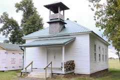 | Brewer School | building | 2004 | 04000506 |
 | Cleburne County Courthouse | building | 1976 | 76000393 |
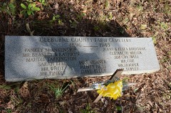 | Cleburne County Farm Cemetery | site | 2005 | 05001066 |
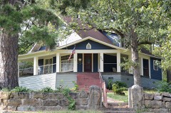 | Dr. Cyrus F. Crosby House | building | 1993 | 93001258 |
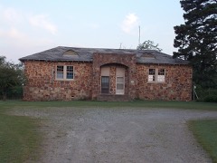 | Dill School | building | 1994 | 94000854 |
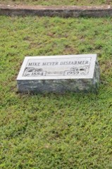 | Mike Meyer Disfarmer Gravesite | site | 2009 | 08001335 |
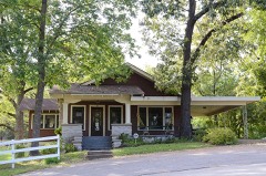 | Clarence Frauenthal House | building | 1993 | 93001256 |
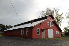 | O.D. Gunn Trade and Sale Barn | building | 2016 | 16000316 |
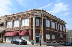 | Heber Springs Commercial Historic District | district | 2009 | 09000266 |
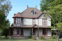 | Hugh L. King House | building | 1992 | 92001224 |
| Martin Dipping Vat | structure | 2022 | 100007717 | |
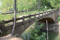 | Old Highway 16 Bridge | structure | 2011 | 11000262 |
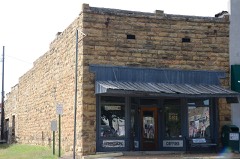 | Olmstead, T. E., & Son Funeral Home | building | 1995 | 95001438 |
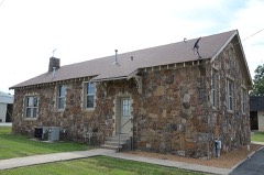 | Quitman Home Economics Building | building | 1992 | 92001127 |
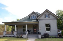 | Rector House | building | 2008 | 08000486 |
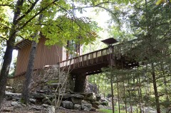 | Shaheen-Goodfellow Weekend Cottage | building | 2002 | 97000854 |
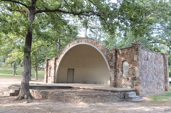 | Woman's Community Club Band Shell | structure | 1994 | 94000849 |
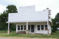 | Woodrow Store | building | 2001 | 00001592 |
Every wildfire the federal occurrence database records inside this county: 445 of them, burning about 6,916 acres. 17 started naturally and 135 were recorded as arson. Each settlement page carries the fires within five miles of it.
| Reported cause | Fires |
|---|---|
| Arson/incendiarism | 135 |
| Debris and open burning | 131 |
| Missing data/not specified/undetermined | 118 |
| Equipment and vehicle use | 21 |
| Natural | 17 |
| Smoking | 11 |
| Misuse of fire by a minor | 7 |
| Recreation and ceremony | 5 |
The five largest, by the area the report gives. Four of them were set deliberately.
| Date | Cause | Size | Reported by | Name on the report |
|---|---|---|---|---|
| 8 September 2005 | Arson/incendiarism | 524 acres | Arkansas Forestry Commission | not named |
| 15 March 2000 | Arson/incendiarism | 278 acres | Arkansas Forestry Commission | not named |
| 6 October 1999 | Missing data/not specified/undetermined | 240 acres | Arkansas Forestry Commission | not named |
| 7 October 1999 | Missing data/not specified/undetermined | 140 acres | Arkansas Forestry Commission | not named |
| 9 September 2005 | Arson/incendiarism | 118 acres | Arkansas Forestry Commission | not named |
| 6 March 2010 | Debris and open burning | 115 acres | Arkansas Forestry Commission | not named |
| 3 February 2017 | Missing data/not specified/undetermined | 100 acres | Arkansas Forestry Commission | not named |
| 26 February 2012 | Arson/incendiarism | 99 acres | Arkansas Forestry Commission | not named |
Every settlement page carries the fires within five miles of it - see the settlement index below.
The NOAA Storm Events Database holds 368 reports for this county, causing 5 deaths, 49 injuries and about $75,671,000 in recorded property damage. Each settlement page carries the reports that name it.
| Kind of event | Reports |
|---|---|
| Thunderstorm Wind | 166 |
| Hail | 123 |
| Flash Flood | 33 |
| Tornado | 29 |
| Lightning | 5 |
| Heavy Rain | 5 |
| Flood | 5 |
| Funnel Cloud | 2 |
The most serious of them, by death, then injury, then recorded damage. The accounts are quoted exactly as the forecast office filed them.
| When | Event | Place named | Harm | What the report says |
|---|---|---|---|---|
| March 1984 | Tornado (F4) | not stated | 2 killed, 10 hurt, $25,000,000 | no account filed |
| June 1997 | Lightning | Heber Spgs | 1 killed, 12 hurt | A group of people were attending a picnic on the shore of Greers Ferry Lake at the Old Highway 25 Park. Lightning struck nearby and injured 12 people. One other person was killed as a result of being struck. The extent of injuries to the others struck consisted of burns. Most of the injured were treated and released from the hospital the same day and several others were kept for observation. |
| March 1976 | Tornado (F3) | not stated | 1 killed, 6 hurt, $250,000 | no account filed |
| March 2010 | Tornado (EF2) | Pearson | 1 killed, 3 hurt, $250,000 | A home was destroyed on South Sawmill Road, and the three occupants in the home were thrown out into a field. A 79 year-old man lost his life. The man's wife, 75 years old, suffered serious injuries, as did their grandson, 23 years old. The washer, dryer, and water heater from the home were found about 750 feet away in some brush. A mobile home on the same property was destroyed. Six other homes received minor damage. Some trees and power lines were blown down. A motorist on Arkansas Highway 107 was injured when his pickup truck was blown off the road. |
| May 2008 | Tornado (EF2) | Crossroads | 12 hurt, $32,000,000 | This tornado exited Van Buren County, east-northeast of Morganton, and moved into Cleburne County, northwest of Crossroads. Across the county, 194 homes received damage. This included 27 houses and five mobile homes destroyed, 66 homes with major damage, and 96 homes with minor damage. A dog kennel, two chicken houses, and a beauty shop were destroyed. Minor damage was done to two chicken houses, a rock quarry, a flea market, a boat storage facility, a beauty shop, a fire department, a print shop, and a community ball park. At least 19 boats and party barges sank in Greers Ferry Lake. Removal of the vessels and clean-up of the spilled fuel and fluids continued well into June. About 6800 homes and businesses lost power. In addition to power lines and poles being blown down, one transmission line and one substation were damaged. Approximately 250 dogs and puppies were killed, along with two horses, and hundreds of chickens. |
| March 1991 | Tornado (F2) | not stated | 1 hurt, $250,000 | no account filed |
| November 1955 | Tornado (F3) | not stated | 1 hurt, $250,000 | no account filed |
| April 2011 | Thunderstorm Wind | Heber Spgs | 1 hurt, $100,000 | Thunderstorm winds caused damage in a small section of Heber Springs. The roof of a storage building at a building supply business was torn off, with part of the roof landing in Arkansas Highway 25B. At a car dealership, two bay doors were blown in and air conditioning units on top of the building were damaged. At another car dealership, a bay door was blown in, and glass from the door went into an employee's foot. A few trees, power poles, and power lines were blown down. |
| November 2005 | Tornado (F2) | Quitman | 1 hurt | A strong tornado moved from southeastern Van Buren County into southwestern Cleburne County about 2.5 miles west of Quitman. The tornado tracked quickly to the northeast, and removed the roofs of several houses. The tornado also destroyed a mobile home, a camper, a chicken house and a few barns and outbuildings. Several other chicken houses were damaged, as well as some vehicles. Hundreds of trees, power lines and power poles were downed. The tornado dissipated 5.5 miles north-northwest of Pearson. |
| May 2003 | Tornado (F2) | Hopewell | 1 hurt | A strong tornado moved out of Faulkner County and into Cleburne County about 2.5 miles southwest of Hopewell. The tornado destroyed a couple of barns and outbuildings. Several houses and mobile homes were also damaged. The tornado also destroyed a mobile home. The mobile home was thrown against an old milking barn, which was also destroyed. A travel trailer was overturned and the person inside suffered minor injuries. An old chicken house was also destroyed and a mobile home was damaged due to flying debris. There were dozens of trees knocked down. The tornado dissipated about 3.8 miles northeast of Hopewell. |
| June 1996 | Lightning | Heber Spgs | 1 hurt | no account filed |
| May 2003 | Flash Flood | Countywide | $3,000,000 | no account filed |
| November 1988 | Tornado (F3) | not stated | $2,500,000 | no account filed |
| December 1982 | Tornado (F3) | not stated | $2,500,000 | no account filed |
| May 2011 | Flood | Prim | $2,000,000 | Some of the campsites around Greers Ferry Lake were closed due to flooding. |
| May 2010 | Thunderstorm Wind | Edgemont | $2,000,000 | Thunderstorm winds struck the Hill Creek Marina on Greers Ferry Lake, destroying three docks. One of the docks was thrown on top of another dock. At least 80 boats were damaged or destroyed, including some boats that overturned or sank. Lightning detection equipment and Doppler weather radar indicated the storm had only a brief life-span. From the time cloud-to-ground lightning developed until it dissipated was only 20 minutes. Altogether, only 13 cloud-to-ground lightning strikes were detected from the storm. Although people were present at the marina when the storm struck, no one was injured. |
| April 2011 | Flood | Prim | $1,000,000 | Widespread areal flooding occurred. |
| October 2009 | Flash Flood | Brewer | $600,000 | A water rescue from a vehicle occurred on Hiram Road. While a sheriff's deputy was en route to the Hiram Road call, his patrol car was swept off Cooter Neck Road. Two people were evacuated from a residence on Scott Street in Heber Springs. Flooding damaged many roads in the county. |
| August 2009 | Thunderstorm Wind | Ida | $375,000 | Nine residences (houses and mobile homes) were damaged, two of which were destroyed; one metal building collapsed; eight metal barns were severely damaged, two of which were flattened and another of which was destroyed; and six vehicles were damaged, one of which was totaled. A number of trees were blown down. Some of the structural damage was due to falling trees and some of it was caused by the wind alone. |
| March 2010 | Thunderstorm Wind | Heber Spg Tnnenbaum | $300,000 | A few boat docks on Greers Ferry Lake near Thunderbird Country Club were damaged from high winds in a severe thunderstorm. |
| April 2018 | Thunderstorm Wind | Prim | $250,000 | A chicken house was destroyed. |
| May 2013 | Flash Flood | Prim | $250,000 | Heavy rain caused considerable damage to county roads and bridges. |
| December 2009 | Flash Flood | Brewer | $250,000 | Widespread heavy rain resulted in the development of flash flooding early on the morning of the 24th. |
| December 2009 | Flood | Brewer | $250,000 | Flash flooding, which developed very early on the 24th, became widespread areal flooding later in the morning on the 24th and continued into Christmas morning. |
| December 1982 | Tornado (F3) | not stated | $250,000 | no account filed |
| April 1968 | Tornado (F2) | not stated | $250,000 | no account filed |
| June 2010 | Lightning | Pearson | $200,000 | Lightning struck a house, setting it on fire. |
| April 2009 | Thunderstorm Wind | Shiloh | $200,000 | A commercial boat dock was destroyed. A number of boats were under the debris and one boat flipped over in the water at Shiloh Marina. |
| August 2011 | Thunderstorm Wind | Quitman | $125,000 | Eight houses suffered roof damage. Eight sheds, three barns, and two shop buildings were destroyed. |
| August 2011 | Thunderstorm Wind | Heber Spgs | $100,000 | Trees were blown down, with two of the trees landing on vehicles. A concrete picnic table at a motel was blown over a fence. |
| May 2013 | Thunderstorm Wind | Heber Spgs | $75,000 | Part of the roof was blown off a propane company, sheds were destroyed, and trees were snapped off or blown down. One tree landed on a house and another fell on a mobile home. Power poles were snapped off, with power, phone, and cable lines blown down. |
| August 2008 | Flash Flood | Brewer | $75,000 | At least one county road was washed out. Damage was reported to roads, homes and businesses. |
| November 2021 | Thunderstorm Wind | Dill | $50,000 | A mobile home was blown off of its foundation. Roof damage occurred to a neighboring house on Richwood Mountain Road. |
| September 2020 | Tornado (EF2) | Hopewell | $50,000 | This tornado formed near Candlestick Road east of Hwy 5, damaging several trees and an outbuilding. The tornado continued northeast damaging more trees and outbuildings along Blakey Circle and Blakey Road. The tornado then continued northeast crossing the Little Red River along Wildflower Road, snapping many healthy trees. This is where the strongest winds were noted. The tornado lifted shortly after this location. |
| April 2018 | Thunderstorm Wind | Stark | $50,000 | Trees and power lines were blown down, along roofs damaged. A boat dock was destroyed at Lacey's Narrows Marina. |
| July 2014 | Thunderstorm Wind | Drasco | $50,000 | Part of the metal roof of a chicken house was blown off. Some of the metal ended up wrapped around a power pole. |
| July 2013 | Thunderstorm Wind | Quitman | $50,000 | Much of the metal roof was peeled off of a building. |
| September 2012 | Thunderstorm Wind | Heber Spgs | $50,000 | Trees were blown down in Heber Springs and many other places in Cleburne County. |
| November 2011 | Flash Flood | Old Fivemile | $50,000 | Several county roads were flooded. Water entered some businesses on Main St. in Heber Springs. |
| April 2010 | Thunderstorm Wind | Shiloh | $50,000 | A number of trees were blown down and several homes sustained roof damage on the south side of the town of Greers Ferry. |
| June 2009 | Lightning | Heber Spgs | $50,000 | Lightning struck a boat storage company, setting it on fire. Only the building burned, as there was time to move the boats to safety. |
| March 2008 | Flash Flood | Brewer | $50,000 | Water was reported over a number of county roads, including some roads in the Higden area and on Paradise Point Road on the south shore of Greers Ferry Lake. Arkansas Highway 263 near Prim was blocked due to high water. |
| June 1994 | Thunderstorm Wind | Quitman | $50,000 | Thunderstorm winds knocked down some power lines. |
| April 2009 | Thunderstorm Wind | Heber Spgs | $35,000 | A tree was down on a roof on Weddingford Road. A pine tree fell in front of a home on West Searcy. A tree was down on the roof of a carport on West Walnut. Several trees were down across the city. |
| March 2017 | Thunderstorm Wind | Heber Spgs | $30,000 | Social media shows a large tree has fallen through a house in Heber Springs. |
| May 2008 | Flash Flood | Heber Spgs | $30,000 | An estimated 4 inches of rain in 45 minutes sent water rushing down Main Street in downtown Heber Springs. Water ran inside several businesses. |
| December 1977 | Tornado (F1) | not stated | $25,000 | no account filed |
| April 1976 | Tornado (F2) | not stated | $25,000 | no account filed |
| April 1970 | Tornado (F2) | not stated | $25,000 | no account filed |
| November 1955 | Tornado (F3) | not stated | $25,000 | no account filed |
| March 2017 | Tornado (EF1) | Crossroads | $20,000 | Trees were blown down, uprooted, or snapped along the path of the tornado. A home had some windows blown out, and some roof damage. Several outbuildings were damaged. |
| July 2012 | Thunderstorm Wind | Wilburn | $20,000 | Roofs were damaged on several houses and trees were blown down onto power lines. |
| February 2009 | Thunderstorm Wind | Greers Ferry | $20,000 | Trees were down across Greers Ferry. |
| February 2008 | Lightning | Quitman | $20,000 | Lightning struck the school campus, causing damage to the school and surveillance system. |
| January 2013 | Thunderstorm Wind | Drasco | $15,000 | Trees and power lines were blown down. |
| May 2013 | Thunderstorm Wind | Shell | $15,000 | A number of large trees were blown down. One tree damaged a residence. |
| August 1998 | Thunderstorm Wind | Pearson | $15,000 | no account filed |
| February 2019 | Thunderstorm Wind | Woodrow | $10,000 | Numerous trees were down across the area with damage to a few outbuildings as well. |
| May 2013 | Thunderstorm Wind | Shell | $10,000 | A number of large trees were blown down. |
| June 2012 | Thunderstorm Wind | Edgemont | $10,000 | Trees were blown down in the Greers Ferry Lake area. A tree limb fell on a power line. |
The Survey's mineral resources record lists 28 workings inside this county. 3 still produce and 25 are closed or unrecorded. Each settlement page carries the workings within five miles of it.
| Commodity | Workings |
|---|---|
| Stone | 13 |
| Sand and Gravel, Construction | 11 |
| Clay | 1 |
| Stone, Crushed/Broken | 1 |
| Sand and Gravel, Construction, Stone, Crushed/Broken | 1 |
| Stone, Stone, Crushed/Broken | 1 |
The least common of them first, because a county's hundredth gravel pit says nothing its first ten did not.
| Where | Site | Commodity | Status | Recorded |
|---|---|---|---|---|
| Heber Springs Quarry & Mill | Sand and Gravel, Construction, Stone, Crushed/Broken | Producer | ||
| Hellcat Heights Quarry Division | Stone, Crushed/Broken | Producer | ||
| Unk | Clay | Past Producer | ||
| Unk | Stone, Stone, Crushed/Broken | Past Producer | ||
| Pryor Mtn | Sand and Gravel, Construction | Producer | ||
| Unk | Sand and Gravel, Construction | Past Producer | ||
| Unk | Sand and Gravel, Construction | Past Producer | ||
| Unk | Sand and Gravel, Construction | Past Producer | ||
| Unk | Sand and Gravel, Construction | Past Producer | ||
| Unk | Sand and Gravel, Construction | Past Producer | ||
| Unk | Sand and Gravel, Construction | Past Producer | ||
| Unk | Sand and Gravel, Construction | Past Producer | ||
| Unk | Sand and Gravel, Construction | Past Producer | ||
| Unk | Sand and Gravel, Construction | Past Producer | ||
| Unk | Sand and Gravel, Construction | Past Producer | ||
| Unk | Stone | Past Producer | ||
| Unk | Stone | Past Producer | ||
| Unk | Stone | Past Producer | ||
| Unk | Stone | Past Producer | ||
| Unk | Stone | Past Producer | ||
| Unk | Stone | Past Producer | ||
| Unk | Stone | Past Producer | ||
| Unk | Stone | Past Producer | ||
| Unk | Stone | Past Producer | ||
| Unk | Stone | Past Producer | ||
| Unk | Stone | Past Producer | ||
| Unk | Stone | Past Producer | ||
| Unk Stone Quaries | Stone | Past Producer |
Named settlements recorded in the Geographic Names Information System, each with the topographic sheets covering it. Villages, hamlets and abandoned places alike. Each is shown with the nearest named watercourse or landform and the survey quadrangle it falls on.
Township 1 · 72044 · Near Eva Turnley Hollow · Greers Ferry quadrangle
15 sheets, 1892 to 1992
Township 1 · 72130 · On Everett Ridge · Prim quadrangle
15 sheets, 1892 to 1992
No longer a settlement
Township 2 · 72543 · Near Bridal Veil Hollow · Heber Springs quadrangle
11 sheets, 1956 to 1992
Township 2 · 72543 · By Libby Bluff · West Pangburn quadrangle
10 sheets, 1953 to 1986
No longer a settlement
Township 2 · 72543 · On Cove Creek · Brownsville quadrangle
16 sheets, 1892 to 1992
No longer a settlement
Township 1 · 72067 · On Shiloh Creek · Greers Ferry quadrangle
15 sheets, 1892 to 1992
No longer a settlement
Township 2 · 72543 · On Pierce Branch · Heber Springs quadrangle
11 sheets, 1956 to 1992
Township 1 · 72581 · On Dill Branch · Greers Ferry Dam quadrangle
15 sheets, 1890 to 1986
Township 1 · 72179 · On Dry Fork · Floral quadrangle
15 sheets, 1890 to 1986
No longer a settlement
The vanished settlements of Cleburne County: the places named above that are no longer on the map.