 Block
From the record
15 National Register listings published here.
Sources: the National Register database, National Park Service
74 topographic sheets cover 45 settlements here, and 15 properties are on the National Register of Historic Places.
15 National Register listings published here.
Sources: the National Register database, National Park Service
Every property in this county listed on the National Register of Historic Places, with the year it was listed and the federal nomination document.
| Photograph | Property | Type | Listed | Reference |
|---|---|---|---|---|
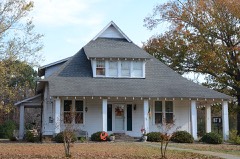 | Attwood-Hopson House | building | 1994 | 94000848 |
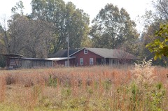 | Barnett-Attwood House | building | 1977 | 77000247 |
| Cherry Cemetery | site | 2024 | 100010830 | |
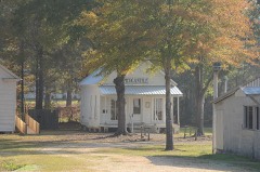 | Cleveland County Clerk's Building | building | 1976 | 76000394 |
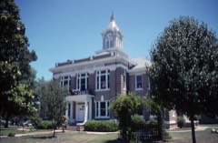 | Cleveland County Courthouse | building | 1977 | 77000248 |
| Magnolia Petroleum Company Filling Station | building | 2019 | 100003325 | |
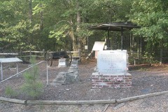 | Marks' Mills Battlefield Park | site | 1970 | 70000119 |
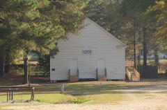 | Mount Olivet Methodist Church | building | 1975 | 75000377 |
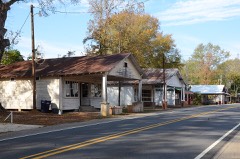 | New Edinburg Commercial Historic District | district | 2001 | 01001118 |
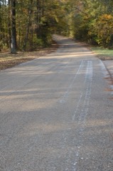 | Old US 79, Kingsland Segment | structure | 2005 | 05001067 |
| Phoenix Hotel | building | 2002 | 02001071 | |
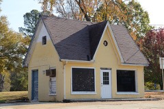 | Rison Cities Service Station | building | 2001 | 01000486 |
| Rison Overpass | structure | 2021 | 100006533 | |
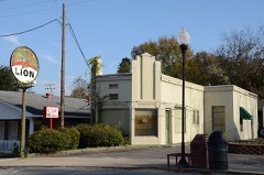 | Rison Texaco Service Station | building | 2002 | 01001243 |
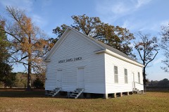 | Wesley Chapel | building | 1995 | 95001412 |
Every wildfire the federal occurrence database records inside this county: 445 of them, burning about 3,161 acres. 21 started naturally and 75 were recorded as arson. Each settlement page carries the fires within five miles of it.
| Reported cause | Fires |
|---|---|
| Missing data/not specified/undetermined | 165 |
| Debris and open burning | 142 |
| Arson/incendiarism | 75 |
| Natural | 21 |
| Equipment and vehicle use | 19 |
| Railroad operations and maintenance | 7 |
| Misuse of fire by a minor | 6 |
| Recreation and ceremony | 5 |
| Smoking | 5 |
The five largest, by the area the report gives. Four of them were set deliberately.
| Date | Cause | Size | Reported by | Name on the report |
|---|---|---|---|---|
| 8 August 2011 | Natural | 129 acres | Arkansas Forestry Commission | KINGSLAND |
| 9 December 2007 | Arson/incendiarism | 110 acres | Arkansas Forestry Commission | not named |
| 20 February 2007 | Misuse of fire by a minor | 96 acres | Arkansas Forestry Commission | not named |
| 2 October 2004 | Arson/incendiarism | 80 acres | Arkansas Forestry Commission | not named |
| 29 January 2011 | Arson/incendiarism | 75 acres | Arkansas Forestry Commission | not named |
| 29 April 2001 | Missing data/not specified/undetermined | 70 acres | Arkansas Forestry Commission | not named |
| 5 December 2005 | Arson/incendiarism | 65 acres | Arkansas Forestry Commission | not named |
| 18 November 2017 | Missing data/not specified/undetermined | 65 acres | Arkansas Forestry Commission | not named |
Every settlement page carries the fires within five miles of it - see the settlement index below.
The NOAA Storm Events Database holds 271 reports for this county, causing no deaths, 3 injuries and about $5,567,500 in recorded property damage. Each settlement page carries the reports that name it.
| Kind of event | Reports |
|---|---|
| Thunderstorm Wind | 134 |
| Hail | 82 |
| Flash Flood | 29 |
| Tornado | 11 |
| Flood | 10 |
| Heavy Rain | 4 |
| Lightning | 1 |
The most serious of them, by death, then injury, then recorded damage. The accounts are quoted exactly as the forecast office filed them.
| When | Event | Place named | Harm | What the report says |
|---|---|---|---|---|
| January 1953 | Tornado (F2) | not stated | 2 hurt, $2,500 | no account filed |
| May 2000 | Thunderstorm Wind | Rye | 1 hurt | no account filed |
| March 2008 | Tornado (EF2) | New Edinburg | $1,000,000 | An old, unoccupied house was destroyed. Two houses had much of the roofs blown off. A house trailer was destroyed by falling trees. Several chicken houses were destroyed. Roof and shingle damage occurred to several other houses. A number of barns and outbuildings were damaged. Hundreds of trees were blown down. |
| May 2011 | Flood | Mt Zion | $500,000 | no account filed |
| September 2008 | Flood | Staves | $360,000 | Numerous roads were flooded. Eight large culverts were washed out. A culvert was washed out along Gullett Road in the Orlando community, leaving three households stranded. A bridge across Moro Creek at Darby Crossing was floating and was damaged. |
| October 2009 | Flash Flood | Staves | $325,000 | Numerous county roads were damaged by flash flooding. |
| December 2009 | Flood | Staves | $300,000 | Flash flooding, which developed on the morning of the 24th, became widespread areal flooding later on the 24th and continued into the 25th. Several county roads suffered significant damage. A bridge on Prairie Road, east of Kingsland, was damaged. Roads closed due to high water included Darby Crossing Road north of Kingsland, Brushy Creek Road between Rison and Woodlawn, Dunkeffie Road west of Kedron, and Harmony Church Road at Rye. The county road department had to repair washouts on 85 roads. |
| December 2009 | Flash Flood | Staves | $300,000 | Widespread heavy rain resulted in the development of flash flooding on the 24th. |
| January 2013 | Thunderstorm Wind | Rye | $250,000 | A microburst damaged three chicken houses, one severely, and two sheds. Several large pine trees were blown down. |
| December 2009 | Flood | Chowan | $250,000 | Rising river waters swept a truck and several pieces of machinery parked near Pool access point along U.S. Highway 79 into the Saline River between Kingsland and Rison. The equipment had been used to make repairs to a nearby railroad crossing over the river. |
| May 2009 | Flood | Staves | $250,000 | Heavy rainfall in the basin pushed the Saline River at the gage near Rye above flood stage for most of the month of May. Numerous recreational cabins and primary residences were impacted by inundation or isolation. County and state roads also suffered damage. The crest at the gage was the 6th highest of record and the highest stage since 1987. |
| October 2009 | Thunderstorm Wind | New Edinburg | $250,000 | The Cleveland County judge indicated that virtually every road south of a line from New Edinburg to Rye was blocked by fallen trees. This included U.S. Highway 63, and Arkansas Highways 35 and 189. Recent wet weather kept loggers from working, so they used their equipment to help clear some of the roads. Power outages were widespread. |
| July 2016 | Thunderstorm Wind | Rison | $200,000 | Numerous chicken houses were damaged in the Rison area. |
| May 2010 | Thunderstorm Wind | Rye | $200,000 | Trees and power lines were blown down, a barn and some sheds were destroyed, tin was blown off barns, shingles were blown off a house, and a TV antenna was blown off a house. One tree at a residence fell on a truck and a car, and destroyed a shed. |
| October 2009 | Thunderstorm Wind | Rison | $150,000 | Trees and power lines were down. Several houses in the area sustained roof damage, and several chicken houses had their roofs torn off. |
| July 2016 | Thunderstorm Wind | Rison | $100,000 | Over 100 reports of trees and power lines down near Rison and across Cleveland County. |
| January 2012 | Tornado (EF2) | Kingsland | $100,000 | This tornado exited Dallas County north of the Fordyce airport and entered Cleveland County west-northwest of Kingsland. In Cleveland County, the tornado destroyed a church that had stood since 1852. A mobile home was destroyed, with a mattress hung up in a tree. Another mobile home had its roof taken off. Hundreds of trees were blown down. The tornado ended near the Saline River, in the Channings Ferry area. |
| April 2011 | Flood | Mt Zion | $100,000 | Widespread areal flooding occurred. |
| October 2009 | Flash Flood | New Edinburg | $100,000 | Many county roads were washed out. U.S. Highway 79 near Kingsland had several inches of water flowing across it. |
| August 2011 | Thunderstorm Wind | Pansy | $75,000 | A barn and a shop building were badly damaged. |
| October 2009 | Thunderstorm Wind | Pansy | $75,000 | Dozens of large trees were blown down, one of which fell on a house. Shingles were torn off houses and tin was taken off the roofs of old chicken houses. Power lines were blown down. |
| April 2022 | Thunderstorm Wind | Rison | $50,000 | Several trees fell on a mobile home, resulting in one fatality. |
| May 2009 | Flash Flood | Randall | $50,000 | Several unpaved roads were washed out across the county. Road washouts occurred north of Kingsland and in Rison. |
| March 2007 | Thunderstorm Wind | Rison | $50,000 | On U.S. 79, much of the tin roof was torn off the waste transfer station. On Niven Road, about three dozen large trees were blown down. Four mobile homes were damaged by the falling trees. One trailer, which was vacant, had a tree slice all the way through it. Two of the trailers were occupied, but there were no injuries. Power lines were knocked down by the falling trees. On Adams Road, a porch roof was blown off and a pine tree about 20 inches in diameter fell, taking down a power line. |
| November 1994 | Thunderstorm Wind | Rison | $50,000 | Thunderstorm winds downed some trees. A tree also fell onto a house causing roof damage. |
| October 2009 | Thunderstorm Wind | Pansy | $35,000 | A large tree was blown down onto a house. |
| October 2009 | Thunderstorm Wind | New Edinburg | $35,000 | A few large trees were down, one of which fell on a pickup truck. Power lines were also blown down. |
| April 2011 | Thunderstorm Wind | Rison | $25,000 | Trees and power lines were blown down onto roads around Rison. |
| July 2011 | Thunderstorm Wind | Randall | $25,000 | Trees were blown down. One of the trees landed on a car. |
| May 2010 | Tornado (EF1) | Herbine | $25,000 | Numerous trees were blown down. |
| May 2009 | Thunderstorm Wind | Rison | $25,000 | Trees blocked roadways and knocked down power lines in the area. An oak tree fell across Arkansas Highway 35 South at Rison blocking both lanes of traffic. A large pine tree fell in a resident's yard on Arkansas Highway 133 north of Rison, breaking an underground water line. |
| April 2008 | Flood | Chowan | $25,000 | The Saline River flood wave from the Benton gage progressed downstream to Cleveland County by the second week of April. Minor flooding at the Rye gage occurred during this time and caused some county roads to flood. Also, some pastures were flooded and access to timber was cut off. |
| April 1982 | Tornado (F2) | not stated | $25,000 | no account filed |
| May 1960 | Tornado (F2) | not stated | $25,000 | no account filed |
| June 2012 | Thunderstorm Wind | Rison | $20,000 | Many power lines were reported down in Rison. This caused many people to lose power throughout the town. |
| April 2011 | Thunderstorm Wind | Rison | $20,000 | Trees and power lines were blown down. |
| July 2007 | Flash Flood | Rison | $20,000 | Flooding was reported on several city streets. County roads and Arkansas Highway 35 South were flooded. Major damage was reported to Brushy Creek Road, Jack White Road and Tom Taylor Road. |
| July 2010 | Lightning | Rison | $15,000 | Lightning struck a transformer in Rison, knocking out power to the downtown area and much of the city. |
| May 2009 | Thunderstorm Wind | Kingsland | $15,000 | Numerous trees were down in Kingsland along U.S. Highway 79. |
| July 2009 | Thunderstorm Wind | Rison | $15,000 | Trees and power lines were down in Rison. |
| October 2009 | Thunderstorm Wind | Kedron | $15,000 | Trees and power lines were blown down. |
| October 2009 | Thunderstorm Wind | Y | $15,000 | Trees and power lines were blown down. |
| January 2010 | Flood | Chowan | $10,000 | This is a continuation of flooding from December, 2009. The Saline River at Rye remained above flood stage from the afternoon of December 27th through the morning of New Year's Day. |
| March 1997 | Thunderstorm Wind | Rison | $7,000 | no account filed |
| April 2014 | Thunderstorm Wind | Staves | $5,000 | Some trees were blown down. |
| June 2014 | Thunderstorm Wind | Kingsland | $5,000 | Trees were blown down. |
| June 2014 | Thunderstorm Wind | Rye | $5,000 | Trees were blown down. |
| December 2013 | Flood | Calmer | $5,000 | Arkansas 114 was closed due to flooding. |
| July 2012 | Thunderstorm Wind | Woodlawn | $5,000 | Trees were blown down. |
| August 2012 | Thunderstorm Wind | Staves | $5,000 | Trees were blown down. |
| August 2012 | Thunderstorm Wind | Kingsland | $5,000 | Trees were blown down. |
| September 2012 | Thunderstorm Wind | Unionville | $5,000 | Trees were blown down onto Arkansas 133. |
| April 2011 | Thunderstorm Wind | Rison | $5,000 | Trees were blown down. |
| July 2007 | Flash Flood | Woodlawn | $5,000 | County roads were flooded around Woodlawn. Smith Road sustained considerable damage. |
| July 2007 | Flash Flood | Kingsland | $5,000 | Heavy rains damaged roads around Kingsland. Cross Road suffered substantial damage. |
| November 1994 | Thunderstorm Wind | New Edinburg | $5,000 | Thunderstorm winds downed some trees. |
| May 1994 | Thunderstorm Wind | New Edinburg | $5,000 | Thunderstorm winds knocked down some trees. |
| October 1993 | Thunderstorm Wind | not stated | $5,000 | Thunderstorm winds downed several trees. |
| May 2013 | Thunderstorm Wind | Orlando | $3,000 | Trees were blown down on Arkansas 189. |
| March 1997 | Thunderstorm Wind | Rison | $3,000 | no account filed |
The Survey's mineral resources record lists 62 workings inside this county. 2 still produce and 60 are closed or unrecorded. Each settlement page carries the workings within five miles of it.
| Commodity | Workings |
|---|---|
| Sand and Gravel, Construction | 58 |
| Clay | 2 |
| Gemstone | 1 |
| Iron | 1 |
The least common of them first, because a county's hundredth gravel pit says nothing its first ten did not.
| Where | Site | Commodity | Status | Recorded |
|---|---|---|---|---|
| Rison | Iron | Unknown | ||
| Unk | Gemstone | Past Producer | ||
| Unk | Clay | Past Producer | ||
| Unk | Clay | Past Producer | ||
| Cleveland County Pit | Sand and Gravel, Construction | Producer | ||
| Cleveland County Pit | Sand and Gravel, Construction | Producer | ||
| Frank & Grady Wilson Pit | Sand and Gravel, Construction | Past Producer | ||
| Unk | Sand and Gravel, Construction | Past Producer | ||
| Unk | Sand and Gravel, Construction | Past Producer | ||
| Unk | Sand and Gravel, Construction | Past Producer | ||
| Unk | Sand and Gravel, Construction | Past Producer | ||
| Unk | Sand and Gravel, Construction | Past Producer | ||
| Unk | Sand and Gravel, Construction | Past Producer | ||
| Unk | Sand and Gravel, Construction | Past Producer | ||
| Unk | Sand and Gravel, Construction | Past Producer | ||
| Unk | Sand and Gravel, Construction | Past Producer | ||
| Unk | Sand and Gravel, Construction | Past Producer | ||
| Unk | Sand and Gravel, Construction | Past Producer | ||
| Unk | Sand and Gravel, Construction | Past Producer | ||
| Unk | Sand and Gravel, Construction | Past Producer | ||
| Unk | Sand and Gravel, Construction | Past Producer | ||
| Unk | Sand and Gravel, Construction | Past Producer | ||
| Unk | Sand and Gravel, Construction | Past Producer | ||
| Unk | Sand and Gravel, Construction | Past Producer | ||
| Unk | Sand and Gravel, Construction | Past Producer | ||
| Unk | Sand and Gravel, Construction | Past Producer | ||
| Unk | Sand and Gravel, Construction | Past Producer | ||
| Unk | Sand and Gravel, Construction | Past Producer | ||
| Unk | Sand and Gravel, Construction | Past Producer | ||
| Unk | Sand and Gravel, Construction | Past Producer | ||
| Unk | Sand and Gravel, Construction | Past Producer | ||
| Unk | Sand and Gravel, Construction | Past Producer | ||
| Unk | Sand and Gravel, Construction | Past Producer | ||
| Unk | Sand and Gravel, Construction | Past Producer | ||
| Unk | Sand and Gravel, Construction | Past Producer | ||
| Unk | Sand and Gravel, Construction | Past Producer | ||
| Unk | Sand and Gravel, Construction | Past Producer | ||
| Unk | Sand and Gravel, Construction | Past Producer | ||
| Unk | Sand and Gravel, Construction | Past Producer | ||
| Unk | Sand and Gravel, Construction | Past Producer | ||
| Unk | Sand and Gravel, Construction | Past Producer | ||
| Unk | Sand and Gravel, Construction | Past Producer | ||
| Unk | Sand and Gravel, Construction | Past Producer | ||
| Unk | Sand and Gravel, Construction | Past Producer | ||
| Unk | Sand and Gravel, Construction | Past Producer | ||
| Unk | Sand and Gravel, Construction | Past Producer | ||
| Unk | Sand and Gravel, Construction | Past Producer | ||
| Unk | Sand and Gravel, Construction | Past Producer | ||
| Unk | Sand and Gravel, Construction | Past Producer | ||
| Unk | Sand and Gravel, Construction | Past Producer | ||
| Unk | Sand and Gravel, Construction | Past Producer | ||
| Unk | Sand and Gravel, Construction | Past Producer | ||
| Unk | Sand and Gravel, Construction | Past Producer | ||
| Unk | Sand and Gravel, Construction | Past Producer | ||
| Unk | Sand and Gravel, Construction | Past Producer | ||
| Unk | Sand and Gravel, Construction | Past Producer | ||
| Unk | Sand and Gravel, Construction | Past Producer | ||
| Unk | Sand and Gravel, Construction | Past Producer | ||
| Unk | Sand and Gravel, Construction | Past Producer | ||
| Unk | Sand and Gravel, Construction | Past Producer | ||
| Unk | Sand and Gravel, Construction | Past Producer | ||
| Unk | Sand and Gravel, Construction | Past Producer |
Named settlements recorded in the Geographic Names Information System, each with the topographic sheets covering it. Villages, hamlets and abandoned places alike. Each is shown with the nearest named watercourse or landform and the survey quadrangle it falls on.
Hurricane township · 71665 · Cornerville quadrangle
10 sheets, 1935 to 1986
No longer a settlement
Saline township · 71725 · On Spring Branch · Bunn quadrangle
9 sheets, 1955 to 1985
No longer a settlement
White Oak township · 71665 · On Grisly Creek · Fordyce NE quadrangle
12 sheets, 1953 to 1989
Saline township · 71652 · On Caney Creek · Bunn quadrangle
9 sheets, 1955 to 1985
No longer a settlement
Kingsland township · 71652 · Kingsland quadrangle
12 sheets, 1953 to 1989
No longer a settlement
Bowman township · 71665 · On Little Brushy Creek · Faith quadrangle
9 sheets, 1955 to 1985
No longer a settlement
Redland township · 71660 · New Edinburg quadrangle
12 sheets, 1953 to 1989
No longer a settlement
Hurricane township · 71665 · On Little Blakey Creek · Herbine quadrangle
12 sheets, 1953 to 1989
No longer a settlement
Kingsland township · 71652 · On Camp Creek · Kingsland quadrangle
12 sheets, 1953 to 1989
No longer a settlement
Rison township · 71665 · On Harrison Creek · Rison quadrangle
12 sheets, 1953 to 1989
No longer a settlement
Kingsland township · 71652 · On Gooley Creek · Rison quadrangle
12 sheets, 1953 to 1989
No longer a settlement
Smith township · 71665 · On Double Creek · Herbine quadrangle
12 sheets, 1953 to 1989
No longer a settlement
Redland township · 71652 · New Edinburg quadrangle
12 sheets, 1953 to 1989
No longer a settlement
Kingsland township · 71652 · On Toad Creek · Ivan quadrangle
12 sheets, 1953 to 1989
No longer a settlement
The vanished settlements of Cleveland County: the places named above that are no longer on the map.