Block
From the record
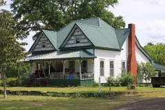
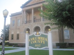
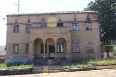
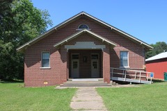
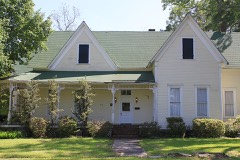
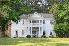
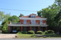
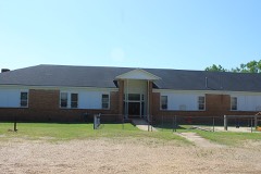
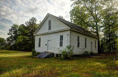
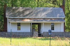
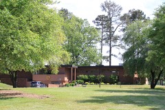
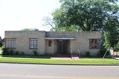
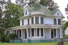
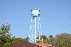
24 National Register listings published here.
Sources: the National Register database, National Park Service
41 topographic sheets cover 63 settlements here, and 24 properties are on the National Register of Historic Places.
24 National Register listings published here.
Sources: the National Register database, National Park Service
Every property in this county listed on the National Register of Historic Places, with the year it was listed and the federal nomination document.
Every wildfire the federal occurrence database records inside this county: 764 of them, burning about 8,788 acres. 41 started naturally and 206 were recorded as arson. Each settlement page carries the fires within five miles of it.
| Reported cause | Fires |
|---|---|
| Missing data/not specified/undetermined | 257 |
| Arson/incendiarism | 206 |
| Debris and open burning | 176 |
| Equipment and vehicle use | 44 |
| Natural | 41 |
| Smoking | 19 |
| Railroad operations and maintenance | 11 |
| Misuse of fire by a minor | 5 |
| Recreation and ceremony | 5 |
The five largest, by the area the report gives. Two of them were set deliberately.
| Date | Cause | Size | Reported by | Name on the report |
|---|---|---|---|---|
| 22 March 2004 | Natural | 727 acres | Arkansas Forestry Commission | BUSSEY |
| 12 March 2005 | Equipment and vehicle use | 264 acres | Arkansas Forestry Commission | not named |
| 3 April 2011 | Missing data/not specified/undetermined | 236 acres | Arkansas Forestry Commission | EMERSON |
| 8 March 2007 | Arson/incendiarism | 231 acres | Arkansas Forestry Commission | TAYLOR #81 |
| 9 August 2011 | Arson/incendiarism | 221 acres | Arkansas Forestry Commission | WALDO |
| 8 October 2011 | Missing data/not specified/undetermined | 213 acres | Arkansas Forestry Commission | MACEDONIA |
| 16 October 2011 | Missing data/not specified/undetermined | 175 acres | Arkansas Forestry Commission | AIRPORT |
| 9 April 2013 | Missing data/not specified/undetermined | 165 acres | Arkansas Forestry Commission | CORNELIUS |
Every settlement page carries the fires within five miles of it - see the settlement index below.
The NOAA Storm Events Database holds 464 reports for this county, causing 4 deaths, 25 injuries and about $140,950,560 in recorded property damage. Each settlement page carries the reports that name it.
| Kind of event | Reports |
|---|---|
| Thunderstorm Wind | 202 |
| Hail | 167 |
| Flash Flood | 46 |
| Tornado | 36 |
| Lightning | 8 |
| Flood | 2 |
| Funnel Cloud | 2 |
| Heavy Rain | 1 |
The most serious of them, by death, then injury, then recorded damage. The accounts are quoted exactly as the forecast office filed them.
| When | Event | Place named | Harm | What the report says |
|---|---|---|---|---|
| December 1957 | Tornado (F4) | not stated | 2 killed, 9 hurt, $25,000 | no account filed |
| March 1964 | Tornado (F3) | not stated | 1 killed, $250,000 | no account filed |
| August 2000 | Thunderstorm Wind | Magnesia Spgs | 1 killed, $30,000 | Tree fell on a house resulting in one fatality. Numerous other trees down in and around Magnolia. |
| May 1981 | Tornado (F2) | not stated | 4 hurt, $250,000 | no account filed |
| May 2003 | Hail | Magnolia | 3 hurt | Numerous car and home windows were shattered and numerous roofs stripped of shingles. An estimated 400 homes and 40 mobile homes received moderate to major damage according to Farm Bureau Insurance and the Emergency Management. Damage extended from County Road 36 between Woodland Acres Estates and Lake Sue Nursery, across US 82 and continued southeastwardly through the Calhoun and Tidewater Communities. Damage was also reported along County Roads 11, 25, 30, 34, 35, 36, 402, 447, and 525 to name a few. The brunt of the storm appeared to be along the Calhoun/Old El Dorado Highway area. Damage included dented decking on roofs, broken windows, roofs damaged, water damage, sprinkler heads broken off, greenhouses totally destroyed and plants pulverized. The chopped up leaf debris, twigs and small limbs ripped from arbors was also impressive. At least 3 people were injured. A hailstone went through the sunroof of a car and flying glass cut one female occupant. Another man was hurt when his car was hit by hailstones. A family made a run for a storm shelter but was beaten by the falling ice. One 7 year old child was struck in the head by a large stone and suffered many bruises. All the injuries were treated and released. |
| April 1982 | Tornado (F1) | not stated | 2 hurt, $25,000 | no account filed |
| April 1962 | Tornado (F2) | not stated | 2 hurt, $25,000 | no account filed |
| December 1973 | Tornado (F1) | not stated | 1 hurt, $250,000 | no account filed |
| October 2009 | Tornado (EF1) | Agricultural School | 1 hurt, $200,000 | Another EF1 tornado touched down on the northeast side of Magnolia, Arkansas. The tornado touched down on CR 47 about one quarter of a mile east of Hwy. 79. Some significant to major damage was observed to several mobile homes and powerlines and poles were snapped. A residential shop was also damaged by fallen trees. Winds were estimated at 95-105 mph. |
| August 2010 | Lightning | Chalybeat Spgs | 1 hurt, $75,000 | Lightning struck a container at the Key Energy Services Salt Water Disposal Plant about one mile north of the Louisiana state line in extreme southern Columbia County, Arkansas. This lightning strike set off an explosion and fire from nine tanks. The explosion and fire injured the operator on duty at the facility. He was taken to Magnolia Regional Medical Center with only minor injuries. The facility was a total loss. |
| June 2004 | Thunderstorm Wind | Magnolia | 1 hurt, $40,000 | Thunderstorm wind gusts downed trees which fell atop two pick-up trucks. One of the drivers was injured and taken to a local hospital where he was treated and released. |
| June 2004 | Thunderstorm Wind | Taylor | 1 hurt, $20,000 | Severe wind gusts downed a tree which fell atop a driven vehicle on U.S. Hwy 371. The man driving the vehicle was injured and taken to a local hospital where he was treated and released. |
| October 2001 | Flash Flood | Magnolia | $120,000,000 | Numerous roads closed from high water. The county was declared a disaster area due to the washed out roads and bridges. Nearly 8 inches of rain fell in less than 12 hours. |
| April 1997 | Flash Flood | Magnolia | $11,000,000 | Flooding was reported across the entire city. The local hospital had one foot of water in it while water also entered numerous homes. Rainfall for a 24 hour period averaged just under twelve inches. Many roads and bridges were washed out resulting in 1 million dollars damage alone. |
| April 1994 | Tornado (F2) | Magnolia | $5,000,000 | An F2 tornado touched down in Magnolia. The tornado traveled approximately two miles through Magnolia before lifting. The tornado damaged a number of vehicles in a car lot, destroyed a greenhouse at a local Wal-Mart and damaged a local gas station. Several mobile homes were either damaged or destroyed and a small church was also damaged. |
| May 1999 | Tornado (F3) | Magnolia | $600,000 | Two frame homes were demolished, several frame homes suffered roof damage, 1 church and 3 businesses suffered roof and frame damage. Many trees were snapped and uprooted. Damage estimates includes timber damage. |
| November 1994 | Thunderstorm Wind | Welcome | $500,000 | Thunderstorm winds overturned two mobile homes. |
| October 2009 | Flash Flood | Bright | $250,000 | Numerous roads were closed in town and across the county from excessive heavy rainfall. Just some of the roads closed throughout the county included County Roads 7, 31, 38, 47, 60, 72, 204, 246 and 400. At the high of the storm, four dozen county and state roads had high water across them. Many of these roads were washed out as well and will need to be replaced along with adjacent culverts. Columbia County was declared a Federal Disaster Area because of the extreme flood and storm damage that ensued during the month of October. |
| May 1981 | Tornado (F1) | not stated | $250,000 | no account filed |
| April 1997 | Tornado (F1) | Emerson | $200,000 | A tornado touched down 1 mile southwest of Cotton Valley in Webster Parish, LA., and moved northeast past Shangaloo into Columbia County, AR., 7 miles southwest of Emerson. The tornado snapped numerous trees and damaged one home. |
| May 1999 | Tornado (F2) | Taylor | $150,000 | A supercell developed under favourable atmospheric conditions. A partial roof was removed from a frame home. One mobile home was heavily damaged. Numerous trees were snapped or uprooted. Damage estimates include timber damage. |
| April 1999 | Flash Flood | Magnolia | $140,000 | Numerous county roads were under 4 to 6 feet of water. One small bridge was washed out. |
| April 2025 | Thunderstorm Wind | Kilgore Lodge | $110,000 | A strong downburst with estimated maximum winds near 110 mph was confirmed by a NWS Storm Survey team and drone video just southeast of Lake Columbia in Western Columbia County. Hundreds of trees were snapped and uprooted, all lying in a north-northeasterly direction along County Roads 27 and 53, Highway 344, and County Road 33. One home suffered moderate damage when two pine trees were uprooted and fell along the front and backside of the home, crushing their front porch and temporarily trapping 2 residents inside. One manufactured home and the Lakeside Water Association office along Highway 344 also suffered minor roof damage. |
| April 2014 | Thunderstorm Wind | Magnolia Muni Arpt | $100,000 | The NWS conducted a storm survey in Columbia County, Arkansas and determined that the damage across the county was consistent with that produced by a bow echo. Numerous trees were downed south of Magnolia, Arkansas and the winds resulted in damage to several outbuildings and shingles off of roofs. |
| October 2009 | Flash Flood | Beech Creek | $100,000 | County Roads 7, 41, 45, 53, 55, 60, 64, 79, 114, 140, 246 and 349 were all closed due to flooding. Columbia County was one of 20 counties across the state that were declared disaster areas from rainfall up to the 13th, 14th and 15th of October. |
| March 2008 | Hail | Magnolia | $100,000 | Hail knocked out windows to homes and damaged automobiles. |
| August 2008 | Flash Flood | Magnolia | $100,000 | Flooding was occurring in Magnolia and other nearby communities. Several county roads were underwater including high water across County Road 15 or Burnt Bridge Road. In Magnolia, Arkansas, several city streets were underwater including the intersections of East Main and Dudney as well as East North and Dudney. Barricades were needed along West Main Street near the West Side High School. Vine Street was washed out where some cars were flooded out. |
| July 2007 | Lightning | Emerson | $80,000 | Lightning struck an oil and saltwater tank about 2 miles north of the La. state line just off Hwy. 79. Resultant fire spread and burned 8 tanks...three of which completely melted. Multiple fire agencies on the Louisiana and Arkansas side of the fire needed to be called in to extinguish the fire. No injuries or evacuations were reported. |
| April 2011 | Tornado (EF1) | Box Spgs | $75,000 | The National Weather Service conducted a storm survey in Columbia County Arkansas and concluded that storm damage was the result of an EF1 tornado. The tornado touched down at around 9:28 AM, south of Waldo AR along county road 153 ripping off tin from a small barn. A home east of CR 153 sustained minor roof damage and the adjacent garage sustained minor roof damage and some structural damage. The tornado continued east southeast crossing CR 148 where several trees were snapped and uprooted. A home sustained minor roof damage and a small shed had half of its roof torn off. Further eastseveral trees were snapped and uprooted in a field and a abandoned home had portions of its roof torn off and thrown southeast. The tornado lifted on the south side of cr 148. Maximum winds are estimated at 85-90 mph. |
| April 2011 | Thunderstorm Wind | Magnolia | $75,000 | Numerous fallen trees resulted in damage to a mobile home and a residence at the 600 block of CR. 148 near Magnolia. |
| October 2009 | Tornado (EF1) | Magnolia Muni Arpt | $75,000 | An EF1 tornado touched down in Magnolia, Arkansas. The tornado uprooted several trees and some minor damage was noted to homes at the intersection of South Washington and Hampton Drive. One business in downtown Magnolia had its sign blown out. Winds were estimated at 80-90 mph. |
| July 2007 | Lightning | Magnolia | $60,000 | Lightning struck a tree near 79 Sassafras Drive in Magnolia, Arkansas blasting a hole in the yard. The bolt traveled through water pipes in the home of a local resident. No occupants were home at the time but two dogs were overcome by smoke. |
| October 2019 | Tornado (EF1) | Welcome | $50,000 | This is a continuation of the Southeast Lafayette County tornado. This EF-1 tornado, with estimated maximum winds around 100 mph, continued east along County Road 21 in far Southwest Columbia County just north of the Louisiana state line, where it reached peak intensity and partially removed the roof from two homes. A few large trees were also snapped at the trunk or had several large limbs removed before crossing Highway 371. The tornado remained on a slight east northeast track in far Southern Columbia County where it continued to produce sporadic tree damage before lifting near County Road 278. |
| May 2019 | Lightning | Welcome | $50,000 | Highway 371 was closed due to lightning striking one of the natural gas refinery tanks near the roadway. |
| July 2012 | Flash Flood | Agricultural School | $50,000 | Some cars were flooded and water was beginning to enter a few businesses in downtown Magnolia, Arkansas. |
| October 2009 | Tornado (EF1) | Agricultural School | $50,000 | Another EF1 tornado touched down on the northeast side of Magnolia, Arkansas. The tornado touched down near CR. 61 just east of CR. 431 or about one and one half mile east of Hwy. 79. Some roof damage was observed to one home and a tree fell on one vehicle. After the initial touchdown, sporadic tree damage associated with this tornado was observed just east of CR. 61 all the way up to just north of CR. 75. Winds were estimated at 80-90 mph. |
| October 2009 | Thunderstorm Wind | Taylor | $50,000 | Several trees and powerlines were downed in the Taylor, Arkansas community. Many powerlines were downed between the Southern Arkansas University Campus and the town of McNeil as 7 power poles were downed in that location. In addition, several trees were downed on the Emerson-Taylor School campus where windows were shattered. Among roads across the county that were blocked included Arkansas 19 south of Walkerville and Arkansas 98 between Emerson and Arkansas 160 east of Taylor. County Road 61 in the Ebenezer area was blocked by a downed tree with trees also across County Roads 3, 27 and 80. In Magnolia, a tree blocked South Washington Street near the Bethlehem Missionary Baptist Church, and other trees blocked portions of West University. |
| April 1994 | Thunderstorm Wind | Lumber | $50,000 | Thunderstorm winds downed a number of trees. |
| November 1994 | Thunderstorm Wind | Walkerville | $50,000 | Thunderstorm winds downed numerous trees and power lines. |
| February 2009 | Thunderstorm Wind | Magnolia | $40,000 | Numerous trees and power lines were downed. An awning was blown off the Coca Cola plant and a radio tower was blown down at the police department. |
| October 2009 | Flash Flood | Magnolia Muni Arpt | $40,000 | Heavy rainfall caused flash flooding in the Magnolia community. One car and driver on North Dudley Street near East Main found herself in water up to her car seat. Two other vehicles flooded on Stadium Drive near the Louisiana and North West Railroad. |
| August 2003 | Thunderstorm Wind | Magnolia | $40,000 | Several trees down. One large tree fell on a house. |
| July 2003 | Lightning | Macedonia | $40,000 | The Rudd's Crossing Volunteer Fire Department went to a barn fire on Columbia 147 off Arkansas 271 which was started by a lightning strike. The structure was reported a total loss. |
| January 2023 | Tornado (EF1) | Mt Vernon | $35,000 | An EF-1 tornado with estimated maximum winds near 100 mph touched down near County Road 52 near Lake Columbia. There, it snapped several softwood trees before continuing onward into forested areas where it caused intermittent damage. As the tornado continued to move northeast, damage was again observed near North Mill and North Cottage Street where trees were snapped and uprooted. The tornado continued on to uproot and snap trees as it crossed Washington and Neil Streets in the city of Waldo. Prior to reaching Highway 371, the tornado damaged an awning of a church, before knocking over several power poles and snapping trees across several blocks in Waldo. On the northeast side of the city limits, the tornado completely destroyed a small metal outbuilding and continued on to snap more trees at the edge of a farm before lifting. |
| April 2002 | Thunderstorm Wind | Taylor | $30,000 | Several large trees down including one tree that crushed a mobile home. |
| May 2020 | Tornado (EF1) | Bright | $25,000 | An EF-1 tornado with estimated maximum winds near 100 mph touched down along Columbia Road 31 where it snapped tree limbs on several hardwood trees. The tornado continued to uproot approximately ten trees and flipped a car near a residence along Columbia Road 104. The tornado reached its maximum intensity when it snapped trees as it crossed Highway 355 before crossing over into Southern Nevada County. |
| April 2016 | Tornado (EF0) | Village | $25,000 | An EF-0 tornado touched down near the intersection of County Road 294 and Highway 82 east of Magnolia, where it damaged several trees and snapped numerous limbs. It remained on the ground for just over one mile where it snapped a large oak tree along County Road 34 before lifting. A large barn just south along County Road 34 also collapsed due to the rear flank downdraft winds associated with the storm. Maximum winds from this tornado were estimated near 74 mph. |
| May 1977 | Tornado (F1) | not stated | $25,000 | no account filed |
| May 1957 | Tornado (F2) | not stated | $25,000 | no account filed |
| March 1996 | Thunderstorm Wind | Magnolia | $20,000 | no account filed |
| August 2001 | Lightning | Magnolia | $12,000 | Lightning struck a home in Magnolia when the owners head a loud pop. The power went off and it was discovered the lightning struck the meter loop, traveled from the loop to the northwest (far) end of the house where the breaker box was located in a utility room and set fire to the carport, utility room, and kitchen. The lightning hit with enough force to knock pictures off the walls of the home. |
| April 2002 | Thunderstorm Wind | Welcome | $10,000 | Straight line wind gusts destroyed a barn and blew bricks off a home. Several large trees were also blown over. |
| April 1999 | Thunderstorm Wind | Magnolia | $10,000 | Winds were measured at Industrial Plant which suffered roof damage. |
| September 1996 | Thunderstorm Wind | Mc Neil | $10,000 | no account filed |
| September 2009 | Flash Flood | Magnolia Muni Arpt | $5,000 | Excessive heavy rainfall flooded city street in Magnolia, Arkansas including a home at the corner of Columbia and Buffington. The rain turned a ditch on the south side of Columbia near the Magnolia Hospital into a raging torrent. Local Police Department blocked off a portion of Dudney Street between Main and Union Streets due to high water. |
| July 2007 | Thunderstorm Wind | Magnolia | $5,000 | Awning blown off of a building on Washington Street near downtown. Powerlines were also knocked down on North Jackson Street near downtown. Trees were downed on county road 27. Around 15 trees were taken down by damaging wind gusts just south of the city. |
| October 2001 | Flash Flood | Jefferson | $5,000 | A railroad underpass was under water 1/2 mile east of the county line on Hwy 82. An 18-wheeler was damaged attempting to cross. |
| November 1994 | Thunderstorm Wind | Waldo | $5,000 | Several trees were blown down and a barn received some roof damage. |
| November 1994 | Thunderstorm Wind | Emerson | $5,000 | Thunderstorm winds downed several trees. |
| June 1994 | Thunderstorm Wind | Lumber | $5,000 | Thunderstorm winds blew down several trees. |
The Survey's mineral resources record lists 58 workings inside this county. 3 still produce and 55 are closed or unrecorded. Each settlement page carries the workings within five miles of it.
| Commodity | Workings |
|---|---|
| Sand and Gravel, Construction | 46 |
| Bromine | 9 |
| Clay | 3 |
| Sulfur | 1 |
The least common of them first, because a county's hundredth gravel pit says nothing its first ten did not.
| Where | Site | Commodity | Status | Recorded |
|---|---|---|---|---|
| Magnolia Plant | Sulfur, Bromine | Producer | ||
| Unk | Clay | Past Producer | ||
| Unk | Clay | Past Producer | ||
| Unk | Clay | Past Producer | ||
| Dow Chem. Bromine Plant | Bromine | Producer | ||
| Unk | Bromine | Past Producer | ||
| Unk | Bromine | Past Producer | ||
| Unk | Bromine | Past Producer | ||
| Unk | Bromine | Past Producer | ||
| Unk | Bromine | Past Producer | ||
| Unk | Bromine | Past Producer | ||
| Unk | Bromine | Past Producer | ||
| Lambert & Barr,Inc | Sand and Gravel, Construction | Past Producer | ||
| Unk | Sand and Gravel, Construction | Past Producer | ||
| Unk | Sand and Gravel, Construction | Past Producer | ||
| Unk | Sand and Gravel, Construction | Past Producer | ||
| Unk | Sand and Gravel, Construction | Past Producer | ||
| Unk | Sand and Gravel, Construction | Past Producer | ||
| Unk | Sand and Gravel, Construction | Past Producer | ||
| Unk | Sand and Gravel, Construction | Past Producer | ||
| Unk | Sand and Gravel, Construction | Past Producer | ||
| Unk | Sand and Gravel, Construction | Past Producer | ||
| Unk | Sand and Gravel, Construction | Past Producer | ||
| Unk | Sand and Gravel, Construction | Past Producer | ||
| Unk | Sand and Gravel, Construction | Past Producer | ||
| Unk | Sand and Gravel, Construction | Past Producer | ||
| Unk | Sand and Gravel, Construction | Past Producer | ||
| Unk | Sand and Gravel, Construction | Producer | ||
| Unk | Sand and Gravel, Construction | Past Producer | ||
| Unk | Sand and Gravel, Construction | Past Producer | ||
| Unk | Sand and Gravel, Construction | Past Producer | ||
| Unk | Sand and Gravel, Construction | Past Producer | ||
| Unk | Sand and Gravel, Construction | Past Producer | ||
| Unk | Sand and Gravel, Construction | Past Producer | ||
| Unk | Sand and Gravel, Construction | Past Producer | ||
| Unk | Sand and Gravel, Construction | Past Producer | ||
| Unk | Sand and Gravel, Construction | Past Producer | ||
| Unk | Sand and Gravel, Construction | Past Producer | ||
| Unk | Sand and Gravel, Construction | Past Producer | ||
| Unk | Sand and Gravel, Construction | Past Producer | ||
| Unk | Sand and Gravel, Construction | Past Producer | ||
| Unk | Sand and Gravel, Construction | Past Producer | ||
| Unk | Sand and Gravel, Construction | Past Producer | ||
| Unk | Sand and Gravel, Construction | Past Producer | ||
| Unk | Sand and Gravel, Construction | Past Producer | ||
| Unk | Sand and Gravel, Construction | Past Producer | ||
| Unk | Sand and Gravel, Construction | Past Producer | ||
| Unk | Sand and Gravel, Construction | Past Producer | ||
| Unk | Sand and Gravel, Construction | Past Producer | ||
| Unk | Sand and Gravel, Construction | Past Producer | ||
| Unk | Sand and Gravel, Construction | Past Producer | ||
| Unk | Sand and Gravel, Construction | Past Producer | ||
| Unk | Sand and Gravel, Construction | Past Producer | ||
| Unk | Sand and Gravel, Construction | Past Producer | ||
| Unk | Sand and Gravel, Construction | Past Producer | ||
| Unk | Sand and Gravel, Construction | Past Producer | ||
| Unk | Sand and Gravel, Construction | Past Producer | ||
| Unk | Sand and Gravel, Construction | Past Producer |
Named settlements recorded in the Geographic Names Information System, each with the topographic sheets covering it. Villages, hamlets and abandoned places alike. Each is shown with the nearest named watercourse or landform and the survey quadrangle it falls on.
Emerson township · 71740 · On Spring Branch · Emerson SE quadrangle
13 sheets, 1953 to 1989
No longer a settlement
Emerson township · 71740 · On North Cypress Creek · Emerson quadrangle
13 sheets, 1953 to 1989
McNeil township · 71753 · On Pretty Branch · Magnolia NW quadrangle
13 sheets, 1953 to 1989
No longer a settlement
Emerson township · 71740 · On Chalybeate Springs Branch · Emerson SE quadrangle
13 sheets, 1953 to 1989
Emerson township · 71740 · On White Oak Creek · Walkerville quadrangle
14 sheets, 1953 to 1989
Magnolia township · 71753 · On Mill Creek · Macedonia quadrangle
15 sheets, 1953 to 1989
McNeil township · 71752 · On Pretty Branch · Magnolia NW quadrangle
13 sheets, 1953 to 1989
Village township · 71753 · On Slow Motion Creek · Spotville quadrangle
12 sheets, 1953 to 1989
Village township · 71753 · On Harper Creek · Spotville quadrangle
12 sheets, 1953 to 1989
Taylor township · 71861 · On Little Crooked Creek · Taylor quadrangle
13 sheets, 1953 to 1989
Emerson township · 71740 · On Chalybeate Springs Branch · Emerson SE quadrangle
13 sheets, 1953 to 1989
The vanished settlements of Columbia County: the places named above that are no longer on the map.