 Block
From the record
One of 24 National Register listings published here for Columbia County · listed in 1982 · category: Building.
Sources: the National Register database, National Park Service · the Wikipedia article
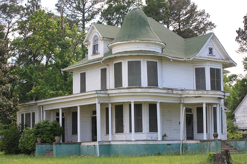
Listed on the National Register of Historic Places in 1982.
One of 24 National Register listings published here for Columbia County · listed in 1982 · category: Building.
Sources: the National Register database, National Park Service · the Wikipedia article
Regional context, not property-specific evidence. The federal wildfire occurrence database lists 118 fires within 5 miles of Kate Turner House between 1997 and 2020, burning about 789 acres in total. 3 started naturally. 33 were recorded as arson. Distance is straight-line from the map coordinates, so a fire counted here may appear on a neighbouring settlement's page as well.
| Reported cause | Fires |
|---|---|
| Debris and open burning | 43 |
| Missing data/not specified/undetermined | 35 |
| Arson/incendiarism | 33 |
| Smoking | 3 |
| Natural | 3 |
| Recreation and ceremony | 1 |
The most recent of them, most recent first, with the day each was reported and the service that recorded it.
| Date | Cause | Size | Reported by | Name on the report |
|---|---|---|---|---|
| 9 September 2013 | Missing data/not specified/undetermined | 5.0 acres | Arkansas Forestry Commission | not named |
| 6 September 2000 | Arson/incendiarism | 2.0 acres | Arkansas Forestry Commission | not named |
| 6 September 2000 | Arson/incendiarism | 2.0 acres | Arkansas Forestry Commission | not named |
| 5 September 1998 | Arson/incendiarism | 1.0 acres | Arkansas Forestry Commission | not named |
| 5 September 1998 | Arson/incendiarism | 2.0 acres | Arkansas Forestry Commission | not named |
| 4 September 1998 | Debris and open burning | 1.0 acres | Arkansas Forestry Commission | not named |
| 4 September 1998 | Debris and open burning | 2.0 acres | Arkansas Forestry Commission | not named |
| 29 September 2000 | Debris and open burning | 1.0 acres | Arkansas Forestry Commission | not named |
Regional context, not property-specific evidence. The federal mineral resources record lists 7 workings within 5 miles of Kate Turner House: 6 past producers, 1 producer. 1 still produces. What was taken out: Bromine, Sand and Gravel, Construction. Distance is straight-line from the map coordinates, so a quarry counted here may appear on a neighbouring settlement's page as well.
Regional context, not property-specific evidence. The National Weather Service names Magnolia, the town this property stands in, in 98 storm reports between 1993 and 2025: 48 thunderstorm wind, 33 hail, 11 flash flood, 3 lightning. The reports record 4 injuries. Each account below is quoted exactly as the forecast office filed it, from the NOAA Storm Events Database, and each date opens the federal record of that event.
| When | Event | Place named | Harm | What the report says |
|---|---|---|---|---|
| May 2003 | Hail | Magnolia | 3 hurt | Numerous car and home windows were shattered and numerous roofs stripped of shingles. An estimated 400 homes and 40 mobile homes received moderate to major damage according to Farm Bureau Insurance and the Emergency Management. Damage extended from County Road 36 between Woodland Acres Estates and Lake Sue Nursery, across US 82 and continued southeastwardly through the Calhoun and Tidewater Communities. Damage was also reported along County Roads 11, 25, 30, 34, 35, 36, 402, 447, and 525 to name a few. The brunt of the storm appeared to be along the Calhoun/Old El Dorado Highway area. Damage included dented decking on roofs, broken windows, roofs damaged, water damage, sprinkler heads broken off, greenhouses totally destroyed and plants pulverized. The chopped up leaf debris, twigs and small limbs ripped from arbors was also impressive. At least 3 people were injured. A hailstone went through the sunroof of a car and flying glass cut one female occupant. Another man was hurt when his car was hit by hailstones. A family made a run for a storm shelter but was beaten by the falling ice. One 7 year old child was struck in the head by a large stone and suffered many bruises. All the injuries were treated and released. |
| June 2004 | Thunderstorm Wind | Magnolia | 1 hurt, $40,000 | Thunderstorm wind gusts downed trees which fell atop two pick-up trucks. One of the drivers was injured and taken to a local hospital where he was treated and released. |
| October 2001 | Flash Flood | Magnolia | $120,000,000 | Numerous roads closed from high water. The county was declared a disaster area due to the washed out roads and bridges. Nearly 8 inches of rain fell in less than 12 hours. |
| April 1997 | Flash Flood | Magnolia | $11,000,000 | Flooding was reported across the entire city. The local hospital had one foot of water in it while water also entered numerous homes. Rainfall for a 24 hour period averaged just under twelve inches. Many roads and bridges were washed out resulting in 1 million dollars damage alone. |
| April 1994 | Tornado (F2) | Magnolia | $5,000,000 | An F2 tornado touched down in Magnolia. The tornado traveled approximately two miles through Magnolia before lifting. The tornado damaged a number of vehicles in a car lot, destroyed a greenhouse at a local Wal-Mart and damaged a local gas station. Several mobile homes were either damaged or destroyed and a small church was also damaged. |
| May 1999 | Tornado (F3) | Magnolia | $600,000 | Two frame homes were demolished, several frame homes suffered roof damage, 1 church and 3 businesses suffered roof and frame damage. Many trees were snapped and uprooted. Damage estimates includes timber damage. |
| April 1999 | Flash Flood | Magnolia | $140,000 | Numerous county roads were under 4 to 6 feet of water. One small bridge was washed out. |
| March 2008 | Hail | Magnolia | $100,000 | Hail knocked out windows to homes and damaged automobiles. |
| August 2008 | Flash Flood | Magnolia | $100,000 | Flooding was occurring in Magnolia and other nearby communities. Several county roads were underwater including high water across County Road 15 or Burnt Bridge Road. In Magnolia, Arkansas, several city streets were underwater including the intersections of East Main and Dudney as well as East North and Dudney. Barricades were needed along West Main Street near the West Side High School. Vine Street was washed out where some cars were flooded out. |
| April 2011 | Thunderstorm Wind | Magnolia | $75,000 | Numerous fallen trees resulted in damage to a mobile home and a residence at the 600 block of CR. 148 near Magnolia. |
| July 2007 | Lightning | Magnolia | $60,000 | Lightning struck a tree near 79 Sassafras Drive in Magnolia, Arkansas blasting a hole in the yard. The bolt traveled through water pipes in the home of a local resident. No occupants were home at the time but two dogs were overcome by smoke. |
| February 2009 | Thunderstorm Wind | Magnolia | $40,000 | Numerous trees and power lines were downed. An awning was blown off the Coca Cola plant and a radio tower was blown down at the police department. |
| August 2003 | Thunderstorm Wind | Magnolia | $40,000 | Several trees down. One large tree fell on a house. |
| March 1996 | Thunderstorm Wind | Magnolia | $20,000 | no account filed |
| August 2001 | Lightning | Magnolia | $12,000 | Lightning struck a home in Magnolia when the owners head a loud pop. The power went off and it was discovered the lightning struck the meter loop, traveled from the loop to the northwest (far) end of the house where the breaker box was located in a utility room and set fire to the carport, utility room, and kitchen. The lightning hit with enough force to knock pictures off the walls of the home. |
| April 1999 | Thunderstorm Wind | Magnolia | $10,000 | Winds were measured at Industrial Plant which suffered roof damage. |
| July 2007 | Thunderstorm Wind | Magnolia | $5,000 | Awning blown off of a building on Washington Street near downtown. Powerlines were also knocked down on North Jackson Street near downtown. Trees were downed on county road 27. Around 15 trees were taken down by damaging wind gusts just south of the city. |
| April 1994 | Thunderstorm Wind | Magnolia | $5,000 | Thunderstorm winds downed some trees. |
| October 1993 | Thunderstorm Wind | Magnolia | $5,000 | Thunderstorm winds downed some power lines. |
| May 2025 | Thunderstorm Wind | Magnolia | - | A tree was blown down onto South Fredrick Street in Magnolia. |
| June 2025 | Flash Flood | Magnolia | - | Several city and rural streets and highways flooded with some closed, including high water underneath the Highway 82 overpass with water in vehicles. |
| September 2025 | Thunderstorm Wind | Magnolia | - | Trees were downed across the west side of Magnolia, including across West North Street, South Heights Street, and Pecan Street. |
| September 2025 | Thunderstorm Wind | Magnolia | - | Trees were blown down on Gladys Street in Magnolia. |
| March 2024 | Flash Flood | Magnolia | - | Numerous roads were flooded and closed throughout Columbia County with widespread rainfall amounts in excess of 5 inches and at least 2 high water rescues for stranded motorists. |
| December 2024 | Hail | Magnolia | - | Nickel size hail reported on Main Street in Magnolia. |
| April 2021 | Thunderstorm Wind | Magnolia | - | A 60 mph wind gust was estimated in Magnolia. |
| April 2021 | Hail | Magnolia | - | Nickel size hail fell in Magnolia. |
| May 2020 | Hail | Magnolia | - | Nickel to quarter size hail fell in Downtown Magnolia, although a few stones up to half dollar size were observed as well. |
| June 2019 | Thunderstorm Wind | Magnolia | - | Several trees and power lines were downed blocking roads across Columbia County. |
| March 2017 | Thunderstorm Wind | Magnolia | - | A tree was blown down onto a power line on West McNeil Street in Magnolia. |
| April 2015 | Thunderstorm Wind | Magnolia | - | Trees were downed on the SAU campus. |
| November 2015 | Thunderstorm Wind | Magnolia | - | Trees were downed in the Magnolia community and elsewhere around the county. |
| December 2015 | Thunderstorm Wind | Magnolia | - | Powerlines were downed in Magnolia, Arkansas. |
| March 2014 | Thunderstorm Wind | Magnolia | - | Numerous trees downed including some downed on Hwy. 79. |
| July 2014 | Thunderstorm Wind | Magnolia | - | Trees and powerlines were downed throughout the entire county. |
| March 2013 | Thunderstorm Wind | Magnolia | - | Trees were downed at the Columbia County, Lafayette County line at U.S. Hwy. 82. |
| January 2013 | Thunderstorm Wind | Magnolia | - | Several trees were downed in Magnolia and just south of town. |
| March 2012 | Flash Flood | Magnolia | - | County Road 15 was flooded and closed south of Magnolia, Arkansas. |
| March 2012 | Flash Flood | Magnolia | - | Hwy. 19 and County Road 5 south of Magnolia, Arkansas were flooded and closed. |
| June 2012 | Thunderstorm Wind | Magnolia | - | Several trees were downed throughout the county. Trees were downed on South Calhoun and Renfro Roads. |
| August 2012 | Thunderstorm Wind | Magnolia | - | The window of a house in Magnolia was blown out from debris. |
| October 2009 | Thunderstorm Wind | Magnolia | - | Trees and powerlines were downed across the city with roads closed. |
| October 2009 | Thunderstorm Wind | Magnolia | - | Trees were downed across the county with roads closed. |
| May 2007 | Thunderstorm Wind | Magnolia | - | Trees downed across County Road 76. |
| July 2007 | Flash Flood | Magnolia | - | Hwy. 82 at Dudney Road was closed with waist deep water. |
| September 2006 | Thunderstorm Wind | Magnolia | - | Trees downed along Hwy 82 west. |
| August 2005 | Thunderstorm Wind | Magnolia | - | Trees downed across a road. |
| June 2004 | Thunderstorm Wind | Magnolia | - | Trees downed in many locations in town. |
| August 2004 | Thunderstorm Wind | Magnolia | - | Trees downed near the Village community. |
| June 2004 | Thunderstorm Wind | Magnolia | - | Trees downed. |
| May 2003 | Thunderstorm Wind | Magnolia | - | Numerous trees down. |
| May 2003 | Hail | Magnolia | - | Windows were broken in 40 mobile homes and numerous car windows were broken. |
| April 2002 | Thunderstorm Wind | Magnolia | - | Numerous large trees down. |
| May 2002 | Thunderstorm Wind | Magnolia | - | Several large trees down. |
| February 2001 | Flash Flood | Magnolia | - | CR 122 and 258 flooded and impassable. |
| October 2001 | Flash Flood | Magnolia | - | Numerous streets flooded. East Main Street closed due to high water. |
| March 2000 | Thunderstorm Wind | Magnolia | - | Numerous trees down. |
| April 2000 | Thunderstorm Wind | Magnolia | - | Trees and power lines down across Hwy 344. |
| May 1999 | Thunderstorm Wind | Magnolia | - | Numerous trees down across CR 7. |
| May 1999 | Lightning | Magnolia | - | A 36 minute blackout was created from the lightning strike. |
No historic map-sheet match is published for this property yet. That does not mean no map exists. This record needs a coordinate-quality review before it can be joined to a sheet boundary. Browse the county's mapped places while that work is pending.
Other National Register properties close enough to walk or drive between, ordered by distance from this one. Both positions come from the same geocoding pass that matched these properties to their map sheets.
| Photograph | Property | Distance | Listed |
|---|---|---|---|
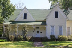 | Couch-Marshall House | 0.2 miles | 1992 |
 | Dr. H. A. Longino House | 0.3 miles | 1982 |
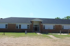 | Magnolia Colored School Historic District | 0.3 miles | 2014 |
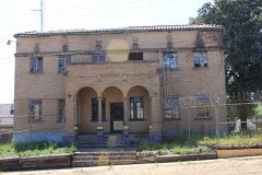 | Columbia County Jail | 0.4 miles | 1982 |
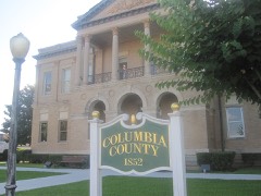 | Columbia County Courthouse | 0.4 miles | 1978 |
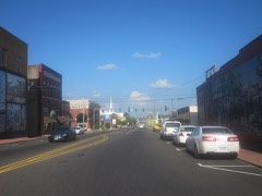 | Magnolia Commercial Historic District | 0.5 miles | 2008 |
| National Archives record | The nomination case file for reference 82002099 in Record Group 79. |
| Wikipedia article | Community-written account of this property, licensed CC BY-SA. |
| Columbia County | All 24 listed properties in this county. |