Block
From the record
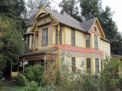
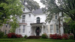
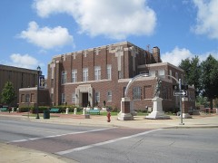
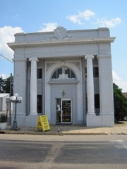
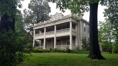
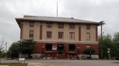
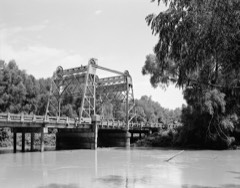
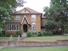
25 National Register listings published here.
Sources: the National Register database, National Park Service
55 topographic sheets cover 91 settlements here, and 25 properties are on the National Register of Historic Places.
25 National Register listings published here.
Sources: the National Register database, National Park Service
Every property in this county listed on the National Register of Historic Places, with the year it was listed and the federal nomination document.
Every wildfire the federal occurrence database records inside this county: 106 of them, burning about 1,088 acres. None started naturally and 16 were recorded as arson. Each settlement page carries the fires within five miles of it.
| Reported cause | Fires |
|---|---|
| Debris and open burning | 59 |
| Arson/incendiarism | 16 |
| Missing data/not specified/undetermined | 16 |
| Equipment and vehicle use | 6 |
| Smoking | 6 |
| Misuse of fire by a minor | 2 |
| Recreation and ceremony | 1 |
The five largest, by the area the report gives. One of them was set deliberately.
| Date | Cause | Size | Reported by | Name on the report |
|---|---|---|---|---|
| 18 February 2016 | Smoking | 98 acres | Arkansas Forestry Commission | not named |
| 6 March 2006 | Arson/incendiarism | 80 acres | Arkansas Forestry Commission | not named |
| 9 February 2009 | Debris and open burning | 70 acres | Arkansas Forestry Commission | not named |
| 4 March 1999 | Debris and open burning | 70 acres | Arkansas Forestry Commission | not named |
| 6 June 2007 | Debris and open burning | 61 acres | Arkansas Forestry Commission | not named |
| 10 April 2006 | Debris and open burning | 55 acres | Arkansas Forestry Commission | not named |
| 12 February 2015 | Debris and open burning | 51 acres | Arkansas Forestry Commission | not named |
| 19 February 2004 | Debris and open burning | 37 acres | Arkansas Forestry Commission | not named |
Every settlement page carries the fires within five miles of it - see the settlement index below.
The NOAA Storm Events Database holds 647 reports for this county, causing 42 deaths, 654 injuries and about $346,117,820 in recorded property damage. Each settlement page carries the reports that name it.
| Kind of event | Reports |
|---|---|
| Thunderstorm Wind | 301 |
| Hail | 194 |
| Flash Flood | 82 |
| Tornado | 54 |
| Flood | 8 |
| Lightning | 6 |
| Heavy Rain | 2 |
The most serious of them, by death, then injury, then recorded damage. The accounts are quoted exactly as the forecast office filed them.
| When | Event | Place named | Harm | What the report says |
|---|---|---|---|---|
| May 1968 | Tornado (F4) | not stated | 34 killed, 350 hurt, $25,000 | no account filed |
| May 1973 | Tornado (F4) | not stated | 3 killed, 257 hurt, $25,000 | no account filed |
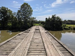
| May 2009 | Flash Flood | Greensboro | 2 killed, $25,000 | Heavy rain produced flash flooding across Northern Craighead County in Eastern Arkansas. County roads 785, 791 and 792 along with Highway 49 were flooded. A sport utility vehicle was pulling into a flooded driveway off county road 785, which had a bridge over a creek, and was swept downstream. At least 2 feet of water covered the bridge. The SUV was swept 100 yards downstream. A portion of the bridge was washed out. Two people inside the SUV were killed. |
| December 2021 | Tornado (EF3) | Needham | 1 killed, 5 hurt, $2,500,000 | The tornado produced its first damage north of Bay, damaging storage and outbuildings. The tornado gradually strengthened and destroyed a farm tractor storage building along Highway 135 northwest of Lake City. The tornado possibly weakened slightly as it crossed the St. Francis River area, but re-strengthened as it approached Monette. Northern and northwestern portions of Monette suffered significant damage. Homes and retail facilities had their roofs partially or completely removed, and the roof of a nursing home partially collapsed. One fatality and at least 5 injuries occurred in the nursing home. After leaving Monette the tornado crossed into Mississippi County. Peak winds were estimated at 145 mph in Craighead County. |
| May 2009 | Flash Flood | Jonesboro | 1 killed, $50,000 | Heavy rain produced flash flooding in northern parts of Jonesboro in Eastern Arkansas. A boy was swept into a drainage ditch near Burke Avenue and Vine Street and was killed. Several homes were flooded along Burke Avenue and North Patrick Street. |
| June 2014 | Thunderstorm Wind | Bono | 1 killed | Straight line winds produced widespread wind damage across Craighead County. Numerous trees and power lines were knocked down. Some trees fell onto vehicles, homes and across roads producing damage. One tree fell onto a home in Jonesboro killing the occupant. Shingles were also blown off of roofs. Numerous buildings in Jonesboro sustained roof damage. Damage also occurred to the tower of the courthouse. One plane sustained damage at the Jonesboro airport. A train with 38 cars derailed in Otwell due to the winds. |
| March 2020 | Tornado (EF3) | Jonesboro | 22 hurt, $300,000,000 | This tornado developed just north of I-555 and west of Caraway Road. The tornado quickly intensified and caused EF2 damage near the intersection of Caraway Rd. and Race St. The tornado weakened slightly, but produced EF2 damage again at the Mall at Turtle Creek. The tornado reached its most intense stage as it approached and moved across the Jonesboro Airport. Several large industrial buildings were severely damaged. As the tornado moved through residential areas northeast of the airport, it caused EF2 to isolated EF3 damage to homes. The tornado began weakening after it crossed Highway 49 northeast of Jonesboro, with the final damage observed to the northeast of Brookland. Peak winds were estimated at 150 mph. |
| April 2025 | Tornado (EF3) | Davis | 8 hurt, $4,000,000 | The tornado moved into Craighead county and intensified as it crossed I-555, snapping utility poles along Highway 463 and derailing a train on Main Street just southeast of Bay, AR. The tornado snapped additional wooden utility poles along Highway 158 east of Bay and gained strength as it moved northeast. Several high-tension power line trusses were heavily damaged or destroyed north of County Road 672 and west of County Road 683. Significant damage to trees and a home was noted on County Roads 686 and 682, but the damage became more widespread as the tornado entered Lake City. Several homes suffered significant damage near the intersection of Highways 18 and 135. A few damage indicators in this area indicated high-end EF3 wind speeds of up to 160 mph, but most of the structures maintained at least some wall structures, precluding a higher rating. Some stubbed trees were noted in this area as well, with minor debarking observed, possibly enhanced by flying debris. Additional significant tree and power line damage was surveyed along County Road 984, followed by more sporadic damage over agricultural land. Structural damage ramped back up as the tornado approached Monette. Several homes suffered significant damage on the west and northern sides of Monette. The tornado moved northeast into the Delfore area, likely lifting just before reaching the Mississippi County line. There were zero fatalities and eight injuries reported with this tornado. Peak winds estimated 160 mph. |
| August 1978 | Tornado (F2) | not stated | 3 hurt, $2,500,000 | no account filed |
| April 1984 | Tornado (F3) | not stated | 2 hurt, $25,000,000 | no account filed |
| March 1997 | Tornado (F3) | Egypt | 2 hurt, $25,000 | no account filed |
| May 2016 | Flash Flood | Oak Ridge | 1 hurt, $2,100,000 | Street flooding reported in west Jonesboro with 6 to 8 inches of water covering roadways at the intersection of Matthews and Madison roads. Several roadways across town have been closed by Law Enforcement. Stranded cars in flood water have also been reported. One child was swept into a storm drain and suffered injuries in the Wesley Court section of Jonesboro. |
| December 1982 | Tornado (F1) | not stated | 1 hurt, $250,000 | no account filed |
| March 1955 | Tornado (F2) | not stated | 1 hurt, $25,000 | no account filed |
| April 2007 | Thunderstorm Wind | Jonesboro | 1 hurt, $2,000 | Straight line winds produced damage to a school bus at Highway 63 and Commerce Drive near Jonesboro. One adult was injured as a result. He was on the bus when the windows shattered resulting in the injury. He was transported to the hospital. |
| May 2003 | Lightning | Jonesboro | 1 hurt | A man was injured when he was struck by lightning while working near a radio transmitter site. |
| March 2016 | Flash Flood | Aggie | $1,000,000 | Very heavy rainfall occurred across the Jonesboro area. Over five inches of rain fell in some spots and as a result widespread flash flooding occurred. Many roads were flooded and impassable with over two feet of water. Several roads were washed out as well. The police department responded to 32 calls of stalled vehicles in water. Many parking lots were flooded. There were also reports of water entering homes. Two feet of water was reported in a home on the 2500 block of Mary Jane Street in East Jonesboro. At least three water rescues from vehicles occurred. Flooding also occurred on the Arkansas State Campus. |
| April 2025 | Tornado (EF2) | Risher | $750,000 | The tornado started just west of Highway 18 between Risher and Riggs, causing tree damage and roof damage to multiple metal outbuildings. The tornado continued northeast, crossing Highway 226 where a farm outbuilding was destroyed, trees snapped, and damage to farm equipment was noted. The most notable damage was along County Road 160, where a grain silo bin was torn and twisted. The silo had been bolted to the ground. The tornado continued northeast towards Herman, where trees were snapped and uprooted. Damage was noted at Westside High School, where the gymnasium roof was damaged and multiple nearby farm shops were destroyed. Additional trees were damaged along Highway 63 before the tornado lifted. Peak winds were estimated at 120 mph. |
| July 2017 | Tornado (EF1) | Jonesboro | $750,000 | A brief EF1 tornado with maximum speeds of 100 to 105 mph touched down approximately one half mile south southeast of downtown Jonesboro with a highly localized area of damage between Citizens Street and the intersection of Rains street and East Oak Avenue. An apartment complex sustained roof damage and several windows were blown out. In addition, fence and siding debris were lofted and scattered about the area. |
| September 2007 | Flash Flood | Brookland | $750,000 | Heavy rainfall of four to five inches produced flash flooding on Bridger Creek. The flood waters moved into the Windsor Landing and Sage Meadow Subdivisions in the Farrville area. At least twenty-five homes were flooded. Two of the home's garages exploded due to fumes from gasoline containers interacting with water heater pilot lights. A few automobiles were also flooded. |
| October 2013 | Tornado (EF1) | Degelow | $500,000 | A tornado touched down just southwest of the business district in Caraway and moved northeast. The tornado lifted near the far northeastern edge of town. Significant structural damage occurred as a result of the tornado. Damage occurred to many roofs of homes, businesses, churches and a convenience store. Several dozens of trees were uprooted as well. |
| August 2019 | Thunderstorm Wind | Nettleton | $250,000 | Sixty-mile per hour straight line winds affected the Industrial Area of Jonesboro on CW Post Road just east of Highway 463. More than 60 utility poles were blown down in the area and significant damage to the County Shop was sustained as well. |
| April 2011 | Tornado (EF1) | Bowman | $250,000 | A tornado briefly touched down near Pekin Road near Bowman and moved northeast. The tornado lifted near Highland Drive in Bowman. Five homes and one business garage was damaged. Three mobile homes sustained roof damage. Two brick homes and one business garage also sustained roof damage. A storage shed was destroyed. A chain link fence was blown over. A few trees and tree limbs were knocked down. |
| March 2008 | Flood | Fisher | $250,000 | Heavy rain caused flooding along the Cache River and Big Creek ditch. Arkansas 226, County Roads 212 and 204 were closed due to flooding. The Windsor Landing Subdivision on U.S. 49 at Farville was flooded as well as the Cottonwood Subdivision near Jonesboro. Many streets in the city of Jonesboro were flooded as well. Wheat fields were damaged by high water. |
| April 2007 | Tornado (EF1) | Nettleton | $250,000 | A tornado touched down 2 miles east southeast of Nettleton, immediately west of Moore Road. The tornado resulted in significant damage to a large metal building at the Aramark complex located at 3320 Moore Road. Damage consisted of portions of the metal roof and wall panels being pulled from the building. Vehicles parked around the facility were also damaged. Some trailers at the facility were also blown over by the tornado. The tornado was short-lived as the path length was approximately 110 yards. |
| December 1982 | Tornado (F1) | not stated | $250,000 | no account filed |
| April 1972 | Tornado (F3) | not stated | $250,000 | no account filed |
| February 2023 | Flash Flood | Nettleton | $200,000 | Several roads throughout Jonesboro were flooded and impassable. A subdivision behind the Dollar General on Highway 1 South was flooded with several homes suffering significant water damage. |
| January 1999 | Tornado (F2) | Lake City | $150,000 | The tornado started just southwest of Lake City and tracked northeast reaching the northwest corner of Lake City and then continued northeast. Two homes were destroyed and five others were damaged in Lake City. An electrical substation was badly damaged. Several trees and power lines were also blown down. |
| December 2021 | Tornado (EF1) | Cary | $125,000 | A tornado developed near the Poinsett/Craighead County line and damaged trees along County Road 452. The tornado damaged a large rice facility along Highway 1, and destroyed a storage building near County Road 406. The tornado dissipated as it approached Highway 158. Peak winds were estimated at 100 mph. |
| July 2004 | Thunderstorm Wind | Jonesboro | $125,000 | Several businesses and homes were damaged. Fifteen fiberglass poles were damaged. Some trees were blown down. |
| May 2000 | Thunderstorm Wind | Jonesboro | $125,000 | Some homes and businesses were damaged in Monette. Numerous trees and power lines were knocked down between Jonesboro and Monette. |
| December 2021 | Tornado (EF1) | Dryden | $100,000 | A tornado touched down northeast of Cash, snapping 12 power poles and damaging a barn. Peak winds were estimated to be 105 mph. |
| June 2019 | Thunderstorm Wind | Brookland | $100,000 | Several county roads were blocked to downed power lines and trees. The city of Brookland suffered from several downed trees and power lines as well. An equipment shed on County Road 741 suffered roof damage. |
| May 2011 | Flood | Aetna | $100,000 | Heavy rain during late April into early May caused the St. Francis River at Lake City to rise to tie the all-time record crest set back in 1979. The river remained above flood stage through the end of May. Several homes sustained minor damage from the flooding. Several roads were closed and/or damaged. Several hundred acres of cropland was flooded. |
| April 2002 | Hail | Cash | $100,000 | The Bay city hall was windows broken by the hail. Both of the town's police cars were damaged. Some homes in Bay were also damaged. |
| April 2022 | Tornado (EF1) | Aetna | $75,000 | This tornado began near County Road 963 east-southeast of Brookland, damaging trees as it moved east-northeast across Ditch Levee Road. Several wooden, high-tension power poles were down southwest of the intersection of Brookland School Road East and Bowman Road. A home also sustained roof damage near this intersection. More substantial damage was seen in the Dixie community where several structures sustained roof damage and trees were uprooted. The tornado continued to move northeast, ending just past County Road 999. Peak winds were estimated at 100 mph. Thanks to NSSL for assistance with this damage survey. |
| August 2019 | Thunderstorm Wind | Nettleton | $75,000 | Semi-truck blown over on Interstate 555 near the Commerce Drive exit. |
| April 1998 | Thunderstorm Wind | Jonesboro | $75,000 | Three trailers and an outbuilding were destroyed. One trailer was moved off of its foundation. Numerous trees and power lines were blown down. |
| February 2018 | Thunderstorm Wind | Nalle | $60,000 | Pavillion destroyed near Bono. Multiple reports of wind damage in the area. |
| March 2025 | Tornado (EF0) | Herndon | $50,000 | A tornado touched down in northern Craighead County near County Road 780 shortly after midnight CDT. Damage in this area was mostly uprooted and snapped trees with minor damage to a few homes. The tornado continued to the northeast and moved into Greene County. Peak winds in Craighead County were 90 mph. |
| April 2025 | Thunderstorm Wind | Richer | $50,000 | A large tree sustained damage south of Cash, on the west side of the Lake City tornado path. Several power poles were broken and downed along and near CR 161. |
| March 2021 | Flash Flood | Jonesboro | $50,000 | Many streets were flooded and closed off in southeast Jonesboro. Several cars were stalled and stranded. Timms Street was flooded and water rescues from vehicles occurred on Red Wolf Boulevard south of Nettleton Avenue. |
| August 2020 | Tornado (EF1) | Bowman | $50,000 | A tornado developed west of Lake City and crossed Highway 18. The tornado damaged a church along Highway 18. The tornado moved into open field and dissipated south of Lester Road. |
| February 2019 | Flood | Fisher | $50,000 | Roads flooded along the Cache River. |
| March 2017 | Thunderstorm Wind | Goobertown | $50,000 | Roof damage to a home and a metal carport destroyed. Several trees snapped or uprooted. |
| May 2017 | Thunderstorm Wind | Oak Ridge | $50,000 | Trees and power lines down in west Jonesboro. |
| May 2017 | Thunderstorm Wind | Valley View | $50,000 | Large metal shop roof blown off along Highway 1 just south of Jonesboro. |
| January 2008 | Thunderstorm Wind | Jonesboro | $50,000 | Straight line winds damaged several buildings. Several trees were knocked down damaging a house. A vehicle was also damaged. |
| August 2002 | Flash Flood | Jonesboro | $50,000 | Twenty homes and some businesses were flooded. Many roads throughout the city were flooded. |
| July 2001 | Thunderstorm Wind | Jonesboro | $50,000 | Some roof damage occurred on the campus of Arkansas State University. A mobile home was damaged. A radio tower was blown over. Numerous trees were blown down. Some trees fell on several homes. |
| July 2001 | Lightning | Jonesboro | $50,000 | A vacant restaurant was badly damaged by a fire started by lightning. |
| January 1999 | Tornado (F0) | Egypt | $50,000 | The tornado started southwest of Egypt and moved northeast into Lawrence county. Two residences were destroyed. An antenna was blown down. |
| November 1994 | Thunderstorm Wind | Jonesboro | $50,000 | A number of homes sustained wind damage in Jonesboro. The damage mainly consisted of broken windows and awnings. Some roofs were also damaged. A number of trees and power lines were also blown down. |
| April 1994 | Thunderstorm Wind | Jonesboro | $50,000 | Thunderstorm winds downed trees and power lines. |
| August 1993 | Thunderstorm Wind | Brookland | $50,000 | Thunderstorm winds took the roof off a pro shop and maintenance building at a golf course. Several tree limbs were downed. |
| August 2020 | Tornado (EF1) | Goobertown | $35,000 | A tornado developed near County Road 940 and moved northwest across County Roads 967 and 964. The tornado damaged three homes in this neighborhood, partially unroofing one home. The tornado dissipated just after crossing Highway 49. |
| May 2008 | Thunderstorm Wind | Maysville | $35,000 | Straight line winds destroyed two grain bins and knocked down power lines near the intersection of County Roads 977 and 997. |
| May 2008 | Thunderstorm Wind | Bay | $35,000 | Straight line winds blew trees and power lines down on Fielder Street in Bay. Damage also occurred to a shop on County Road 654. A tree fell on a car on County Road 654 as well and a house sustained roof damage. |
| June 2019 | Thunderstorm Wind | Bay | $30,000 | Trained spotter reported an overturned semi on I-555 near mile marker 31. |
The Survey's mineral resources record lists 35 workings inside this county. 5 still produce and 30 are closed or unrecorded. Each settlement page carries the workings within five miles of it.
| Commodity | Workings |
|---|---|
| Sand and Gravel, Construction | 32 |
| Clay | 3 |
The least common of them first, because a county's hundredth gravel pit says nothing its first ten did not.
| Where | Site | Commodity | Status | Recorded |
|---|---|---|---|---|
| Jonesboro Brick Co | Clay | Unknown | ||
| Jonesboro Brick Co | Clay | Unknown | ||
| Jonesboro Brick Co | Clay | Unknown | ||
| Bartholamu Pit | Sand and Gravel, Construction | Producer | ||
| Griffith Pit & Plant | Sand and Gravel, Construction | Producer | ||
| Jonesboro Pit | Sand and Gravel, Construction | Producer | ||
| Jonesboro Pit & Plant | Sand and Gravel, Construction | Producer | ||
| M Smith Pit | Sand and Gravel, Construction | Past Producer | ||
| Smoot's Standard Gravel Co Inc | Sand and Gravel, Construction | Producer | ||
| Unk | Sand and Gravel, Construction | Unknown | ||
| Unk | Sand and Gravel, Construction | Unknown | ||
| Unk | Sand and Gravel, Construction | Unknown | ||
| Unk | Sand and Gravel, Construction | Unknown | ||
| Unk | Sand and Gravel, Construction | Unknown | ||
| Unk | Sand and Gravel, Construction | Unknown | ||
| Unk | Sand and Gravel, Construction | Unknown | ||
| Unk | Sand and Gravel, Construction | Unknown | ||
| Unk | Sand and Gravel, Construction | Unknown | ||
| Unk | Sand and Gravel, Construction | Unknown | ||
| Unk | Sand and Gravel, Construction | Unknown | ||
| Unk | Sand and Gravel, Construction | Unknown | ||
| Unk | Sand and Gravel, Construction | Unknown | ||
| Unk | Sand and Gravel, Construction | Unknown | ||
| Unk | Sand and Gravel, Construction | Unknown | ||
| Unk | Sand and Gravel, Construction | Unknown | ||
| Unk | Sand and Gravel, Construction | Unknown | ||
| Unk | Sand and Gravel, Construction | Unknown | ||
| Unk | Sand and Gravel, Construction | Unknown | ||
| Unk | Sand and Gravel, Construction | Unknown | ||
| Unk | Sand and Gravel, Construction | Unknown | ||
| Unk | Sand and Gravel, Construction | Unknown | ||
| Unk | Sand and Gravel, Construction | Unknown | ||
| Unk | Sand and Gravel, Construction | Unknown | ||
| Unk | Sand and Gravel, Construction | Unknown | ||
| Unk | Sand and Gravel, Construction | Unknown |
Named settlements recorded in the Geographic Names Information System, each with the topographic sheets covering it. Villages, hamlets and abandoned places alike. Each is shown with the nearest named watercourse or landform and the survey quadrangle it falls on.
Black Oak township · 72414 · On Black Oak Ridge · Caraway quadrangle
10 sheets, 1941 to 1986
Black Oak township · 72419 · Near Panther Island · Hatchie Coon quadrangle
11 sheets, 1941 to 1986
Lake City township · 72437 · On Cane Island · Lake City quadrangle
10 sheets, 1941 to 1986
No longer a settlement
Black Oak township · 72447 · Near Coopers Ridge · Caraway quadrangle
10 sheets, 1941 to 1986
Little Texas township · 72421 · Grubbs quadrangle
10 sheets, 1935 to 1986
No longer a settlement
Black Oak township · 72419 · Near Maumelle Prairie · Hatchie Coon quadrangle
11 sheets, 1941 to 1986
Black Oak township · 72419 · Near Grapevine Island · Lake City quadrangle
10 sheets, 1941 to 1986
Buffalo township · 72438 · On Kinnemore Slough · Leachville quadrangle
10 sheets, 1941 to 1986
Nettleton township · 72401 · Jonesboro quadrangle
11 sheets, 1939 to 1986
No longer a settlement
Nettleton township · 72404 · On Higginbottom Creek · Jonesboro quadrangle
11 sheets, 1939 to 1986
Powell township · 72405 · Brookland quadrangle
10 sheets, 1939 to 1986
No longer a settlement
Taylor township · 72437 · On Purcell Slough · Hatchie Coon quadrangle
11 sheets, 1941 to 1986
Big Creek township · 72416 · On Trinity Branch · Bono quadrangle
11 sheets, 1935 to 1986
Nettleton township · 72437 · Needham quadrangle
10 sheets, 1939 to 1986
No longer a settlement
Prairie township · 72437 · Near Maumelle Prairie · Lake City quadrangle
10 sheets, 1941 to 1986
Promised Land township · 72404 · On Gunner Slough · Herman quadrangle
11 sheets, 1935 to 1986
No longer a settlement
Black Oak township · 72419 · Rivervale quadrangle
11 sheets, 1941 to 1986
No longer a settlement
Brookland township · 72417 · Brookland quadrangle
10 sheets, 1939 to 1986
No longer a settlement
Black Oak township · 72419 · Rivervale quadrangle
11 sheets, 1941 to 1986
No longer a settlement
Nettleton township · 72401 · On Bridger Creek · Needham quadrangle
10 sheets, 1939 to 1986
No longer a settlement
Jonesboro township · 72401 · On Murray Creek · Needham quadrangle
10 sheets, 1939 to 1986
No longer a settlement
The vanished settlements of Craighead County: the places named above that are no longer on the map.