 Block
From the record
16 National Register listings published here.
Sources: the National Register database, National Park Service
57 topographic sheets cover 50 settlements here, and 16 properties are on the National Register of Historic Places.
16 National Register listings published here.
Sources: the National Register database, National Park Service
Every property in this county listed on the National Register of Historic Places, with the year it was listed and the federal nomination document.
| Photograph | Property | Type | Listed | Reference |
|---|---|---|---|---|
| Block, Isaac, House | building | 1998 | 98000851 | |
| Capt. Isaac N. Deadrick House | building | 1993 | 93000964 | |
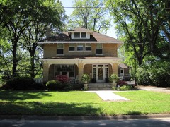 | East Hamilton Avenue Historic District | district | 2011 | 11000330 |
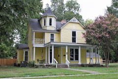 | Giboney-Robertson-Stewart House | building | 1998 | 98000585 |
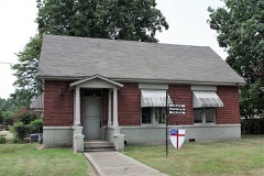 | Grace Episcopal Church | building | 1992 | 92000106 |
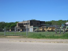 | John H. Johnston Cotton Gin Historic District | district | 2005 | 05000490 |
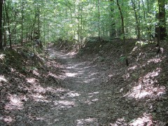 | Memphis to Little Rock Road-Village Creek Segment | structure | 2003 | 03000193 |
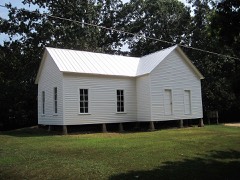 | New Hope School | building | 2008 | 08001037 |
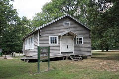 | Northern Ohio School | building | 2014 | 14000247 |
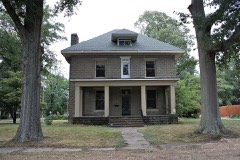 | Servetus W. Ogan House | building | 2015 | 15000624 |
 | South Elementary School | building | 2006 | 06000419 |
| Wittsburg Store and Gas Station | building | 2000 | 00001386 | |
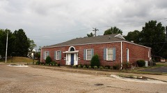 | Woman's Progressive Club | building | 1990 | 90000430 |
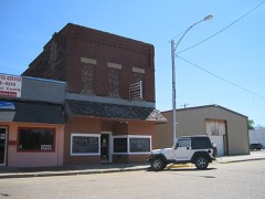 | Wynne Commercial Historic District | district | 2009 | 09001115 |
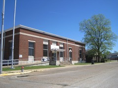 | Wynne Post Office | building | 1998 | 98000914 |
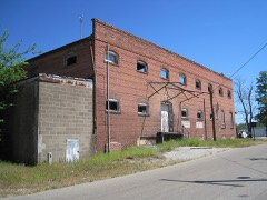 | Wynne Wholesale Commercial Historic District | district | 2010 | 09000772 |
Every wildfire the federal occurrence database records inside this county: 43 of them, burning about 533 acres. None started naturally and 12 were recorded as arson. Each settlement page carries the fires within five miles of it.
| Reported cause | Fires |
|---|---|
| Debris and open burning | 25 |
| Arson/incendiarism | 12 |
| Missing data/not specified/undetermined | 3 |
| Smoking | 2 |
| Equipment and vehicle use | 1 |
The five largest, by the area the report gives. Three of them were set deliberately.
| Date | Cause | Size | Reported by | Name on the report |
|---|---|---|---|---|
| 20 March 2009 | Arson/incendiarism | 203 acres | Arkansas Forestry Commission | BAY VILLAGE |
| 3 April 2004 | Debris and open burning | 56 acres | Arkansas Forestry Commission | not named |
| 14 March 2001 | Debris and open burning | 38 acres | Arkansas Forestry Commission | not named |
| 13 May 2005 | Arson/incendiarism | 25 acres | Arkansas Forestry Commission | not named |
| 29 November 1998 | Arson/incendiarism | 22 acres | Arkansas Forestry Commission | not named |
| 11 November 2005 | Debris and open burning | 20 acres | Arkansas Forestry Commission | not named |
| 10 September 1999 | Missing data/not specified/undetermined | 19 acres | Arkansas Forestry Commission | not named |
| 19 December 2015 | Debris and open burning | 13 acres | Arkansas Forestry Commission | not named |
Every settlement page carries the fires within five miles of it - see the settlement index below.
The NOAA Storm Events Database holds 199 reports for this county, causing 11 deaths, 60 injuries and about $164,284,570 in recorded property damage. Each settlement page carries the reports that name it.
| Kind of event | Reports |
|---|---|
| Thunderstorm Wind | 99 |
| Hail | 55 |
| Tornado | 28 |
| Flash Flood | 11 |
| Flood | 3 |
| Lightning | 2 |
| Funnel Cloud | 1 |
The most serious of them, by death, then injury, then recorded damage. The accounts are quoted exactly as the forecast office filed them.
| When | Event | Place named | Harm | What the report says |
|---|---|---|---|---|
| March 2023 | Tornado (EF3) | Mc Manus | 4 killed, 26 hurt, $150,000,000 | NWS meteorologists determined an EF-3 tornado touched down in western Cross County at 431 PM CDT on March 31 on County Road 537, just south of Highway 284. The tornado tracked to the east-northeast towards Wynne, AR where it crossed Highway 284 multiple times. EF-2 damage was observed north of Ellis Chapel and McElroy. Just east northeast of McElroy, significant EF-2 damage to the sewage treatment plant was noted where an 80-yard-long shed with a sturdy roofing structure of metal failed and became lofted. The roofing wadded up and destroyed two cinder block buildings before landing 100 yards away. The tornado strengthened to an EF-3 as it moved into the western section of Wynne, AR. The tornado then ravaged the center of Wynne, including the Wynne High School. Several one and two-family residences in Wynne were partially to completely destroyed. The tornado weakened as it moved away from Wynne and traveled to the north of Parkin, AR where EF-2 damage was observed. The tornado then crossed into Crittenden County. Peak winds in Cross County were estimated at 150 mph. |
| March 1952 | Tornado (F4) | not stated | 4 killed, 5 hurt, $250,000 | no account filed |
| January 1978 | Tornado (F3) | not stated | 1 killed, 8 hurt, $2,500,000 | no account filed |
| May 2011 | Flood | Bay Vlg | 1 killed, $200,000 | Heavy rain during late April into early May caused the St. Francis River to rise to near record levels. The river remained above flood stage through the end of May. Several homes sustained minor damage from the flooding. Several roads were closed and/or damaged. Several hundred acres of cropland was flooded. A man drowned when he disobeyed closed road signs on Highway 42 and drove his vehicle into 12-18 inches of running water that covered the road. The vehicle was then swept away. |
| February 1999 | Thunderstorm Wind | Hickory Ridge | 1 killed, $75,000 | One man was killed in Wynne when a tree fell onto his mobile home crushing the home. An awning was blown off of a building in Vanndale. Several other businesses were damaged. Several trees and power poles were knocked down. |
| April 2006 | Tornado (F3) | Fairoaks | 5 hurt, $5,000,000 | This tornado continued east from Woodruff County into Cross County eventually crossing into Crittenden County. The most affected area was the Fitzgerald Crossing community located south of Wynne and the Village Creek State Park. Twenty-four homes and two mobile homes were destroyed. Ten homes had major damage with twenty seven homes and five mobile homes receiving minor damage. Most of this damage occurred south of Wynne near the Intersection of State Highway 1 and County Road 652. The Village Creek State Park suffered damage to the Visitors' Center and the tennis court. Five minor injuries occurred with the tornado. |
| May 2003 | Tornado (F3) | Tilton | 4 hurt, $1,000,000 | The tornado moved into Cross County from Woodruff County near Tilton and moved east. Five homes were destroyed and four others were damaged in Tilton. Another three homes were damaged in Vanndale. |
| March 1986 | Thunderstorm Wind | not stated | 4 hurt | no account filed |
| December 2002 | Thunderstorm Wind | Wynne | 2 hurt, $750,000 | Three mobile homes were overturned. The roof was blown off of a restaurant. |
| March 2006 | Tornado (F2) | Fairoaks | 2 hurt, $100,000 | The tornado moved into Cross County from Woodruff County and continued to move northeast. Five houses were badly damaged. One mobile home was displaced 100 feet from its foundation and damaged. A large metal storage shed was severely damaged with its roof removed and several large steel cross beams twisted. Several other outbuildings and barns were damaged. Many trees, power lines and power poles were also blown down. |
| March 1986 | Thunderstorm Wind | not stated | 2 hurt | no account filed |
| April 2025 | Tornado (EF2) | Wilkins | 1 hurt, $500,000 | The tornado moved from St. Francis County into Cross County and caused additional damage just west of Highway 1 in Wilkins. A large outbuilding was shifted off its foundation with a couple of walls collapsed. The tornado caused damage to a chemical plant, flipped a semi, and damaged numerous homes near the Fitzgerald Crossing area. The most significant damage in this area was to a 2400 square foot metal outbuilding that was completely destroyed and a couple of manufactured homes that were destroyed on County Road 741. The tornado then continued its track past Fitzgerald Crossing, damaging numerous solar panels in a large solar farm between Highway 1 and Cathy Lake. The tornado then moved onto Crowleys Ridge where significant damage occurred at a country club and an entire storage building was lofted 100 yards northeast of its original location. The Levesque area was then impacted with multiple uprooted trees and a few small outbuildings destroyed. The tornado lifted just east of Highway 163. Peak winds were estimated around 125 mph. |
| June 2009 | Thunderstorm Wind | Vanndale | 1 hurt | Straight line winds knocked down power lines in Vanndale and across the rest of Cross County. In addition, some structural damage occurred in Vanndale including two mobile homes and a farm shop. One person received minor injuries from the storm. |
| May 2013 | Flash Flood | Hickory Ridge | $914,000 | Approximately seven inches of rain produced flash flooding across Northern Cross County. Highways 42 and 193 and multiple county roads were flooded near Hickory Ridge. One home suffered minor flood damage near Hickory Ridge. The CO-OP was completely flooded. Highways 1 and 42 were flooded near Cherry Valley. A culvert on an unnamed county road was washed out leaving four families stranded. One home had minor flood damage near Cherry Valley. |
| March 1997 | Tornado (F3) | Hickory Ridge | $750,000 | no account filed |
| February 2018 | Tornado (EF1) | Cherry Vly | $500,000 | The tornado started just south of Highway 42 about 5 miles west of the town of Cherry Valley causing damage to two farmsteads. One home on the north side of the state highway suffered the worst damage with a large portion of the roof removed. The tornado then traveled northeast about 3 miles through open fields before taking a single wide trailer off it's foundation. The tornado then lifted shortly after crossing County Road 210 approximately 4 miles northwest of Cherry Valley. Other damage included downed tree limbs and minor damage to a few farm outbuildings and one grain bin. Estimated peak wind was 100 mph. |
| April 2017 | Thunderstorm Wind | Tilton | $250,000 | Several trees, houses, outbuildings and power poles damaged from north of Titon to south of Cherry Valley. |
| October 2009 | Flash Flood | Cherry Vly | $161,000 | Heavy rain produced flash flooding in Cross County. Numerous roads were closed as a result. |
| May 2010 | Tornado (EF1) | Fairoaks | $100,000 | A tornado moved northeast into Cross County from Woodruff County, Arkansas near Primrose, east of Highway 49. The tornado first tracked across open farm land. The tornado then damaged three homes and several outbuildings on US Highway 64. One home sustained major damage and a two-story barn was completely collapsed. The other two homes had minor damage. Several very large trees were also knocked down. Five power poles were also snapped along US Highway 64. The tornado then continued northeast across open farm land before snapping power lines along County Road 165 before lifting. |
| January 2002 | Thunderstorm Wind | Wynne | $100,000 | One trailer was destroyed. Two homes and 28 other structures were damaged. Numerous trees and power lines were knocked down. |
| May 1997 | Tornado (F2) | Vanndale | $100,000 | A tornado touched down near the town of Vanndale. Nearly 100 residential homes were damaged or destroyed. Three dozen mobile homes were damaged or destroyed. Three persons were injured. One cow was killed. Numerous trees and power lines were knocked down. |
| April 2025 | Tornado (EF1) | Duvall | $75,000 | A tornado formed in far eastern Cross County, southeast of Parkin, near the intersection of County Road 811 and Cross Road 8100. Minor damage was noted to a farm outbuilding before crossing into Crittenden County. Estimated peak winds were 90 mph in Cross County. |
| June 2018 | Thunderstorm Wind | L Angiulle | $75,000 | Roof collapsed on large combine shed. |
| May 2004 | Tornado (F2) | Cherry Vly | $75,000 | The tornado touched down west of Cherry Valley. Two farm buildings and five large grain bins were destroyed. Two houses suffered roof damage. Many trees were knocked down. |
| January 2007 | Flash Flood | Wynne | $68,000 | Heavy rain produced flash flooding over Cross County as a result 50 county roads had damage. One bridge went completely under water as well as one culvert was washed away. |
| June 2023 | Thunderstorm Wind | Hamlin | $50,000 | A roof was blown off of a home and a few semi-trailers were overturned along Highway 193. |
| November 1993 | Thunderstorm Wind | Wynne | $50,000 | Thunderstorm winds downed numerous trees. |
| June 2018 | Thunderstorm Wind | L Angiulle | $40,000 | Twelve large power poles snapped in a row along Highway 64 just west of Wynne. |
| August 2020 | Tornado (EF1) | Hickory Ridge | $30,000 | A tornado developed southeast of Hickory Ridge and moved north-northwest through town. An airplane hangar was damaged west of County Road 259. The tornado damaged trees and several roofs and awnings as it moved through Hickory Ridge. The tornado dissipated just northwest of town. |
| April 2017 | Thunderstorm Wind | Wynne | $30,000 | Trees and power lines down. Damage to one home. |
| May 2008 | Tornado (EF1) | Fairoaks | $30,000 | A tornado crossed into Cross County from Woodruff County and moved northeast eventually lifting near the intersection of County Road 521 and Highway 284. One house had shingles blown off the roof and windows blown out. A farm shop and grain bin were also damaged. Numerous trees were knocked down near the intersection of Highway 284 and Highway 259. |
| May 2003 | Flash Flood | Countywide | $30,000 | Parkin City Hall was flooded. Several homes had their basements flooded. Some of the roads lost chunks of asphalt. Numerous roads were flooded across the county with water on some roads nearly knee high. Some fields were also flooded. |
| March 2021 | Lightning | Wynne Muni Arpt | $25,000 | Lightning struck a home on Killough Street causing exterior damage and blowing out an interior wall. |
| March 2016 | Tornado (EF1) | Togo | $25,000 | A tornado touched down just east of Arkansas Route 75 causing minor roof damage to a house and outbuilding. The tornado then moved northeast and flipped a couple of irrigation pivots before damaging a hangar and removing a door off of a barn. |
| January 2008 | Tornado (EF0) | Princedale | $25,000 | A tornado touched down along Highway 64 west of Parkin and moved northeast. A roof was ripped off a mobile home near Barnes Lake. Trees and power lines were knocked down along the path. Several farm water rig pivots were blown over. The path was non-continuous and ended just south of Twist. |
| November 2002 | Tornado (F2) | Twist | $25,000 | The tornado touched down just southwest of Twist and moved northeast and later moved into Crittenden County. Some farm buildings were damaged. Several trees and power poles were blown down. |
| June 2018 | Thunderstorm Wind | Fitzgerald Crossing | $20,000 | Trees down at Fitzgerald Crossing south of Wynne. |
| February 2018 | Thunderstorm Wind | Gieseck | $20,000 | Power lines down along Highway 75. |
| July 2010 | Flash Flood | Wynne | $20,000 | Heavy rain, 3.07 inches in 75 minutes, produced widespread flash flooding in Wynne. Falls Boulevard had water as high as vehicle headlights and several vehicles were stalled as a result. |
| May 2003 | Thunderstorm Wind | Countywide | $20,000 | A church had its doors damaged in Hickory Ridge. Many trees were blown down. |
| May 2020 | Thunderstorm Wind | Parkin | $15,000 | A grain bin was damaged along Highway 64. |
| August 2025 | Thunderstorm Wind | Cherry Vly | $10,000 | Tree and powerlines down on Highway 42 in the city limits. |
| June 2023 | Thunderstorm Wind | Fairoaks | $10,000 | Some grain hoppers were overturned in the Penrose area. |
| June 2023 | Thunderstorm Wind | Levesque | $10,000 | Straight-line winds knocked down numerous trees blocking County Road 367. |
| March 2021 | Thunderstorm Wind | Vanndale | $10,000 | Power lines were knocked down on Highway 1 in Vanndale. |
| May 2020 | Thunderstorm Wind | Fairoaks | $10,000 | Trees were knocked down in Fair Oaks along Highway 49. A power pole was snapped along Highway 49 near Fair Oaks. |
| March 2008 | Thunderstorm Wind | Wynne | $10,000 | Straight line winds knocked down trees and power lines in Wynne. |
| April 2006 | Thunderstorm Wind | Hickory Ridge | $10,000 | Some trees and power lines were knocked down in Hickory Ridge. |
| July 2003 | Thunderstorm Wind | Hickory Ridge | $10,000 | Many trees were knocked down. |
| May 2003 | Thunderstorm Wind | Hickory Ridge | $10,000 | Several trees and power lines were knocked down. |
| April 2000 | Thunderstorm Wind | Parkin | $10,000 | Some trees and power lines were knocked down. |
| May 2000 | Thunderstorm Wind | Fairoaks | $10,000 | Some trees and power lines were knocked down. |
| July 1998 | Thunderstorm Wind | Cherry Vly | $10,000 | Several trees and power lines were knocked down. |
| January 1996 | Thunderstorm Wind | Hickory Ridge | $10,000 | no account filed |
| April 2001 | Hail | Wynne | $7,600 | Hail ranged in size from quarters to baseballs. |
| June 2025 | Thunderstorm Wind | Parkin | $7,000 | Trees and power lines were knocked down along Highway 64. |
| April 2025 | Tornado (EF0) | Bay Vlg | $5,000 | A tornado touched down just south of Bay Village to the west of Highway 163 in extreme northern Cross County. Multiple trees were uprooted just to the east of Highway 163, past Sugar Creek before crossing into Poinsett County. Peak winds were estimated 85 mph. |
| April 2023 | Thunderstorm Wind | Wynne | $5,000 | A metal outbuilding was damaged. |
| May 2020 | Thunderstorm Wind | Wynne | $5,000 | Attached carport was destroyed along Highway 193 South. |
| January 2012 | Hail | Wilkins | $5,000 | Half dollar size hail fell in extreme southern Cross County. |
The Survey's mineral resources record lists 26 workings inside this county. 9 still produce and 17 are closed or unrecorded. Each settlement page carries the workings within five miles of it.
| Commodity | Workings |
|---|---|
| Sand and Gravel, Construction | 26 |
The least common of them first, because a county's hundredth gravel pit says nothing its first ten did not.
| Where | Site | Commodity | Status | Recorded |
|---|---|---|---|---|
| Adkinsson Sand and Gravel Pit | Sand and Gravel, Construction | Producer | ||
| Baskins Pit | Sand and Gravel, Construction | Producer | ||
| Bay Road Material Pit and Plant | Sand and Gravel, Construction | Producer | ||
| Bay Village Pit | Sand and Gravel, Construction | Producer | ||
| Birdseye Pit | Sand and Gravel, Construction | Producer | ||
| Brawner | Sand and Gravel, Construction | Producer | ||
| Cross County Pit | Sand and Gravel, Construction | Producer | ||
| Easton Pit | Sand and Gravel, Construction | Producer | ||
| Kail Pit | Sand and Gravel, Construction | Producer | ||
| Killough | Sand and Gravel, Construction | Past Producer | ||
| Kirby | Sand and Gravel, Construction | Past Producer | ||
| Unk | Sand and Gravel, Construction | Unknown | ||
| Unk | Sand and Gravel, Construction | Unknown | ||
| Unk | Sand and Gravel, Construction | Unknown | ||
| Unk | Sand and Gravel, Construction | Unknown | ||
| Unk | Sand and Gravel, Construction | Unknown | ||
| Unk | Sand and Gravel, Construction | Unknown | ||
| Unk | Sand and Gravel, Construction | Unknown | ||
| Unk | Sand and Gravel, Construction | Unknown | ||
| Unk | Sand and Gravel, Construction | Unknown | ||
| Unk | Sand and Gravel, Construction | Unknown | ||
| Unk | Sand and Gravel, Construction | Unknown | ||
| Unk | Sand and Gravel, Construction | Unknown | ||
| Unk | Sand and Gravel, Construction | Unknown | ||
| Unk | Sand and Gravel, Construction | Unknown | ||
| Unk | Sand and Gravel, Construction | Unknown |
Named settlements recorded in the Geographic Names Information System, each with the topographic sheets covering it. Villages, hamlets and abandoned places alike. Each is shown with the nearest named watercourse or landform and the survey quadrangle it falls on.
Hickory Ridge township · 72347 · Tilton quadrangle
10 sheets, 1940 to 1986
No longer a settlement
Smith township · 72396 · Wittsburg quadrangle
13 sheets, 1940 to 1986
No longer a settlement
Mitchell township · 72324 · On Halk Creek · Cherry Valley West quadrangle
12 sheets, 1939 to 1986
Coldwater township · 72373 · On Sycamore Slough · Parkin quadrangle
13 sheets, 1940 to 1986
Tyronza township · 72373 · On Tyronza River · Parkin quadrangle
13 sheets, 1940 to 1986
No longer a settlement
Smith township · 72373 · On Elbow Slough · Wittsburg quadrangle
13 sheets, 1940 to 1986
Coldwater township · 72373 · On Fortune Slough · Monterey quadrangle
13 sheets, 1940 to 1986
Coldwater township · 72373 · Near Sunk Timber Lake · Monterey quadrangle
13 sheets, 1940 to 1986
Smith township · 72373 · On Bee Tree Slough · Princedale quadrangle
12 sheets, 1940 to 1986
Smith township · 72373 · On Bee Tree Slough · Princedale quadrangle
12 sheets, 1940 to 1986
Tyronza township · 72373 · On Tyronza River · Parkin quadrangle
13 sheets, 1940 to 1986
No longer a settlement
Coldwater township · 72373 · Near Sunk Timber Lake · Monterey quadrangle
13 sheets, 1940 to 1986
No longer a settlement
Coldwater township · 72373 · Monterey quadrangle
13 sheets, 1940 to 1986
No longer a settlement
Brushy Lake township · 72396 · Tilton quadrangle
10 sheets, 1940 to 1986
No longer a settlement
The vanished settlements of Cross County: the places named above that are no longer on the map.